8-13-06
Yesterday I attended the memorial for Ed Miller, a member of nwhikers.net. After a sobering but but good afternoon at the memorial I needed a day in the mountains. Suzanne and I decided on Alta Mountain. We were to meet at Suzanne's house by 7:15 am. I woke up looked at the clock and it was 7:12. Uh oh... Somehow I managed to get out of the house in 20 minutes and we on our way by 7:45. By 9:00 we were in the lot. It was early on a Sunday morning and the first row was full and the second row was at least a third full. There were a lot more cars than I expected.
As we headed up the trail we were having some second thoughts about Rachel Lake and Alta. We had two dogs along this week and were not looking forward to the crowds. I had been hoping to take a crack at Hibox this year and brought it up as a possibility. While we knew where the side trail began I had not checked out any route info. The first 2 1/2 miles of the Rachel Lake trail is so flat we sped right along. We did meet one group coming down who mentioned the bugs were really bad near the lakes. That sealed it.
We found the side trail with no problems. It has some branches blocking it but is obvious. From the last open meadow we could see the summit of Hibox and guess as to where the route likely went. The first 100' of the trail are pretty level. That's about the last level spot for the next 3000 vertical feet. The trail is in forest for most of the first 1000'. It is steep but not difficult to follow. Did I say steep? There are a few big steps where I needed to use my hands.
The route traverses to the right and nears a creek in a gully. There are a few spots where the trail is a steep gully and rock fall is a concern. These are fairly short. There are a few spots where the route is not well defined but picks up again in a short distance. It manages to avoid any brush. After the worst of the steepness the route actually moderates. It moves over to the left and then traverses right back towards the creek. That takes care of the next 1000'.
After going around a rocky point the trail seems to end in the middle of an open slope. The summit is now 1000' right above. There are some cairns if you look carefully. The obvious route is right up the slope. I thought I had seem a report from a year earlier where the route went to the right of the summit block. We found a trail through some trees and came out right up against the near vertical wall of the block.
Cairns continued up a steep gully between two summits. Suzanne stayed below with the dogs while I took a closer look. Up on loose rock then a step and then another. The last one was at the limit of my comfort zone. With easier terrain just ahead common sense kicked in and I headed down. I heard Suzanne talking with someone as I descended. I was sure this was not the scramble route. In fact, a climber was coming down from the summit. He was gone by the time I arrived. He did point to a route to the right that goes up to the southeast ridge.
With this new information we headed on up. There is a lot of loose talus and scree but an obvious route. We reached the summit ridge with my altimeter reading 6300'. The summit is 6560'. Just over the ridge was a snow patch. The dogs headed right for it. The day began pleasantly cool and continued to head up. By the ridge it was just plain hot. We had some lunch and I headed up to look for the summit. An obvious trail soon became many trails.
First I headed to the right of the ridge. A route headed down and around the summit block. It ended without any sign of a scramble route. Coming back I headed up a ledge to the ridge top. No obvious scramble route here either. I headed back on down and looked to the left side of the ridge. It might have gone but was not at all obvious. Between my first gully and rambling on the southwest ridge Suzanne had been waiting for long enough. The dogs needed to be leashed or they would scamper up the ridge into unsafe terrain. Only one of us could go scrambling at a time.
With that in mind I called it a day. The summit will have to wait for another try. The view from the ridge is outstanding. Three Queens is much closer than I have ever seen it. I was able to see both Park Lakes far below us. Lake Kachess was in the distance. Mt. Rainier and Mt. Adams were to the south. Rachel Lake was below and Lila Lakes and Alta Mountain were close by. As always, I had a nice view of Mt. Stuart. The Cascade crest from Chikamin, Lemah, to Bears Breast, Hinman, and Daniel are easily in sight. Quite a nice viewpoint.
At long last came the part I was not looking forward to. The descent is a grind. Loose talus a first, steep grass, and more loose scree. For the most part the tread is okay just jarring on the knees. I was seriously overheated by this point and not moving very fast. I was glad to get back into the forest and more glad to see the flat Rachel Lake trail again. At the first creek access we washed off a lot of dirt. I took the opportunity to soak my shirt. The last 2 1/2 miles were a steady stream of families hiking back down. We passed many of them.
I was very glad to see the parking lot. I'm glad to finally have a chance to hike up Hibox. We did not reach the summit but came close. I did get in a lot of scrambling, more than if I knew where I was going. The views were outstanding and we had far more solitude than most everyone else on the Rachel Lake trail. Not a summit but a fun if a little painful day in the mountains.
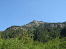
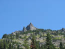
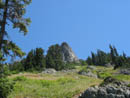
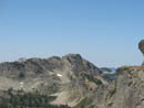
First Summit View |
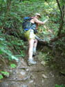
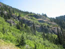
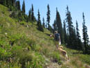
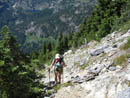
Heading Up |
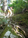
On Root |
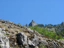
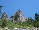
Summit Above |
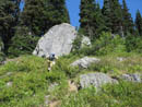
Meadow |
Brush |
Berry Bushes |
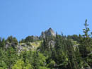
Closer |
Top Of Meadow |
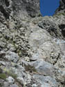
Steep Enough |
Gully Above |
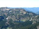
Rachel Lake |
Near Summit Block |
Alta Mountain |
Wrong Gully |
Photo Page 2
Trips - 2006
Home