1-26-08
Freezing cold, snow coming in, where to go? I took
a short trip over to Cougar Mountain. The heavily used trails on Tiger Mountain
are a sheet of ice. I hoped that the lower peaks of Cougar would below
the ice snow packed to ice level. I was partly right. The lot at Red Town
was almost full at 9:15 AM. I headed up the road/trail soon reaching Coal
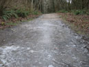
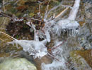
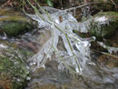
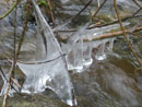
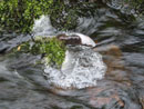
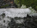
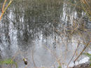
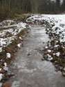
Creek. All along the creek was ice. Rocks were icy, branches were icy,
ferns were icy. It was very pretty. I planned on a fast loop but I could
see that there would be enough photo distractions to slow me way down.
I passed a number of folks in the first half mile but the crowds lessened as I hiked farther. I took another detour at the top of Far Country Falls. Lots more ice there. I headed on to Far Country Lookout next. The view is getting smaller by the year as trees close in the viewpoint. The trail headed towards Shy Bear Pass but I chose to turn off towards Doughty Falls and Long View Peak.
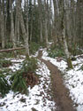
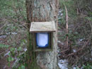
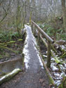
I stopped at Doughty Falls but not much water was coming down. The snow level was supposed to be at 500' and I was now at 850'. It began to rain. Not hard but definitely not snow. I headed uphill to Deceiver Ridge and on to Long View Peak. Not much view left there either. A drop and short climb brought me to Shy Bear Pass. On the climb to Wilderness Peak I finally found some snow along the trail. Near the summit there was some ice covered trail. Not much but enough to require some careful footing. I signed the register and headed right down.
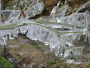
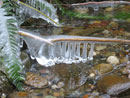
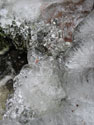
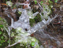
From Shy Bear Pass I took the Shy Bear Trail then continued on Fred's Railroad. At the East Fork Trail I headed uphill towards the Clay Pit. Anywhere that water had pooled it was solid ice. On the trail in a few places and in small ponds along side. Jerry's Dock Pond is frozen over. No problems at the Clay Pit as the mud was solid. There were some impressive ice sheets and frozen creeks. I headed from there to Anti-Aircraft Peak. Along the way the rain picked up and an umbrella came in handy.
It was almost all downhill from there. The last mile saw rain change to snow. It was raining at 1600' but it was now snowing at 600'. In fact it was snowing very hard when I made it back to my car. The loop was almost 11 miles with about 2000' of elevation gain. The ice provided an unexpected bonus. It was not something we see often at low elevations in the Seattle area. It was a good way to spend a cold winter day.
Click on thumbnails to get larger pictures.
Trips - 2008
Home
I passed a number of folks in the first half mile but the crowds lessened as I hiked farther. I took another detour at the top of Far Country Falls. Lots more ice there. I headed on to Far Country Lookout next. The view is getting smaller by the year as trees close in the viewpoint. The trail headed towards Shy Bear Pass but I chose to turn off towards Doughty Falls and Long View Peak.
I stopped at Doughty Falls but not much water was coming down. The snow level was supposed to be at 500' and I was now at 850'. It began to rain. Not hard but definitely not snow. I headed uphill to Deceiver Ridge and on to Long View Peak. Not much view left there either. A drop and short climb brought me to Shy Bear Pass. On the climb to Wilderness Peak I finally found some snow along the trail. Near the summit there was some ice covered trail. Not much but enough to require some careful footing. I signed the register and headed right down.
From Shy Bear Pass I took the Shy Bear Trail then continued on Fred's Railroad. At the East Fork Trail I headed uphill towards the Clay Pit. Anywhere that water had pooled it was solid ice. On the trail in a few places and in small ponds along side. Jerry's Dock Pond is frozen over. No problems at the Clay Pit as the mud was solid. There were some impressive ice sheets and frozen creeks. I headed from there to Anti-Aircraft Peak. Along the way the rain picked up and an umbrella came in handy.
It was almost all downhill from there. The last mile saw rain change to snow. It was raining at 1600' but it was now snowing at 600'. In fact it was snowing very hard when I made it back to my car. The loop was almost 11 miles with about 2000' of elevation gain. The ice provided an unexpected bonus. It was not something we see often at low elevations in the Seattle area. It was a good way to spend a cold winter day.
Skating Rink |
Ice Sculpture |
Neat Shape |
More Ice |
Even More Ice |
Coal Creek Ice |
Solid Ice |
Floating Ice |
Icy Moss |
Finally Some Snow |
Summit Register |
Another Creek |
Icy Reflection |
Not Flowing Now |
An Ice Bridge |
Trips - 2008
Home