3-14-10
After a long day
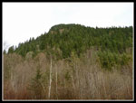
of snowshoeing yesterday I chose an easy destination. Fuller Mountain
is one of those short trips that I never chose to spend a day hiking.
Today would be my first visit. This was the first day of Daylight
Saving Time and with the time change I struggled out the door at 10:10.
It was already 11:15 by the time I reached Spur 10 and started walking.
The gate is on the left side about 3.5 miles up the North Fork
Snoqualmie Road beyond the end of pavement. I chose to park near the
main road and walk the short distance down to the gate.
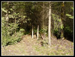
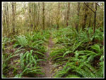
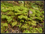
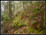
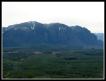
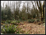
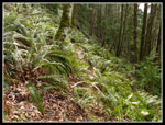
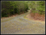
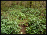
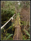
As mentioned in other reports the trail begins across the wide road from the gate, just to the left of the signs. There are two posts but no trail sign remains. Just a few minutes along the trail 10 Creek is reached. The creek is pretty wide and deep. A log bridge with a rope handrail makes crossing pretty easy. Lots of sword ferns and moss along this part of the trail. The route crosses one old road that is now completely covered by grass and moss. The trail soon breaks out of the forest at another gravel road. A gravel pit is to the right and the road also heads to the left.
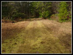
I had not planned on this trip but when other plans fell through I took a quick look online, printed an old map, and grabbed my Footsore book. A little more online research would have saved me some time and frustration. Footsore said to follow the road above the gravel pit and pick up the trail once again. That's what I tried to do. The road ended and there were no signs of footprints let alone a trail. I headed back down and climbed up to a flat area to the left of the pit. An old road headed in the correct direction so I took it. Lots of small alder trees to work through and I climbed up to.. another dead end. Try as I might all those animal tracks just did not look like a trail.
I consulted my map and reread the book. One more look and I gave up. It seems that the mighty Fuller Mountain had defeated me. I dropped part way back down and found the end of another old road. This one in better shape. I scanned the uphill side as I descended and son of a gun if I didn't find an unmarked trail heading into the woods. Had I turned left on the gravel pit road after exiting the forest on trail I would have found the bottom of the correct road just a few minutes later. A right there and the trail appears within a few minutes.
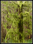
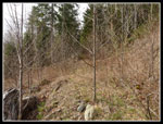
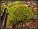
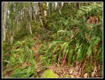
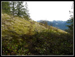
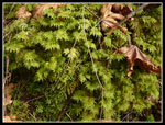
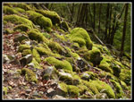
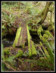
Now back on track after wasting 45 minutes, I followed the trail as it gently climbs while traversing most of the way around the mountain. It is gentle in grade but narrow and rocky with numerous small ups and downs. There is an amazing display of moss on this trail. The overcast sky really brought out the green. After a long traverse the route finally got down to gaining elevation. There are several logs down across the trail but none posed a problem. Easy to go over or under. A series of switchbacks brought me to the upper mountain. On flatter ground the trail was much less distinct. Dried leaves covered everything. The route weaves around salal and more sword ferns as it heads for the summit.
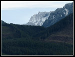
I had to stop a few times as the route seemed to disappear but it always picked up again immediately. One last push and I reached the high point. The top is forested and pretty flat. I passed one hiker with four dogs on the way up. It's not easy to pass a group on the narrow tread. After lunch I took another look at the book. There is a rocky viewpoint and I set out to find it. Just a few steps back down the trail I saw what looked like two faint trails. The one on the left is the way down. I took the other one. It dropped a little in a meadow and entered evergreen forest. A few minutes later I popped out at the viewpoint. I could see over to Si and out to North Bend. Snowy peaks sat roughly behind Lake Hancock. After a few photos I was on my way.
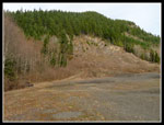
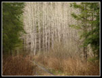
I returned to the junction and headed down the main trail. On the way up there are breaks in the forest providing views out to Klaus Lake. I figured that would be my next destination. Coming down was much faster as I dropped a mile to the road junction in about 30 minutes losing 800'. In a minute or two I reached the road coming from the gravel pit. That would be my route home. Within a few minutes I came to a four way junction. The junction did not seem to be on my old map and I chose to head straight. Another mistake. Shortly I realized my error as the route turned away from Fuller Mountain. I wanted to cut below it.
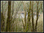
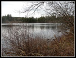
Back to the junction and a left turn had me heading in the right direction. My book mentioned a trail to the lake shore about a half mile up the road. Within 1/3 mile I saw a wide spot on the left side. A close look showed a trail heading into the woods. This trail does wind through forest and end up right on the shore of Klaus Lake. The lake is bigger than I was expecting. A nice place to sit back and relax.
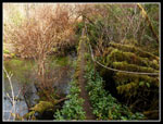
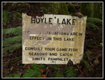
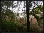
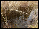
I soon headed back to the road and continued towards Boyle Lake. The road ascended then dropped and came to a "Y". Whitebark had posted a report showing a loop starting here. The main road goes right and an older grassy road heads left. I went left. In a short distance the road ended and a trail headed into the woods. I could now hear the creek and I reached the outlet to Boyle Lake. The bridge is old and rotting but solid enough for now. I crossed the outlet and went part way around the lake. The shore is marshy and there was no place to get a good look at the lake from the shore.
Now it was time to head back. I retraced my steps to the Fuller Mountain road junction and stayed right. Around the next bend was the gravel pit and the trail heading back to the start. The last half mile did not take long at all. For the day I saw one hiker and two mountain bikers. Not bad solitude for a trail right outside North Bend. If I had time to do some research I would not have taken a few wild goose chases but heck that's just part of the fun on a new route. Fuller is a neat little summit and adding the loop Whitebark described around the three lakes would make for a full day of hiking. I'll have to come back and give it a try.
Click on thumbnails to get larger pictures.
Trips - 2010
Home
As mentioned in other reports the trail begins across the wide road from the gate, just to the left of the signs. There are two posts but no trail sign remains. Just a few minutes along the trail 10 Creek is reached. The creek is pretty wide and deep. A log bridge with a rope handrail makes crossing pretty easy. Lots of sword ferns and moss along this part of the trail. The route crosses one old road that is now completely covered by grass and moss. The trail soon breaks out of the forest at another gravel road. A gravel pit is to the right and the road also heads to the left.
I had not planned on this trip but when other plans fell through I took a quick look online, printed an old map, and grabbed my Footsore book. A little more online research would have saved me some time and frustration. Footsore said to follow the road above the gravel pit and pick up the trail once again. That's what I tried to do. The road ended and there were no signs of footprints let alone a trail. I headed back down and climbed up to a flat area to the left of the pit. An old road headed in the correct direction so I took it. Lots of small alder trees to work through and I climbed up to.. another dead end. Try as I might all those animal tracks just did not look like a trail.
I consulted my map and reread the book. One more look and I gave up. It seems that the mighty Fuller Mountain had defeated me. I dropped part way back down and found the end of another old road. This one in better shape. I scanned the uphill side as I descended and son of a gun if I didn't find an unmarked trail heading into the woods. Had I turned left on the gravel pit road after exiting the forest on trail I would have found the bottom of the correct road just a few minutes later. A right there and the trail appears within a few minutes.
Now back on track after wasting 45 minutes, I followed the trail as it gently climbs while traversing most of the way around the mountain. It is gentle in grade but narrow and rocky with numerous small ups and downs. There is an amazing display of moss on this trail. The overcast sky really brought out the green. After a long traverse the route finally got down to gaining elevation. There are several logs down across the trail but none posed a problem. Easy to go over or under. A series of switchbacks brought me to the upper mountain. On flatter ground the trail was much less distinct. Dried leaves covered everything. The route weaves around salal and more sword ferns as it heads for the summit.
I had to stop a few times as the route seemed to disappear but it always picked up again immediately. One last push and I reached the high point. The top is forested and pretty flat. I passed one hiker with four dogs on the way up. It's not easy to pass a group on the narrow tread. After lunch I took another look at the book. There is a rocky viewpoint and I set out to find it. Just a few steps back down the trail I saw what looked like two faint trails. The one on the left is the way down. I took the other one. It dropped a little in a meadow and entered evergreen forest. A few minutes later I popped out at the viewpoint. I could see over to Si and out to North Bend. Snowy peaks sat roughly behind Lake Hancock. After a few photos I was on my way.
I returned to the junction and headed down the main trail. On the way up there are breaks in the forest providing views out to Klaus Lake. I figured that would be my next destination. Coming down was much faster as I dropped a mile to the road junction in about 30 minutes losing 800'. In a minute or two I reached the road coming from the gravel pit. That would be my route home. Within a few minutes I came to a four way junction. The junction did not seem to be on my old map and I chose to head straight. Another mistake. Shortly I realized my error as the route turned away from Fuller Mountain. I wanted to cut below it.
Back to the junction and a left turn had me heading in the right direction. My book mentioned a trail to the lake shore about a half mile up the road. Within 1/3 mile I saw a wide spot on the left side. A close look showed a trail heading into the woods. This trail does wind through forest and end up right on the shore of Klaus Lake. The lake is bigger than I was expecting. A nice place to sit back and relax.
I soon headed back to the road and continued towards Boyle Lake. The road ascended then dropped and came to a "Y". Whitebark had posted a report showing a loop starting here. The main road goes right and an older grassy road heads left. I went left. In a short distance the road ended and a trail headed into the woods. I could now hear the creek and I reached the outlet to Boyle Lake. The bridge is old and rotting but solid enough for now. I crossed the outlet and went part way around the lake. The shore is marshy and there was no place to get a good look at the lake from the shore.
Now it was time to head back. I retraced my steps to the Fuller Mountain road junction and stayed right. Around the next bend was the gravel pit and the trail heading back to the start. The last half mile did not take long at all. For the day I saw one hiker and two mountain bikers. Not bad solitude for a trail right outside North Bend. If I had time to do some research I would not have taken a few wild goose chases but heck that's just part of the fun on a new route. Fuller is a neat little summit and adding the loop Whitebark described around the three lakes would make for a full day of hiking. I'll have to come back and give it a try.
 Start Of Trail |
 Harvest Schedule |
 Lots Of Ferns |
 Ten Creek Bridge |
 Shades Of Green |
 Crossing Old Road |
 Glowing Moss |
 Fuller & Gravel Pit |
 Not The Way |
 Snow On Peak |
 Yellow Violet |
 Nice Colors |
 On Fuller Mt. Trail |
 Mossy Rock |
 Alder & Ferns Up Higher |
 Klaus Lake |
 Big & Little Si |
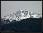 Fresh Snow On Peak |
 Viewpoint Near Summit |
 Near Summit |
 Trail Is Faint |
 More greenery |
 Moss On Rocks |
 Bare Trees |
 Klaus Lake Shore |
 Underwater |
 Fuller Mt. Summit |
 Boyle Lake Bridge |
 Old Sign |
 Boyle Lake |
 Start Of Klaus Trail |
 Reflection |
 Turn To Fuller Mt. Trail |
 Back To Ferns |
 Recrossing Bridge |
Trips - 2010
Home