8-21-10
This was the
first spring in decades that I did not do a snow scramble up Iron Peak
in the Teanaway. With a respite from the heat of summer I decided to
make a later season visit. Iron alone up the Beverly Creek trail was
not enough to I made it a loop over Bean Peak and out Bean Creek Basin.
I arrived at the Beverly trailhead at 8:30 and was on the trail a few
minutes later. The NF Teanaway Road has finally been graded and gravel
laid up to the Beverly Creek Bridge. It is now washboardy but that is a
big improvement over car eating potholes. The first half mile to Bean
Creek goes fast. The creek crossing was an easy rock hop. The trail is
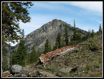
in fine shape with no down logs or other problems.
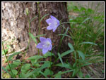
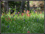
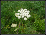
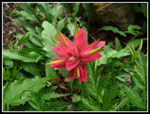
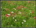
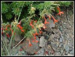
Parts of Beverly Creek go underground in the summer. At one point in the forest I was near it and heard no sound. Where the trail comes out of the forest and nears the creek it was just a trickle but some water was above ground. Higher up the flow is much stronger. The sky was pretty clear when I started but clouds came in fast. Comfortable short sleeve weather all day but never very hot. Perfect conditions for me in the Teanaway in summer. At the end of the switchbacks I passed two women hiking in. I did not see them again. A few flowers are still hanging on in this part of the trail. Even a few scarlet gilia.
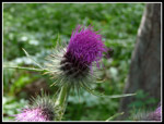
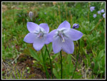
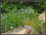
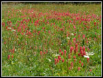
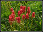
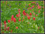
I've been curious about the distance to the summit of Iron and this day I had a GPS along. At the Fourth Creek junction it read 2.85 miles. It took me 71 minutes so that seems about right. Just past the junction are a few small creeks in spring. They still had some flow in late August and the result were flowers. Red and orange Indian paintbrush dominated with some tall thistles too. Much more color than found here most years. I crossed Beverly Creek and began the long switchbacks up the slope. Almost no mud but more of the late season flower show. Just enough water left to keep them blooming.
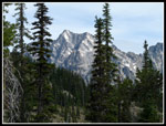
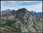
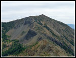
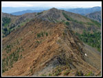
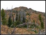
As I neared the saddle between Iron and Teanaway Peaks I heard a voice. Looking up I could just make out a scrambler high on the side of Teanaway. At maximum zoom I was able to get a pretty good photo of him. When I first hiked up the summit ridge of Iron Peak in 1988 there was a meager boot path over to the right of the existing trail. Now there is a full trail all the way to the top. The old route was mostly along the rocks on the ridge crest. Now it is on dirt to the right. What used to feel like a bit of a scramble is now just a trail. Looking at the scraggly trees just before the summit shows that there is about 10 feet of snow at that spot where I winter/spring camp.
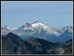
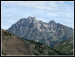
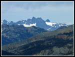
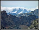
I reached the summit at 10:55 and then clouds now covered the sky. My GPS showed 4.87 miles to the summit. That is more than I expected though at 2:12 the time suggests that is correct. Those long switchbacks add 2 miles from the junction. The register is two years old and 75% full. Might get one more year out of it. Views were very good though Mt. Stuart just does not look right without much snow. I had plenty of time this day though I only spent about 20 minutes on the summit. The morning forecast added a chance of thundershowers and I still had a ways to go to get up and over Bean Peak.
Heading down I met two different groups of couples stopped and enjoying the views from low on the ridge. The descent down to Beverly Creek went fast. At the Fourth Creek junction I turned left and headed uphill. This short steep climb is pretty miserable in mid summer but this overcast day it was not bad at all. At Fourth Creek Pass I met two horse riders. I took a short break to slather on sunscreen. Another hiker passed me here. Soon I was on my way hiking the County Line Trail. The meadows along here still are plenty green though most flowers are finished. I passed the lone hiker and did not see him again.
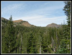
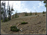
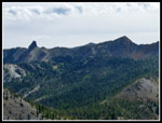
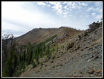
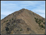
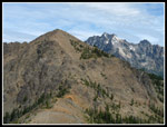
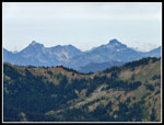
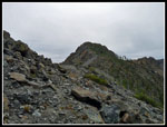
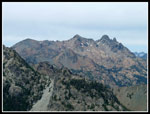
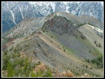
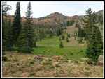
It was getting a little breezy and cool as I climbed the open switchbacks to the saddle alongside Volcanic Neck. Now I could see out to Navaho and Earl Peaks as well as back to Iron Peak. The scramble up the ridge of Bean is a fun climb. Not all that tough and not long. Soon I was on top of Bean and found nobody else up there. I could see one person in Bean Creek Basin and nobody on the surrounding peaks. The overcast did bring out the red coloring in Bean and the ridge to Mary Peak.
It was 1:40 when I summited. Still no signs of thunder and lightening. Clouds were below peak level at the Cascade crest now. I was glad to be well to the east. I finished my lunch and enjoyed the view from the summit. I've been known to spend hours on Bean but this day's stay was short. At 2:10 I started down. One week earlier I rolled my ankle badly and I knew the rocky descent to Bean Creek Basin was going to be the hardest part of the day. I had lots of time and I went very slowly.
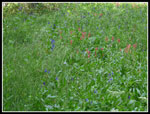
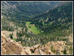
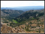
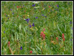
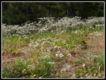
On another summer loop over Bean Gary and I dropped down far to our right and found sloping meadows of flowers hanging on in shade along small creeks. I did not expect to find any flowers left in the basin so I tried to follow our route from that day. Far to the right I did find a seeping creek and lots of color, especially Indian paintbrush. More exploring found several more glades of color. Happy with my detour I dropped down to the upper basin.
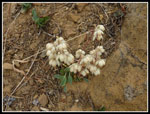
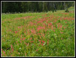
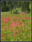
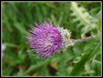
What did I find? One heck of a lot more blooming flowers than I expected. Paintbrush, monkshood, valarian, thistle, and a dozen more varieties. Progress ground to a halt. I was all alone in the upper basin in late summer and it was a flower bonanza! I stumbled through three campsites reaching the basin and none were taken. I guess the forecast scared away the crowds. There was just enough light to highlight the colors without washing them out. I could not have had much better conditions. The flowers mostly ended as I dropped down to the lower basin though color persisted along the creek.
On the way down I did pass half a dozen groups heading up. Still not the crowds I had expected from Bean Creek Basin on down. Before leaving the basin I had one more small flower display including a number of blooming scarlet gilia. The rest of the way down went quickly. After crossing Bean Creek I noticed the work a recent WTA work party had done. The trail is now very dusty where they dug but it is wider and much nicer. I arrived at my car a little after 4:30 to end another nearly eight hour "work" day. For the day I traveled just over 12 miles with 4400' of elevation gain. A very nice way to finally get in my annual Iron Peak trip.
Click on thumbnails to get larger pictures.
Trips - 2010
Home
Parts of Beverly Creek go underground in the summer. At one point in the forest I was near it and heard no sound. Where the trail comes out of the forest and nears the creek it was just a trickle but some water was above ground. Higher up the flow is much stronger. The sky was pretty clear when I started but clouds came in fast. Comfortable short sleeve weather all day but never very hot. Perfect conditions for me in the Teanaway in summer. At the end of the switchbacks I passed two women hiking in. I did not see them again. A few flowers are still hanging on in this part of the trail. Even a few scarlet gilia.
I've been curious about the distance to the summit of Iron and this day I had a GPS along. At the Fourth Creek junction it read 2.85 miles. It took me 71 minutes so that seems about right. Just past the junction are a few small creeks in spring. They still had some flow in late August and the result were flowers. Red and orange Indian paintbrush dominated with some tall thistles too. Much more color than found here most years. I crossed Beverly Creek and began the long switchbacks up the slope. Almost no mud but more of the late season flower show. Just enough water left to keep them blooming.
As I neared the saddle between Iron and Teanaway Peaks I heard a voice. Looking up I could just make out a scrambler high on the side of Teanaway. At maximum zoom I was able to get a pretty good photo of him. When I first hiked up the summit ridge of Iron Peak in 1988 there was a meager boot path over to the right of the existing trail. Now there is a full trail all the way to the top. The old route was mostly along the rocks on the ridge crest. Now it is on dirt to the right. What used to feel like a bit of a scramble is now just a trail. Looking at the scraggly trees just before the summit shows that there is about 10 feet of snow at that spot where I winter/spring camp.
I reached the summit at 10:55 and then clouds now covered the sky. My GPS showed 4.87 miles to the summit. That is more than I expected though at 2:12 the time suggests that is correct. Those long switchbacks add 2 miles from the junction. The register is two years old and 75% full. Might get one more year out of it. Views were very good though Mt. Stuart just does not look right without much snow. I had plenty of time this day though I only spent about 20 minutes on the summit. The morning forecast added a chance of thundershowers and I still had a ways to go to get up and over Bean Peak.
Heading down I met two different groups of couples stopped and enjoying the views from low on the ridge. The descent down to Beverly Creek went fast. At the Fourth Creek junction I turned left and headed uphill. This short steep climb is pretty miserable in mid summer but this overcast day it was not bad at all. At Fourth Creek Pass I met two horse riders. I took a short break to slather on sunscreen. Another hiker passed me here. Soon I was on my way hiking the County Line Trail. The meadows along here still are plenty green though most flowers are finished. I passed the lone hiker and did not see him again.
It was getting a little breezy and cool as I climbed the open switchbacks to the saddle alongside Volcanic Neck. Now I could see out to Navaho and Earl Peaks as well as back to Iron Peak. The scramble up the ridge of Bean is a fun climb. Not all that tough and not long. Soon I was on top of Bean and found nobody else up there. I could see one person in Bean Creek Basin and nobody on the surrounding peaks. The overcast did bring out the red coloring in Bean and the ridge to Mary Peak.
It was 1:40 when I summited. Still no signs of thunder and lightening. Clouds were below peak level at the Cascade crest now. I was glad to be well to the east. I finished my lunch and enjoyed the view from the summit. I've been known to spend hours on Bean but this day's stay was short. At 2:10 I started down. One week earlier I rolled my ankle badly and I knew the rocky descent to Bean Creek Basin was going to be the hardest part of the day. I had lots of time and I went very slowly.
On another summer loop over Bean Gary and I dropped down far to our right and found sloping meadows of flowers hanging on in shade along small creeks. I did not expect to find any flowers left in the basin so I tried to follow our route from that day. Far to the right I did find a seeping creek and lots of color, especially Indian paintbrush. More exploring found several more glades of color. Happy with my detour I dropped down to the upper basin.
What did I find? One heck of a lot more blooming flowers than I expected. Paintbrush, monkshood, valarian, thistle, and a dozen more varieties. Progress ground to a halt. I was all alone in the upper basin in late summer and it was a flower bonanza! I stumbled through three campsites reaching the basin and none were taken. I guess the forecast scared away the crowds. There was just enough light to highlight the colors without washing them out. I could not have had much better conditions. The flowers mostly ended as I dropped down to the lower basin though color persisted along the creek.
On the way down I did pass half a dozen groups heading up. Still not the crowds I had expected from Bean Creek Basin on down. Before leaving the basin I had one more small flower display including a number of blooming scarlet gilia. The rest of the way down went quickly. After crossing Bean Creek I noticed the work a recent WTA work party had done. The trail is now very dusty where they dug but it is wider and much nicer. I arrived at my car a little after 4:30 to end another nearly eight hour "work" day. For the day I traveled just over 12 miles with 4400' of elevation gain. A very nice way to finally get in my annual Iron Peak trip.
 Bill's Peak |
 Iron & Teanaway Peaks |
 Small Flowers |
 Meadow Flowers |
 Red & Blue Flowers |
 Thistle |
 Bee On Aster |
 Iron In Sight |
 Framed Mt. Stuart |
 Volcanic Neck & Bean |
 Iron Peak Ridge |
 Scrambler On Teanaway |
 Mt. Daniel |
 Bill's Peak & B-T Pass |
 Teanaway Peak Summit |
 Teanaway & Stuart |
 Mt. Stuart From Iron |
 Hibox, Alta, 3 Queens |
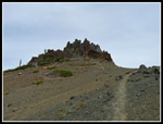
 Chimney Rock Area |
 Red Rock At Saddle |
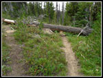 Tree Across Trail |
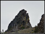 Pinnacle |
 Near Ridge & V-Neck |
 Bean Peak Ahead |
 Clouds Over Crest |
 Fortune & Ingalls |
 Mary & Judi Peaks |
 Bean Creek Basin |
 Earl Peak |
 Bean - Mary Ridge |
 Wider Basin View |
 Ridge To Volcanic Neck |
 Flower Below Bean Peak |
 Twins |
 Bean Summit |
 Flower On Barren Slope |
 Paintbrush Close Up |
 Pocket Meadow |
 Upper Basin Color |
 Basin & Bean Peak |
 Color Everywhere |
 Bright Paintbrush Bouquet |
 Even More Paintbrush |
 Just Me & Flowers |
 Mix In Some White |
 Terrific Color |
 Another Thistle |
 Bees On Blooms |
 Scarlet Gilia |
 Field Of White |
Trips - 2010
Home