1-31-10
Another drizzly
day and no idea where to go. I wanted a short drive and some miles. The
night before I saw a trip report for the Silent Swamp on Tiger
Mountain. The northeast side of East Tiger Mountain is the one corner
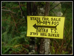
of Tiger I had not hiked. The report noted that a timber sale was
marked along the start of the trail. I decided I had better get out and
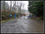
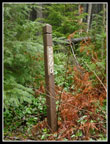
see it before the trees come down. The trailhead for the East Side Road
is 3.1 miles from I-90 on Highway 18. There is room for about 4 or 5
cars without blocking the gate. I arrived at 9:10 am. It was raining
lightly as I packed up to go. Rain gear was in order from the start.
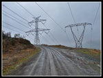
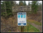
The road climbs a little to the power line corridor then follows under the power lines for a half mile or so. Where the lines drop down and cross over to Rattlesnake Mountain the road turns left and enters forest. At 1.3 miles I reached the Northwest Timber Trail. This is a biker/hiker trail that goes over to the main lot at Tiger Summit. As with all the bike trails it is closed from October 15 - April 15. While I was looking at the trail sign a truck drove by. That was one more than I was expecting. I headed on up the road. It dropped 100' to cross a creek and headed up again. At 2.3 miles I reached the Silent Swamp trailhead.
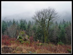
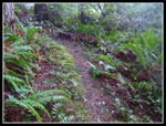
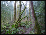
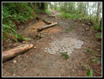
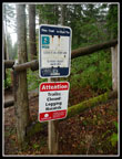
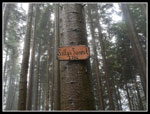
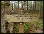
There was a sign stating the trail was closed due to "logging hazards". I somehow missed it. At least as of now, there is zero logging hazard on the trail. That will change when they start cutting. I did see the sign on the way down. I saw many markers on trees showing the logging boundary. Looks like the trail will be getting nuked soon. The trail is mostly on a an old railroad grade that gently gains elevation. A sign at the trailhead mentioned that logging in 1997 along the trail took out most trees but left many large old trees to provide a canopy. The cuts were above and below the trail but were not as bad as a true clear cut. Hopefully the new cuts will not close the trail too long and will leave some larger trees as well.
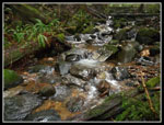
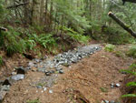
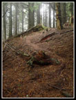
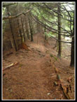
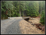
The trail leaves the grade as it nears Trout Hatchery Creek. I crossed the creek and the nature of the trail changed drastically. It headed straight up the fall line. This section was short and very steep. At the top it reaches an old narrow road and takes a right turn. Now the grade is very gentle once again. A second creek crossing is on mossy logs but was not too slick. The last bit of the trail has had a lot of recent work. Gravel, cement blocks, and hay on the mud along with a few logs cut out. After about 1 3/4 miles I met up with the East Side Road once again. The trail did cut off half a mile or more vs. walking the road.
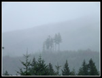
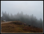
My plans were not very concrete and I debated heading on. I read about Beaver Valley in Footsore 1. It is just up the road from the Silent Swamp upper trailhead. The East Side Road also leads to the summit of East Tiger Mountain. I wasn't sure of the distance but the upper trail hits the road at 1960' and the summit is 3004'. Another 1040' didn't sound so bad. It was still misty though there was no steady rain all day. I headed up the road.
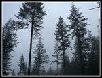
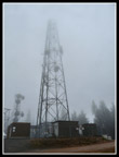
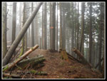
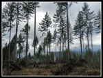
The road is moderately steep but easy walking. I passed one new logging road and the gravel pit dug to provide gravel for the roads. The road finally flattens then drops a little to a junction. Left drops down to the Main Tiger Road and right climbs to the summit of East Tiger in 3/4 mile. I was just up East Tiger a month earlier via the usual route from Tiger Summit. The last road has been regraded and is easier to walk up. At the top I could see a good 100'. Even the top of the towers went into and out of the clouds. I saw the truck that passed by earlier but not the worker.
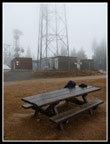
A quick lunch was the only reason to stay on top. I was soon heading down. It was about 6 1/4 miles going up. It took me about 2 1/2 hours. It did not take long to drop to the junction. It was only 37 degrees on top with some wind and I needed to warm up. Hiking downhill did not generate much heat. I had read a report a few years earlier about a small summit on the downhill side of the road near the East Side Road high point. I saw it on the way up. Did I really want to go searching for a way up now? At first I figured the answer was no. I passed the open gate and began to descend. I could see the ridge above and had second thoughts.
Oh what the heck! I found an opening in the brush and headed up. At the ridge I found a trail. I wasn't expecting that. I turned left and in a few minutes I was on top. High on a tree was a sign stating "Sally's Summit - 2786'. An unplanned new summit for me. I followed the short trail all the way down. The start is not obvious. It is just before the gate. Now It was almost all down hill. Just beyond the gate was the only mile marker I was to see. 6 miles to go.
My last order of business was to try to find the start of the railroad grade to Beaver Valley. I went off too early on my first attempt and had to fight devils club just to get from the road down to the forest. A second try looked like a grade but it was too high too. I think I found the grade near the Silent Swamp upper trailhead though it will require a lot a work climbing over logs. I'll save that for another day.
The road down from there was long but easy. I stopped at the Northwest Timber Trail for a food break and saw the first people of the day. Two hikers were coming out on the trail though it is clearly marked as closed to all users from October 15 - April 15. I also saw a lone biker coming down the East Side Road. On the last 1.3 miles there was a little sunshine peeking through. It was 2:50 when I reached my car. Just about 5 1/2 hours on the day with 13 miles hiked and 2400' gained. Not a bad way to spend a foggy and misty day.
Click on thumbnails to get larger pictures.
Trips - 2010
Home
The road climbs a little to the power line corridor then follows under the power lines for a half mile or so. Where the lines drop down and cross over to Rattlesnake Mountain the road turns left and enters forest. At 1.3 miles I reached the Northwest Timber Trail. This is a biker/hiker trail that goes over to the main lot at Tiger Summit. As with all the bike trails it is closed from October 15 - April 15. While I was looking at the trail sign a truck drove by. That was one more than I was expecting. I headed on up the road. It dropped 100' to cross a creek and headed up again. At 2.3 miles I reached the Silent Swamp trailhead.
There was a sign stating the trail was closed due to "logging hazards". I somehow missed it. At least as of now, there is zero logging hazard on the trail. That will change when they start cutting. I did see the sign on the way down. I saw many markers on trees showing the logging boundary. Looks like the trail will be getting nuked soon. The trail is mostly on a an old railroad grade that gently gains elevation. A sign at the trailhead mentioned that logging in 1997 along the trail took out most trees but left many large old trees to provide a canopy. The cuts were above and below the trail but were not as bad as a true clear cut. Hopefully the new cuts will not close the trail too long and will leave some larger trees as well.
The trail leaves the grade as it nears Trout Hatchery Creek. I crossed the creek and the nature of the trail changed drastically. It headed straight up the fall line. This section was short and very steep. At the top it reaches an old narrow road and takes a right turn. Now the grade is very gentle once again. A second creek crossing is on mossy logs but was not too slick. The last bit of the trail has had a lot of recent work. Gravel, cement blocks, and hay on the mud along with a few logs cut out. After about 1 3/4 miles I met up with the East Side Road once again. The trail did cut off half a mile or more vs. walking the road.
My plans were not very concrete and I debated heading on. I read about Beaver Valley in Footsore 1. It is just up the road from the Silent Swamp upper trailhead. The East Side Road also leads to the summit of East Tiger Mountain. I wasn't sure of the distance but the upper trail hits the road at 1960' and the summit is 3004'. Another 1040' didn't sound so bad. It was still misty though there was no steady rain all day. I headed up the road.
The road is moderately steep but easy walking. I passed one new logging road and the gravel pit dug to provide gravel for the roads. The road finally flattens then drops a little to a junction. Left drops down to the Main Tiger Road and right climbs to the summit of East Tiger in 3/4 mile. I was just up East Tiger a month earlier via the usual route from Tiger Summit. The last road has been regraded and is easier to walk up. At the top I could see a good 100'. Even the top of the towers went into and out of the clouds. I saw the truck that passed by earlier but not the worker.
A quick lunch was the only reason to stay on top. I was soon heading down. It was about 6 1/4 miles going up. It took me about 2 1/2 hours. It did not take long to drop to the junction. It was only 37 degrees on top with some wind and I needed to warm up. Hiking downhill did not generate much heat. I had read a report a few years earlier about a small summit on the downhill side of the road near the East Side Road high point. I saw it on the way up. Did I really want to go searching for a way up now? At first I figured the answer was no. I passed the open gate and began to descend. I could see the ridge above and had second thoughts.
Oh what the heck! I found an opening in the brush and headed up. At the ridge I found a trail. I wasn't expecting that. I turned left and in a few minutes I was on top. High on a tree was a sign stating "Sally's Summit - 2786'. An unplanned new summit for me. I followed the short trail all the way down. The start is not obvious. It is just before the gate. Now It was almost all down hill. Just beyond the gate was the only mile marker I was to see. 6 miles to go.
My last order of business was to try to find the start of the railroad grade to Beaver Valley. I went off too early on my first attempt and had to fight devils club just to get from the road down to the forest. A second try looked like a grade but it was too high too. I think I found the grade near the Silent Swamp upper trailhead though it will require a lot a work climbing over logs. I'll save that for another day.
The road down from there was long but easy. I stopped at the Northwest Timber Trail for a food break and saw the first people of the day. Two hikers were coming out on the trail though it is clearly marked as closed to all users from October 15 - April 15. I also saw a lone biker coming down the East Side Road. On the last 1.3 miles there was a little sunshine peeking through. It was 2:50 when I reached my car. Just about 5 1/2 hours on the day with 13 miles hiked and 2400' gained. Not a bad way to spend a foggy and misty day.
 Trailhead |
 Trees In The Mist |
 Some Color |
 Power Lines |
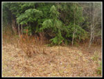
 Ferns On Swamp Trail |
 Draped Moss |
 Trees & Clouds |
 Nice Contrast |
 Trout Hatchery Creek |
 Mossy Arms |
 Trail Work |
 More Work |
 Upper Trailhead |
 Summit Tower |
 Wet Picnic Table |
 Nice Views |
 Trail To Sally's Summit |
 Summit Sign |
 Summit Scene |
 Heading Down Trail |
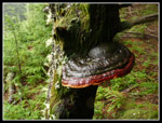 Fungus |
 Start Of Trail |
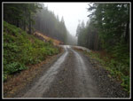 Gravel Pit & New Road |
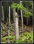 Section Marker |
 Road Marker |
 New Bridge |
 3.3 Miles To Go |
 Recent Cut |
 Silent Swamp Cut Sign |
 Northwest Timber Trail |
Trips - 2010
Home