01-22-11
I
didn't get out of the house until
after 9:00 am. I headed east with a few options in mind. I made my
first visit to Fuller Mountain in late winter last year. I had a heck
of a time finding the trail beyond the gravel pit. I must have wasted
an hour climbing all around. Eventually I headed back to the road, made
a quick right turn and stumbled into the real trail. I also went on to
Klaus and Boyle Lakes. Passing the High Point exit I saw dozens and
dozens of cars parked to hike Tiger Mountain. I figured I would see
very few people at Fuller Mountain.
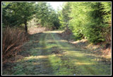
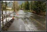
I drove through North Bend and onto the road to the NF Snoqualmie. Just before leaving the low valley there were two spots close together where water was running over the road. The big one was about 75' across. That was not expected. I headed uphill and soon pavement gave way to gravel. It is 3 1/2 miles on dirt to the starting point at the Spur 10 gates. I parked near the main road and walked downhill to the gate. It was 10:10 when I got started. Opposite the gate I found the unsigned trail.
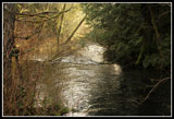
There was a flood warning for King County, the Snoqualmie was running high, and I was about to reach 10 Creek. I expected it would be very high. I remembered the log bridge with a rope handrail and hoped it would still be there. I could hear the creek long before I reached it. It was running much higher than on my visit last year. Part of the trail leading to the bridge was a creek. The first post for the handrail was hanging loose. The next one was partly pulled out. the handline was useless for the first half of the log bridge. The water was very deep and running very fast. I gingerly worked my way across. A short bit without wire mesh was very slick.
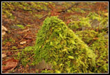
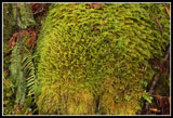
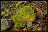
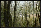
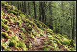
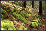
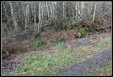
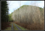
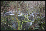
What I did not recall was that there was another part of the creek to still cross. This log was only a few inches above the water. I made it across with dry feet. The next section of trail is almost a rainforest. Moss hanging from the trees and moss covering rocks, stumps, and the ground. I soon reached the road at the entrance to the old gravel pit. There were dozens of culverts right where the trail reaches the road. Looks like this is the central culvert storage area. Having learned from my first visit, I turned left and in a few minutes took the uphill road to the right. A short way up I found the unmarked start to the Fuller Mountain trail. The start is not very obvious but a few steps in tread is found.
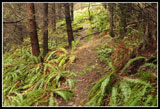
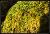
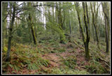
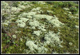
The trail is narrow and rocky. This day it was covered with red wet leaves making it even slicker than normal. I moved pretty slowly as I tried to stay on my feet. A little sun was breaking through but it was mostly overcast. That helped to bring out the many shades of green. Lots of photo opportunities on this short trail. I recorded .92 miles to the summit trail. It's another 1 1/4 miles to the summit. Many small branches were down across the trail and a few bigger logs. I removed most of the smaller branches. The biggest downed trees are near the ridge top. At my slow pace it was 11:40 when I reached the ridge.
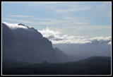
The trail from there to the summit is not entirely obvious. I had to stop several times to poke around and find it again. The fact the ground is covered in leaves does not help. I took a short break at the 1880' high point and pulled out the summit cache. Only two other folks had signed it since my visit 10 months earlier. The summit is completely forested so I headed over to the viewpoint. There were still a lot of clouds but I had sunshine beating down on me.
Soon I was heading down. I lost the route several times on the ridge but picked it up again each time. Towards the bottom of the trail I heard dogs and met the only group I was to see all day. Once off the summit trail I had to choose where else to go. I turned right on the road then right again and in a few hundred feet right once more. This is the road that runs parallel to Klaus lake. It was a lake in places last March but now it is completely dry. At the first wide spot on the left I turned onto an unmarked trail. It winds through forest a short way to the shore of Klaus Lake. A nice place for a break in the sun.
My break was short and I was soon back on the road. I took a left and continued up the road. Just before the road reaches Boyle Lake it makes a rightward turn. A very grassy spur goes straight ahead. I took this spur last time and met a trail that crosses the outlet and continues around the lake. That trail goes on to Bridges Lake and I have yet to hike it very far. The road began to climb above the lakes. The farther along the road I hiked the softer the tread. Gravel gave way to grass. Near the end there are small trees growing in the road and in a few years it will require bushwhacking. Still, that is only a short bit.
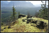
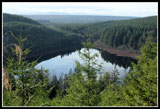
The road came to a "Y" with a treed bump right in the middle. The right road is long overgrown. The left is a little overgrown but easy walking. The road quickly ended at a grassy landing. Trees are small but have grown up enough to block all views. Bridges Lake is below but out of sight. The treed bump was now less than 100' above me. I was going to head back but decided to take a quick look to see if there was a boot path heading up. Son of a gun! Not just a boot path. There is a built trail switchbacking up. In just a few minutes I was on top. I'm guessing this is the "Biergarten" described in a trip report by Whitebark. The top was scalped sometime in the past and trees are growing larger. There are still some nice views out, especially down to Bridges Lake.
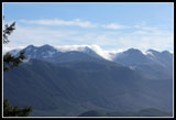
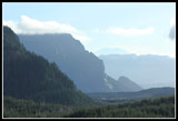
It was already 2:20 and I was 3 1/4 miles from my car so I made this break a short one. Now it was mostly sunny and very comfortable. There is an unusual angled view of Big and Little Si from the viewpoint. The trip down was pretty fast. I was back at the car at 3:50. This is a seldom visited area. It's close to North Bend but a million miles off the radar screen of most hikers. The low elevation makes it a good choice for a winter walk. I still have some more exploring to do. For the day I hiked about 9 1/2 miles with 1600' of gain.
Click on thumbnails to get
larger pictures.
Trips - 2011
Home
I drove through North Bend and onto the road to the NF Snoqualmie. Just before leaving the low valley there were two spots close together where water was running over the road. The big one was about 75' across. That was not expected. I headed uphill and soon pavement gave way to gravel. It is 3 1/2 miles on dirt to the starting point at the Spur 10 gates. I parked near the main road and walked downhill to the gate. It was 10:10 when I got started. Opposite the gate I found the unsigned trail.
There was a flood warning for King County, the Snoqualmie was running high, and I was about to reach 10 Creek. I expected it would be very high. I remembered the log bridge with a rope handrail and hoped it would still be there. I could hear the creek long before I reached it. It was running much higher than on my visit last year. Part of the trail leading to the bridge was a creek. The first post for the handrail was hanging loose. The next one was partly pulled out. the handline was useless for the first half of the log bridge. The water was very deep and running very fast. I gingerly worked my way across. A short bit without wire mesh was very slick.
What I did not recall was that there was another part of the creek to still cross. This log was only a few inches above the water. I made it across with dry feet. The next section of trail is almost a rainforest. Moss hanging from the trees and moss covering rocks, stumps, and the ground. I soon reached the road at the entrance to the old gravel pit. There were dozens of culverts right where the trail reaches the road. Looks like this is the central culvert storage area. Having learned from my first visit, I turned left and in a few minutes took the uphill road to the right. A short way up I found the unmarked start to the Fuller Mountain trail. The start is not very obvious but a few steps in tread is found.
The trail is narrow and rocky. This day it was covered with red wet leaves making it even slicker than normal. I moved pretty slowly as I tried to stay on my feet. A little sun was breaking through but it was mostly overcast. That helped to bring out the many shades of green. Lots of photo opportunities on this short trail. I recorded .92 miles to the summit trail. It's another 1 1/4 miles to the summit. Many small branches were down across the trail and a few bigger logs. I removed most of the smaller branches. The biggest downed trees are near the ridge top. At my slow pace it was 11:40 when I reached the ridge.
The trail from there to the summit is not entirely obvious. I had to stop several times to poke around and find it again. The fact the ground is covered in leaves does not help. I took a short break at the 1880' high point and pulled out the summit cache. Only two other folks had signed it since my visit 10 months earlier. The summit is completely forested so I headed over to the viewpoint. There were still a lot of clouds but I had sunshine beating down on me.
Soon I was heading down. I lost the route several times on the ridge but picked it up again each time. Towards the bottom of the trail I heard dogs and met the only group I was to see all day. Once off the summit trail I had to choose where else to go. I turned right on the road then right again and in a few hundred feet right once more. This is the road that runs parallel to Klaus lake. It was a lake in places last March but now it is completely dry. At the first wide spot on the left I turned onto an unmarked trail. It winds through forest a short way to the shore of Klaus Lake. A nice place for a break in the sun.
My break was short and I was soon back on the road. I took a left and continued up the road. Just before the road reaches Boyle Lake it makes a rightward turn. A very grassy spur goes straight ahead. I took this spur last time and met a trail that crosses the outlet and continues around the lake. That trail goes on to Bridges Lake and I have yet to hike it very far. The road began to climb above the lakes. The farther along the road I hiked the softer the tread. Gravel gave way to grass. Near the end there are small trees growing in the road and in a few years it will require bushwhacking. Still, that is only a short bit.
The road came to a "Y" with a treed bump right in the middle. The right road is long overgrown. The left is a little overgrown but easy walking. The road quickly ended at a grassy landing. Trees are small but have grown up enough to block all views. Bridges Lake is below but out of sight. The treed bump was now less than 100' above me. I was going to head back but decided to take a quick look to see if there was a boot path heading up. Son of a gun! Not just a boot path. There is a built trail switchbacking up. In just a few minutes I was on top. I'm guessing this is the "Biergarten" described in a trip report by Whitebark. The top was scalped sometime in the past and trees are growing larger. There are still some nice views out, especially down to Bridges Lake.
It was already 2:20 and I was 3 1/4 miles from my car so I made this break a short one. Now it was mostly sunny and very comfortable. There is an unusual angled view of Big and Little Si from the viewpoint. The trip down was pretty fast. I was back at the car at 3:50. This is a seldom visited area. It's close to North Bend but a million miles off the radar screen of most hikers. The low elevation makes it a good choice for a winter walk. I still have some more exploring to do. For the day I hiked about 9 1/2 miles with 1600' of gain.
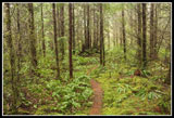 Start Of The Trail |
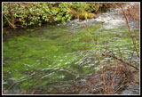 Green Water |
 First Bridge |
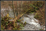 Second Log Bridge |
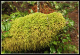 Moss On Everything |
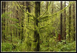 Mossy Trees |
 Culvert City |
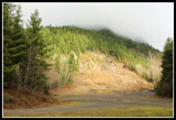 Fuller From Quarry |
 On Fuller Mt. Trail |
 Mini Fuller Mountain |
 Colorful Moss |
 Shades Of Green |
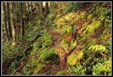 Narrow Trail |
 Colorful Rock |
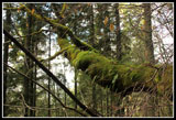 Moss & Ferns On Tree |
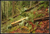 Downed Trees |
 North Ridge |
 Klaus Lake View |
 White & Green |
 Big & Little Si From Fuller |
 Clouds Over Ridge |
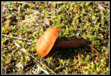 Mushroom |
 Viewpoint |
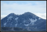 Snowy Bumps |
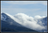 Clouds Blow Over |
 Mossy Rocks |
 Descending Trail |
 Start Of Trail |
 Fuller Mountain |
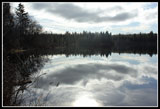 Klaus Lake Reflection |
 Grassier Road |
 Bridges Lake |
 Mts. Si From Viewpoint |
 Ten Creek From Bridge |
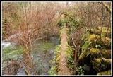
 Dammed Creek |
 Water Over Road |
Trips - 2011
Home