8-14-11
After
a beautiful sunny day on Norse Peak the day before, Kim proposed a
short scramble for a wet Sunday. Gee Point is an old lookout site
located in the area between Highways 20 and 530. To the
south, the Mountain Loop Highway has a number of trails. The area we
were visiting used to have a number of trails. Logging has shortened or
completely obliterated most of them. The trail to Gee Point is just a
fraction of what it once was. It is now only 1.50 miles to the lookout
site. The drive is also a long way. It is 31.6 miles from Darrington
and about 22 miles from Concrete. The roads are part paved and part
gravel. Other than some deep water bars the grade is pretty smooth.
Here
are driving directions taken from the WTA website:
From Burlington, take State Route (SR) 20 (North Cascades Highway) east. Just past Concrete and milepost (MP) 88, turn right on the Concrete-Sauk Road. Cross the Skagit River in one mile and bear left. Go for around 8.8 miles and turn right onto forest road (FR) 17. Go 10.5 miles and turn right on FR 1720. Follow 1720 for 2.1 miles and bear right onto FR 1722. Go 5.4 miles to the road end where the trail starts on a decommissioned road.
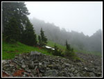
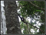
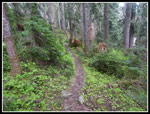
The summit is at 4974' and the trailhead is at 4275'. As we drove higher we entered the clouds. The road passes Little Gee lake about half a mile before the end. At the end there is plenty of room for half a dozen cars. We found a truck with two hunters. I never though about wearing orange but in the thick clouds visibility was minimal. Fortunately, the hunters left soon after we arrived. The route begins on the old road. It has been trenched and is now filled with willow trees. We put on rain gear and it was soaked within 50 feet. There are also some big puddles to slog through. That ends fast. The overgrown foliage also thins before long. Within about a quarter mile the road ends and an obvious boot path heads uphill.
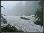
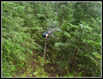
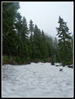
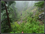
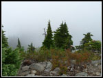
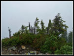
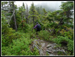
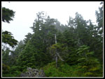
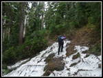
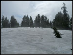
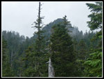
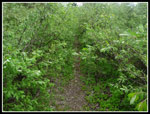
The trail starts out steep but is easy enough to follow. This is an old clear cut and is full of ferns and brush but the trail is not overgrown. Soon the grade eases and enters old growth forest. There are some big trees along here. We found half a dozen large trees recently fallen. None were too hard to get over. Otherwise, the trail is in pretty good shape for one that is not a high priority to maintain. When the snow started it quickly covered all the ground. We had Craig Romano's Hiking the North Cascades book but left it in the truck. We did not recall the directions exactly. That proved to be a bit of a problem. My GPS had a trail on it and we followed that. There were some footprints in the snow too. The meadow described in the book is now a big snow field.
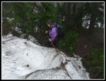
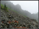
There must be 2-3 feet of snow in the meadow. The trail description mentioned going by the remains of an old cabin. Our route was now on the crest of the ridge. The ridge narrowed and footprints ended. My GPS showed the trail continuing on a moderately wide ridge right to the summit. Our ridge was rapidly getting narrower. We reached a point where the ridge dropped steeply to a saddle. The route down was on wet mossy rocks. This was definitely not the trail to the summit. It might go but it was not the route we had read about. We took a look at the left side but it just dropped steeply a long way. The right side did too. We backtracked along the ridge looking over the right (now left) side. I found a spot that looked like it might be a trail below us.
We dropped down through wet brush and found bare trail above what I had seen. Now we were back on track. Unfortunately, the snow began almost immediately. We looked high and low and chose a level traverse. Kim noticed some boards that identified the old cabin spot. We recalled talk about going around a talus field. Talus was there but under snow. We traversed farther until snow gave way to talus. Now under the summit of Gee Point we looked for any signs of a trail. After a while it was clear there was no trail. The best option now was to head back to the cabin and go up to the saddle above. A short climb to the ridge brought us to... a trail. Son of a gun. From here the climbers path leads to the summit. It is not a trail. It is a climbers path. There is deadly exposure in several places. Being wet it was a little tougher too.
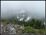
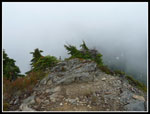
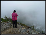
The first part is easy and safe to a viewpoint on the ridge. Of course we had no views through the clouds. We turned onto the left side of the ridge traversing with some steep climbing around the summit. The climb ends at the back of the peak. As usual it was easier to get up than down. I'm no fan of exposure. I was okay but this is not a route for trial hikers. The summit is a small flat area blasted off the top of the point. Photos show that the views are outstanding. From Olympics to Puget Sound to Mt. Baker to Glacier Peak. Mt. Higgins is also pretty close by. Our views were varying shades of gray. A short break did give us a view of Gee Point Lake, still surrounded by snow.
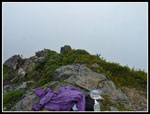
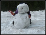
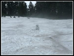
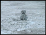
I was not looking forward to the descent but it proved easier than I expected. Our trip back was easy as we now knew the route. When we climbed back up to the ridge we found we missed the route down by 20 feet as it was not at all obvious under snow. Wed did see bits of wire cable for the old lookout communications system and a few insulators too. Back at the meadow I suggested we build a snowman. It just seemed crazy to be building a snowman at 4400' west of Darrington in mid August. There should be no snow let alone 3 feet of it. From a distance he looked like a hiker sitting in the meadow. Might be a surprise for the next person going by.
It was much brighter when we returned to the start though not close to sunny. The route is 3 miles round trip with about 800' of gain. We added some distance and nearly doubled the elevation gain with our off route wanderings. We did get to see some additional neat terrain though. For those who do not mind a little exposure the route to the summit is short and easy to follow, at least once the snow is gone. I believe the views would be excellent. The forest is worth the trip alone. Kim and I need to return on a clear day to see what we missed. A new trip for both of us and a fun little scramble.
Click on thumbnails to get
larger pictures.
Trips - 2011
Home
From Burlington, take State Route (SR) 20 (North Cascades Highway) east. Just past Concrete and milepost (MP) 88, turn right on the Concrete-Sauk Road. Cross the Skagit River in one mile and bear left. Go for around 8.8 miles and turn right onto forest road (FR) 17. Go 10.5 miles and turn right on FR 1720. Follow 1720 for 2.1 miles and bear right onto FR 1722. Go 5.4 miles to the road end where the trail starts on a decommissioned road.
The summit is at 4974' and the trailhead is at 4275'. As we drove higher we entered the clouds. The road passes Little Gee lake about half a mile before the end. At the end there is plenty of room for half a dozen cars. We found a truck with two hunters. I never though about wearing orange but in the thick clouds visibility was minimal. Fortunately, the hunters left soon after we arrived. The route begins on the old road. It has been trenched and is now filled with willow trees. We put on rain gear and it was soaked within 50 feet. There are also some big puddles to slog through. That ends fast. The overgrown foliage also thins before long. Within about a quarter mile the road ends and an obvious boot path heads uphill.
The trail starts out steep but is easy enough to follow. This is an old clear cut and is full of ferns and brush but the trail is not overgrown. Soon the grade eases and enters old growth forest. There are some big trees along here. We found half a dozen large trees recently fallen. None were too hard to get over. Otherwise, the trail is in pretty good shape for one that is not a high priority to maintain. When the snow started it quickly covered all the ground. We had Craig Romano's Hiking the North Cascades book but left it in the truck. We did not recall the directions exactly. That proved to be a bit of a problem. My GPS had a trail on it and we followed that. There were some footprints in the snow too. The meadow described in the book is now a big snow field.
There must be 2-3 feet of snow in the meadow. The trail description mentioned going by the remains of an old cabin. Our route was now on the crest of the ridge. The ridge narrowed and footprints ended. My GPS showed the trail continuing on a moderately wide ridge right to the summit. Our ridge was rapidly getting narrower. We reached a point where the ridge dropped steeply to a saddle. The route down was on wet mossy rocks. This was definitely not the trail to the summit. It might go but it was not the route we had read about. We took a look at the left side but it just dropped steeply a long way. The right side did too. We backtracked along the ridge looking over the right (now left) side. I found a spot that looked like it might be a trail below us.
We dropped down through wet brush and found bare trail above what I had seen. Now we were back on track. Unfortunately, the snow began almost immediately. We looked high and low and chose a level traverse. Kim noticed some boards that identified the old cabin spot. We recalled talk about going around a talus field. Talus was there but under snow. We traversed farther until snow gave way to talus. Now under the summit of Gee Point we looked for any signs of a trail. After a while it was clear there was no trail. The best option now was to head back to the cabin and go up to the saddle above. A short climb to the ridge brought us to... a trail. Son of a gun. From here the climbers path leads to the summit. It is not a trail. It is a climbers path. There is deadly exposure in several places. Being wet it was a little tougher too.
The first part is easy and safe to a viewpoint on the ridge. Of course we had no views through the clouds. We turned onto the left side of the ridge traversing with some steep climbing around the summit. The climb ends at the back of the peak. As usual it was easier to get up than down. I'm no fan of exposure. I was okay but this is not a route for trial hikers. The summit is a small flat area blasted off the top of the point. Photos show that the views are outstanding. From Olympics to Puget Sound to Mt. Baker to Glacier Peak. Mt. Higgins is also pretty close by. Our views were varying shades of gray. A short break did give us a view of Gee Point Lake, still surrounded by snow.
I was not looking forward to the descent but it proved easier than I expected. Our trip back was easy as we now knew the route. When we climbed back up to the ridge we found we missed the route down by 20 feet as it was not at all obvious under snow. Wed did see bits of wire cable for the old lookout communications system and a few insulators too. Back at the meadow I suggested we build a snowman. It just seemed crazy to be building a snowman at 4400' west of Darrington in mid August. There should be no snow let alone 3 feet of it. From a distance he looked like a hiker sitting in the meadow. Might be a surprise for the next person going by.
It was much brighter when we returned to the start though not close to sunny. The route is 3 miles round trip with about 800' of gain. We added some distance and nearly doubled the elevation gain with our off route wanderings. We did get to see some additional neat terrain though. For those who do not mind a little exposure the route to the summit is short and easy to follow, at least once the snow is gone. I believe the views would be excellent. The forest is worth the trip alone. Kim and I need to return on a clear day to see what we missed. A new trip for both of us and a fun little scramble.
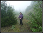 Kim On Old Road |
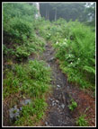 Steep Boot Path |
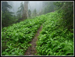 Vivid Green |
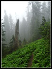 Walking In Mist |
 Snowy Meadow |
 Climbing Onto Snow |
 Bushwhacking |
 Snowy Cabin Site |
 Talus Field |
 Heading The Wrong Way |
 On Scramble Route |
 Gee Point Lake From Top |
 View South |
 Great Views |
 Glacier Peak? |
 Breathtaking Views |
 Kim Enjoying Views |
 Off Steep Scramble |
 Looking Up To Summit |
 Ascending From Cabin |
 Wire Insulator |
 Back To Meadow |
 Snowman |
 Child Sitting In Meadow |
 Hiker With Backpack |
 Clouds Are Gone |
 Gee Point |
 Brush Near Start |
Trips - 2011
Home