6-25-11
Gary
and John joined me for another
trip to the Teanaway. Gary and I did Miller via Iron Creek a few years
ago. We hoped to find wildflowers, blue sky, a long hike, and not too
much snow. Overall, we did just fine. The hike to Iron Bear Peak was
the WTA hike of the week meaning the small parking lot would be full
early. There is room for more cars down the road but we wanted to get
out ahead of the expected crowds. The trail usually melts out early up
to Iron Bear. Dropping down the backside the snow hangs in much later.
The ridge to Miller is open and gets a lot of snow. We hoped that it
would be well melted out. With 13 miles to cover we did not need a lot
of mushy snow.
We met in Bellevue at 6:30 and headed east. Through Cle Elum then north on Highway 970 and then 97. Iron Creek Road is 2.3 miles north of Mineral Springs. The road is in good shape and crossing the creek in my car near the trailhead was no problem. The tiny lot at the trailhead holds 6 or 7 cars at most. We were the third car. One group left as we arrived and a larger group hiked up the road before we left. The third group was Tigerman and Boot Up from nwhikers. They left just after us. By 8:20 we were on the trail.
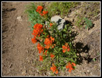
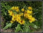
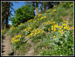
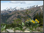
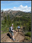
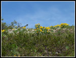
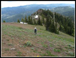
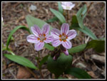
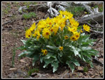
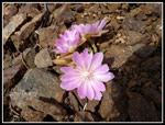
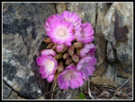
There are a few creeks in the first mile but none are any problem to get across with dry feet. After that there is zero water on the route to Miller Peak. Flowers start immediately with vanilla leaf leading the way. The good stuff starts when the route starts to break out into the open. Lots of balsamroot here and almost everywhere else we hiked. Orange and red Indian paintbrush dotted the hillside. There were a few scarlet gilia in full bloom. I looked for bitterroot but did not see any. We made numerous stops to photograph the flowers. The low morning sunshine was excellent. In short order we reached the ridge top and the four way intersection. We turned to the right and headed for Iron Bear Peak.
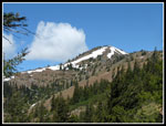
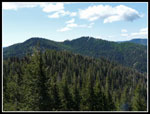
On the way to the ridge we were passed by two motorcycles and two bicycles. Hikers were still in short supply. The trail slowly gains elevation as it is very gentle. Snow was non existent on the way to Iron Bear. In the forest below the peak we came upon several clumps of peaking trillium. At the summit we took a break. We could now see much of the ridge we would take to Miller. It was almost totally snow free. There was snow near the summit of Miller but a bare spot where we scramble up. That was a surprise.
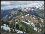
As expected there was snow on the north side of Iron Bear where the trail begins to descend. Lots of footprints and the snow was not deep. There were 4 or 5 logs down across the trail. Some we went over and some around. These would be more of a problem for horses and motorcycles. The bicyclers we saw went on by with no problem. We were to see them again several times. As we rounded Jester Mountain we passed by many larch trees with bright light green needles. The way was then all downhill to the saddle where the Shaser Road comes in. We snowshoed up to that junction just 14 months earlier in April 2010. It was getting plenty warm and now it was time to head uphill again.
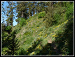
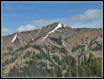
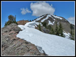
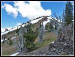
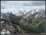
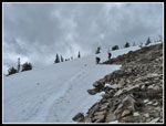
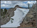
The route is gentle at first as it winds along an open slope. More wildflowers here. Lots of balsamroot, paintbrush, and ballhead waterleaf. The trail cuts across the ridge where it was blasted away, crosses a meadow with a little snow, and finally begins to ascend. Miller seemed to be a long way away from Iron Bear but now it was right in front of us. The trail makes two sets of switchbacks and then we headed cross country. Up on the ridge top we found bare on the left and snow in many places on the right side. There is one place where we needed to scramble up the rock. Otherwise it was just a nice ridge walk. We took a short break at the point the ridge turns straight uphill. A bit of a boot path has emerged. Snow on the left and on the right but bare where we climbed.
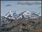
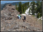
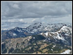
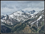
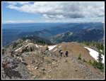
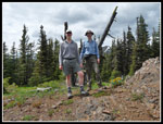
The scree is a bit of a pain but in short order we were on firm ground then some snow just below the top. We arrived to find two hikers at the summit already. They came up the Miller trail from the end of the Stafford Creek Road in the Teanaway. We heard the same story from all who took that route. Several tough water crossings and many blow downs. Our route was easy by comparison though much longer. We arrived at 12:08, just in time for lunch. The usual great views of Jolly, Earl, Little Navaho, Navaho Fortune, South Ingalls, Ingalls, Stuart, and much of the Stuart Range.
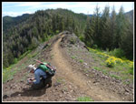
The first two hikers left and were soon replaced by two more. Next were the two bikers. On our way up to the ridge top we saw them reach the big snow wall blocking the trail below Miller. They carried their bikes up the slope and over the snow where it was passable. They were certainly resourceful. Their route was much longer than ours. Another group came up via the Miller trail. I have never seen that many people on the summit. We spent over an hour on top. In the mean time clouds to the west blew our way. It was a little dark when we left the summit.
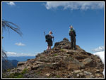
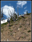
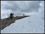
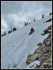
On the way down we plunge stepped a little snow and glissaded one short spot. That allowed us to miss the worst of the scree. We followed the ridge again to where we came up. Back down the switchbacks and to along the open rocky slope. At the blasted spot we caught up with a couple who left the summit ahead of us. They were doing the whole Miller Bear Loop. Once back at the Shaser Road junction we faced the steep motorcycle cut straight up the slope. This loose gravelly cut gains 280' in a short distance. The cloudy sky was still providing plenty of heat for the climb. Not much fun but it was over pretty quickly. As we traversed around Jester we left the trail and headed up to the summit. Summit #3 on the day. Gary and John recognized the silvered snag we stood next to for photos last year. The only difference was several feet of snow back then.
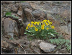
We took another short break on top of Iron Bear. Several groups there. We saw a number of groups still coming in as we headed down. At the ridge near the four way junction we found the missing bitterroot. The closed flowers had evaded my morning search. On the way down from the saddle we found a few more patches of blooming bitterroot. It was just after 5:00 pm when we arrived at the bottom. The two bikers were still there. They passed us in the last mile. They went down the Miller trail and up Bear Creek to complete the Miller Loop and up and down the Iron Creek trail. On the drive out we found cars parked along the road for some distance. It was a busy day at Iron Bear but we missed most of the crowds.
We met all the criteria for the day. Great wildflowers, almost entirely snow free trail, great views, and mostly sunny weather. It will be at least another two weeks before motorcycles can make the whole loop. In the mean time there is nothing that would stop a resourceful hiker. A good day was had by all.
Click on thumbnails to get
larger pictures.
Trips - 2011
Home
We met in Bellevue at 6:30 and headed east. Through Cle Elum then north on Highway 970 and then 97. Iron Creek Road is 2.3 miles north of Mineral Springs. The road is in good shape and crossing the creek in my car near the trailhead was no problem. The tiny lot at the trailhead holds 6 or 7 cars at most. We were the third car. One group left as we arrived and a larger group hiked up the road before we left. The third group was Tigerman and Boot Up from nwhikers. They left just after us. By 8:20 we were on the trail.
There are a few creeks in the first mile but none are any problem to get across with dry feet. After that there is zero water on the route to Miller Peak. Flowers start immediately with vanilla leaf leading the way. The good stuff starts when the route starts to break out into the open. Lots of balsamroot here and almost everywhere else we hiked. Orange and red Indian paintbrush dotted the hillside. There were a few scarlet gilia in full bloom. I looked for bitterroot but did not see any. We made numerous stops to photograph the flowers. The low morning sunshine was excellent. In short order we reached the ridge top and the four way intersection. We turned to the right and headed for Iron Bear Peak.
On the way to the ridge we were passed by two motorcycles and two bicycles. Hikers were still in short supply. The trail slowly gains elevation as it is very gentle. Snow was non existent on the way to Iron Bear. In the forest below the peak we came upon several clumps of peaking trillium. At the summit we took a break. We could now see much of the ridge we would take to Miller. It was almost totally snow free. There was snow near the summit of Miller but a bare spot where we scramble up. That was a surprise.
As expected there was snow on the north side of Iron Bear where the trail begins to descend. Lots of footprints and the snow was not deep. There were 4 or 5 logs down across the trail. Some we went over and some around. These would be more of a problem for horses and motorcycles. The bicyclers we saw went on by with no problem. We were to see them again several times. As we rounded Jester Mountain we passed by many larch trees with bright light green needles. The way was then all downhill to the saddle where the Shaser Road comes in. We snowshoed up to that junction just 14 months earlier in April 2010. It was getting plenty warm and now it was time to head uphill again.
The route is gentle at first as it winds along an open slope. More wildflowers here. Lots of balsamroot, paintbrush, and ballhead waterleaf. The trail cuts across the ridge where it was blasted away, crosses a meadow with a little snow, and finally begins to ascend. Miller seemed to be a long way away from Iron Bear but now it was right in front of us. The trail makes two sets of switchbacks and then we headed cross country. Up on the ridge top we found bare on the left and snow in many places on the right side. There is one place where we needed to scramble up the rock. Otherwise it was just a nice ridge walk. We took a short break at the point the ridge turns straight uphill. A bit of a boot path has emerged. Snow on the left and on the right but bare where we climbed.
The scree is a bit of a pain but in short order we were on firm ground then some snow just below the top. We arrived to find two hikers at the summit already. They came up the Miller trail from the end of the Stafford Creek Road in the Teanaway. We heard the same story from all who took that route. Several tough water crossings and many blow downs. Our route was easy by comparison though much longer. We arrived at 12:08, just in time for lunch. The usual great views of Jolly, Earl, Little Navaho, Navaho Fortune, South Ingalls, Ingalls, Stuart, and much of the Stuart Range.
The first two hikers left and were soon replaced by two more. Next were the two bikers. On our way up to the ridge top we saw them reach the big snow wall blocking the trail below Miller. They carried their bikes up the slope and over the snow where it was passable. They were certainly resourceful. Their route was much longer than ours. Another group came up via the Miller trail. I have never seen that many people on the summit. We spent over an hour on top. In the mean time clouds to the west blew our way. It was a little dark when we left the summit.
On the way down we plunge stepped a little snow and glissaded one short spot. That allowed us to miss the worst of the scree. We followed the ridge again to where we came up. Back down the switchbacks and to along the open rocky slope. At the blasted spot we caught up with a couple who left the summit ahead of us. They were doing the whole Miller Bear Loop. Once back at the Shaser Road junction we faced the steep motorcycle cut straight up the slope. This loose gravelly cut gains 280' in a short distance. The cloudy sky was still providing plenty of heat for the climb. Not much fun but it was over pretty quickly. As we traversed around Jester we left the trail and headed up to the summit. Summit #3 on the day. Gary and John recognized the silvered snag we stood next to for photos last year. The only difference was several feet of snow back then.
We took another short break on top of Iron Bear. Several groups there. We saw a number of groups still coming in as we headed down. At the ridge near the four way junction we found the missing bitterroot. The closed flowers had evaded my morning search. On the way down from the saddle we found a few more patches of blooming bitterroot. It was just after 5:00 pm when we arrived at the bottom. The two bikers were still there. They passed us in the last mile. They went down the Miller trail and up Bear Creek to complete the Miller Loop and up and down the Iron Creek trail. On the drive out we found cars parked along the road for some distance. It was a busy day at Iron Bear but we missed most of the crowds.
We met all the criteria for the day. Great wildflowers, almost entirely snow free trail, great views, and mostly sunny weather. It will be at least another two weeks before motorcycles can make the whole loop. In the mean time there is nothing that would stop a resourceful hiker. A good day was had by all.
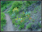 Flowers Begin Early |
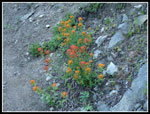 Red & Orange Paintbrush |
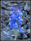 Blue Wildflower |
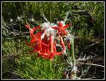 Scarlet Gilia |
 Bright Paintbrush |
 Yellow Hillside |
 Great Lighting |
 Balsamroot Everywhere |
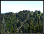
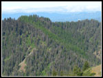 Swath Of Larch Trees |
 Teanaway Peaks |
 Jester Summit |
 Stuart & Navaho Peaks |
 Gary, John, & Miller |
 Miller Is Ahead |
 Yellow Against Blue |
 Snow Blocks Trail Ahead |
 Jester & Iron Bear Peaks |
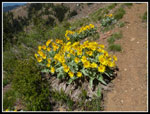 More Balsamroot |
 Bump On The Ridge |
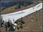 Bikers Cross Snow Wall |
 Bare Rock & Snow |
 Short Rock Scramble |
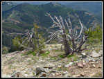
 Snags On Ridge |
 Final Climb |
 Earl Peak |
 Navaho Peak |
 County Line Trail Route |
 Three Brothers |
 New Arrivals |
 Summit Snags |
 John On Summit |
 Glissade Time |
 John's Turn |
 Snow Hangs On |
 Heading Off Ridge |
 Balsamroot Alcove |
 Spring Beauty |
 Afternoon Light |
 Jester Summiteers |
 Teanaway Ridge |
 Good Bitterroot |
 Best Bitterroot |
Trips - 2011
Home