3-17-13
Snow
in the mountains, sun in Seattle, and rain most other places. Where to
go. In addition, repaving had I-5 down to two lanes southbound from the
University District. For St. Patrick's Day the race had the viaduct
closed. How to get out of town. No easy way. Highway 99 was closed at
the north end of the Aurora Bridge. I ended up in a long line on I-5.
With all that I was not out of town until later than planned. I settled
on East Tiger Mountain from Tiger Summit on Highway 18. With a snow
level down to 1200' - 1500' the 1350' trailhead would ensure little
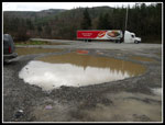
rainy hiking. I pulled in at 9:30 am. The lakes in the parking lot are
as big as ever. "Puddles" does not do them justice.
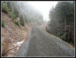
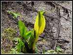
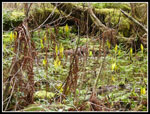
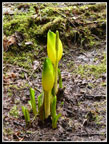
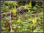
There were a few snow flakes coming down as I started up the road at 9:40 am. Just beyond the gate are ponds that are full of skunk cabbage in the spring. I figured this would still be too early. Not at all. Lots of yellow cabbage to be seen. It was just below freezing with a bit of a cold wind. Much of the way up was sheltered from the wind. Where it was not it was very cold. A few hundred feet up the road it turns to the left. Now it also goes straight ahead. That new logging road was put in since my last visit in May of last year.
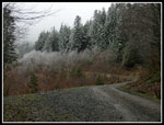
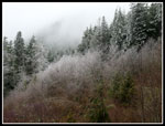
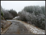
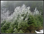
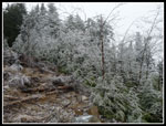
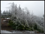
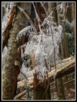
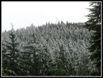
The road walk is fast even with steady elevation gain. For the most part there was no precipitation. Just a few occasional snow flurries. Although there were about a dozen cars in the lot I saw only a couple groups on my way up. Beyond the two mile sign there was a little fresh snow on the sides in places. Nothing on the road itself. Bright white rime ice covered some trees above that point. I could not see the summit as the upper mountain was completely in the clouds. The 2.5 mile sign is missing facing downhill. On the way down I did see one facing uphill.
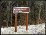
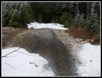
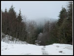
At about 2.75 miles I reached the junction. There is now a big sign pointing right and listing East Tiger Summit as 1.1 miles away. The wind was blowing harder here. To hard or a baseball cap. It's too steep for a jacket however. I planned to stay dry. The next junction also has a sign now. It points left and lists .70 miles to go.To the right there was suddenly snow on the road. I went left. The gate was open. Soon there were patches of rock hard icy snow followed by bare road. I brought yak trax but with the bare spots I chose to slip and slide in boots alone. The snow was extremely hard packed and very icy. Poles helped a lot.
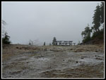
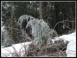
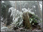
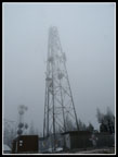
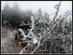
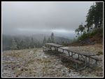
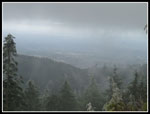
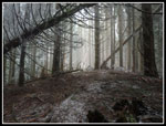
I was now completely in the clouds. No views at all. As I neared the summit I heard a dog barking so I knew I was not the first to reach the top this day. I found a group of four bundled up and eating lunch at the picnic tables. There were some good examples of rime ice on trees along the upper road and also at the summit. I arrived on top just a few minutes before 11:00 am. About 1:18 to hike up 3.8 miles. Almost as long as the Mt.Si trail but with just over half the elevation gain. A lot faster to hike up too, even with icy snow up high. My stay was short. Ten minutes later I was on my way down. As expected visibility at the summit was zero. I headed down before the other group.
Back at the first junction I went left instead of returning the way I came. In a short way there was a big shipping container. It almost sits on the start of the short way trial to Sally's Summit. I cleaned up a few big branches that fell on the way trail. Almost no snow in the trees. When I first went up Sally's Summit there was a summit sign. A year later it was gone. A year later a new one was in place. Today it was gone. Someone really must have a need to remove the summit sign from a little visited point.
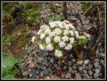
From there I dropped back to the first junction. I followed my uphill track back to the next junction. Instead of turning left back to the trailhead I went straight. A half mile walk along the road added another mile to my round trip total. Before my turn around I met the summit group once again. The hike down was fast and easy. I passed half a dozen groups coming up. Several were good sized. Just before the bottom I turned off on the connector trail to the summer parking lot. The bicycle trails are closed to everyone for the winter. This trail was closed to bikes but open to hikers. There were a few early wildflowers in bloom but not much yet.
Back at the beginning I took a short detour to get more skunk cabbage photos. It was still only 1:40 as I packed up to go. Four hours total to hike 9 miles with about 2000' of gain. The afternoon drive home was much easier than the morning traffic mess. This is not a great scenic hike but it is easy enough and with all the roads and side trails you can make it as long as you like. It rained much of the drive home but I had no rain on my trip.
Click on thumbnails to get
larger pictures.
Trips - 2013
Home
There were a few snow flakes coming down as I started up the road at 9:40 am. Just beyond the gate are ponds that are full of skunk cabbage in the spring. I figured this would still be too early. Not at all. Lots of yellow cabbage to be seen. It was just below freezing with a bit of a cold wind. Much of the way up was sheltered from the wind. Where it was not it was very cold. A few hundred feet up the road it turns to the left. Now it also goes straight ahead. That new logging road was put in since my last visit in May of last year.
The road walk is fast even with steady elevation gain. For the most part there was no precipitation. Just a few occasional snow flurries. Although there were about a dozen cars in the lot I saw only a couple groups on my way up. Beyond the two mile sign there was a little fresh snow on the sides in places. Nothing on the road itself. Bright white rime ice covered some trees above that point. I could not see the summit as the upper mountain was completely in the clouds. The 2.5 mile sign is missing facing downhill. On the way down I did see one facing uphill.
At about 2.75 miles I reached the junction. There is now a big sign pointing right and listing East Tiger Summit as 1.1 miles away. The wind was blowing harder here. To hard or a baseball cap. It's too steep for a jacket however. I planned to stay dry. The next junction also has a sign now. It points left and lists .70 miles to go.To the right there was suddenly snow on the road. I went left. The gate was open. Soon there were patches of rock hard icy snow followed by bare road. I brought yak trax but with the bare spots I chose to slip and slide in boots alone. The snow was extremely hard packed and very icy. Poles helped a lot.
I was now completely in the clouds. No views at all. As I neared the summit I heard a dog barking so I knew I was not the first to reach the top this day. I found a group of four bundled up and eating lunch at the picnic tables. There were some good examples of rime ice on trees along the upper road and also at the summit. I arrived on top just a few minutes before 11:00 am. About 1:18 to hike up 3.8 miles. Almost as long as the Mt.Si trail but with just over half the elevation gain. A lot faster to hike up too, even with icy snow up high. My stay was short. Ten minutes later I was on my way down. As expected visibility at the summit was zero. I headed down before the other group.
Back at the first junction I went left instead of returning the way I came. In a short way there was a big shipping container. It almost sits on the start of the short way trial to Sally's Summit. I cleaned up a few big branches that fell on the way trail. Almost no snow in the trees. When I first went up Sally's Summit there was a summit sign. A year later it was gone. A year later a new one was in place. Today it was gone. Someone really must have a need to remove the summit sign from a little visited point.
From there I dropped back to the first junction. I followed my uphill track back to the next junction. Instead of turning left back to the trailhead I went straight. A half mile walk along the road added another mile to my round trip total. Before my turn around I met the summit group once again. The hike down was fast and easy. I passed half a dozen groups coming up. Several were good sized. Just before the bottom I turned off on the connector trail to the summer parking lot. The bicycle trails are closed to everyone for the winter. This trail was closed to bikes but open to hikers. There were a few early wildflowers in bloom but not much yet.
Back at the beginning I took a short detour to get more skunk cabbage photos. It was still only 1:40 as I packed up to go. Four hours total to hike 9 miles with about 2000' of gain. The afternoon drive home was much easier than the morning traffic mess. This is not a great scenic hike but it is easy enough and with all the roads and side trails you can make it as long as you like. It rained much of the drive home but I had no rain on my trip.
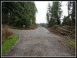 New Logging Road |
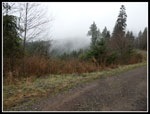 Wafting Clouds |
 Icy Tees Ahead |
 Very Icy Trees |
 Into The Clouds |
 Snow Starts Ahead |
 New Sign |
 Snowy & Bare |
 Green & White |
 No Views |
 More Rime |
 Lone White Tree |
 Very White |
 Tower In Clouds |
 Thick Rime Ice |
 Info Board |
 Warning |
 A Little View Now |
 Almost A View |
 Still More Rime |
 Icy Branches |
 Neat Lighting |
 Snowy Road |
 Summit Tower |
 Wildflower |
 Lone Skunk Cabbage |
 A Lot More |
 Good Color |
 A Nice Patch |
 Tiger "Lake" |
Trips - 2013
Home