6-22-13
The
final sentence on my 2002 trip report for Mt. Aix reads "After
returning to this fine trail I will make
sure not to wait 11 years to come back." Well I waited another 11
years. Now I'll have to say it again. This is such a fun hike it
deserves to be in a much shorter rotation. Last year Gwen and I were on
a trip to Meeks
Table. Farther down that road is
the eastern trailhead for Mt. Aix. I mentioned what a great trip it is.
Gwen wanted to go. This spring the topic came up again and we planned
for a trip up after most snow had melted but before the heat of summer.
This weekend looked good on both accounts. Since there had been no trip
reports this year we had to guesstimate on the snow conditions. With
that in mind we took both microspikes and ice axes. It is a long drive
from Seattle so we headed over late Friday afternoon.
Our 2:50 exit from my house put us ahead of the worst of the rush hours traffic. We headed through Enumclaw and east on Highway 410. It was a dark cloudy afternoon but we held out hope for the forecast sunny day on Saturday before the clouds rolled but in on Sunday. We headed over Chinook Pass and down to the Bumping River Road. At the end of pavement we went 2.3 miles to a left turn at the junction and 1.5 more miles to the Mt. Aix trailhead. The dirt road was in better shape than I have ever seen it. We found a nice big campsite just below the trailhead parking and set up tents. This was the summer solstice and it was not dark until after 10:00 pm. Finally we crawling into tents and tried to get some sleep.
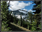
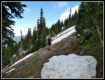
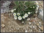
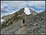
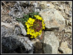
By 6:00 am we were up. Some clouds still but also some blue sky. We ate, packed up, and were heading for the trailhead by 7:05 am. There were two other cars in the lot. One had a tent up. The trail up to Nelson Ridge is a steady climb. The trailhead is at 3650' and the ridge is at 7150' That's 3500' of gain in about 5 miles. For the most part it is about 700' per mile. A few slightly steeper spots but not many. It's just a long grind to reach the ridge. From there you have a mile of high in the sky walking to reach Mt. Aix. The first few creek crossings are still running with plenty of water. Easy to cross but water for those who need to fill bottles. There were a few trillium and yellow violets in bloom. While we were early for the flower show up high we did find a number of varieties of wildflowers in bloom along the way.
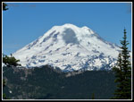
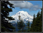
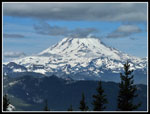
Forest continues higher than I remembered. Lot of shade even up to 6000' and more. About a mile up the trail we took a break to remove clothing as the day heated up. Matt passed us there. He remembered me from a meeting at Ingalls Pass last fall. We continued the long trek towards the ridge. As we climbed we began to see bits of Mt. Rainier between the trees. We finally had a break in forest and good views over to Rainier. A few clouds but it was mostly in the clear. At 5300' we had some patches of snow then it disappeared once again. A few more snow patches at 6000' then much more beginning at a switchback at 6100'. Here we again met Matt on his way down. He had a dislocation the previous week and used good sense to turn around when the snow became deeper and harder traversing the steepening slope.
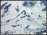
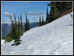
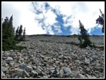
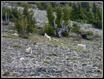
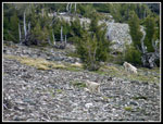
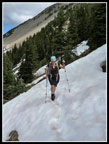
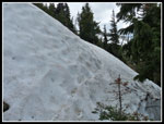
We continued on with me kicking steps across the snow. After each snow crossing we found more bare trail. The snow had frozen overnight and it was just beginning to soften. I was able to kick pretty solid steps while I could see earlier steps from this morning that barely dented the snow/ice. I little higher up we chose to put on our microspikes. A fast slide into trees did not appeal to us. Our ice axes never were put to use. By 6600' we removed the microspikes. The grade lessened and the snow had softened. At one point we crossed bellow an huge talus field. I stopped to take a photo of the field. Gwen immediately pointed out the goats high above us. Using my zoom lens I was able to get some good photos. We counted five adults and two kids. Starting up the last long traverse we met the other hiker coming down. He did not have traction devices and hiking alone had decided enough was enough. Those were the only people we saw all day.
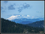
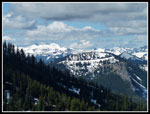
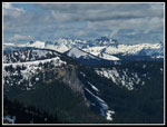
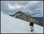
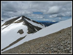
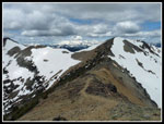
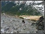
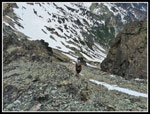
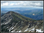
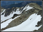
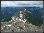
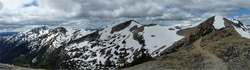
The snow lessened the last 150' to the ridge top. With lots of stops, routing water off the trail, and photos it was already 11:20 am when we reached the trail junction. I have never turned left on Nelson Ridge. Not this day either. We still had another mile to reach Mt. Aix. The blue sky of morning was turning to darker high clouds. At 7150' the clouds did not seem so high either. We could see Mt. St. Helens, the Goat Rocks and Mt. Rainier. There was only one major snow patch on the ridge. We headed south along the side of Nelson Ridge. The trail is not on the ridge top itself. A little climbing and a little drop brought us to where Nelson ridge drops steeply before climbing on its way south to Bismarck Peak. Crossing the nose of the ridge meant a traverse of steep snow. We kicked steps most of the way across then it became a very steep downward traverse to the trail. The snow was hard. The run out was about 500' down. We chose to climb the snow to the top and then climb down the talus and scree on the other side. A bit of a pain but much safer.
Once across it was all bare trail to the summit of Mt. Aix. Once around the ridge we now had Mt. Aix right in front of us. To get there we had several hundred feet to lose to a final saddle. That went easy enough. Easy but not quickly. There were a number of wildflowers blooming in the dirt and rocks. I was surprised to see a lot of yellow wallflower up there. After dropping down to 7100' we had a final 600' to climb. On all my previous trips I had followed the rocky trail as it climbs to beneath the summit then traverses to the far east ridge of Aix. It continues down to that trailhead near Meeks Table. A spur trail climbs to the ridge, crosses it, and drops then climbs again to the summit of Aix. That back side always has more snow. So far I had encountered more snow than on any previous trip. On my last visit we met several groups on the summit who had come straight up the south side on a scramble route. With all that in mind, I figured we would try to find that shorter and snow free route up.
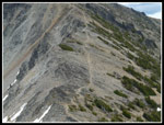
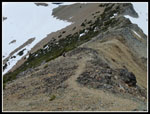
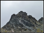
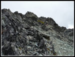
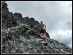
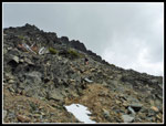
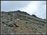
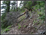
We hiked up the trail to the west ridge and looked up. It seemed like it might go but I could see no boot path. We continued on a little farther until seeing an obvious boot path heading nearly straight up. Up we went. The rock is loose and crappy most of the way up. There is a beaten path that I as able to follow all the way. We did not have helmets and were especially careful at several spots where it is straight up. I went first and moved to the side of the route before Gwen followed. There was plenty of loose rock that could come down. For the most part it is a rightward traverse which helped. The route gained 350' in a very short distance. Soon we were on top.
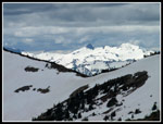
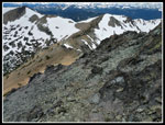
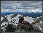
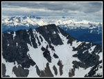
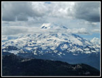
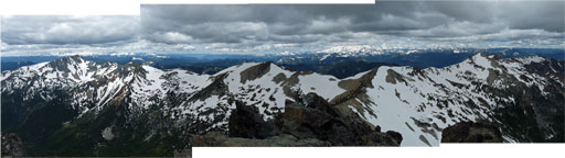
Except for Mt. Rainier and peaks directly around it I can't think of any peak between the Goat Rocks and Mt. Daniel that is higher than the 7766' of Mt. Aix. The views are spectacular. Clouds hid Mt. Adams and Mt. Stuart but we could see Rainier, the Goat Rocks, St. Helens, and the many peaks north of Snoqualmie Pass including Hinman and Daniel. There is still a lot of snow on higher peaks which really adds to the beauty. It was about 1:00 pm when we reached the top and we stayed for 30 minutes. There was almost no wind on top. I could see that the other trail crossed the ridge and descended on bare ground. There is a snowfield to cross on the back side but it is not as big as I expected. That route is much safer and technically easier than the scramble route we came up. We took lots of photos and soaked up the views.
All to soon it was time to leave. We still had 6 miles with 4500' to descend plus more than three hours to drive home. The scramble descent went just fine. We dropped to the saddle then had that one final climb back to and around the nose of Nelson Ridge. This time we traverse the steep snow rather than climb to the top of the snowfield. The snow was softer and traversing uphill is easier than down. Back on Nelson Ridge Gwen noticed some tiny pink steer's heads in bloom. That is a flower I have seldom seen. There were plenty of glacier lilies on the open slopes beneath the ridge junction. Our trip down was long but uneventful. the snow had softened significantly. We had no need for microspikes. It was just about 6:00 pm when we reached the car.
What a fun trip. Lots of distance and elevation gain. Terrific views from the ridge and even better from the summit. Only two other hikes all day meant plenty of solitude. The summit scramble added a new twist to my previous visits. I will caution that while it is not a difficult scramble it is far from a trail route. There is one of those and it goes around the back side. Rock fall is a danger on the scramble. Thanks to Gwen for persevering as this was much more difficult than any trips she had down so far this year. Heck any hike where you see more goats that people is a good hike.
One addendum. We stopped at about one mile in. Gwen had a black altimeter watch on a carabiner attached to her pack. It came off there and was accidentally left on the upside of the trail. We searched on the way down to no avail. If anyone else hikes this trail and finds the watch please contact me via my website.
Click on thumbnails to get
larger pictures.
Trips - 2013
Home
Our 2:50 exit from my house put us ahead of the worst of the rush hours traffic. We headed through Enumclaw and east on Highway 410. It was a dark cloudy afternoon but we held out hope for the forecast sunny day on Saturday before the clouds rolled but in on Sunday. We headed over Chinook Pass and down to the Bumping River Road. At the end of pavement we went 2.3 miles to a left turn at the junction and 1.5 more miles to the Mt. Aix trailhead. The dirt road was in better shape than I have ever seen it. We found a nice big campsite just below the trailhead parking and set up tents. This was the summer solstice and it was not dark until after 10:00 pm. Finally we crawling into tents and tried to get some sleep.
By 6:00 am we were up. Some clouds still but also some blue sky. We ate, packed up, and were heading for the trailhead by 7:05 am. There were two other cars in the lot. One had a tent up. The trail up to Nelson Ridge is a steady climb. The trailhead is at 3650' and the ridge is at 7150' That's 3500' of gain in about 5 miles. For the most part it is about 700' per mile. A few slightly steeper spots but not many. It's just a long grind to reach the ridge. From there you have a mile of high in the sky walking to reach Mt. Aix. The first few creek crossings are still running with plenty of water. Easy to cross but water for those who need to fill bottles. There were a few trillium and yellow violets in bloom. While we were early for the flower show up high we did find a number of varieties of wildflowers in bloom along the way.
Forest continues higher than I remembered. Lot of shade even up to 6000' and more. About a mile up the trail we took a break to remove clothing as the day heated up. Matt passed us there. He remembered me from a meeting at Ingalls Pass last fall. We continued the long trek towards the ridge. As we climbed we began to see bits of Mt. Rainier between the trees. We finally had a break in forest and good views over to Rainier. A few clouds but it was mostly in the clear. At 5300' we had some patches of snow then it disappeared once again. A few more snow patches at 6000' then much more beginning at a switchback at 6100'. Here we again met Matt on his way down. He had a dislocation the previous week and used good sense to turn around when the snow became deeper and harder traversing the steepening slope.
We continued on with me kicking steps across the snow. After each snow crossing we found more bare trail. The snow had frozen overnight and it was just beginning to soften. I was able to kick pretty solid steps while I could see earlier steps from this morning that barely dented the snow/ice. I little higher up we chose to put on our microspikes. A fast slide into trees did not appeal to us. Our ice axes never were put to use. By 6600' we removed the microspikes. The grade lessened and the snow had softened. At one point we crossed bellow an huge talus field. I stopped to take a photo of the field. Gwen immediately pointed out the goats high above us. Using my zoom lens I was able to get some good photos. We counted five adults and two kids. Starting up the last long traverse we met the other hiker coming down. He did not have traction devices and hiking alone had decided enough was enough. Those were the only people we saw all day.
The snow lessened the last 150' to the ridge top. With lots of stops, routing water off the trail, and photos it was already 11:20 am when we reached the trail junction. I have never turned left on Nelson Ridge. Not this day either. We still had another mile to reach Mt. Aix. The blue sky of morning was turning to darker high clouds. At 7150' the clouds did not seem so high either. We could see Mt. St. Helens, the Goat Rocks and Mt. Rainier. There was only one major snow patch on the ridge. We headed south along the side of Nelson Ridge. The trail is not on the ridge top itself. A little climbing and a little drop brought us to where Nelson ridge drops steeply before climbing on its way south to Bismarck Peak. Crossing the nose of the ridge meant a traverse of steep snow. We kicked steps most of the way across then it became a very steep downward traverse to the trail. The snow was hard. The run out was about 500' down. We chose to climb the snow to the top and then climb down the talus and scree on the other side. A bit of a pain but much safer.
Once across it was all bare trail to the summit of Mt. Aix. Once around the ridge we now had Mt. Aix right in front of us. To get there we had several hundred feet to lose to a final saddle. That went easy enough. Easy but not quickly. There were a number of wildflowers blooming in the dirt and rocks. I was surprised to see a lot of yellow wallflower up there. After dropping down to 7100' we had a final 600' to climb. On all my previous trips I had followed the rocky trail as it climbs to beneath the summit then traverses to the far east ridge of Aix. It continues down to that trailhead near Meeks Table. A spur trail climbs to the ridge, crosses it, and drops then climbs again to the summit of Aix. That back side always has more snow. So far I had encountered more snow than on any previous trip. On my last visit we met several groups on the summit who had come straight up the south side on a scramble route. With all that in mind, I figured we would try to find that shorter and snow free route up.
We hiked up the trail to the west ridge and looked up. It seemed like it might go but I could see no boot path. We continued on a little farther until seeing an obvious boot path heading nearly straight up. Up we went. The rock is loose and crappy most of the way up. There is a beaten path that I as able to follow all the way. We did not have helmets and were especially careful at several spots where it is straight up. I went first and moved to the side of the route before Gwen followed. There was plenty of loose rock that could come down. For the most part it is a rightward traverse which helped. The route gained 350' in a very short distance. Soon we were on top.
Except for Mt. Rainier and peaks directly around it I can't think of any peak between the Goat Rocks and Mt. Daniel that is higher than the 7766' of Mt. Aix. The views are spectacular. Clouds hid Mt. Adams and Mt. Stuart but we could see Rainier, the Goat Rocks, St. Helens, and the many peaks north of Snoqualmie Pass including Hinman and Daniel. There is still a lot of snow on higher peaks which really adds to the beauty. It was about 1:00 pm when we reached the top and we stayed for 30 minutes. There was almost no wind on top. I could see that the other trail crossed the ridge and descended on bare ground. There is a snowfield to cross on the back side but it is not as big as I expected. That route is much safer and technically easier than the scramble route we came up. We took lots of photos and soaked up the views.
All to soon it was time to leave. We still had 6 miles with 4500' to descend plus more than three hours to drive home. The scramble descent went just fine. We dropped to the saddle then had that one final climb back to and around the nose of Nelson Ridge. This time we traverse the steep snow rather than climb to the top of the snowfield. The snow was softer and traversing uphill is easier than down. Back on Nelson Ridge Gwen noticed some tiny pink steer's heads in bloom. That is a flower I have seldom seen. There were plenty of glacier lilies on the open slopes beneath the ridge junction. Our trip down was long but uneventful. the snow had softened significantly. We had no need for microspikes. It was just about 6:00 pm when we reached the car.
What a fun trip. Lots of distance and elevation gain. Terrific views from the ridge and even better from the summit. Only two other hikes all day meant plenty of solitude. The summit scramble added a new twist to my previous visits. I will caution that while it is not a difficult scramble it is far from a trail route. There is one of those and it goes around the back side. Rock fall is a danger on the scramble. Thanks to Gwen for persevering as this was much more difficult than any trips she had down so far this year. Heck any hike where you see more goats that people is a good hike.
One addendum. We stopped at about one mile in. Gwen had a black altimeter watch on a carabiner attached to her pack. It came off there and was accidentally left on the upside of the trail. We searched on the way down to no avail. If anyone else hikes this trail and finds the watch please contact me via my website.
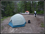 Campsite |
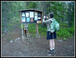 Trailhead |
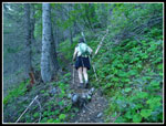 Starting Up Trail |
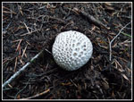 Mushroom |
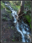 Small Waterfall |
 First Rainier View |
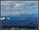
 Mt. St. Helens |
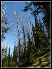 Silvered Snags |
 Snowy Nelson Ridge |
 Goat Rocks |
 Little Tahoma |
 Sun On Snowy Peaks |
 Framed Mt. Rainier |
 Snow On Trail |
 Big Talus Field |
 Goats! |
 More Goats |
 Bare Trail & Snow |
 Rainier & A Cloud |
 Gwen Traversing Snow |
 Cloudier St. Helens |
 Nelson Ridge Junction |
 Snow On Nelson Ridge |
 Mt. Aix In Sight |
 Nelson Ridge South |
 Trail Near Saddle |
 Western Anemone |
 Sunny Peaks |
 Hiking Above Saddle |
 Looking At Saddle |
 Gwen Ascending Trail |
 Summit & Scramble Rte |
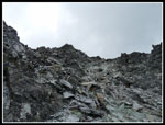 Crappy Rock |
 Leaving Poles |
 Scramble Rte Below |
 Gwen On Route |
 Towards Meeks Table |
 Backside Summit Trail |
 Gwen On Summit |
 Bismarck & Goat Rocks |
 NE Ridge |
 Heading Down |
 Gwen On Skyline |
 Mountain Woman |
 Nearing The Trail |
 Start Of Scramble |
 Bright Color |
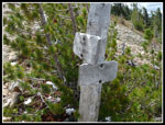
 Bleached |
 Phlox |
 Softer Snow |
 Clouds Thinning |
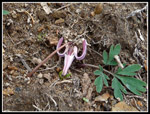 Steer's Head |
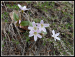 Spring Beauty |
 Tree Across Trail |
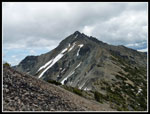
 South End Of Nelson Ridge |
 A More Complete View Of Nelson Ridge |
Trips - 2013
Home