3-31-13
Kim
and I hiked the beginning of the new Pratt River Connector trail
several years ago. We hiked to the end of the trail work and dropped
down to the MF Snoqualmie River. Finding the old boot path we took it
back. This last fall I read that the new trail was completed to the old
route up the Pratt River. When I found out the MF Road was just
regraded to the Forest Service boundary I decided it was time to check
it out. Kim planned to come along but had to cancel at the last minute.
The drive up the graded gravel road was great. The last3.5 miles was
not. In spots my Subaru just bounced from one deep pothole to the next
and the next. Though I could have walked faster in spots the grading
really sped up the drive. It took me 90 minutes from North Seattle to
the trailhead. There were three cars in the lot at 8:50 am. One had
been there overnight. One was a Corolla. Congratulations on driving
that car up that road. At the end of the day the lot was full of trucks
and SUVs. There was also a Civic and a Prius. I would not have driven
either one up that road.
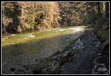
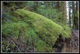
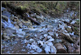
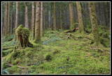
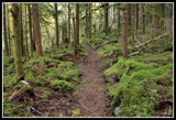
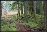
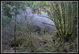
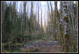
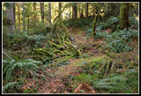
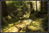
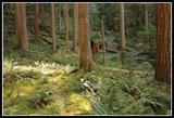
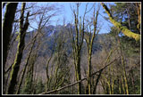
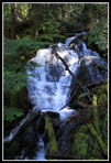
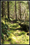
I was prepared for a near 70 degree day. It was a little cold at first but warmed up quickly. Over the Gateway Bridge and a right turn onto the signed "Pratt Lake Trail". This trail is as green as any trail I've hiked. Green like the Olympic rain forest but with a lot shorter drive. When the Middle Fork Road is paved in a few years this will become a much more popular trail. The trail quickly moves away from the river and there are few places it is seen for the next 3.3 miles. What you have is a dark forest with moss covering the trees, logs, rocks, and any hiker who sits still too long. This is not a "view" hike. The forest is the view. While there is only about 300' difference from the trailhead to the Pratt River there are a lot of ups and downs. The route stays high on the slope where the often flooding river cannot get at it. The route is a bit muddy in the first mile but the river will never wash it out.
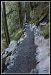
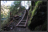
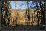
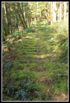
The new trail was built by the same firm that built the PCT section over the Kendall Katwalk. Like the Katwalk they blasted the trail across several sheer rock faces. Think in terms of "mini-katwalks". There are a few Lake Serene like long stairways but all in all this trail does not feel "overbuilt". I like it. It is also fast. Many photo stops slowed me down but I made very good time on the way back. At exactly 2.5 miles, per my GPS, the new trail ends at an old road. This continues for on to near the Pratt River. At 3.3 miles I reached a spot near the Middle Fork River. I took the short detour to the river. My GPS map showed a trail straight ahead that near the Pratt River then heads up the Pratt River Valley. A dashed line cuts up valley from here soon meeting the other trail.
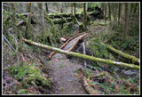
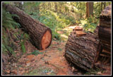
I took the more obvious short cut. My route never did get to the Pratt River so I'll have to return, take the other route, and find a way over. I was not far from the river. The short cut was easy hiking and I soon met up with the other trail. From here the route begins to climb up the valley. The trail is obvious enough but has had few boots on it the last 40 years. It was nearly that long ago that a cable "bridge" spanned the Middle Fork. The river can be forded at low water in the fall most years but this is the first time in nearly four decades that an easy trail leads to the Pratt Valley. There was been some recent log cutting and some very old cut logs as well. A few logs are down across the trail but far fewer than I was expecting.
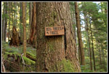
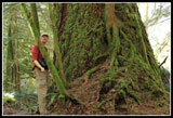
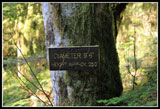
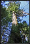
From looking at trip reports the night before I had a suspicion where the big tree was located. I knew there was a sign for it off the main trail. I kept glancing at my GPS to make sure I did not miss it. The last time I checked I saw I was very close. I looked up and there was the sign. I recorded 4.5 miles to the junction. The Big Tree Trail is very narrow. It goes up and down until it meets an old logging railroad grade. The grade went up the other side of the river, crossed it and climbed the valley wall heading down the valley. I was now on the section heading down to the river. After about .40 miles i found the big tree. A sign next to it states: 9 foot 6 inches and about 205 feet tall. It is a big one. I have no idea whey they left this tree right next to the railroad grade. Next time I'll fight downed trees and continue to the river.
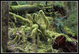
I had lunch here and then headed back to the junction. From there I took the left fork which climbs steeply to the old railroad grade. The same grade I was on earlier. Now came a walk on the wider old grade. This route continues about 10 miles to Pratt Lake. I doubt many people have hiked the whole way since the cable bridge went away. Again, I was surprised by the lack of downed trees. On this steep slope i would expect many trees to fall across the grade. That is not the case. A look at the moss covered "humps" across the grade make clear that the old railroad ties are still there. I only saw two that were not completely covered with moss. There are several creek crossings. One has a waterfall above and a much longer one below the crossing. I even found a fire ring near one creek. It would make for a lonesome camp. After a little over a mile I turned around. It was only about 12:30 pm.
I heard some yelling as I neared the junction. A little farther down I met a big group of 8 or 9 folks out on an Easter hike. Two members were no longer with the group. I told then I had seen nobody on the railroad grade. I hope they found the wayward hikers. That was the first group I had seen all day. On the way back I saw two other groups before seeing a number more in the last half mile. When back at the lower junction on the short cut trail near the river I took that short cut a little way then dropped to a viewpoint above the river. Here I found a cable dropping to and into the river. I wonder if it is the site of the old cable bridge?
The last 3.3 miles went by very fast. Now in shorts and short sleeves it felt like summer. I reached my car at 3:00 pm. It's always fun to hike a new trail. Especially one so close to home. Especially after the MF Road is paved this will become a low elevation river walk open much of the year. I expect to return many times. It was a fine warm spring day of exploring the lower Pratt River Valley.
Click on thumbnails to get
larger pictures.
Trips - 2013
Home
I was prepared for a near 70 degree day. It was a little cold at first but warmed up quickly. Over the Gateway Bridge and a right turn onto the signed "Pratt Lake Trail". This trail is as green as any trail I've hiked. Green like the Olympic rain forest but with a lot shorter drive. When the Middle Fork Road is paved in a few years this will become a much more popular trail. The trail quickly moves away from the river and there are few places it is seen for the next 3.3 miles. What you have is a dark forest with moss covering the trees, logs, rocks, and any hiker who sits still too long. This is not a "view" hike. The forest is the view. While there is only about 300' difference from the trailhead to the Pratt River there are a lot of ups and downs. The route stays high on the slope where the often flooding river cannot get at it. The route is a bit muddy in the first mile but the river will never wash it out.
The new trail was built by the same firm that built the PCT section over the Kendall Katwalk. Like the Katwalk they blasted the trail across several sheer rock faces. Think in terms of "mini-katwalks". There are a few Lake Serene like long stairways but all in all this trail does not feel "overbuilt". I like it. It is also fast. Many photo stops slowed me down but I made very good time on the way back. At exactly 2.5 miles, per my GPS, the new trail ends at an old road. This continues for on to near the Pratt River. At 3.3 miles I reached a spot near the Middle Fork River. I took the short detour to the river. My GPS map showed a trail straight ahead that near the Pratt River then heads up the Pratt River Valley. A dashed line cuts up valley from here soon meeting the other trail.
I took the more obvious short cut. My route never did get to the Pratt River so I'll have to return, take the other route, and find a way over. I was not far from the river. The short cut was easy hiking and I soon met up with the other trail. From here the route begins to climb up the valley. The trail is obvious enough but has had few boots on it the last 40 years. It was nearly that long ago that a cable "bridge" spanned the Middle Fork. The river can be forded at low water in the fall most years but this is the first time in nearly four decades that an easy trail leads to the Pratt Valley. There was been some recent log cutting and some very old cut logs as well. A few logs are down across the trail but far fewer than I was expecting.
From looking at trip reports the night before I had a suspicion where the big tree was located. I knew there was a sign for it off the main trail. I kept glancing at my GPS to make sure I did not miss it. The last time I checked I saw I was very close. I looked up and there was the sign. I recorded 4.5 miles to the junction. The Big Tree Trail is very narrow. It goes up and down until it meets an old logging railroad grade. The grade went up the other side of the river, crossed it and climbed the valley wall heading down the valley. I was now on the section heading down to the river. After about .40 miles i found the big tree. A sign next to it states: 9 foot 6 inches and about 205 feet tall. It is a big one. I have no idea whey they left this tree right next to the railroad grade. Next time I'll fight downed trees and continue to the river.
I had lunch here and then headed back to the junction. From there I took the left fork which climbs steeply to the old railroad grade. The same grade I was on earlier. Now came a walk on the wider old grade. This route continues about 10 miles to Pratt Lake. I doubt many people have hiked the whole way since the cable bridge went away. Again, I was surprised by the lack of downed trees. On this steep slope i would expect many trees to fall across the grade. That is not the case. A look at the moss covered "humps" across the grade make clear that the old railroad ties are still there. I only saw two that were not completely covered with moss. There are several creek crossings. One has a waterfall above and a much longer one below the crossing. I even found a fire ring near one creek. It would make for a lonesome camp. After a little over a mile I turned around. It was only about 12:30 pm.
I heard some yelling as I neared the junction. A little farther down I met a big group of 8 or 9 folks out on an Easter hike. Two members were no longer with the group. I told then I had seen nobody on the railroad grade. I hope they found the wayward hikers. That was the first group I had seen all day. On the way back I saw two other groups before seeing a number more in the last half mile. When back at the lower junction on the short cut trail near the river I took that short cut a little way then dropped to a viewpoint above the river. Here I found a cable dropping to and into the river. I wonder if it is the site of the old cable bridge?
The last 3.3 miles went by very fast. Now in shorts and short sleeves it felt like summer. I reached my car at 3:00 pm. It's always fun to hike a new trail. Especially one so close to home. Especially after the MF Road is paved this will become a low elevation river walk open much of the year. I expect to return many times. It was a fine warm spring day of exploring the lower Pratt River Valley.
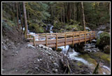
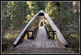 Gateway Bridge |
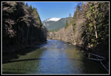 River From Bridge |
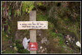 Pratt River Sign |
 Blasted Trail |
 Trail Along River |
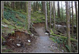 Green Everywhere |
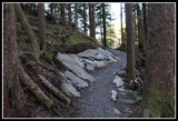 Rocky Section |
 Mini Katwalk |
 Rainy Creek Bridge |
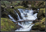 Cascading Creek |
 Rainy Creek |
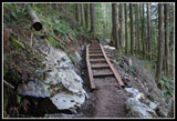 Rare Stairway |
 Did I Say Green? |
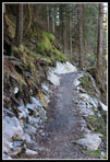
 Water On Trail |
 Biggest Stariway |
 Moss Covers Everything |
 Narrow Trail |
 Rare View Of River |
 Draped Moss |
 Log Down On Bridge |
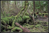 Mossy Log |
 Leaving Forest |
 Steep Slope |
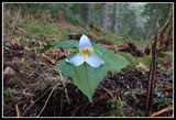 Trillium |
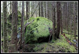 Mossy Rock |
 Nice Contrast |
 Now On Old Road |
 River View |
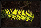 Lit Up Fern |
 Old Pratt Valley Trail |
 Mossy Ground |
 Freshly Cut Log |
 Faint Trail |
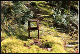
 Junction |
 Big Tree |
 Hiker For Scale |
 Dimensions |
 250' Tall |
 View To Peaks |
 Railroad History |
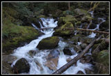
 Falls On Grade |
 Mossy Grade |
 Railroad Ties |
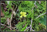 Yellow Violet |
 Old Bridge Cable? |
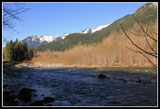
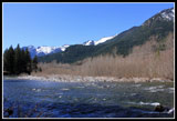 MF Snoqualmie River |
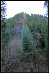
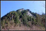 Steep Relief |
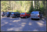 Cars That Braved Road |
Trips - 2013
Home