2-17-13
I
signed on to this trip late the
night before. I had done the Red Mountain near Salmon La Sac two times.
Both trips were on snow. On the first
trip clouds came in and we had
minimal views. On the second
trip clouds blocked most views.
I hoped
the third time would be the charm. The forecast was for clearing skies
as the day went on. There was supposed to be a few inches of fresh snow
the day before. We have not had much snow in the mountains the last
month. Mist and a little light rain on the west side of the mountains.
One sign for chains required and another for traction tires required. A
few inches of snow? By Easton we had some blue sky. Beyond Ronald the
road had fresh snow. Much less snow in Roslyn than usual but fresh snow
on the road. We arrived at the Cooper River Road a little after 9:00
am. Since my last winter visit in 2009 signs have been put up showing
there is parking on one side of the road. One other vehicle wass there
when we
arrived.
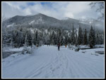
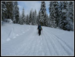
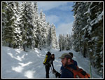
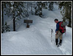
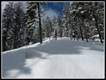
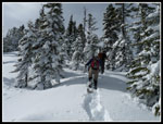
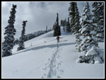
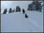
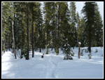
My 9:15 am we were on our way. The Cooper River Road had several inches of fresh snow. There were only two snowmobile tracks in the fresh snow. Soon we had snowshoes on as the fresh snow was deep enough to slow us down. Trees along the road were nicely plastered with snow. After 1.6 miles we reached the start of the summer trail to Red Mountain. Instead of following the summer trail route up the valley we went nearly straight up following a ridge that continues to the summit. The trail sign was not covered with snow and Barry noticed it as we hiked up the road.
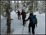
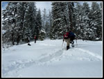
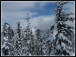
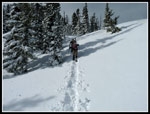
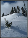
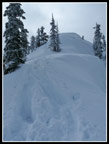
The snow was quickly 5 - 6 inches deep. It seemed to be fresh snow over bare ground as we sank down to grass. As we ascended the snow became deeper. I had one short lead where I noticed a buried track. It was much firmer following the old track. Soon it disappeared under still deeper snow. We were well east of the Cascade Crest. Very little snow had fallen over the crest the past few weeks. Why did it all fall right here? Barry and David did most of the trail breaking. We gained 300' in 1.6 miles on the road. We would gain another 3300' in 2 miles to the top. At first it was not very steep but soon the grade turned much more vertical. Lots of snow brushed off of heavily laden trees. More falling down my neck. It was hard to stay dry. Climbing through the fresh snow was enough work that I was soon down to short sleeves though it was about 32 degrees.
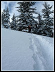
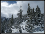
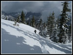
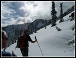
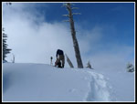
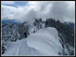
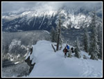
The flocked trees were very pretty. Almost made up for all the hard work it caused. From prior trips I knew we would cross a road abut half way up. It made for a good place for a break. Still about 1700' to gain in a little under one mile. Another steep section took care of a big chunk of the elevation, about 600'. The tree cover thinned and the grade lessened. The snow was much deeper out in the open. There were a lot of clouds overhead but also some sunshine. David pointed out a view of Cathedral Peak. It was soon buried in clouds. The grade steepened again for the final push to the top. We switchbacked up near a band of trees. To our right was a big open slope of unconsolidated snow. Backcountry skiers would love it. The snow was just too deep to go straight up. On short traverses it would occasionally break away and I would be left kicking to get a grip. Very tiring work. I fell a little behind as I was taking a few more photos. The rest of the group stopped and waited for me to catch back up.
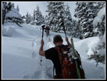
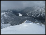
It was pitifully slow in places as the snow was up to my knees and occasionally thighs. More switchbacks brought us up to a flat spot on the ridge top. From there it is only about another 75' to the top. This last slope was the deepest and steepest of the day. Barry went first and powered up to the top. I was wallowing. The snow was so deep that nothing would hold my weight. It must have taken 7 or 8 minutes to grunt out the last short way. I was beat when we reached the top. It took me 3:30 from car to summit. It seems awfully slow for only 3.5 miles but it was actually the same time as trip one and an hour faster than trip two.
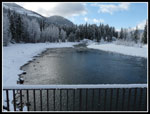
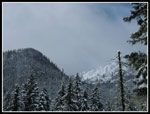
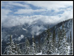
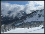
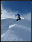
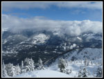
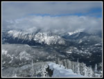
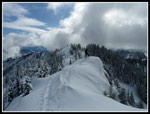
We had some views. Cooper Lake was right below. Polallie Ridge was partly in the clear. The top of Davis Peak, everything to the west and the top of Sasse Ridge were in the clouds. No Mt. Daniel or Mt. Stuart visible this day. After a few minutes for photos we dropped back to the flat ridge top for lunch. Even with a jacket it was very cold. Soon we were packed up and ready to descend. I was not sure if my snowshoes would just be skis or if I would have any control heading down. In fact the conditions were excellent. We were able to plunge straight down the slope at a good speed. A few hundred feet down we met two snowshoers coming up. They had the good luck to have a nice packed trench to follow up. Someone benefited from our hard work. They were the first and only people we saw off the Cooper Road.
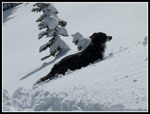
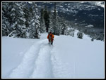
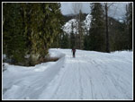
Once down to the forest level the snow was less deep and plunging down to the hard crust was much harder and slower than above. Still our pace was good. It took us about 1:15 to descend including several clothing change stops. On my last trip I cramped near the bottom of the descent. That rarely happens to me. This time it happened again. I guess I need to carry even more water for this trip in the future. The last 1.6 miles of road slogging is not the most fun part of the trip. We met a few snowshoers here as well as more snowmobiles. Our total time back to the car of just under two hours was exactly the same as both earlier trips. I'm nothing if not consistent. The road back to Roslyn was mostly bare now.
This was a fun trip and a lot of hard work. Three times up in the winter and still no clear views. I guess I'll just have to try again in a few years. Good company, good if a little too deep snow, and pretty good weather made for a fun winter day in the mountains.
Click on thumbnails to get
larger pictures.
Trips - 2013
Home
My 9:15 am we were on our way. The Cooper River Road had several inches of fresh snow. There were only two snowmobile tracks in the fresh snow. Soon we had snowshoes on as the fresh snow was deep enough to slow us down. Trees along the road were nicely plastered with snow. After 1.6 miles we reached the start of the summer trail to Red Mountain. Instead of following the summer trail route up the valley we went nearly straight up following a ridge that continues to the summit. The trail sign was not covered with snow and Barry noticed it as we hiked up the road.
The snow was quickly 5 - 6 inches deep. It seemed to be fresh snow over bare ground as we sank down to grass. As we ascended the snow became deeper. I had one short lead where I noticed a buried track. It was much firmer following the old track. Soon it disappeared under still deeper snow. We were well east of the Cascade Crest. Very little snow had fallen over the crest the past few weeks. Why did it all fall right here? Barry and David did most of the trail breaking. We gained 300' in 1.6 miles on the road. We would gain another 3300' in 2 miles to the top. At first it was not very steep but soon the grade turned much more vertical. Lots of snow brushed off of heavily laden trees. More falling down my neck. It was hard to stay dry. Climbing through the fresh snow was enough work that I was soon down to short sleeves though it was about 32 degrees.
The flocked trees were very pretty. Almost made up for all the hard work it caused. From prior trips I knew we would cross a road abut half way up. It made for a good place for a break. Still about 1700' to gain in a little under one mile. Another steep section took care of a big chunk of the elevation, about 600'. The tree cover thinned and the grade lessened. The snow was much deeper out in the open. There were a lot of clouds overhead but also some sunshine. David pointed out a view of Cathedral Peak. It was soon buried in clouds. The grade steepened again for the final push to the top. We switchbacked up near a band of trees. To our right was a big open slope of unconsolidated snow. Backcountry skiers would love it. The snow was just too deep to go straight up. On short traverses it would occasionally break away and I would be left kicking to get a grip. Very tiring work. I fell a little behind as I was taking a few more photos. The rest of the group stopped and waited for me to catch back up.
It was pitifully slow in places as the snow was up to my knees and occasionally thighs. More switchbacks brought us up to a flat spot on the ridge top. From there it is only about another 75' to the top. This last slope was the deepest and steepest of the day. Barry went first and powered up to the top. I was wallowing. The snow was so deep that nothing would hold my weight. It must have taken 7 or 8 minutes to grunt out the last short way. I was beat when we reached the top. It took me 3:30 from car to summit. It seems awfully slow for only 3.5 miles but it was actually the same time as trip one and an hour faster than trip two.
We had some views. Cooper Lake was right below. Polallie Ridge was partly in the clear. The top of Davis Peak, everything to the west and the top of Sasse Ridge were in the clouds. No Mt. Daniel or Mt. Stuart visible this day. After a few minutes for photos we dropped back to the flat ridge top for lunch. Even with a jacket it was very cold. Soon we were packed up and ready to descend. I was not sure if my snowshoes would just be skis or if I would have any control heading down. In fact the conditions were excellent. We were able to plunge straight down the slope at a good speed. A few hundred feet down we met two snowshoers coming up. They had the good luck to have a nice packed trench to follow up. Someone benefited from our hard work. They were the first and only people we saw off the Cooper Road.
Once down to the forest level the snow was less deep and plunging down to the hard crust was much harder and slower than above. Still our pace was good. It took us about 1:15 to descend including several clothing change stops. On my last trip I cramped near the bottom of the descent. That rarely happens to me. This time it happened again. I guess I need to carry even more water for this trip in the future. The last 1.6 miles of road slogging is not the most fun part of the trip. We met a few snowshoers here as well as more snowmobiles. Our total time back to the car of just under two hours was exactly the same as both earlier trips. I'm nothing if not consistent. The road back to Roslyn was mostly bare now.
This was a fun trip and a lot of hard work. Three times up in the winter and still no clear views. I guess I'll just have to try again in a few years. Good company, good if a little too deep snow, and pretty good weather made for a fun winter day in the mountains.
 Red Mt. From Start |
 Down River |
 Up Cle Elum River |
 Walking Road |
 Snowmobiles Passing |
 Red Mt. Trail |
 Red Mt. Summit |
 Into The Forest |
 Untouched Snow |
 Deeper Trench |
 Getting Steeper |
 Trailbreakers |
 First Views Out |
 Sunshine |
 Towards Summit |
 Here Comes Elle |
 Through The Trees |
 Pristine Snow |
 Sasse Ridge |
 Izzy |
 Barry Leads The Way |
 Steeper Than It Looks |
 Great Ski Slope |
 Barry On Ridge Top |
 Wallowing Near Summit |
 Cloudy Summit Views |
 Davis Peak |
 Cooper Lake |
 Barry On Ridge Bump |
 David's Turn |
 Lunch Spot Below Summit |
 View Of Summit |
 Starting Down |
 Tracks Down |
 Forest Near Road |
 Road Slog |
Trips - 2013
Home