Day 4
Day 4
The last day would be almost all downhill. The Buck Creek Pass trail is a horse trail. It is dusty. On my two previous hikes on it the dust was very bad. Gary and John were interested in going up above the pass towards Liberty Cap for better views. The morning was still a bit smoky and I doubted the views would be great. John was the only one who had not been up that trail and I can see why he should head on up. On the other hand, I had been up it and the opportunity to hike down alone without any dust appealed to me. Therefore, I chose to head on down while they headed up. Besides, it would give me time to hike down the road and retrieve the car.
Just as I was packed up and set to leave I checked and my car keys were missing. Some day I'll tell the whole story. For now lets just say I emptied everything out of my backpack only to find the keys not far from where they should have been. That 25 minute detour had me leaving camp at 7:23 am, a little later than planned. The high at the trailhead was forecast the previous Friday to be about 90 degrees. Hot, smoky, and dust are not my favorite conditions. Another reason for my early departure.
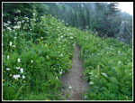
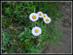
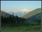
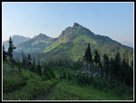
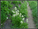
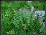
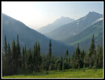
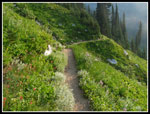
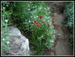
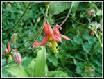
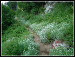
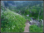
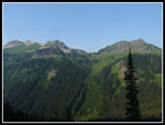
I hiked up out of the pass to the main trail and views of Glacier Peak. Better than the afternoon before but very hazy. Hardly worth a photo. Definitely not worth getting up at sunrise. I was glad I did not do it. The wildflower show was a little past prime but still very good. The early morning light brought out great colors. My progress was slowed along the first part of the trail by the photo opportunities. Looking across to Buck Mountain it was very much in the haze. The first part of the trail down hugs the north wall of the valley. Much of it was shaded from the early morning sun. It was cooler than I was expecting. Gary had the water pump. I had two quarts of water for the trip down. It proved to be plenty. Most all of the small creeks along the way were still running.
Hiking along I came face to face with a deer heading up. He was gone in seconds. Not as camera friendly as all the others on this trip. When I entered forest the camera was put away and my speed picked up. After the first set of switchbacks the route came near Buck Creek for the only time. It also popped out into an avalanche swath. Unlike the one below Miners Ridge, this one had no logs left to climb over. It did have some ups and downs where the trail now goes over piles of debris. My recollection of the trail being out in the open a lot was faulty. Most of the way was in forest. There were more avalanche swaths that were meadows not forest.
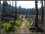
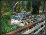
At the second swath I met a couple hiking in. It was only 9:00 am and they were over six miles up the trail. A few minutes later I met a solo backpacker heading up. I met one more group before being recognized by a group of four. That's the second time in a month. It is still a rare occurrence that is always fun. They were doing the loop in the opposite direction. The same way we did it in 2005. Our conversation must have lasted ten minutes. I hope they had a good trip without too much smoke. After that it was just more trail. The only landmarks I recalled where crossing the Chiwawa River and reaching the old Chiwawa Road now trail. It was farther from there than I recalled. As the day went on and I dropped lower the heat really picked up. It felt like the high 80s when I reached the parking lot.
I dropped my pack after 10.5 miles of hiking and headed down the road. It was nice to hike without the backpack but it was very hot along the dusty road. It only took 11 minutes to hike the .60 miles. The car was fine though coated in a thick layer of dust. A Few minutes later I was back in the parking lot at Trinity. It was too hot to do anything but sit by Phelps Creek and pour cold water over my arms and legs. 1:20 later Gary and John arrived. We were soon off to the 59er Diner for food and milk shakes.
The trip proved to be a success. Though it looked like smoke would ruin things on day two it proved to be only a small problem. On day four I hiked 11 miles with 500' of elevation gain. For the whole trip I hiked 46 miles with 11,200' of elevation gain. This was a rare trip where we all hiked different mileages. Gary did the last day trip to near Liberty Cap. John did that plus the road walk on day one. He had over 50 miles hiked.
 Buck Creek Pass Map |
 Starting Out |
 Asters |
 Hazy Glacier Peak |
 Liberty Cap |
 Western Anemone |
 Lewis Monkey Flower |
 Hazy Down Valley |
 Flowers And Sun |
 Indian Paintbrush |
 Columbine |
 Pearly Everlasting |
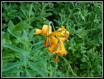 Tiger Lilies |
 Creek Ahead |
 High Pass Trail |
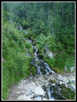 Waterfall |
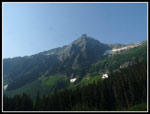 Buck Mountain |
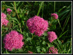 Spirea |
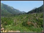 First Avy Swath |
 Another Avy Chute |
 Trees Like Matchsticks |
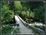 Chiwawa River |
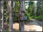 Trail Junction |
 Trinity - The End |
<< Photo Page
Spider - Buck Report
Trips - 2014
Home