5-14-16
I
first hiked up to the Greider Lakes on 10-29-89. It was a five mile
round trip hike plus I added another mile by taking a trail above the
lakes to a viewpoint. In the years since I had not been back. Kim and I
were kicking around a trip on a day that might have rain. She brought
up Greider. It was time for me to return. The only down side was that
there is a fire burning on the south side of Highway 2 to the
south of Greider. We figured to take our chances on any smoke. At the
Bothell Park and Ride I ran into David (Opus) who was waiting for
Lauren. They had planned on Lake Isabel, north of the fire, and changed
their plans to Sauk Mountain up north. We stuck to Greider. Kim arrived
a little after 8:00 am and we headed northeast. Through Monroe and
Sultan then we turned left on the Sultan Basin Road. About 10 miles of
pavement then 7 more of gravel. The gravel part was fine for any car. A
few potholes but not that many. The signed lot on the right a few miles
after pavement ends is where you must sign in to the watershed. We
filled out the form and continued on. Right at the signed junction
after the sign in spot and on to the end of the road and new trailhead.
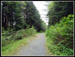
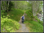
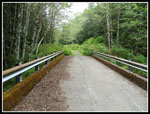
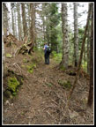
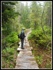
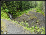
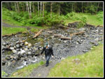
When I did the hike in 1989 I drove another 2+ miles to the old trailhead. Now, the last bit of road has been decommissioned and all the culverts pulled. The concrete bridge over Greider Creek remains. We reached the parking lot at 9:45 am. Folks are rediscovering this trail. Even with the extra mileage it is getting use. There were already 8 or 9 cars in the lot. We were on the trail just before 10:00 am. The parking lot is right near Spada Lake. A short trail heads over to the old closed road to the old trailhead. We immediately found the first removed culvert. There are many. Some are just s few feet down then up again. A few have a trail with a switchback to get down and up. Crossing a few of them could be a problem with a lot of spring runoff. We managed to rock hop them all with dry feet.
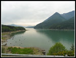
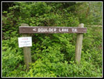
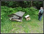
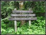
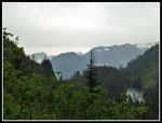
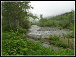
Part way along the old road is a spot just above the road with a viewpoint of Spada Lake. There is a picnic table there too. We took a short break. One group hiked to the old trailhead then headed back. They were at the picnic table. The day was very cloudy but we could see the peaks and ridges around the lake. From Bald Mountain off the Walt Bailey Trail I have looked down on the lake several times. We continued on an came to the old trailhead. A sign points to Boulder Lake which is 1.2 miles farther. It does state that a bridge is out on that trail and it is closed. The outhouses was dismantled or collapsed and the parts are piled up.
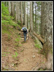
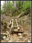
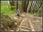
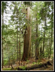
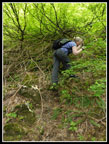
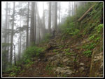
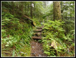
Now it was time to leave the road and head up the trail. After so many years I had almost no recollection of the trail. The route consists of many short switchbacks. The forest is full of trees of the same general size. Lots of underbrush too. We decided that it was likely burned in a fire as there were no logging stumps but no big old trees either, at least at lower elevations. The slope grew steeper as we climbed. Higher up the route seemed to go under or over cliffy areas. Quite a neat route. There were several big trees down and several root balls where trees fell over the trail. For the most part they have been cleared up. One set of down trees were just cut out recently judging by the fresh sawdust. We met one backpacker heading down after one night at the lakes. A few other groups were already coming down as we continued up. The second half of the route gets a bit steeper. There are a few steps that are very steep. We found the steps to be less of a problem than reports indicated.
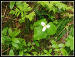
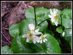
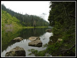
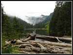
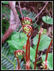
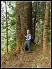
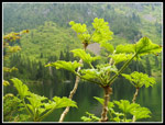
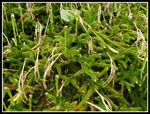
There are a number of wildflowers in bloom, We saw trillium, yellow violets, valerian, marsh marigolds, false Solomon's seal, and more. The trail finally flattens out as it nears the lower lake. Along here we found some very large cedars and silver firs. Very near the lake this changed to small trees and no undergrowth. Quite a variety of forests. We reached the lower lake and went down to the shore to get a look down the lake. A very nice view it is. There are a number of campsites along the lake. There area a few trees down across the trail. We continued on to the bridge over the lake outlet. The route climbs a little to Big Greider Lake. I recalled that on my earlier trip I took a trail up to a higher viewpoint. My old copy of Footsore 2 mentioned a half mile trail that gained 600'. It was shown heading uphill between the two lakes. We looked for any sign of a trail.
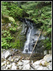
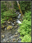
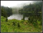
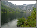
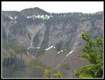
Kim found what looked a little like an old route. We headed off on it. It clearly was an old trail. We even found a few rock steps. No doubt about it. The route started up in a patch of forest. Most of the hillside was brush. We were not planning to beat brush for 600 vertical feet. The trail headed right and out of the forest. It continued in brush a short way then disappeared. We looked all around and decided to head down then on to the upper lake. We found one group camping at the lake. Smoke from their fires was the most we smelled all day. The fire south of us did not seem to add much if any smoke to the day. It was starting to rain lightly. We found a spot on the forested shore with a view of the lake. At the end of the basin the steep walls held a little snow and four or five big waterfalls. A very nice sight.
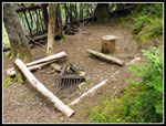
As we sat down for lunch the rain began to pick up. Yesterday it was 80 degrees in Seattle. This day was in the low 50s and damp. Not altogether a bad thing. After lunch we headed down. The steep section below the lower lake was faster but not particularly fast. Steep enough with some rocks to make us carefully place our steps. By the time we reached the road the rain was even a little harder. Not real heavy but very consistent. The road walk was a bit of a slog. We did not see anyone coming up as we descended. Back at the parking lot there was just one other car. It was now 6:00 pm so we had a long eight hour hike. The outhouses have a covered "porch" at the front with benches. A perfect place to change into dry clothes while the rain kept coming down.
It is always fun to do a hike that I had only done once many years before. It feels both like a brand new trail and one for which I had a few lingering memories. With the addition of about 4.5 miles of road hiking the total distance to Big Greider Lake is now about 9.5 miles vs. 5 miles before the road was decommissioned. It now seems like much more of a hike. The added length has not kept all folks away. While not crowded it is not forgotten either. All in all, it was a great way to spend a half dry and half raining day in the mountains.
Click on thumbnails to get
larger pictures.
Trips - 2016
Home
When I did the hike in 1989 I drove another 2+ miles to the old trailhead. Now, the last bit of road has been decommissioned and all the culverts pulled. The concrete bridge over Greider Creek remains. We reached the parking lot at 9:45 am. Folks are rediscovering this trail. Even with the extra mileage it is getting use. There were already 8 or 9 cars in the lot. We were on the trail just before 10:00 am. The parking lot is right near Spada Lake. A short trail heads over to the old closed road to the old trailhead. We immediately found the first removed culvert. There are many. Some are just s few feet down then up again. A few have a trail with a switchback to get down and up. Crossing a few of them could be a problem with a lot of spring runoff. We managed to rock hop them all with dry feet.
Part way along the old road is a spot just above the road with a viewpoint of Spada Lake. There is a picnic table there too. We took a short break. One group hiked to the old trailhead then headed back. They were at the picnic table. The day was very cloudy but we could see the peaks and ridges around the lake. From Bald Mountain off the Walt Bailey Trail I have looked down on the lake several times. We continued on an came to the old trailhead. A sign points to Boulder Lake which is 1.2 miles farther. It does state that a bridge is out on that trail and it is closed. The outhouses was dismantled or collapsed and the parts are piled up.
Now it was time to leave the road and head up the trail. After so many years I had almost no recollection of the trail. The route consists of many short switchbacks. The forest is full of trees of the same general size. Lots of underbrush too. We decided that it was likely burned in a fire as there were no logging stumps but no big old trees either, at least at lower elevations. The slope grew steeper as we climbed. Higher up the route seemed to go under or over cliffy areas. Quite a neat route. There were several big trees down and several root balls where trees fell over the trail. For the most part they have been cleared up. One set of down trees were just cut out recently judging by the fresh sawdust. We met one backpacker heading down after one night at the lakes. A few other groups were already coming down as we continued up. The second half of the route gets a bit steeper. There are a few steps that are very steep. We found the steps to be less of a problem than reports indicated.
There are a number of wildflowers in bloom, We saw trillium, yellow violets, valerian, marsh marigolds, false Solomon's seal, and more. The trail finally flattens out as it nears the lower lake. Along here we found some very large cedars and silver firs. Very near the lake this changed to small trees and no undergrowth. Quite a variety of forests. We reached the lower lake and went down to the shore to get a look down the lake. A very nice view it is. There are a number of campsites along the lake. There area a few trees down across the trail. We continued on to the bridge over the lake outlet. The route climbs a little to Big Greider Lake. I recalled that on my earlier trip I took a trail up to a higher viewpoint. My old copy of Footsore 2 mentioned a half mile trail that gained 600'. It was shown heading uphill between the two lakes. We looked for any sign of a trail.
Kim found what looked a little like an old route. We headed off on it. It clearly was an old trail. We even found a few rock steps. No doubt about it. The route started up in a patch of forest. Most of the hillside was brush. We were not planning to beat brush for 600 vertical feet. The trail headed right and out of the forest. It continued in brush a short way then disappeared. We looked all around and decided to head down then on to the upper lake. We found one group camping at the lake. Smoke from their fires was the most we smelled all day. The fire south of us did not seem to add much if any smoke to the day. It was starting to rain lightly. We found a spot on the forested shore with a view of the lake. At the end of the basin the steep walls held a little snow and four or five big waterfalls. A very nice sight.
As we sat down for lunch the rain began to pick up. Yesterday it was 80 degrees in Seattle. This day was in the low 50s and damp. Not altogether a bad thing. After lunch we headed down. The steep section below the lower lake was faster but not particularly fast. Steep enough with some rocks to make us carefully place our steps. By the time we reached the road the rain was even a little harder. Not real heavy but very consistent. The road walk was a bit of a slog. We did not see anyone coming up as we descended. Back at the parking lot there was just one other car. It was now 6:00 pm so we had a long eight hour hike. The outhouses have a covered "porch" at the front with benches. A perfect place to change into dry clothes while the rain kept coming down.
It is always fun to do a hike that I had only done once many years before. It feels both like a brand new trail and one for which I had a few lingering memories. With the addition of about 4.5 miles of road hiking the total distance to Big Greider Lake is now about 9.5 miles vs. 5 miles before the road was decommissioned. It now seems like much more of a hike. The added length has not kept all folks away. While not crowded it is not forgotten either. All in all, it was a great way to spend a half dry and half raining day in the mountains.
 On The Old Road |
 Spada Lake |
 Watershed Information |
 Small Waterfall |
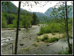 Sultan River |
 Road Narrows |
 Greider Creek Bridge |
 Greider Creek |
 1.2 Miles To Boulder TH |
 Outhouse Is Down |
 Old Trailhead Sign |
 Nice Map |
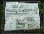 NRCA Info |
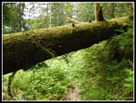 Big Mossy Log |
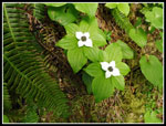 Bunchberries |
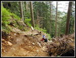 Rebuilt Trail |
 Up The Trail |
 Steeper Steps |
 Looks Steeper |
 Trillium |
 Big Cedar |
 Marsh Marigolds |
 Greider Lake |
 Campsite |
 View From Outlet |
 Looking Back To Lake |
 Fiddlehead Ferns |
 Big Silver Fir |
 On Old Trail |
 Nice Old Tread |
 View To The North |
 Rock Steps |
 Big Greider Lake |
 Big Waterfalls |
 Devil's Club |
 Tiny Forest |
 On The Boardwalk |
 Misty Descent |
 Very Green |
 Sultan River Again |
 Big Dip |
 Last Creek Crossing |
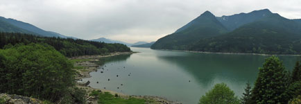 Panorama Shot Of Spada Lake From The Viewpoint |
Trips - 2016
Home