4-02-16
Gwen
was interested in a snow hike and we settled on Hex Mountain. It would
be my fourth visit and Gwen's second. I have only done it on snow. This
would be the least snowy of my trips up Hex. We met in Bellevue at 7:30
am and headed east. Low clouds which would burn off later blocked the
sun until we were east of Snoqualmie Pass. We headed over to Roslyn
then north to Cle Elum Lake. There was almost no snow along the road. A
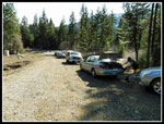
couple miles past The Last Resort we found the road just across Newport
Creek. We were the first car of the day. On all my prior winer trips we
parked at a plowed wide spot along the main road a few hundred feet
before Newport Creek. With no snow we parked along the dirt road below
the gate. We arrived at 8:55 m and were on our way by 9:06 am.
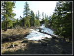
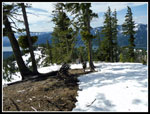
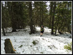
On my first trip in 2001 there was the main road and little else. We had no problem following the road to the summer trailhead. On my last visit in 2012 there were a number of newer spur roads. We took a wrong turn and ended up navigating off tral to find the trailhead. We had a map this time though the new roads were not on it. My gps might have helped but the memory card was not seated and it showed no map. Problem solved after the hike. Best I can tell there are no signs at the junctions. The road was snow free at first and never had more than 6-8 inches of snow up to the summer trailhead.
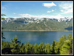
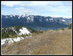
Friends of ours did the trip several days earlier. They had two dogs along. At a few road junctions we took the route that included many foot and several dog prints. This was going to be easy. Or maybe not. We reached one spot with a great view out to Cle Elum Lake.. I did not remember that. Well, I probably dust forgot. The road network kept climbing. Then the road came to an end. That was not supposed to happen. The foot and dog prints headed up the hillside on snow. We followed. Then the prints ended. Hmm... With the map and altimeters we were able to pinpoint our position. We were 350' below the trailhead. Time for a little off trail scramble. We just had to reach a close by ridge, drop down, climb over a big bump, drop again, and climb a short way to the correct road at a point beyond the summer trailhead. It looked a lot like the route on my last trip up Hex.
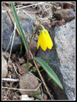
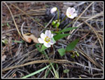
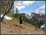
The going was not too bad. While climbing up the big bump we found lots of spring beauty and yellow bells in bloom. A small benefit for taking the wrong route. We noticed quite a few old melted ski tracks along our route. It looks like skiers are using a non road route. We found the correct road and turned right to work our way back to the summer trailhead. Mission accomplished. There was some snow on the road but the trail began mostly on dirt. The first time I had ever seen the actual trail without a snow cover. Our friends did not take or need snowshoes so wed did not bring them. The route climbs up a ridge all the way to the top of Sasse Ridge near the summit of Hex. Other than the road navigation is not much of a problem.
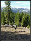
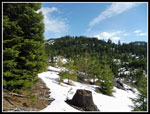
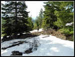
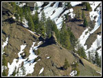
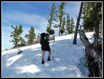
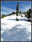
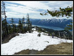
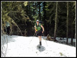
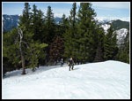
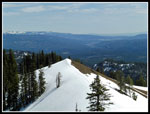
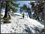
One group passed us then later another. It was a beautiful sunny day and we had plenty of time to stop and enjoy the photographic opportunities. The lower section is mostly in forest and the upper section is too. The middle part is mostly in the open with great views. It also is a wind tunnel. It has always been blowing on my trips, even when it is calm lower and higher. This day was no exception. Though I was in shorts I had to put on a jacket in the wind tunnel. Though the middle section is mostly snowy there are already patches of dirt. We were glad to reach the upper forest below Sasse Ridge as the trees blocked most of the wind. It blocked the sun too but that was not a bad trade off. The snow was much harder in the forest. We brought microspikes but did fine with just boots and poles.
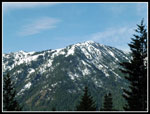
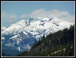
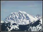
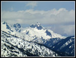
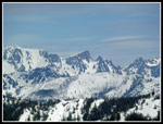
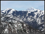
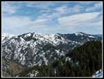
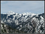
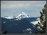
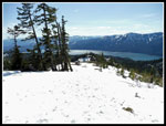
We reached the ridge top and turned right for the last quarter mile to the top. The ridge is pretty flat then comes the short steep climb to the top. We reached the 5034' summit at 1:00 pm. For a couple minutes were are alone on top. Great views all around. We could see Yellow Hill and Elbow Peak which we hiked last spring. Mt. Stuart dominates to the north east. Jolly Mountain is a rounded summit just to the left of Stuart. Farther west was Mts. Hinman and Daniel. The spire of Bears Breast Mountain stood out. Across Cle Elum Lake were Domerie, Baldy, Thomas, and Red Mountains. The summit itself was mostly snow free. It made for a lounging spot.
Within a few minutes the next group arrived. Then another and another. The summit is not all that big. We stayed until 1:40 pm though it was pretty crowded on top. With our unplanned route up it took as nearly four hours to summit. The trip down was much faster. The middle open section was great as the views were laid out right in front of us. At the trailhead we turned left and headed down the easy road route. Easier but much less adventurous than the off trail scramble I seem to be getting used to. The fact that half the road had a thin snow cover made it much easier on my knees than the hard packed dirt. We found our wrong turn much lower down than we expected. By 3:35 pm we were back at the car. A little less than two hours to come down.
This turned out to be a great hike. We added some adventure to a road walk by taking a wrong turn. It was a very sunny day with great views. The strong wind in the wind tunnel section was not as strong on the exposed summit. There was enough snow to really make for beautiful scenery but not enough to make for harder travel. We did not need snowshoes or an ice axe. I have not done as many winter snow climbs as usual but this one was excellent. I'm sure Ill be back in a few years to try once again to decipher the road network.
Click on thumbnails to get
larger pictures.
Trips - 2016
Home
On my first trip in 2001 there was the main road and little else. We had no problem following the road to the summer trailhead. On my last visit in 2012 there were a number of newer spur roads. We took a wrong turn and ended up navigating off tral to find the trailhead. We had a map this time though the new roads were not on it. My gps might have helped but the memory card was not seated and it showed no map. Problem solved after the hike. Best I can tell there are no signs at the junctions. The road was snow free at first and never had more than 6-8 inches of snow up to the summer trailhead.
Friends of ours did the trip several days earlier. They had two dogs along. At a few road junctions we took the route that included many foot and several dog prints. This was going to be easy. Or maybe not. We reached one spot with a great view out to Cle Elum Lake.. I did not remember that. Well, I probably dust forgot. The road network kept climbing. Then the road came to an end. That was not supposed to happen. The foot and dog prints headed up the hillside on snow. We followed. Then the prints ended. Hmm... With the map and altimeters we were able to pinpoint our position. We were 350' below the trailhead. Time for a little off trail scramble. We just had to reach a close by ridge, drop down, climb over a big bump, drop again, and climb a short way to the correct road at a point beyond the summer trailhead. It looked a lot like the route on my last trip up Hex.
The going was not too bad. While climbing up the big bump we found lots of spring beauty and yellow bells in bloom. A small benefit for taking the wrong route. We noticed quite a few old melted ski tracks along our route. It looks like skiers are using a non road route. We found the correct road and turned right to work our way back to the summer trailhead. Mission accomplished. There was some snow on the road but the trail began mostly on dirt. The first time I had ever seen the actual trail without a snow cover. Our friends did not take or need snowshoes so wed did not bring them. The route climbs up a ridge all the way to the top of Sasse Ridge near the summit of Hex. Other than the road navigation is not much of a problem.
One group passed us then later another. It was a beautiful sunny day and we had plenty of time to stop and enjoy the photographic opportunities. The lower section is mostly in forest and the upper section is too. The middle part is mostly in the open with great views. It also is a wind tunnel. It has always been blowing on my trips, even when it is calm lower and higher. This day was no exception. Though I was in shorts I had to put on a jacket in the wind tunnel. Though the middle section is mostly snowy there are already patches of dirt. We were glad to reach the upper forest below Sasse Ridge as the trees blocked most of the wind. It blocked the sun too but that was not a bad trade off. The snow was much harder in the forest. We brought microspikes but did fine with just boots and poles.
We reached the ridge top and turned right for the last quarter mile to the top. The ridge is pretty flat then comes the short steep climb to the top. We reached the 5034' summit at 1:00 pm. For a couple minutes were are alone on top. Great views all around. We could see Yellow Hill and Elbow Peak which we hiked last spring. Mt. Stuart dominates to the north east. Jolly Mountain is a rounded summit just to the left of Stuart. Farther west was Mts. Hinman and Daniel. The spire of Bears Breast Mountain stood out. Across Cle Elum Lake were Domerie, Baldy, Thomas, and Red Mountains. The summit itself was mostly snow free. It made for a lounging spot.
Within a few minutes the next group arrived. Then another and another. The summit is not all that big. We stayed until 1:40 pm though it was pretty crowded on top. With our unplanned route up it took as nearly four hours to summit. The trip down was much faster. The middle open section was great as the views were laid out right in front of us. At the trailhead we turned left and headed down the easy road route. Easier but much less adventurous than the off trail scramble I seem to be getting used to. The fact that half the road had a thin snow cover made it much easier on my knees than the hard packed dirt. We found our wrong turn much lower down than we expected. By 3:35 pm we were back at the car. A little less than two hours to come down.
This turned out to be a great hike. We added some adventure to a road walk by taking a wrong turn. It was a very sunny day with great views. The strong wind in the wind tunnel section was not as strong on the exposed summit. There was enough snow to really make for beautiful scenery but not enough to make for harder travel. We did not need snowshoes or an ice axe. I have not done as many winter snow climbs as usual but this one was excellent. I'm sure Ill be back in a few years to try once again to decipher the road network.
 Mts Domerie & Baldy |
 No Snow Yet |
 Lake Cle Elum |
 Heading Cross Country |
 Yellow Bell |
 Climbing The Bump |
 Spring Beauties |
 Correct Ridge |
 Across The Bump |
 Suddenly Cloudy |
 View Of Summit |
 Rock Spire |
 Mt. Daniel |
 Snowy Open Ridge |
 Snow & Dirt |
 More Steep Uphill |
 Up To A Landing |
 Almost To Forest |
 Back In Forest |
 Sunny Spot |
 Group Nears Summit |
 Mt. Stuart |
 Summit Chief Area |
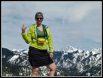 Gwen & Stuart |
 Stuart Range & Iron Pk |
 Jolly & Stuart |
 Gwen & Others |
 Elbow & Yellow Pks |
 Stuart Range |
 False Summit |
 Sharp Peak |
 Heading Down |
 Open Ridge |
 Trailhead Sign |
 Parking Spot |
Trips - 2016
Home