8-27-16
I
planned for a longer hike with significant elevation gain on Saturday.
Friday night I called Kim. She had other plans for Saturday. Except she
didn't. She was not interested in my plan for Iron and Bean Peaks but
she was up for a loop over Bean Peak. We did that trip together in 2008.
I suggested she do the Bean Loop and I would go out ahead and summit
Iron Peak first then meet her farther around the loop. That was our
plan. It's a long drive so we met at 6:20 am in North Seattle. We drove
over Snoqualmie Pass to Cle Elum then north to the NF Teanaway Road. We
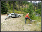
arrived at the trailhead at the end of the Beverly Creek Road at 8:17
am. There were only a couple of cars in the lot. Kim immediately
noticed hornets buzzing around us. They were not aggressive but they
were everywhere. I packed up quickly and was on the trail by 8:26 am.
It was a little chilly at first. Good conditions for hiking uphill.
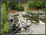
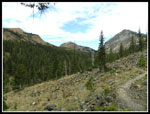
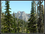
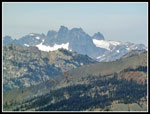
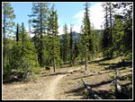
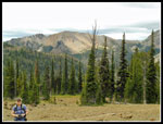
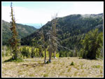
I quickly reached Bean Creek. Unlike most of my visits which are in the spring and early summer, the creek was small. An easy rock hop across. Very soon the temperature warmed up and it was a bit humid. Short sleeves and shorts were plenty. When the trail neared Beverly Creek I could hear the sound of the water. Higher up it was completely silent. The creek was underground. When I came out of the forest the trail goes right over to the creek. It was dry. A little higher up the trail switchbacks away from the creek and I could hear running water once again. I continued up the valley as Bill then Teanaway Peaks came into view. I reached the junction with the Fourth Creek Trail in 71 minutes. I checked trip reports the night before and found on a previous trip it took me 70 minutes. I am consistent.
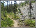
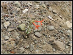
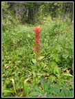
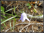
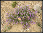
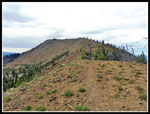
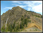
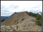
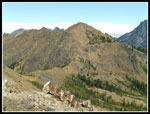
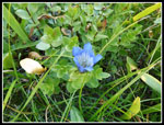
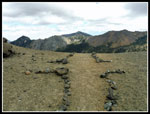
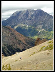
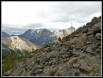
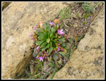
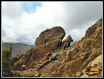
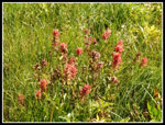
There was water where I crossed Beverly Creek. Near the creek I saw some wildflowers still in bloom. Lower down I saw two scarlet gilia in bloom. Up here there were some Indian paintbrush, harebells, asters, and thistles. I hiked up the trail at a steady pace. I turned off on the Iron Peak Trail and climbed up to the pass between Iron and Teanaway Peaks. I arrived at 10:16 am. I took 39 minutes from the Fourth Creek junction. Now I just had a half mile or so to the summit. The forecast was for strong winds building in the afternoon. I was hit by a few hard bursts down in the valley. I feared that it might be blowing 20 mph on the ridge. That did not happen. There was a steady wind but it was just in the mid to high single digits. Not bad at all. I reached the summit at 10:31 am. I took 2:05 to reach the summit from the trailhead.
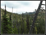
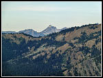
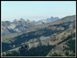
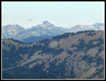
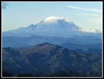
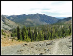
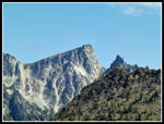
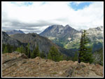
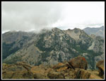
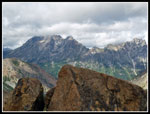
There were a lot of clouds to the east but it was mostly clear to the west, south, and north. I had a great view of Mt. Stuart and the Stuart Range. Mt. Rainier was in the open though it had a cloud cover close in on the upper mountain. The peaks of the Cascade Crest were in the clear. I took 15 minutes to sign the register, take photos and eat and drink. At 10:46 I headed down. Kim would be well ahead of me so I picked up the pace on the way down. With photo stops I did not make up too much time. I turned left at the Fourth Creek junction and climbed to Fourth Creek Pass, arriving at 11:45 am. Here I met the first two people I had seen all day long. They were heading over the ridge and into Hardscrabble Basin. I stopped for another food and water break and to put on sun screen. I would be out in the sun a lot the rest of the way.
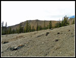
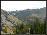
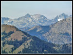
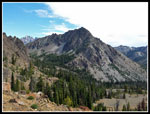
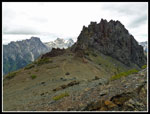
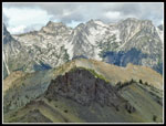
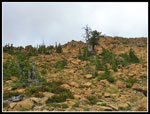
The trail over to the saddle next to Volcanic Neck is damp in early summer with some big mud patches. Not now. Most all the mud has dried out. Only a few trickles of water are running across the trail. The trail slowly gains elevation as it traverses beneath the ridge connecting Mary and Bean Peaks. When it began to climb more steeply I finally caught up with Kim. She had had a more leisurely hike with more time for photos. The sun went in and out of the clouds. Hot when it was shining and comfortable when it was behind clouds. Where the trail grade moderates beneath the Volcanic Neck - Bean Peak ridge we took one more break. Just above the views really improved. Iron Peak, Bill Peak, Mt. Stuart, and more were now clearly in view. We met another couple who were turning around and heading back the way we had come.
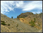
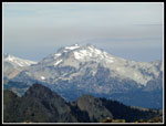
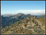
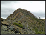
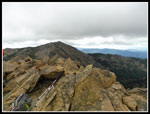
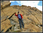
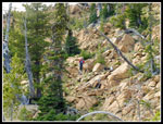
Now the trail switchbacks up the slope to the ridge top. I went ahead. As we climbed the wind really picked up. When I reached the saddle the wind was probably about 15 mph steady with higher gusts. Cold enough to put on a wind shirt even for the climb to the top of Bean Peak. Kim soon arrived and also donned another layer. The scramble to the top is not difficult and only requires hands near the summit. Higher on the ridge we met two more climbers, the fifth, sixth, and last people we saw all day. Who says Teanaway trails are crowded in the summer? Just below the summit the wind was really howling. Oddly, as we topped out it moderated. Still windy but not as bad. Clouds had been blowing in for some time and now views were much more limited. The top of Mt. Stuart was encased in white. Lower peaks were still mostly in the open. At one point a low cloud blew through and blocked out nearby Bill Peak. We arrived at the summit at about 1:50 pm.
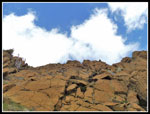
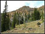
We took time for lots of photos. At one point a few drops of rain blew onto the summit. We could see some rain a distance away. It did not last long. We dropped off the summit at about 2:20 pm. We spent a cold windy half hour on the summit of Bean Peak. Instead of following the ridge down we took my usual route straight off the summit. The wall is very steep but small ledges provide a route down the first one hundred feet or so to easy terrain. Once down that the wind was much weaker. Now came the talus, loose rock, and boulder descent. We headed right then left finding some nice ramps to ease the descent. It was still early enough that we were not in a hurry. Lots of stops to look at the unusual rocks and some more stands of wildflowers. Harebells were especially prolific here.
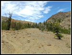
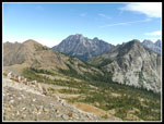
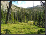
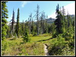
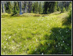
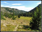
As we dropped down we ran into the old boot path that used to disappear as it climbed. Now it looks more like a trail. Lots of boots have changed this part of the scramble. The path was slick with small rocks underfoot but better than nothing. In due time we reached Upper Bean Creek Basin. Lots of green grass and some wildflowers still holding on. Most of the color is done for this year. We took yet another break to enjoy the peaks above and the broad meadow. It was near 4:00 pm when we headed down. The last three or so miles went by quickly. It was about 5:25 when we reached the car. Just about exactly nine hours since I started my hike. I saw some hornets on the summit of Iron Peak and they were out in force at the car. I moved the car to the other ind of the lot and.... they were there too. We gave up and drove back to the start of pavement to change out of our boots.
I seldom hike in the Teanaway area in summer as it is usually just too hot. Occasionally, we get cooler days in August. After 90 degrees in Seattle just a few days earlier it was mostly pleasant well east of the crest this day. Kim had the nine mile 3200' gain trip she wanted and I had the 12 mile 4400' day I planned. It worked out perfectly for both of us. This trip is almost a complete loop as only the first and last half mile is repeated. Along the way I had a 6520' and 6725' summits along with some off trail scrambling. Everything to make the four hours in the car well worth it. A fine day was had in the mountains.
Click on thumbnails to get
larger pictures.
Trips - 2016
Home
I quickly reached Bean Creek. Unlike most of my visits which are in the spring and early summer, the creek was small. An easy rock hop across. Very soon the temperature warmed up and it was a bit humid. Short sleeves and shorts were plenty. When the trail neared Beverly Creek I could hear the sound of the water. Higher up it was completely silent. The creek was underground. When I came out of the forest the trail goes right over to the creek. It was dry. A little higher up the trail switchbacks away from the creek and I could hear running water once again. I continued up the valley as Bill then Teanaway Peaks came into view. I reached the junction with the Fourth Creek Trail in 71 minutes. I checked trip reports the night before and found on a previous trip it took me 70 minutes. I am consistent.
There was water where I crossed Beverly Creek. Near the creek I saw some wildflowers still in bloom. Lower down I saw two scarlet gilia in bloom. Up here there were some Indian paintbrush, harebells, asters, and thistles. I hiked up the trail at a steady pace. I turned off on the Iron Peak Trail and climbed up to the pass between Iron and Teanaway Peaks. I arrived at 10:16 am. I took 39 minutes from the Fourth Creek junction. Now I just had a half mile or so to the summit. The forecast was for strong winds building in the afternoon. I was hit by a few hard bursts down in the valley. I feared that it might be blowing 20 mph on the ridge. That did not happen. There was a steady wind but it was just in the mid to high single digits. Not bad at all. I reached the summit at 10:31 am. I took 2:05 to reach the summit from the trailhead.
There were a lot of clouds to the east but it was mostly clear to the west, south, and north. I had a great view of Mt. Stuart and the Stuart Range. Mt. Rainier was in the open though it had a cloud cover close in on the upper mountain. The peaks of the Cascade Crest were in the clear. I took 15 minutes to sign the register, take photos and eat and drink. At 10:46 I headed down. Kim would be well ahead of me so I picked up the pace on the way down. With photo stops I did not make up too much time. I turned left at the Fourth Creek junction and climbed to Fourth Creek Pass, arriving at 11:45 am. Here I met the first two people I had seen all day long. They were heading over the ridge and into Hardscrabble Basin. I stopped for another food and water break and to put on sun screen. I would be out in the sun a lot the rest of the way.
The trail over to the saddle next to Volcanic Neck is damp in early summer with some big mud patches. Not now. Most all the mud has dried out. Only a few trickles of water are running across the trail. The trail slowly gains elevation as it traverses beneath the ridge connecting Mary and Bean Peaks. When it began to climb more steeply I finally caught up with Kim. She had had a more leisurely hike with more time for photos. The sun went in and out of the clouds. Hot when it was shining and comfortable when it was behind clouds. Where the trail grade moderates beneath the Volcanic Neck - Bean Peak ridge we took one more break. Just above the views really improved. Iron Peak, Bill Peak, Mt. Stuart, and more were now clearly in view. We met another couple who were turning around and heading back the way we had come.
Now the trail switchbacks up the slope to the ridge top. I went ahead. As we climbed the wind really picked up. When I reached the saddle the wind was probably about 15 mph steady with higher gusts. Cold enough to put on a wind shirt even for the climb to the top of Bean Peak. Kim soon arrived and also donned another layer. The scramble to the top is not difficult and only requires hands near the summit. Higher on the ridge we met two more climbers, the fifth, sixth, and last people we saw all day. Who says Teanaway trails are crowded in the summer? Just below the summit the wind was really howling. Oddly, as we topped out it moderated. Still windy but not as bad. Clouds had been blowing in for some time and now views were much more limited. The top of Mt. Stuart was encased in white. Lower peaks were still mostly in the open. At one point a low cloud blew through and blocked out nearby Bill Peak. We arrived at the summit at about 1:50 pm.
We took time for lots of photos. At one point a few drops of rain blew onto the summit. We could see some rain a distance away. It did not last long. We dropped off the summit at about 2:20 pm. We spent a cold windy half hour on the summit of Bean Peak. Instead of following the ridge down we took my usual route straight off the summit. The wall is very steep but small ledges provide a route down the first one hundred feet or so to easy terrain. Once down that the wind was much weaker. Now came the talus, loose rock, and boulder descent. We headed right then left finding some nice ramps to ease the descent. It was still early enough that we were not in a hurry. Lots of stops to look at the unusual rocks and some more stands of wildflowers. Harebells were especially prolific here.
As we dropped down we ran into the old boot path that used to disappear as it climbed. Now it looks more like a trail. Lots of boots have changed this part of the scramble. The path was slick with small rocks underfoot but better than nothing. In due time we reached Upper Bean Creek Basin. Lots of green grass and some wildflowers still holding on. Most of the color is done for this year. We took yet another break to enjoy the peaks above and the broad meadow. It was near 4:00 pm when we headed down. The last three or so miles went by quickly. It was about 5:25 when we reached the car. Just about exactly nine hours since I started my hike. I saw some hornets on the summit of Iron Peak and they were out in force at the car. I moved the car to the other ind of the lot and.... they were there too. We gave up and drove back to the start of pavement to change out of our boots.
I seldom hike in the Teanaway area in summer as it is usually just too hot. Occasionally, we get cooler days in August. After 90 degrees in Seattle just a few days earlier it was mostly pleasant well east of the crest this day. Kim had the nine mile 3200' gain trip she wanted and I had the 12 mile 4400' day I planned. It worked out perfectly for both of us. This trip is almost a complete loop as only the first and last half mile is repeated. Along the way I had a 6520' and 6725' summits along with some off trail scrambling. Everything to make the four hours in the car well worth it. A fine day was had in the mountains.
 Kim At Trailhead |
 Bean Creek |
 Beverly Creek Trail |
 Scarlet Gilia |
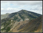
 Iron, Teanaway, Bill Pks |
 Indian Paintbrush |
 Harebell |
 View To Volcanic Neck |
 Top Of Mt. Stuart |
 Ridge Of Iron Peak |
 Saddle Ahead |
 Red Rock At Saddle |
 View East |
 Wildflowers In Bloom |
 On Iron's Ridge |
 Teanaway Peak |
 Hibox Mountain |
 Cascade Crest Peaks |
 Nearing Iron Summit |
 Mt. Daniel |
 Alta &Three Queens |
 Chimney Rock |
 Chikamin Peak |
 Framed Mt. Stuart |
 Saddle & Teanaway |
 Hawkins & Esmerelda |
 Mt. Rainier |
 Bill Peak |
 Helicopter |
 Heading Down |
 Meadow |
 Fourth Creek Pass |
 County Line Trail |
 Little Annapurna |
 Gentian |
 Meadow & Bean Peak |
 Cotton Grass |
 Kim & Iron Peak |
 Cloudy Mt. Stuart |
 Saddle & Navaho Peak |
 Kim & Stuart |
 Volcanic Neck |
 Bean Peak Summit |
 Hiking Ridge |
 Wildflowers |
 Low Clouds From Top |
 Earl Peak |
 Neck & Stuart Range |
 Navaho Close Up |
 Cloudier Mt. Stuart |
 Kim Below Summit |
 Steep Wall |
 Ridge Top Rock |
 Descending Rocks |
 Kim On Descent |
 Bean From Below |
 Nearing Bean Basin |
 In Bean Creek Basin |
 Last Wildflowers |
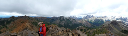 Bean Peak Summit Panorama |
Trips - 2016
Home