2-06-16
I
was looking for a longer trip that I could do alone. With a
considerable avalanche danger I wanted a low start and low risk. Time
for another visit to Mt. Teneriffe. I went up Teneriffe via the road
route on 1-25-15. Last winter we did not have winter. In late January I
found only a few snow patches even at the 4788' summit. This time there
would be snow. I packed snowshoes, Yaktrax, and an ice axe. I didn't
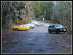
want to have to turn around because of the conditions. The parking lot
is small and I thought I might have to detour to the Mt. Si trailhead
and take the Talus Loop route to the Teneriffe Road. In fact, at 8:40
am there were still a few spots left. By 8:50 am I was packed up and on
my way. The trailhead is at only 940'. There is 3850' net gain to the
summit.
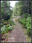
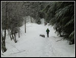
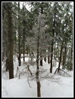
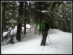
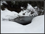
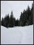
Most people are hiking up the new trail to Teneriffe (Kamikaze) Falls or on up a climbers track to the summit of Teneriffe. That route is very steep and much shorter than the route route. This day I was out for miles and as an added benefit far fewer folks take the road route. On last year's trip the road to trail conversion was nearly done. All the culverts were removed and the road was somewhat narrowed. The temperature started off just below freezing and stayed there much of the day. After about a mile I reached the junction. A sign points out the newer route to the falls heading right. There is no sign for my route to the left. Almost immediately I came to the first new bridge. Probably about 50' long. Soon I came to the second and at the end of the flats is number three. There are several other unbridged creek crossings along here. The bridges were not there last January.
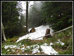
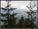
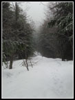
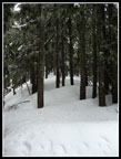
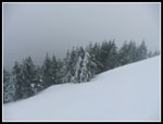
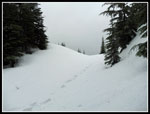
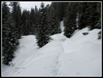
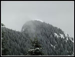
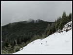
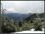
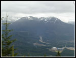
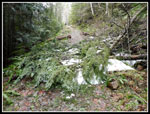
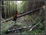
Now came the climbing. Almost immediately there was a log across the trail. In the next mile or less there were nearly a dozen more. Only a couple were a pain to get over or under. There is definitely a day's work for a saw crew. After that the rest of the way up is clear. The first snow patches were at 2600'. At about 2800' there is about a 60' long dump of snow across the road. nothing above or below. It slid down to the road. It is three or more feet deep and will be there for some time. At 3000' the snow became continuous. Just above there is the viewpoint to the south. This day I could see Rattlesnake Lake but not Mt. Rainier. One guy passed me part way up and now he passed me heading down. The steep section gave way to a flat section and a second hiker caught up with me. The snow was now 3 or 4 inches deep.
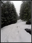
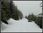
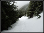
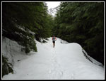
He pulled away but was still in sight on straightaways. At the Mt. Si trail junction there were no tracks heading to Si. The one hiker now ahead of me was setting the only track on our route. Nobody had been up since the last snow a few days earlier. There was enough new snow to cover any older tracks. The snow was soft enough to allow me to sink down but almost never soft enough to post hole. I made was slow but steady progress. More steep uphill gave way to the flatter grade heading towards Teneriffe. Much of this section is out in the open. The snow deepened. There was now 6-8 inches of fresh snow atop a few feet of consolidated snow. I stopped for food and to put gaiters on. Following in packed down steps was a lot easier than setting them. I caught up with the other hiker.
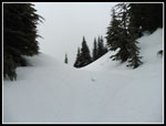
My memory is less than perfect but I think his name was Dave. He stopped to get out his poles and I took the lead. There are a couple now removed culverts which required stomping steps down to running water and then climbing up the other side. That showed that the snow was now about five feet deep. I was sinking in farther as I climbed up the last grade to the saddle where the route to Teneriffe leaves the road. I took a break for more food and water while waiting for Dave to catch up. When he did not I started up the slope to the ridge top. I sank in enough to make for slow travel. Still there was almost no post holing. Sinking in 6 or 8 inches with every step is tiring but not as much as random plunges to below my knee. I could see Dave now in sight below me. I doubt I would have continued on alone. It took a long 3 1/2 hours to reach the saddle over six miles. The summit was still nearly a mile away.
The old route was a boot path that climbed to the ridge top and then followed along the crest. The new trail I saw last January switchbacks up and is below the ridge much of the way. Since I could not see any boot tracks at all I chose to just head to the ridge top and go the route I knew best. At the high point below the descent to the next saddle at the base of the Mt. Teneriffe summit block Dave caught up with me. He had been to about this spot a few weeks earlier before losing the route in snow and turning around. Since he wanted to get to the top this time I joined in for the last bit to the top.
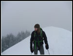
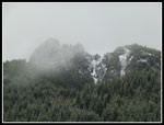
We dropped down the ridge to the saddle then started climbing straight up. Last year I discovered the new trail traverses all the way across the face of Teneriffe to meet the climbers trail from the falls on the far ridge. The trail was now completely buried by snow. I chose to just head straight up as the old boot path used to do. It is very steep climbing up in the forest but the snow conditions were excellent. We sank in enough to provide solid steps but not so much as to make it wallowing uphill. We had been in clouds for the last few thousand feet and it only became denser near the top. I broke out of the trees just below the summit and saw that there were no other people on top. Visibility was minimal. No views this day. The forecast talked about an afternoon clearing but it was not happening here.
Dave made it up to the summit on his second try. Our stay was very short. It was already 1:30 pm when we reached the summit. That meant it took me 3:40 to hike up just under seven miles. Not a very fast pace. There was still about four hours until dark. I thought the steep descent might be difficult but we were able to plunge step down the slope. Up the ridge then along and down it back to the saddle and back on the road/trail. I finished my lunch while Dave headed straight down. That was the last I saw him. If we had not teamed up it is unlikely either of us would have broken trail all the way to the summit. Thanks for the help.
The last six miles was just a slog. The track helped but it was a long way down. I definitely succeeded in having a long hike this day. At the Mt. Si junction there were now tracks in place. The extra tracks made the snow slicker on my descent. I was glad to be back on dirt again below 3000'. I chopped about 45 minutes off my uphill road walking time and made it back to the trailhead at 5:10 pm. Just enough time to drive back to the freeway before dark. I was surprised to find a dozen cars still in the lot that late.
This is an excellent workout in the winter. Via the falls trail the summit is short and very steep. Via the road/trail it is a long trip. The road is a lot less crowded. This is not a trip I do every year but it is one I seem to enjoy every time. I don't tend to hike it in the summer but in winter it is a great trip.
Click on thumbnails to get
larger pictures.
Trips - 2016
Home
Most people are hiking up the new trail to Teneriffe (Kamikaze) Falls or on up a climbers track to the summit of Teneriffe. That route is very steep and much shorter than the route route. This day I was out for miles and as an added benefit far fewer folks take the road route. On last year's trip the road to trail conversion was nearly done. All the culverts were removed and the road was somewhat narrowed. The temperature started off just below freezing and stayed there much of the day. After about a mile I reached the junction. A sign points out the newer route to the falls heading right. There is no sign for my route to the left. Almost immediately I came to the first new bridge. Probably about 50' long. Soon I came to the second and at the end of the flats is number three. There are several other unbridged creek crossings along here. The bridges were not there last January.
Now came the climbing. Almost immediately there was a log across the trail. In the next mile or less there were nearly a dozen more. Only a couple were a pain to get over or under. There is definitely a day's work for a saw crew. After that the rest of the way up is clear. The first snow patches were at 2600'. At about 2800' there is about a 60' long dump of snow across the road. nothing above or below. It slid down to the road. It is three or more feet deep and will be there for some time. At 3000' the snow became continuous. Just above there is the viewpoint to the south. This day I could see Rattlesnake Lake but not Mt. Rainier. One guy passed me part way up and now he passed me heading down. The steep section gave way to a flat section and a second hiker caught up with me. The snow was now 3 or 4 inches deep.
He pulled away but was still in sight on straightaways. At the Mt. Si trail junction there were no tracks heading to Si. The one hiker now ahead of me was setting the only track on our route. Nobody had been up since the last snow a few days earlier. There was enough new snow to cover any older tracks. The snow was soft enough to allow me to sink down but almost never soft enough to post hole. I made was slow but steady progress. More steep uphill gave way to the flatter grade heading towards Teneriffe. Much of this section is out in the open. The snow deepened. There was now 6-8 inches of fresh snow atop a few feet of consolidated snow. I stopped for food and to put gaiters on. Following in packed down steps was a lot easier than setting them. I caught up with the other hiker.
My memory is less than perfect but I think his name was Dave. He stopped to get out his poles and I took the lead. There are a couple now removed culverts which required stomping steps down to running water and then climbing up the other side. That showed that the snow was now about five feet deep. I was sinking in farther as I climbed up the last grade to the saddle where the route to Teneriffe leaves the road. I took a break for more food and water while waiting for Dave to catch up. When he did not I started up the slope to the ridge top. I sank in enough to make for slow travel. Still there was almost no post holing. Sinking in 6 or 8 inches with every step is tiring but not as much as random plunges to below my knee. I could see Dave now in sight below me. I doubt I would have continued on alone. It took a long 3 1/2 hours to reach the saddle over six miles. The summit was still nearly a mile away.
The old route was a boot path that climbed to the ridge top and then followed along the crest. The new trail I saw last January switchbacks up and is below the ridge much of the way. Since I could not see any boot tracks at all I chose to just head to the ridge top and go the route I knew best. At the high point below the descent to the next saddle at the base of the Mt. Teneriffe summit block Dave caught up with me. He had been to about this spot a few weeks earlier before losing the route in snow and turning around. Since he wanted to get to the top this time I joined in for the last bit to the top.
We dropped down the ridge to the saddle then started climbing straight up. Last year I discovered the new trail traverses all the way across the face of Teneriffe to meet the climbers trail from the falls on the far ridge. The trail was now completely buried by snow. I chose to just head straight up as the old boot path used to do. It is very steep climbing up in the forest but the snow conditions were excellent. We sank in enough to provide solid steps but not so much as to make it wallowing uphill. We had been in clouds for the last few thousand feet and it only became denser near the top. I broke out of the trees just below the summit and saw that there were no other people on top. Visibility was minimal. No views this day. The forecast talked about an afternoon clearing but it was not happening here.
Dave made it up to the summit on his second try. Our stay was very short. It was already 1:30 pm when we reached the summit. That meant it took me 3:40 to hike up just under seven miles. Not a very fast pace. There was still about four hours until dark. I thought the steep descent might be difficult but we were able to plunge step down the slope. Up the ridge then along and down it back to the saddle and back on the road/trail. I finished my lunch while Dave headed straight down. That was the last I saw him. If we had not teamed up it is unlikely either of us would have broken trail all the way to the summit. Thanks for the help.
The last six miles was just a slog. The track helped but it was a long way down. I definitely succeeded in having a long hike this day. At the Mt. Si junction there were now tracks in place. The extra tracks made the snow slicker on my descent. I was glad to be back on dirt again below 3000'. I chopped about 45 minutes off my uphill road walking time and made it back to the trailhead at 5:10 pm. Just enough time to drive back to the freeway before dark. I was surprised to find a dozen cars still in the lot that late.
This is an excellent workout in the winter. Via the falls trail the summit is short and very steep. Via the road/trail it is a long trip. The road is a lot less crowded. This is not a trip I do every year but it is one I seem to enjoy every time. I don't tend to hike it in the summer but in winter it is a great trip.
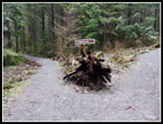 First Junction |
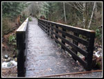 One Of 3 New Bridges |
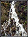 Small Waterfall |
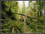 Down Tree |
 Road To Trail |
 Big Snow Patch |
 Rattlesnake Lake |
 Solid Snow Now |
 Dave Passes By |
 Pulling Ahead |
 Upper Road |
 At The First Saddle |
 On The Ridge Top |
 Dave On The Summit |
 Icy Trees On Top |
 Icy Tree |
 Heading Up Ridge |
 Back At The Road/Trail |
 Heading Down |
 Small Pond |
 Slogging Along |
 Five Miles To Go |
 Teneriffe Summit |
 Si In The Distance |
 Mt. Si In The Clouds |
 Viewpoint |
 Trail Runner |
 Mt. Washington |
 Snow Patch |
 Another Down Tree |
 Parking Lot |
Trips - 2016
Home