7-16-16
With
more overcast skies, I planned
for a long hike at lower elevations. I have been visiting a lot of
lakes this not so sunny July. Time for an old favorite. I headed east
on I-90 to Denny Creek and arrived at the Pratt Lake Trailhead at 8:05
am. Ten minutes later I was on the trail. I snagged the last spot in
the lot. Nobody was parked along the access road. Since most folks head
up Granite Mountain I expected that the trail to Pratt would be quiet.
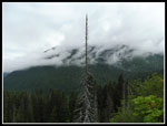
The cloud layer was so low that I could only see half way up Granite
Mountain from the highway.
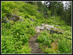
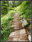
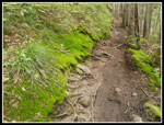
I headed out just before a big group and made good time the first half mile. It the switchback left where an avalanche took out part of the trail a few years ago I found almost ripe wild strawberries. A group of runners went on by not no hikers passed me. I would see more runners this day than hikers. The first thing I noticed is just how low the wilderness boundary is now. It used to be more than two miles up the trail. Now it is well under one mile. The recent Alpine Lakes Wilderness expansion brought the boundary much nearer the highway.
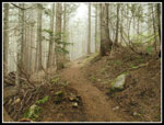
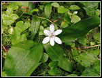
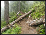
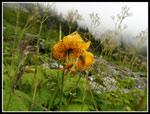
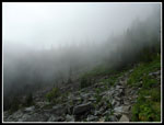
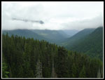
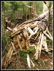
I quickly reached the cloud level. It was darker and misty. I kind of like those conditions. It also made for comfortably cool hiking. Much more so than usual in mid July. All the creeks still have good water flow but are low enough for easy rock hopping. There are a few wildflowers out down low but not many. I cruised past the turnoff for Olallie Lake. There are a few trees down in the next section. Hopefully crews will be up soon. None proved too difficult to cross over.
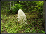
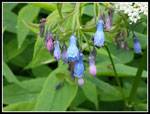
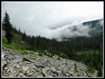
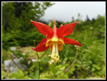
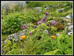
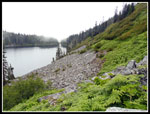
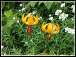
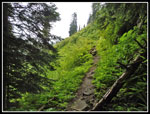
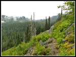
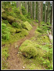
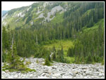
I took a break at the Olallie Lake overlook. Trees are rapidly closing the view. The ridge top does have a lot of beargrass in bloom. I soon reached the junction and headed down to Pratt Lake. Some more logs down along this section. Most every week for the last two months I have seen tiger lilies in bloom. More on this trip. The columbine were especially prolific. Through the forest then out into the boulder field. The old trail went straight down in forest. The new one is longer and goes through the talus where it was blasted into existence. It does proved views that the old forest route did not. This day I had views of thick clouds blowing through the Pratt Lake Basin.
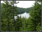
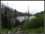
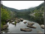
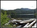
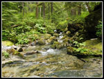
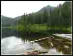
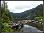
I can still find the junction with the old trail. Down to the flats and through more forest until I reached Pratt Lake. The clouds were rising a little and I could see across it. Hiking along the shore I met two forest service guys. They were heading to Melakwa Lake. I saw a few folks camping but not many. Next I headed on to Lower Tuscohatchie Lake. It was way to cloudy to see Kaleetan Peak. I could see down the valley of the Pratt River though clouds were above it. Just before Tuscohatchie I met a woman who took some incorrect directions and headed down from Melakwa Lake instead of returning to Denny Creek. She realized the error and was in good spirits with the many extra miles by returning via Pratt Lake.
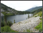
I was a little surprised to see day hikers, runners, and campers at the lake. Not many but some of each. I arrived at the lake at 11:20 am. About 6 miles in about 3:05. Not too bad with breaks and photo stops. In 1988 I backpacked to Lower Tuscohatchie Lake and day hiked to Kaleetan Lake. In the next 28 years I visited Tuscohatchie many times but never went on any of the trail to Kaleetan Lake. This day I was up for some more miles and chose to check out the crossing of the Pratt River on that trail.
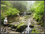
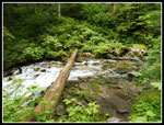
I thought the crossing was just a short way up the trail. In fact, it is about .75 miles along. Most all of it is downhill as I lost 400'. The trail is in pretty good shape. Some signs of maintenance too. A couple trees have recently fallen across the trail. I followed the route down to the crossing. A log goes across. Too skinny for me to walk on but I might scoot across. The rocks slabs are very slick. No way to rock hop yet this year. Though fast the water is not too deep. I would like to return and hike back to Kaleetan Lake in the near future. I climbed back up to Tuscohatchie Lake and met a father daughter combo out for the weekend. They were having a good time even with the sometimes damp weather. I managed to go all day without rain though it seemed about to begin many times.
At 1:06 I headed back. When I reached Pratt Lake I headed onto the nicely signed Pratt River Trail. I did that as a one way hike a few years ago. This day I just checked out the first part. Some maintenance has been done there too. It is marked as "not maintained" and it really is. Some route finding skills are necessary. One group was camping at a site right along the trail. I had to walk right by the tent to get by. Pratt can get crowded on a summer weekend. I turned around right before the first switchback. Now it was time to head for the trailhead. On the way home I was passed by a number of runners. More than I have seen on a hike in the Alpine Lakes Wilderness. I guess the easy access and long distances possible have made this more popular with runner recently.
I still had the big climb back to the ridge top. A bit of work when I had already hiked nine miles. This trail is smoothly graded from start to finish which makes the climbing easier. Once back on the ridge top it became all down hill. One more break at the Olallie overlook then down the last four miles. As usual, I met folks heading up in the later afternoon but less than normal. The overcast did keep a lot of the crowds away this day. At 4:40 pm I reached the trailhead. The lot was mostly full but there were few cars parked along the access road. A far cry from a recent trip on the Mason Lake trail where cars were parked a mile down the road.
All in all, this was an excellent hike. at 14 miles it was a good leg stretcher. The 3700' gained was nearly as much as Granite Mountain. Considering there were no views from Granite, I was quite happy to do the lakes route. I saw folks off and on during the day but had long stretches of solitude as well. Not bad for an I-90 hike. All that and no rain on a misty cloudy day. The sun will return this summer but a nice cool day was alright with me.
Click on thumbnails to get
larger pictures.
Trips - 2016
Home
I headed out just before a big group and made good time the first half mile. It the switchback left where an avalanche took out part of the trail a few years ago I found almost ripe wild strawberries. A group of runners went on by not no hikers passed me. I would see more runners this day than hikers. The first thing I noticed is just how low the wilderness boundary is now. It used to be more than two miles up the trail. Now it is well under one mile. The recent Alpine Lakes Wilderness expansion brought the boundary much nearer the highway.
I quickly reached the cloud level. It was darker and misty. I kind of like those conditions. It also made for comfortably cool hiking. Much more so than usual in mid July. All the creeks still have good water flow but are low enough for easy rock hopping. There are a few wildflowers out down low but not many. I cruised past the turnoff for Olallie Lake. There are a few trees down in the next section. Hopefully crews will be up soon. None proved too difficult to cross over.
I took a break at the Olallie Lake overlook. Trees are rapidly closing the view. The ridge top does have a lot of beargrass in bloom. I soon reached the junction and headed down to Pratt Lake. Some more logs down along this section. Most every week for the last two months I have seen tiger lilies in bloom. More on this trip. The columbine were especially prolific. Through the forest then out into the boulder field. The old trail went straight down in forest. The new one is longer and goes through the talus where it was blasted into existence. It does proved views that the old forest route did not. This day I had views of thick clouds blowing through the Pratt Lake Basin.
I can still find the junction with the old trail. Down to the flats and through more forest until I reached Pratt Lake. The clouds were rising a little and I could see across it. Hiking along the shore I met two forest service guys. They were heading to Melakwa Lake. I saw a few folks camping but not many. Next I headed on to Lower Tuscohatchie Lake. It was way to cloudy to see Kaleetan Peak. I could see down the valley of the Pratt River though clouds were above it. Just before Tuscohatchie I met a woman who took some incorrect directions and headed down from Melakwa Lake instead of returning to Denny Creek. She realized the error and was in good spirits with the many extra miles by returning via Pratt Lake.
I was a little surprised to see day hikers, runners, and campers at the lake. Not many but some of each. I arrived at the lake at 11:20 am. About 6 miles in about 3:05. Not too bad with breaks and photo stops. In 1988 I backpacked to Lower Tuscohatchie Lake and day hiked to Kaleetan Lake. In the next 28 years I visited Tuscohatchie many times but never went on any of the trail to Kaleetan Lake. This day I was up for some more miles and chose to check out the crossing of the Pratt River on that trail.
I thought the crossing was just a short way up the trail. In fact, it is about .75 miles along. Most all of it is downhill as I lost 400'. The trail is in pretty good shape. Some signs of maintenance too. A couple trees have recently fallen across the trail. I followed the route down to the crossing. A log goes across. Too skinny for me to walk on but I might scoot across. The rocks slabs are very slick. No way to rock hop yet this year. Though fast the water is not too deep. I would like to return and hike back to Kaleetan Lake in the near future. I climbed back up to Tuscohatchie Lake and met a father daughter combo out for the weekend. They were having a good time even with the sometimes damp weather. I managed to go all day without rain though it seemed about to begin many times.
At 1:06 I headed back. When I reached Pratt Lake I headed onto the nicely signed Pratt River Trail. I did that as a one way hike a few years ago. This day I just checked out the first part. Some maintenance has been done there too. It is marked as "not maintained" and it really is. Some route finding skills are necessary. One group was camping at a site right along the trail. I had to walk right by the tent to get by. Pratt can get crowded on a summer weekend. I turned around right before the first switchback. Now it was time to head for the trailhead. On the way home I was passed by a number of runners. More than I have seen on a hike in the Alpine Lakes Wilderness. I guess the easy access and long distances possible have made this more popular with runner recently.
I still had the big climb back to the ridge top. A bit of work when I had already hiked nine miles. This trail is smoothly graded from start to finish which makes the climbing easier. Once back on the ridge top it became all down hill. One more break at the Olallie overlook then down the last four miles. As usual, I met folks heading up in the later afternoon but less than normal. The overcast did keep a lot of the crowds away this day. At 4:40 pm I reached the trailhead. The lot was mostly full but there were few cars parked along the access road. A far cry from a recent trip on the Mason Lake trail where cars were parked a mile down the road.
All in all, this was an excellent hike. at 14 miles it was a good leg stretcher. The 3700' gained was nearly as much as Granite Mountain. Considering there were no views from Granite, I was quite happy to do the lakes route. I saw folks off and on during the day but had long stretches of solitude as well. Not bad for an I-90 hike. All that and no rain on a misty cloudy day. The sun will return this summer but a nice cool day was alright with me.
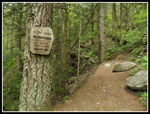 Wilderness Boundary |
 Tropical NW |
 Into The Clouds |
 Queen's Cup |
 Beargrass |
 Olallie Lake |
 Logs Down |
 Columbine |
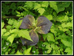
 False Hellebore |
 Bluebells |
 Clouds Roll In |
 Columbine Close Up |
 Old Tiger Lily |
 Thistles |
 A Little Cloudy |
 Pratt Lake In Sight |
 Trail Along Lake |
 Tiger Lilies |
 Pratt Outlet |
 Out Of The Forest |
 Low Clouds |
 Pratt River Valley |
 Nearing Tuscohatchie |
 Lower Tuscohatchie |
 Pratt River Crossing |
 Gorgeous Gorge |
 Blocked Trail |
 Kaleetan Lake Trail |
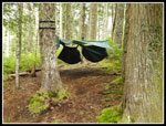 Hennessey Hammocks |
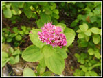 Spirea |
 Leaving Tuscohatchie |
 Trillium |
 Falling Apart |
 Back At Pratt Lake |
 Ferns |
 Looking Back To Pratt |
 Pratt Meadow |
 Colorful Moss |
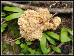 Fungus |
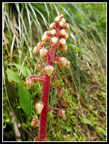 Saprophyte |
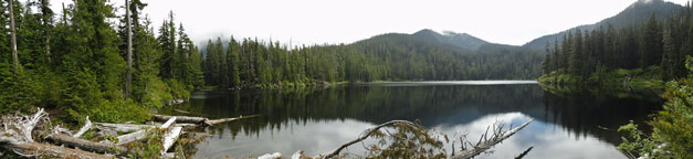 A panorama shot of Lower Tuscohatchie Lake |
Trips - 2016
Home