8/26-27/17
Gary
suggested a weekend backpacking trip. John was free too. I scrambled up
the abandoned trail on Ruby Mountain 23 years ago. Gary did it a few
years before that. We have talked about a return visit for more than a
decade. Several times we had it scheduled when bad weather or fire
smoke or something forced us to cancel. This year we were ready to do
it. The campsite part way up at Fourth of July Pass is in North
Cascades National Park and requires a camping permit. The Marblemount
Ranger Station opens at 7:00 am to issue the permits. There are three
campsites at the pass. There is not lake nor a summit. Just some
campsites in the forest. There should be at least one site free, right?
Gary and John were coming from Kent and I am still a 2 hour drive to
the ranger station. Rather than getting up at 3:30 am we chose to aim
to arrive at 8:00 am. Just in case all the sites were taken, Gary had a
back up plan in the same general area. We met in North Seattle at 6:00
am and headed north. We did arrive at the ranger station right about
8:00 am. All three camping permits were taken. Oh well, yet another
attempt at Ruby Mountain was thwarted. On to the back up plan.
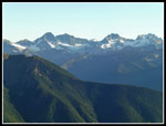
Just a mere 19 years earlier Gary had backpacked just east of Ross Lake in the Pasayten Wilderness. Or is that Wenatchee Wilderness? See the photo below. He went up Crater Mountain and then on to Devil's Park to camp. The next day they scrambled up the end of Jackita Ridge and on to the next summit. Even earlier he had backpacked the whole Devil's Dome Loop trip. That is about a 50 mile loop that includes the trial to Devil's Park. I had not ever hiked these trails. Nor had John. We drove the North Cascades Highway east of Ross Dam to the Canyon Creek Trailhead. We arrived a little before 9:00 am and were on the trail a little after 9:00 am. Though not full, there were eight or nine cars in the lot.
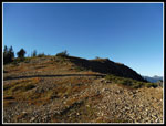
The route quickly crosses the bridge over Granite Creek. A junction with the Chancellor Trail is passed then another bridge crosses Canyon Creek. We met one hiker who was coming out after the first crossing. Once across the creek there is another junction. Left is one end of the Devil's Dome Loop hike on the Ruby Trail. we went right on the Jackita Ridge Trail. A short way along the trail we reached the signboard for the trail. The trail climbs four miles to reach the junction with the Crater Peaks Trail. It gains 3400' from the 1900' trailhead to the 5380' junction. The trail does not seem overly steep but it is relentless. Many switchbacks climb up the slope. It was cool in the parking lot but it warmed up very fast as we climbed. There are not many views out as the route is all in forest. On the other hand, the trees provide shade on a hot summer day.
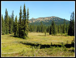
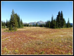
We were nearly two miles in when we reached the wilderness boundary. There were a few streams still running. Our pace was steady but not fast. At the 3 mile mark we saw on of the old metal mile markers nailed to a tree. At about four miles we reached the junction. There are some bolts on a tree but no trail signs. There is a creek just a few feet after the junction. We arrived right at 12.00 pm. 2:55 is not fast for four miles but we did have 3400' done. The junction is near the high point before reaching McMillan Park. Easy terrain quickly brought us to the park. We took our lunch break here. The park provided some views out. We could see Jackita Ridge and the area of Devil's Park, our destination for the day. It does not look to be that far away but their is a significant drop in between. The trail goes farther left to cross with less elevation loss. That does make the distance longer. While eating we saw four guys on the nearby trail. They were heading out. They were the last people I saw that day. Gary and John saw two others later.
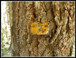
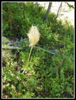
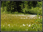
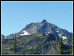
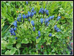
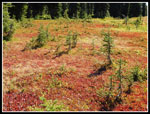
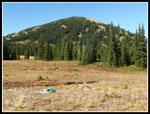
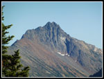
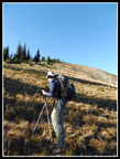
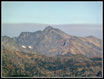
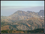
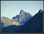
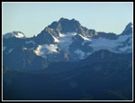
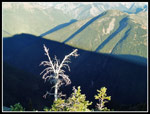
Back on the trail we contoured around the edge of McMillan Park. There were a lot of the cotton like plants I saw a few weeks earlier at Spray Park. We also saw blooming asters and a few Indian paintbrush. A little color but the flower show is about done. There was one white flower that none of us recognized. We saw it in a number of places in full bloom. A ptarmigan mom and chicks sprang into sight. Not the last ones we were to see this weekend. The route begins to drop and loses about 350' to the crossing of Nickol Creek. The creek is completely dry. On the other side the forest is much thinner. This provides views out and also significantly heated us up. Not a lot of shade and a 1000' climb to Devil's Park and our camping spot. Some very close up looks across and up to Crater Mountain. As we climbed Jack Mountain also came into view. There were quite a few ripe berries all along the trail between the parks. Unfortunately, they were smaller than usual. I have seen that on several recent hikes.
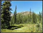
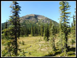
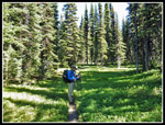
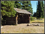
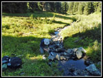
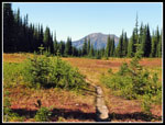
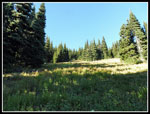
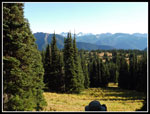
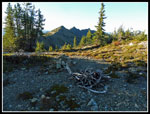
I was really feeling the heat and all the elevation gain as we neared Devil's Park. When we reaches some trees and shade we took another water break. The route became much gentler as we entered the park. At about seven miles we reached the old shelter. Still standing. It has several bunk beds. There is a creek on the map located behind the shelter. We headed down to find plenty of flow to pump water. We did not know if there would be any water nearer our proposed camping area so we partly filled two water bags and carried them on. About half a mile farther the trail turns ninety degrees left and we continued through a big meadow. There are clumps of trees in spots all over the meadow. We found a good spot right at the southern end of Jackita Ridge.
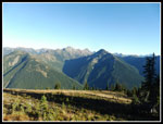
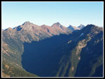
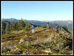
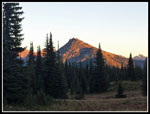
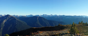
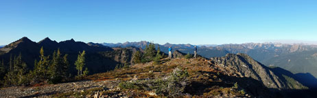
After setting up camp we had dinner. Then we headed off for a little evening stroll 1200' feet up the ridge to the southern most point. We had good views from camp but they were much better as we ascended. The slope is mostly forested with some long open meadowy glades. After first avoiding a very wet marshy spot we headed up. By going to the top of one glade then contouring over to the next we made it all the way up with little forest to fight through. The grade was steady at 1200' in one mile. Near the top we rose above most trees and the views really improved. We reached the top at about 6:25 pm. It took abut 50 minutes to hike up. The top is Point 7111. We could see the snowy and icy north sides of many peaks to the south. There was a lot of glare from the low sun when looking west towards Crater and Jack. Looking east we were able to spot and photograph the Slate Peak Lookout. My 20x zoom lens was the least powerful. Gary and John had more detailed photos of the lookout. We were able to pick out a number of peaks using a map.
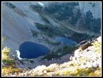
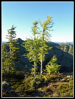
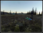
Just below us on the backside of the ridge are two small lakes. I also noticed a couple bright green larch trees on the summit. The summit is large and fairly level. It made for a great viewpoint. We spent forty minutes on top, leaving at 7:05 pm. Enough time to easily make it back to camp before dark. A lot of the glades looked the same gong down. With our GPS units and noticing a few footprints and pole holes we followed our route up on the way down. The only problem with going off route would be ending up in the marshy spot. There was some moonlight but with no city lights star gazing was pretty good. We managed to stay out until 9:30 pm. (The link for Day 2 is below the photos.)
Click on thumbnails to get
larger pictures.
Day 2
Trips - 2017
Home
Just a mere 19 years earlier Gary had backpacked just east of Ross Lake in the Pasayten Wilderness. Or is that Wenatchee Wilderness? See the photo below. He went up Crater Mountain and then on to Devil's Park to camp. The next day they scrambled up the end of Jackita Ridge and on to the next summit. Even earlier he had backpacked the whole Devil's Dome Loop trip. That is about a 50 mile loop that includes the trial to Devil's Park. I had not ever hiked these trails. Nor had John. We drove the North Cascades Highway east of Ross Dam to the Canyon Creek Trailhead. We arrived a little before 9:00 am and were on the trail a little after 9:00 am. Though not full, there were eight or nine cars in the lot.
The route quickly crosses the bridge over Granite Creek. A junction with the Chancellor Trail is passed then another bridge crosses Canyon Creek. We met one hiker who was coming out after the first crossing. Once across the creek there is another junction. Left is one end of the Devil's Dome Loop hike on the Ruby Trail. we went right on the Jackita Ridge Trail. A short way along the trail we reached the signboard for the trail. The trail climbs four miles to reach the junction with the Crater Peaks Trail. It gains 3400' from the 1900' trailhead to the 5380' junction. The trail does not seem overly steep but it is relentless. Many switchbacks climb up the slope. It was cool in the parking lot but it warmed up very fast as we climbed. There are not many views out as the route is all in forest. On the other hand, the trees provide shade on a hot summer day.
We were nearly two miles in when we reached the wilderness boundary. There were a few streams still running. Our pace was steady but not fast. At the 3 mile mark we saw on of the old metal mile markers nailed to a tree. At about four miles we reached the junction. There are some bolts on a tree but no trail signs. There is a creek just a few feet after the junction. We arrived right at 12.00 pm. 2:55 is not fast for four miles but we did have 3400' done. The junction is near the high point before reaching McMillan Park. Easy terrain quickly brought us to the park. We took our lunch break here. The park provided some views out. We could see Jackita Ridge and the area of Devil's Park, our destination for the day. It does not look to be that far away but their is a significant drop in between. The trail goes farther left to cross with less elevation loss. That does make the distance longer. While eating we saw four guys on the nearby trail. They were heading out. They were the last people I saw that day. Gary and John saw two others later.
Back on the trail we contoured around the edge of McMillan Park. There were a lot of the cotton like plants I saw a few weeks earlier at Spray Park. We also saw blooming asters and a few Indian paintbrush. A little color but the flower show is about done. There was one white flower that none of us recognized. We saw it in a number of places in full bloom. A ptarmigan mom and chicks sprang into sight. Not the last ones we were to see this weekend. The route begins to drop and loses about 350' to the crossing of Nickol Creek. The creek is completely dry. On the other side the forest is much thinner. This provides views out and also significantly heated us up. Not a lot of shade and a 1000' climb to Devil's Park and our camping spot. Some very close up looks across and up to Crater Mountain. As we climbed Jack Mountain also came into view. There were quite a few ripe berries all along the trail between the parks. Unfortunately, they were smaller than usual. I have seen that on several recent hikes.
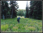
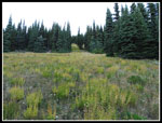
I was really feeling the heat and all the elevation gain as we neared Devil's Park. When we reaches some trees and shade we took another water break. The route became much gentler as we entered the park. At about seven miles we reached the old shelter. Still standing. It has several bunk beds. There is a creek on the map located behind the shelter. We headed down to find plenty of flow to pump water. We did not know if there would be any water nearer our proposed camping area so we partly filled two water bags and carried them on. About half a mile farther the trail turns ninety degrees left and we continued through a big meadow. There are clumps of trees in spots all over the meadow. We found a good spot right at the southern end of Jackita Ridge.
After setting up camp we had dinner. Then we headed off for a little evening stroll 1200' feet up the ridge to the southern most point. We had good views from camp but they were much better as we ascended. The slope is mostly forested with some long open meadowy glades. After first avoiding a very wet marshy spot we headed up. By going to the top of one glade then contouring over to the next we made it all the way up with little forest to fight through. The grade was steady at 1200' in one mile. Near the top we rose above most trees and the views really improved. We reached the top at about 6:25 pm. It took abut 50 minutes to hike up. The top is Point 7111. We could see the snowy and icy north sides of many peaks to the south. There was a lot of glare from the low sun when looking west towards Crater and Jack. Looking east we were able to spot and photograph the Slate Peak Lookout. My 20x zoom lens was the least powerful. Gary and John had more detailed photos of the lookout. We were able to pick out a number of peaks using a map.
Just below us on the backside of the ridge are two small lakes. I also noticed a couple bright green larch trees on the summit. The summit is large and fairly level. It made for a great viewpoint. We spent forty minutes on top, leaving at 7:05 pm. Enough time to easily make it back to camp before dark. A lot of the glades looked the same gong down. With our GPS units and noticing a few footprints and pole holes we followed our route up on the way down. The only problem with going off route would be ending up in the marshy spot. There was some moonlight but with no city lights star gazing was pretty good. We managed to stay out until 9:30 pm. (The link for Day 2 is below the photos.)
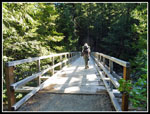 Granite Creek Bridge |
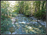 Granite Creek |
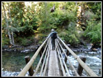 Canyon Creek Bridge |
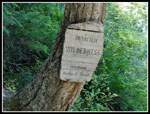 Wilderness Boundary |
 3 Mile Marker |
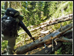 Climbing Over Logs |
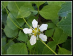 Prolific White Flower |
 Crater From McMillan |
 Jackita Ridge |
 Western Anemone |
 East Crater Again |
 Cotton Like Flower |
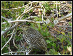 Ptarmigan Chick |
 Jack Mt. In Sight |
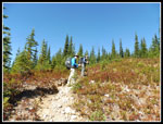 Heading Uphill |
 Shade Near Devil's Park |
 Devil's Park Shelter |
 Gentian |
 Pumping Water |
 Fall Color Begins |
 Great Color |
 Nearing Campsite |
 Gary & Point 7111 |
 Heading Up |
 Looking Back To Camp |
 Big Peak |
 Peaks All Around |
 Gary Heads Up |
 Gary Reaches Summit |
 Mountains Shadow |
 Clouds Or Smoke |
 Slate Peak |
 North Side Of Peaks |
 Great Views |
 John & Gary |
 Two Lakes |
 Larch Trees |
 High Ice |
 Bright Against Dark |
 Enjoying The View |
 Heading Down |
 Looking Up Slope |
 Alpenglow |
 Camp Near Nightfall |
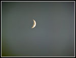 The Moon |
 Summit Panorama |
 Bigger Panorama With Jackita Ridge At Left |
Day 2
Trips - 2017
Home