6-17-17
Sunday
was taken so I needed to get
in a longer hike for Saturday. Few of my day hikes are longer than the
Devil's Gulch Mission Ridge Loop. I first hiked the full loop in 2005.
Janet and I made a return trip in 2011. It seems to take six years for
the pain to fade from my memory. Time for another trip. The Devil's
Gulch part requires three crossings of Mission Creek plus several large
side creeks. In early spring they can be too dangerous. Waiting for
most of the snow to melt up high is crucial. Even so, with no trip
reports this year, I hiked counter clockwise to get the crossings out
of the way in the morning in case the water level rose. Plus if the
first crossing is not safe, you have only hiked 2.5 miles. With a long
drive and long hike planned I arose at 5:00 am and was out the door at
5:45 am.
Traffic was thicker than expected at that hour. Still I was able to drive at or slightly above the speed limit. I drove over Stevens Pass, down to Leavenworth, and on to Cashmere. The Mission Creek Road is paved until the last 2.7 miles of gravel. The road has washed out a number of times. This year it is in excellent shape. Any car can drive it. I arrived at the trailhead at 8:25 am after a 135 mile drive from Seattle. There was one car and the guy was getting his bicycle ready. Soon another biker arrived. The trail is open to hikers, bicyclers, and motorcycles. The mosquitoes were awful at the start. I quickly packed up and hit the trail at 8:37 am. This was my earliest starting time. A big sign at the start mentions all the birds that can be seen on the route. It is more popular with birds than hikers.
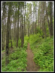
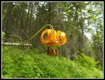
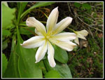
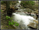
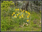
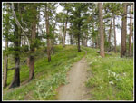
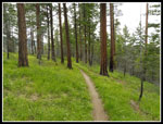
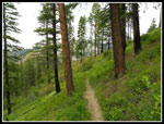
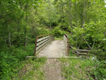
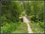
First you cross the creek on a nice big bridge then follow the creek upstream. This section has been recently brushed out. The cuttings are all over the trail. In just a few minutes the Red Devil Trail is met. I found a big tiger lily in bloom here.This can be pretty good wildflower hike in the spring. I had not hiked it this late and hoped for some kind of wildflower show. Little did I know what lay ahead. A minute or two later I reached the second bridge. Straight ahead over the bridge and up Mission Ridge or right and up Devil's Gulch. I turned right. I really like this first part as the trail climbs above the creek on a narrow trail next to sandstone cliffs. Several flowers were in bloom. It was clear that the arrowleaf balsamroot were finished. They provide a lot of bright yellow color in the spring.
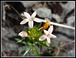
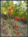
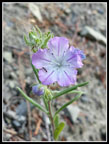
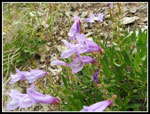
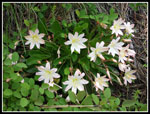
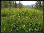
Since the last nine miles has no running water and summer temperatures get into the high 90s or more this trip requires a somewhat cool day for me. The early start and forecast high of about 70 fit the bill. This was a snowy winter and even in mid June there was still a lot of water. Most side creeks were still running. Mission Creek had a good flow but fording it did not seem like it would be very hard. I passed the junction for the trail up Red Hill and kept going. The wildflower show was not too bad down low. Salsify, mariposa lilies, and roses appeared all along the route. Thimbleberry was blooming. Some Indian paintbrush was blooming but I did not see a lot of it. I even saw some non chlorophyll coral root. Not a profusion of colors but small amounts of a wide variety of flowers.
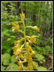
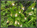
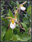
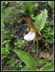
At about 2.6 miles I reached the first crossing of Mission Creek. It was flowing fast but was not deep. I managed to hop from logs to rocks and made it across with dry feet. Now the trail climbs above the creek and enters more open areas. It still goes into forest but there are open rock slopes. I found a lot of balsamroot and scarlet gilia in early June 2011. Those flowers are about done now. I did find one large scarlet gilia in full bloom. I also came across the flower called lady slipper for the first time ever. Quite a surprise. Just after that two runner ran on by heading downstream. The only people not on two wheels I saw all day. The next creek crossing at about 4.7 miles was tougher. There is a log well above the water but I did not like it. I tried rock hopping but the rocks were too slick. I chose to take off my boots and wade across. I ran into two motorcyclists just before the creek. I saw and talked to them several times during the day. Nice guys.
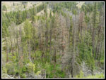
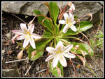
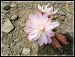
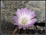
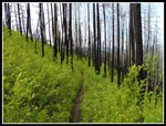
I had passed the spots were I had seen Tweedy Lewisia on earlier trips. I figured it was all finished. Then I found one right at angle level. It was right at its peak. Check off one more seldom seen flower. It did not turn out to be the only one I saw this day. Recent fire reached several spots on this part of the trail. One burned tree fell down a bare dirt slope taking out the trail. It is now a muddy narrow path across the slope. Some trail work would be helpful here. There was one more spot much like that one. The day was heating up and in open spots it was getting a bit toasty. Even this far up the creek there was intermittent forest however. At long last I came to the final crossing of Mission Creek. This one was narrower but fast flowing. No logs across. I was able to get out onto a wet rock and jump to the other side. No more creek crossings and no more water for the rest of the hike.
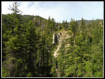
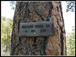
I crossed the creek at the 7 mile mark. Now I had two miles of uphill to get to the top of Mission Ridge. This is a motorcycle trail and the grade is pretty gentle. Lots of switchbacks, some that seem to gain precious little elevation. As I climbed I had some views over to Tronsen Ridge and also down Devil's Gulch. Lupine began to really show up along here. Also some balsamroot was not finished yet. I like how the flowers change as you climb from the gulch to the top of the ridge. At about 9 miles I reached the junction with the Mission Ridge Trail. Right heads higher up the ridge. I went left to hike along and down the ridge. First it was time for food and water.
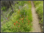
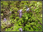
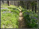
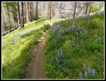
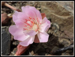
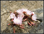
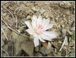
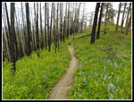
One of the more challenging parts of this trip is that the ridge is not just a long downhill slog. It is an up and downhill slog. The route climbs over a number of bumps on the ridge. On my first few visits to Mission Ridge the old motorcycle trail actually went over about every high spot. Now the trail contours around a number of them. The old tread is still barely visible going straight up and downhill in lots of places. The new route has less elevation gain and loss along the ridge top. At this point less ups and downs was fine with me. There was 8 more miles to get down off the ridge and back to the trailhead. The wildflower show just got better on the ridge top. A stiff climb from the junction brought me to bare ridge top. The ground was littered with hundreds of blooming bitterroot. One of my favorite wildflowers, I did not expect to see many this day. I saw so many that I stopped taking photos of them. Then the Tweedy Lewisia made more appearances along with more lady slippers. Throw in some fields of lupine with some Indian paintbrush and more balsamroot and mariposa lilies and more... everything. I have done the loop twice before and hiked the gulch and ridge on separate trips but I have never seen this variety of wildflowers there before. An embarrassment of riches.
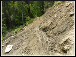
The tread is okay most of the way but along the ridge top there were many stretches where wheels had dug a deep and narrow trench. Too narrow for my feet to easily traverse. I found it much more difficult than a smooth trail. By now my feet were getting plenty tired. A motorcycling couple passed me and later a group of four mountain bikers. That was it for the 8 miles on Mission Ridge. Just a whole lot of solitude. I was very glad when I recognized the last switchbacks dropping down t the end of the ridge. With all the photo stops I was up to 8 hours on the trail. I was glad to cross the bridge and complete the loop. Just a short level walk back to the car. It was now very overcast and humid. The skeeters were just as bad as in the morning. I finished right at 5:00 pm. Within just a few minutes I was in the car and on my way home.
The drive home was awfully easy for Highway 2 on a Sunday. Not even a slowdown in Sultan. I was home by 8:10 pm. This was a really long day. 14:00 home to home. 270 miles driven and 17 miles hiked. The route is in fine shape. The road in is in fine shape. The creek level is low enough for easy fording. The wildflower display was far beyond my wildest expectations. I hiked this route in 2005 and it took 6 years for the pain to be forgotten. I hiked it again in 2011 and it took 6 years for the pain to be forgotten. Looks like I need to put it back on the schedule for 2023.
Click on thumbnails to get
larger pictures.
Trips - 2017
Home
Traffic was thicker than expected at that hour. Still I was able to drive at or slightly above the speed limit. I drove over Stevens Pass, down to Leavenworth, and on to Cashmere. The Mission Creek Road is paved until the last 2.7 miles of gravel. The road has washed out a number of times. This year it is in excellent shape. Any car can drive it. I arrived at the trailhead at 8:25 am after a 135 mile drive from Seattle. There was one car and the guy was getting his bicycle ready. Soon another biker arrived. The trail is open to hikers, bicyclers, and motorcycles. The mosquitoes were awful at the start. I quickly packed up and hit the trail at 8:37 am. This was my earliest starting time. A big sign at the start mentions all the birds that can be seen on the route. It is more popular with birds than hikers.
First you cross the creek on a nice big bridge then follow the creek upstream. This section has been recently brushed out. The cuttings are all over the trail. In just a few minutes the Red Devil Trail is met. I found a big tiger lily in bloom here.This can be pretty good wildflower hike in the spring. I had not hiked it this late and hoped for some kind of wildflower show. Little did I know what lay ahead. A minute or two later I reached the second bridge. Straight ahead over the bridge and up Mission Ridge or right and up Devil's Gulch. I turned right. I really like this first part as the trail climbs above the creek on a narrow trail next to sandstone cliffs. Several flowers were in bloom. It was clear that the arrowleaf balsamroot were finished. They provide a lot of bright yellow color in the spring.
Since the last nine miles has no running water and summer temperatures get into the high 90s or more this trip requires a somewhat cool day for me. The early start and forecast high of about 70 fit the bill. This was a snowy winter and even in mid June there was still a lot of water. Most side creeks were still running. Mission Creek had a good flow but fording it did not seem like it would be very hard. I passed the junction for the trail up Red Hill and kept going. The wildflower show was not too bad down low. Salsify, mariposa lilies, and roses appeared all along the route. Thimbleberry was blooming. Some Indian paintbrush was blooming but I did not see a lot of it. I even saw some non chlorophyll coral root. Not a profusion of colors but small amounts of a wide variety of flowers.
At about 2.6 miles I reached the first crossing of Mission Creek. It was flowing fast but was not deep. I managed to hop from logs to rocks and made it across with dry feet. Now the trail climbs above the creek and enters more open areas. It still goes into forest but there are open rock slopes. I found a lot of balsamroot and scarlet gilia in early June 2011. Those flowers are about done now. I did find one large scarlet gilia in full bloom. I also came across the flower called lady slipper for the first time ever. Quite a surprise. Just after that two runner ran on by heading downstream. The only people not on two wheels I saw all day. The next creek crossing at about 4.7 miles was tougher. There is a log well above the water but I did not like it. I tried rock hopping but the rocks were too slick. I chose to take off my boots and wade across. I ran into two motorcyclists just before the creek. I saw and talked to them several times during the day. Nice guys.
I had passed the spots were I had seen Tweedy Lewisia on earlier trips. I figured it was all finished. Then I found one right at angle level. It was right at its peak. Check off one more seldom seen flower. It did not turn out to be the only one I saw this day. Recent fire reached several spots on this part of the trail. One burned tree fell down a bare dirt slope taking out the trail. It is now a muddy narrow path across the slope. Some trail work would be helpful here. There was one more spot much like that one. The day was heating up and in open spots it was getting a bit toasty. Even this far up the creek there was intermittent forest however. At long last I came to the final crossing of Mission Creek. This one was narrower but fast flowing. No logs across. I was able to get out onto a wet rock and jump to the other side. No more creek crossings and no more water for the rest of the hike.
I crossed the creek at the 7 mile mark. Now I had two miles of uphill to get to the top of Mission Ridge. This is a motorcycle trail and the grade is pretty gentle. Lots of switchbacks, some that seem to gain precious little elevation. As I climbed I had some views over to Tronsen Ridge and also down Devil's Gulch. Lupine began to really show up along here. Also some balsamroot was not finished yet. I like how the flowers change as you climb from the gulch to the top of the ridge. At about 9 miles I reached the junction with the Mission Ridge Trail. Right heads higher up the ridge. I went left to hike along and down the ridge. First it was time for food and water.
One of the more challenging parts of this trip is that the ridge is not just a long downhill slog. It is an up and downhill slog. The route climbs over a number of bumps on the ridge. On my first few visits to Mission Ridge the old motorcycle trail actually went over about every high spot. Now the trail contours around a number of them. The old tread is still barely visible going straight up and downhill in lots of places. The new route has less elevation gain and loss along the ridge top. At this point less ups and downs was fine with me. There was 8 more miles to get down off the ridge and back to the trailhead. The wildflower show just got better on the ridge top. A stiff climb from the junction brought me to bare ridge top. The ground was littered with hundreds of blooming bitterroot. One of my favorite wildflowers, I did not expect to see many this day. I saw so many that I stopped taking photos of them. Then the Tweedy Lewisia made more appearances along with more lady slippers. Throw in some fields of lupine with some Indian paintbrush and more balsamroot and mariposa lilies and more... everything. I have done the loop twice before and hiked the gulch and ridge on separate trips but I have never seen this variety of wildflowers there before. An embarrassment of riches.
The tread is okay most of the way but along the ridge top there were many stretches where wheels had dug a deep and narrow trench. Too narrow for my feet to easily traverse. I found it much more difficult than a smooth trail. By now my feet were getting plenty tired. A motorcycling couple passed me and later a group of four mountain bikers. That was it for the 8 miles on Mission Ridge. Just a whole lot of solitude. I was very glad when I recognized the last switchbacks dropping down t the end of the ridge. With all the photo stops I was up to 8 hours on the trail. I was glad to cross the bridge and complete the loop. Just a short level walk back to the car. It was now very overcast and humid. The skeeters were just as bad as in the morning. I finished right at 5:00 pm. Within just a few minutes I was in the car and on my way home.
The drive home was awfully easy for Highway 2 on a Sunday. Not even a slowdown in Sultan. I was home by 8:10 pm. This was a really long day. 14:00 home to home. 270 miles driven and 17 miles hiked. The route is in fine shape. The road in is in fine shape. The creek level is low enough for easy fording. The wildflower display was far beyond my wildest expectations. I hiked this route in 2005 and it took 6 years for the pain to be forgotten. I hiked it again in 2011 and it took 6 years for the pain to be forgotten. Looks like I need to put it back on the schedule for 2023.
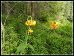 Tiger Lilies |
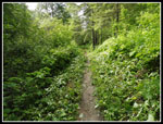 Recent Brushing |
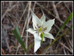 Mariposa Lily |
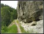 Sandstone Cliff |
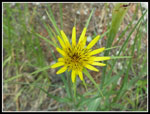 Salsify |
 Bug Eaten |
 Thimbleberry |
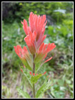 Indian Paintbrush |
 Forest In Gulch |
 Coral Root |
 Lone Tiger Lily |
 Mariposa Lilies |
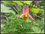 Columbine |
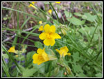 Yellow Monkey Flower |
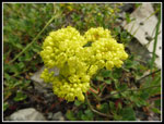 Yellow Buckwheat |
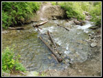 First Creek Crossing |
 Lots Of Lady Slippers |
 Closer Look |
 Peachy Flower |
 Pufball |
 More Buckwheat |
 Scarlet Gilia |
 Tiny Flower |
 View Up To Ridge |
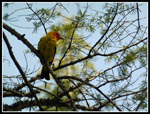 Western Tanager |
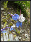 Blue & White |
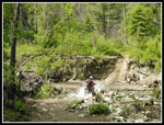 Cycle Crosses Creek |
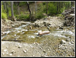 I Forded Creek |
 Penstemon |
 View To Gulch |
 Lupine & Paintbrush |
 Tweedy Lewisia |
 Lone Lady Slipper |
 Clematis |
 Narrow Dirt Trail |
 More Tweedy Lewisia |
 Final Creek Crossing |
 Tronsen Ridge |
 Flower Lined Trail |
 Mission Ridge Junction |
 Wallflower |
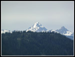 Mt. Stuart |
 Ridge Top Rambling |
 First Bitterroot |
 Pink Bitterroot |
 And Another |
 Big Bunch |
 Almost White |
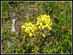
 Arrowleaf Baslsamroot |
 Even More Tweedyi |
 Great Contrast |
 Green & Black |
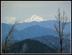 Glacier Peak |
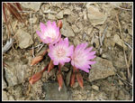 More Bitterroot |
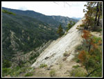 Steep Drop |
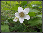
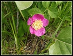 Rose |
 Open Forest |
 Nice Scenery |
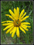
 Mess Of Arnica |
 Descending In Big Trees |
 Closing Loop |
 Back To Trailhead |
Trips - 2017
Home