8-19-17
Gwen
was free and wanted to hike to visit Lake Lillian and hike up Alta
Mountain. Sounded good to me. We met in Bellevue at 7:15 am and headed
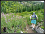
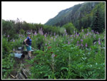
towards Snoqualmie Pass. We reached the trailhead at 8:30 am. We were
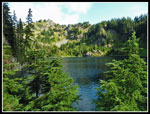
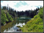
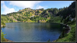
on the trail just before 9:00 am. It is only a mile up to Lake Lillian
but it is very steep. Hot days of summer have given way to cool
mornings. Perfect for steep morning climbs. It took us about fifty
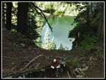
minutes to to ascend the 1000' to Lillian. Going around Lake Lillian
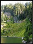
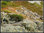
requires crossing a sloping rock outcropping. Below it is the lake.
Reports tell of a route above it. We found a bootpath on the other
side. We went across the rock. The trail goes up and down a bit as it
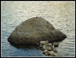
rounds the lake. A rock sits just off shore and someone built a rock
causeway out to it. Gwen had to check it out. There were still some
Lewis monkey flower in bloom along the lake. I keep seeing monkey
flower almost every week this summer.
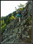
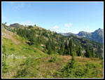
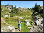
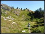
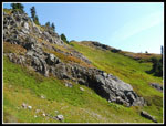
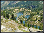
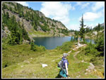
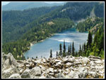
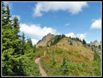
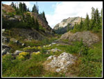
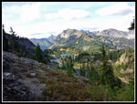
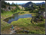
The route quickly begins to climb. Moderately at first then very steeply to the ridge top. Some nice views of the lake as we climbed. The route eased at the ridge top and dropped a little. We continued higher as we passed three tarns. At one Gwen noticed an American Dipper diving to the bottom for food. We also saw several pikas and marmots. From the last tarn we climbed to a saddle on the ridge above Rampart Lakes. Time for a food and water break. It was now 11:18 am. The route down is, of course, very steep. Mostly easy to follow with a few cairns. We met a couple guys near the pass who were exploring from the lakes. Near the bottom we met another group heading up.
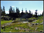
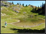
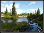
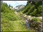
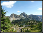
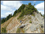
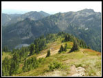
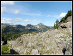
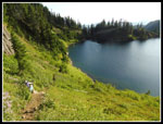
Once at the lakes we continued to the north end. There were a number of folks camping as usual. We both were familiar with the trail along the ridge heading towards Alta. Gwen more than me. There were a few more groups seen along this section. The sun was mostly out and it was getting much warmer. There were a few clouds providing some occasional shade too. We passed the trail down to Rachel Lake. A little farther along is the unsigned route up Alta Mountain. For the entire trip we hiked 9 miles with 2 of them on official trail. The route up Alta is not an official trail but it is very easy to follow. The first part is about the steepest. A little breeze was helpful.
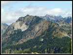
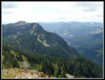
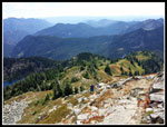
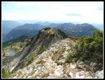
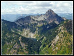
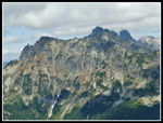
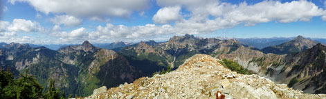
I've been up Alta many times. Coming via Lillian is a little shorter but I found it to be more difficult than via Rachel Lake. We saw a number of folks on the trail to and from the summit. The trail stays mostly on the ridge. There are a number of false summits along the way.A few peaks, like Chikamin, were in clouds but for the most part views were very good. We went over the last false summit and down to the saddle. The scramble up to the ridge seemed to be easier than I remembered it. A minute or two later we were on the summit. Two other groups were there. One left a few minutes later. We arrived at 2:08 pm. The views are really pretty spectacular on top. No big nearby peaks to block the views. The Pacific Crest Trail is mostly in sight from the Kendall Katwalk on to near Park Lakes. The other group left and we were alone on the summit.
At 2:40 pm we headed down. Though steep in spots much of the descent had better traction than most of the route's downhill. Several more groups were just coming up as we went down. We continued down and on to Rampart Lakes without any more stops. We hiked to the far end of the lakes for a final food and water break before the 500' climb up to the ridge top. The route is steep but short. Mostly just straight up the fall line. I was nearly out of water and just set a steady slow pace. There was a breeze up at the ridge top. Great views back to Alta Mountain and Rampart Lakes. The early evening lighting was very good. It was 5:20 pm when we headed down.
The route back to the ridge above Lake Lillian was fun hiking. One more guy zoomed past us on his way out. That first part coming down to Lillian was a pain. Very steep and a bit loose. Much easier to go up. We both made it down without a fall. Back along the lake and then that crossing of the rock outcropping. Not much fun but we went across okay. Now just one more steep mile down to the car. The trail down sometimes breaks into multiple parallel parts. We thought we were on one and expected it to rejoin the route. When it did not we stopped and checked our location. Turns out we managed to head off on the trail to Twin Lakes. That is the official route to Lake Lillian. No harm done but we had to regain a little elevation.
We reached the car at 7:25 pm. We made the most of the whole day on the trail. Going to Alta and Rampart via Rachel Lake means going up and down a really bad section of trail. Most of that trail is very good. Just the climb up the valley headwall is pretty awful. A knee pounding descent. The Lake Lillian route is very scenic. It also has a number of very steep and in some cases rocky ups and downs. Add in the 500' climb up from Rampart Lakes late in the trip and that route is more difficult and tougher on my knees. I'm glad I did it but I'm likely to go in via Rachel next time.
Click on thumbnails to get
larger pictures.
Trips - 2017
Home
The route quickly begins to climb. Moderately at first then very steeply to the ridge top. Some nice views of the lake as we climbed. The route eased at the ridge top and dropped a little. We continued higher as we passed three tarns. At one Gwen noticed an American Dipper diving to the bottom for food. We also saw several pikas and marmots. From the last tarn we climbed to a saddle on the ridge above Rampart Lakes. Time for a food and water break. It was now 11:18 am. The route down is, of course, very steep. Mostly easy to follow with a few cairns. We met a couple guys near the pass who were exploring from the lakes. Near the bottom we met another group heading up.
Once at the lakes we continued to the north end. There were a number of folks camping as usual. We both were familiar with the trail along the ridge heading towards Alta. Gwen more than me. There were a few more groups seen along this section. The sun was mostly out and it was getting much warmer. There were a few clouds providing some occasional shade too. We passed the trail down to Rachel Lake. A little farther along is the unsigned route up Alta Mountain. For the entire trip we hiked 9 miles with 2 of them on official trail. The route up Alta is not an official trail but it is very easy to follow. The first part is about the steepest. A little breeze was helpful.
I've been up Alta many times. Coming via Lillian is a little shorter but I found it to be more difficult than via Rachel Lake. We saw a number of folks on the trail to and from the summit. The trail stays mostly on the ridge. There are a number of false summits along the way.A few peaks, like Chikamin, were in clouds but for the most part views were very good. We went over the last false summit and down to the saddle. The scramble up to the ridge seemed to be easier than I remembered it. A minute or two later we were on the summit. Two other groups were there. One left a few minutes later. We arrived at 2:08 pm. The views are really pretty spectacular on top. No big nearby peaks to block the views. The Pacific Crest Trail is mostly in sight from the Kendall Katwalk on to near Park Lakes. The other group left and we were alone on the summit.
At 2:40 pm we headed down. Though steep in spots much of the descent had better traction than most of the route's downhill. Several more groups were just coming up as we went down. We continued down and on to Rampart Lakes without any more stops. We hiked to the far end of the lakes for a final food and water break before the 500' climb up to the ridge top. The route is steep but short. Mostly just straight up the fall line. I was nearly out of water and just set a steady slow pace. There was a breeze up at the ridge top. Great views back to Alta Mountain and Rampart Lakes. The early evening lighting was very good. It was 5:20 pm when we headed down.
The route back to the ridge above Lake Lillian was fun hiking. One more guy zoomed past us on his way out. That first part coming down to Lillian was a pain. Very steep and a bit loose. Much easier to go up. We both made it down without a fall. Back along the lake and then that crossing of the rock outcropping. Not much fun but we went across okay. Now just one more steep mile down to the car. The trail down sometimes breaks into multiple parallel parts. We thought we were on one and expected it to rejoin the route. When it did not we stopped and checked our location. Turns out we managed to head off on the trail to Twin Lakes. That is the official route to Lake Lillian. No harm done but we had to regain a little elevation.
We reached the car at 7:25 pm. We made the most of the whole day on the trail. Going to Alta and Rampart via Rachel Lake means going up and down a really bad section of trail. Most of that trail is very good. Just the climb up the valley headwall is pretty awful. A knee pounding descent. The Lake Lillian route is very scenic. It also has a number of very steep and in some cases rocky ups and downs. Add in the 500' climb up from Rampart Lakes late in the trip and that route is more difficult and tougher on my knees. I'm glad I did it but I'm likely to go in via Rachel next time.
 Starting Out |
 Lake Laura |
 Lake Lillian |
 Over Outcropping |
 Route Up To Ridge |
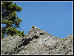
 Bigfoot On Rock |
 Gwen On Rock |
 Lillian From Ridge |
 Heading Off Ridge |
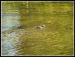 American Dipper |
 Gwen At First Tarn |
 Where's The Marmot? |
 Small Tarn |
 Sentinel Marmot |
 Ridge Above Ramparts |
 Largest Tarn |
 Nice Colors |
 Alta Mt. From Ridge |
 Rampart Lakes Below |
 Down At The Lakes |
 Sun & Shade |
 Last Rampart Lake |
 Creek & Alta Mt. |
 Rachel Lake |
 Steep Climb |
 First False Summit |
 Hibox & Lila Lakes |
 Ramparts & Hyak |
 Alta Mt. Ridge |
 Almost On Summit |
 Alaska Lake |
 Little Bobby Bigfoot |
 Gwen Atop Alta Mt. |
 Chikamin Peak |
 Descending From Summit |
 Heading Down Ridge |
 Near Rampart Lakes |
 Last Look At Lakes |
 Part Way To Ridge |
 Almost To Ridge Top |
 "Y" Tarn |
 Back At Lillian |
 Lewis Monkey Flower |
 Almost Down |
 Panorama Shot Of Lake Lillian |
 Panorama Shot Looking North From Alta Mountain |
Trips - 2017
Home