11-18-17
I
was looking for a long hike without much of a crowd. In years past I
pieced together a road route to the top of West Rattlesnake Mountain.
Back then, there was a boot path up to Rattlesnake Ledges. There was a
boot path that connected to a road up to East Rattlesnake Mountain. I
knew of no path from the winery where Snoqualmie Point is now located.
I wanted to get to the top of the West Peak. The USGS map was way out
of date and most logging roads were not shown. On my first try I ended
up in a big new clear cut with a view of the towers far away. My second
try ended up underneath the East Peak. There was no personal GPS in the
late 1980s. Just a map and compass. On my third try I made it to the
top. Years later a route from Snoqualmie Point made it much easier.
This is strictly a winter walk for me. Best with a little fresh snow
covering the upper road. Still, every now and then I like to head back
up on the road network. It is a long hike with near total solitude.
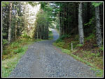
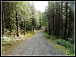
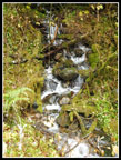
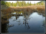
My last trip up was in January 2009. At 2.6 miles a culvert carried Canyon Creek under the road. I arrived that day to find it completely washed out. I was able to ford the creek is the water was low. I tried again a few years later and the roaring creek turned me back. I thought a bout this trip the night before and a check of Google Earth showed a bridge in place. Time to check it out. I arrived at the 880' start at 8:05 am. South on Highway 18 from I-90 a short way to a left turn lane. Go left and park. The paved road of the route goes straight ahead. It is usually gated. The road to homes angles off to the left. By 8:10 I was on my way. The gate was open. I think that's the first time I have seen that. The road crosses a swamp then climbs a bit and turns to the south. At one mile is a big electric power sub station. There are two sets of power lines leading into the station. The second has had a steep trail under it. The other now has a new road heading under the first pylon. The road is new and well traveled. More on this later. The pavement ends and another gate, this one closed, keeps vehicles off the route.
The road has mile signs most half miles. A few are missing. It starts with a very gentle grade. Just after 2.5 miles the road crosses the new bridge. Then comes the steepest stretch of the whole trip. The road parallels Canyon Creek as it gains elevation. After climbing past the 3 mile marker a road comes in from the left. This it the first route I took three decades ago looking for a way up West Peak. The grade eases up to the 4 1/5 mile marker. The old mile markers are gone. Now there are newer ones and more of them. At the 4 1/2 mile marker is a gated road heading uphill to the left. That is the route to the West Summit. The Evergreen Bike web page says going straight ahead also goes to the West Peak. It didn't used to. I know. I tried years ago.
From the open gate on up the road has a newer layer of gravel. At least newer than 2009. The smooth old road was very easy on my feet up to the junction. Now it was less fun. I made very good speed covering the first 4 1/2 miles in 1:21 minutes. A very fast pace for me. The road steepens and with the sharp slightly loose gravel I slowed down. The 5 mile marker is at the next switchback. The 6 mile marker is at the following switchback. There are a few roads going off. Stay on the uphill route. Many old roads have been decommissioned and are closed down. At about 6.7 miles there is another junction. Straight ahead is a heavier traveled road. My guess is it is the new road that went under the power lines near the start. I'll have to check it out some day.
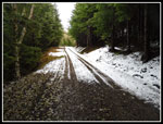
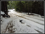
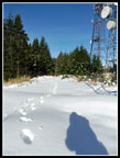
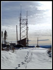
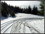
I turned right on the road heading uphill. Soon there was a little snow on the sides. Then there was snow in the middle. At 7.1 miles and 2900' I reached the spot where the new mountain biking trail crosses the road. I hiked up this trail back in September for the first time. I met two bikers here. The first people I saw all day. They had just hit snow on the forested trail below the road. We talked for a while then we all headed up the trail. The trail was mostly snow covered. The bike tire tracks made for some slush and it was hard to keep my feet dry in lightweight trail runners. There was no snow at 2750' on Tiger 2 two days earlier and I did not expect much if any on Rattlesnake. Traction was okay but it was much wetter than hoped for. The trail crossed the road one more time then again just below the summit towers.
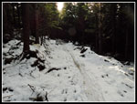
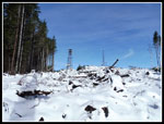
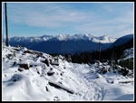
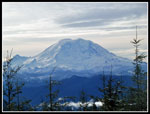
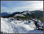
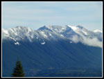
I went across the road a short way to a viewpoint. The sky was mostly clear with great views. Weather was coming in but was sunny this morning. I stopped at the viewpoint on the edge of a big clear cut. It extends along the crest of Rattlesnake Ridge towards the still forested East Peak. It was 10:53 when I stopped, 8.1 miles from the start. Mt. Rainier was clear to the south. Fresh snow covered peaks to the east. There was about 4-6 inches of fresh snow on the ground. Two more bikers slogged/road on by. That accounted for all but two more bikers in the last mile of the day. I had near total solitude. After a 20 minute break I went back to the snowy road and headed for the summit. There was 6+ inches on the road. A truck had been up since the snow. The tracks were almost bare. At the 3260' high point I went off the road to get some better views. At one point I post holed below my knee.
At 11:30 I headed on down. I chose to descend via the road instead of the bike trail. It was a bit longer but much less slushy. At the second switchback I was only about 75' from the Rattlesnake Mountain Trail near Grand Prospect. I have cut through the trees here to get to GP. Soon enough I was back below the snow level. That just left a long road slog back to the car. Below the 3 1/2 mile mark I took the road that I took on my first try for the summit many years ago. I went a little beyond a new bridge over Canyon Creek. This side trip pushed added .38 miles each way and brought my mileage up to a little over 17 miles. It was chilly on the way up but was much warmer the last few miles. I reached the car at 2:21 pm.
This trip provided just what I wanted. I covered 17 miles with 2600' of elevation gain. The drive was short and I managed all that and still finished with several hours of daylight left. The three sets of bikers were the only folks I saw all day long. The last two were barely half a mile from the car at the end of the day. There was more snow than I expected but even with light boots, no poles, and no traction devices I did just fine. The snow highlighting the trees and the surrounding peaks made it much more scenic. A long road walk is not my normal trip but for an occasional day it can be a lot of fun. A great day on the "road" for a change.
Click
on thumbnails to get larger pictures.
Trips - 2017
Home
My last trip up was in January 2009. At 2.6 miles a culvert carried Canyon Creek under the road. I arrived that day to find it completely washed out. I was able to ford the creek is the water was low. I tried again a few years later and the roaring creek turned me back. I thought a bout this trip the night before and a check of Google Earth showed a bridge in place. Time to check it out. I arrived at the 880' start at 8:05 am. South on Highway 18 from I-90 a short way to a left turn lane. Go left and park. The paved road of the route goes straight ahead. It is usually gated. The road to homes angles off to the left. By 8:10 I was on my way. The gate was open. I think that's the first time I have seen that. The road crosses a swamp then climbs a bit and turns to the south. At one mile is a big electric power sub station. There are two sets of power lines leading into the station. The second has had a steep trail under it. The other now has a new road heading under the first pylon. The road is new and well traveled. More on this later. The pavement ends and another gate, this one closed, keeps vehicles off the route.
The road has mile signs most half miles. A few are missing. It starts with a very gentle grade. Just after 2.5 miles the road crosses the new bridge. Then comes the steepest stretch of the whole trip. The road parallels Canyon Creek as it gains elevation. After climbing past the 3 mile marker a road comes in from the left. This it the first route I took three decades ago looking for a way up West Peak. The grade eases up to the 4 1/5 mile marker. The old mile markers are gone. Now there are newer ones and more of them. At the 4 1/2 mile marker is a gated road heading uphill to the left. That is the route to the West Summit. The Evergreen Bike web page says going straight ahead also goes to the West Peak. It didn't used to. I know. I tried years ago.
From the open gate on up the road has a newer layer of gravel. At least newer than 2009. The smooth old road was very easy on my feet up to the junction. Now it was less fun. I made very good speed covering the first 4 1/2 miles in 1:21 minutes. A very fast pace for me. The road steepens and with the sharp slightly loose gravel I slowed down. The 5 mile marker is at the next switchback. The 6 mile marker is at the following switchback. There are a few roads going off. Stay on the uphill route. Many old roads have been decommissioned and are closed down. At about 6.7 miles there is another junction. Straight ahead is a heavier traveled road. My guess is it is the new road that went under the power lines near the start. I'll have to check it out some day.
I turned right on the road heading uphill. Soon there was a little snow on the sides. Then there was snow in the middle. At 7.1 miles and 2900' I reached the spot where the new mountain biking trail crosses the road. I hiked up this trail back in September for the first time. I met two bikers here. The first people I saw all day. They had just hit snow on the forested trail below the road. We talked for a while then we all headed up the trail. The trail was mostly snow covered. The bike tire tracks made for some slush and it was hard to keep my feet dry in lightweight trail runners. There was no snow at 2750' on Tiger 2 two days earlier and I did not expect much if any on Rattlesnake. Traction was okay but it was much wetter than hoped for. The trail crossed the road one more time then again just below the summit towers.
I went across the road a short way to a viewpoint. The sky was mostly clear with great views. Weather was coming in but was sunny this morning. I stopped at the viewpoint on the edge of a big clear cut. It extends along the crest of Rattlesnake Ridge towards the still forested East Peak. It was 10:53 when I stopped, 8.1 miles from the start. Mt. Rainier was clear to the south. Fresh snow covered peaks to the east. There was about 4-6 inches of fresh snow on the ground. Two more bikers slogged/road on by. That accounted for all but two more bikers in the last mile of the day. I had near total solitude. After a 20 minute break I went back to the snowy road and headed for the summit. There was 6+ inches on the road. A truck had been up since the snow. The tracks were almost bare. At the 3260' high point I went off the road to get some better views. At one point I post holed below my knee.
At 11:30 I headed on down. I chose to descend via the road instead of the bike trail. It was a bit longer but much less slushy. At the second switchback I was only about 75' from the Rattlesnake Mountain Trail near Grand Prospect. I have cut through the trees here to get to GP. Soon enough I was back below the snow level. That just left a long road slog back to the car. Below the 3 1/2 mile mark I took the road that I took on my first try for the summit many years ago. I went a little beyond a new bridge over Canyon Creek. This side trip pushed added .38 miles each way and brought my mileage up to a little over 17 miles. It was chilly on the way up but was much warmer the last few miles. I reached the car at 2:21 pm.
This trip provided just what I wanted. I covered 17 miles with 2600' of elevation gain. The drive was short and I managed all that and still finished with several hours of daylight left. The three sets of bikers were the only folks I saw all day long. The last two were barely half a mile from the car at the end of the day. There was more snow than I expected but even with light boots, no poles, and no traction devices I did just fine. The snow highlighting the trees and the surrounding peaks made it much more scenic. A long road walk is not my normal trip but for an occasional day it can be a lot of fun. A great day on the "road" for a change.
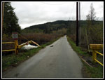 Starting At Open Gate |
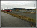 Power Sub Station |
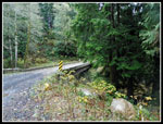 New Bridge |
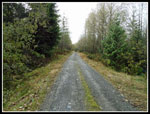 Miles Of Road |
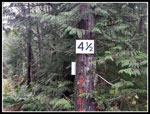 4 1/2 Mile Junction |
 Forested Road |
 Snow On Road |
 Snowy Bike Trail |
 The First Road Crossing |
 Summit Towers |
 View East |
 Mt. Rainier |
 Rattlesnake Ridge |
 Snow Line |
 Deeper Snow |
 Summit Tower |
 Route Route Down |
 Off The Snow |
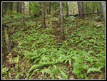 Mountain Greenery |
 Small Creek |
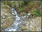 Canyon Creek |
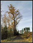 Big Tree |
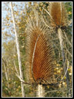 Bristles |
 Almost Done |
Trips - 2017
Home