6-30-18
Gary
joined me for a loop trip
around Esmerelda Peaks. I have hiked the loop about half a dozen times
over the years. Gary had hiked all the trails from both trailheads but
not in one day and not the section between trailheads. Nowhere would
escape gray sky this day but we hoped to minimize any rain by heading
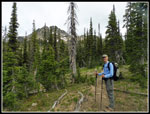
east. I was out the door at the ridiculously early time of 5:30 am and
met Gary at Eastgate at 6:00 am. We headed east to Cle Elum then up to
the Teanaway Road. We left pavement at 29 Pines CG and continued 8 more
miles to DeRoux CG and our 3760' trailhead. I was surprised to see four
or five cars in the parking lot at 7:42 am. By 7:45 am we were on the
trail. The sky was unexpectedly blue. We chose to do the loop
clockwise. I have almost always done it counterclockwise. Time to shake
it up a little. On previous loops I walked the road about 1.75 miles
between trailheads. Gary saw reports of there now being a trail. We
planned to check it out on the last leg of our trip.
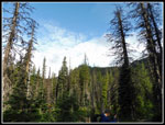
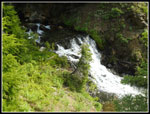
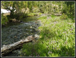
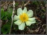
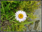
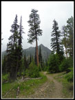
I have posted one previous trip report for this route on 6-29-2014 with Craig Romano. He was doing research for a new hiking guide. That was on an overcast day. This one was likely to end that way. The route quickly reaches the NF Teanaway River. Just over the bridge is a big meadow that is filled with shooting star wildflowers in the late spring. There was not a trace of even one. Not off to a good start. We did see some Indian paintbrush and a few other flowers. The route next crosses DeRoux Creek on a bridge. Just after that is a junction. Left climbs to the ridge between the NF and MF of the Teanaway River. We went right on the Boulder-DeRoux Trail. Two guys went past us. They were heading to Esmerelda Peaks. It did not look like they would have any reason to use their ice axes. It is melting out fast.
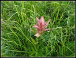
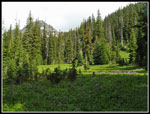
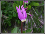
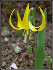
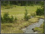
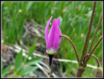
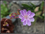
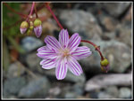
A single hiker was coming down already. As we climbed the forest thinned and we had some views out towards Iron and Teanaway Peaks. We saw some small meadows with shooting stars in bloom too. There were also some penstemon and western anemone in bloom. Recrossing DeRoux Creek can be difficult in early summer. Not a problem now. It was an easy rock hop. Across the creek is a very big meadow. It was full of shooting stars in bloom. The early lack of shooting stars was more than made up for along the rest of the route. There were also cinquefoil in bloom. Crossing the meadow we saw a group of six campers. Five hikers and six campers is not exactly a huge crowd but it is a lot for this trail early in the morning. Still, we had a lot of solitude on the DeRoux part of the trip.
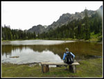
One feature of this hike is that while there is almost 3000' of elevation gain and loss the trail is never steep. The switchbacks from DeRoux Creek up to Gallagher Head Lake are especially gently graded. They go on and on with very slow elevation gain. The morning blue sky did not last very long. A few clouds gave way to more and it was largely cloudy when we arrived at Gallagher Head Lake. A high clearance SUV was at the first site. We said high to the guys and went down to the shore. A bench has been put in since my 2014 visit. A nice spot to sit and view the lake and peaks. On my last visit the clouds were barely above the lake. This time they were at least higher. There were even a few moments of sunshine.
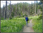
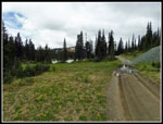
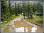
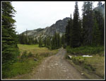
We continued up to the main road and walked along the lake. Near the far end we stopped for a food and water break. The lake is not large and does not have the views of Ingalls Lake but it does make for a nice destination. With a moderate pace and lots of photo stops it was already 10:27 am. We took 2:42 to hike the first 4.4 miles. Speed was not part of the plan. Soon we were back on our way. The next part of the route follows a road that comes up from the Cle Elum River Road upstream from Salmon La Sac. The road is way beyond the time that standard vehicles could drive it. Puddles were small lakes that went from one edge to the other. We saw the SUV heading out. It rocked and rolled and made it through the worst spots. A Jeep was just arriving. The road begins at a gentle grade down with meadows alongside. A lot of glacier lilies here then a white mass of western anemone there. I don't think I have seen anemones that thick anywhere.
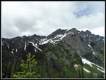
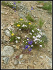
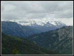
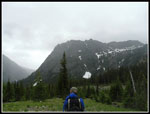
The road then begins to drop much more steeply. It is badly rutted in places but it is still easy enough to walk. There were only a few snow patches left. The two creek crossings were low enough to rock hop with dry boots. It is one mile with 520' of elevation loss to the junction with the Esmerelda Basin Trail. The sign looks to be quite new. The next 1.1 miles gains about 900' up to Fortune Pass. The bottom is quite steep before it settles down to more gentle switchbacks. As we rose up views began to appear. Across to a peak of Hawkins Mountain and out to other Cascade Mountain Peaks. Higher up Mt. Daniel and Cathedral Rock came into view. Daniel had the summit in clouds. We had a good wildflower display on this open rocky terrain. The larkspur were really abundant. We also saw phlox and several other wildflowers.
As we neared the pass we could see rain close by and getting closer. We hoped to get over Fortune Pass before it hit us. It was getting windy near the pass and we would be out of it on the other side. Much better for an umbrella or rain gear to be going downhill. We had a few drops hit us then it stopped. We never did use any rain gear the whole trip though it sure looked like we would need it numerous times. Now 6.5 miles into our trip we had seen five hikers, six campers, and some guys in SUVs navigating the road section. That was all about to change. A guy arrived at the pass shortly after we did. As we started won we met another then another group. Soon came another group then another. It did not take long to exceed the number of people seen over the first 4:40.
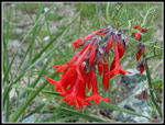
The descent was on more gently graded trail. We saw a lot more shooting stars along the way. Phlox, penstemon, asters, and more were seen. In the last couple miles more varieties showed up. I saw some thistles about to bloom. Some very colorful Columbia Lewisia were right beside the trail. We saw past prime columbine from near the start. Finally, we saw some that were still near their peak. There were a few elephant head's and then a number of scarlet gilia in bloom. We reached the Ingalls parking lot at 2:30 pm. From Fortune Pass to the bottom we passed 73 people. Many were backpacking. It must have been crowded at Lake Ann.
Now we just had to find this newer connector trail. Years back I had camped at DeRoux CG a number of times and hunted for a mythical trail to the Ingalls trailhead. I never found any trace of one. On our drive in this morning we saw an obvious trail at DeRoux. Our GPS maps showed the trail going off the road below the Ingalls lot. We found it with no trouble. The route is an improvement over walking the road. Along the way we saw both pink and yellow monkeyflower in the same place. At 3:18 pm we close the loop back at my car.
This turned out to be a great trip. We had a lot of solitude for about 70% of our route. The other 30% not so much. The wildflower show was not at peak but we had a great variety of flowers. We could not avoid the clouds but we almost missed all the rain. Throw in a lake and a new section of trail and we had a great time. This is not on my most frequent visited trips but I do manage to hike it a time or two each decade. Gary was able to do the entire loop for the first time too. A fun day in the mountains.
Click on thumbnails to get
larger pictures.
Trips - 2018
Home
I have posted one previous trip report for this route on 6-29-2014 with Craig Romano. He was doing research for a new hiking guide. That was on an overcast day. This one was likely to end that way. The route quickly reaches the NF Teanaway River. Just over the bridge is a big meadow that is filled with shooting star wildflowers in the late spring. There was not a trace of even one. Not off to a good start. We did see some Indian paintbrush and a few other flowers. The route next crosses DeRoux Creek on a bridge. Just after that is a junction. Left climbs to the ridge between the NF and MF of the Teanaway River. We went right on the Boulder-DeRoux Trail. Two guys went past us. They were heading to Esmerelda Peaks. It did not look like they would have any reason to use their ice axes. It is melting out fast.
A single hiker was coming down already. As we climbed the forest thinned and we had some views out towards Iron and Teanaway Peaks. We saw some small meadows with shooting stars in bloom too. There were also some penstemon and western anemone in bloom. Recrossing DeRoux Creek can be difficult in early summer. Not a problem now. It was an easy rock hop. Across the creek is a very big meadow. It was full of shooting stars in bloom. The early lack of shooting stars was more than made up for along the rest of the route. There were also cinquefoil in bloom. Crossing the meadow we saw a group of six campers. Five hikers and six campers is not exactly a huge crowd but it is a lot for this trail early in the morning. Still, we had a lot of solitude on the DeRoux part of the trip.
One feature of this hike is that while there is almost 3000' of elevation gain and loss the trail is never steep. The switchbacks from DeRoux Creek up to Gallagher Head Lake are especially gently graded. They go on and on with very slow elevation gain. The morning blue sky did not last very long. A few clouds gave way to more and it was largely cloudy when we arrived at Gallagher Head Lake. A high clearance SUV was at the first site. We said high to the guys and went down to the shore. A bench has been put in since my 2014 visit. A nice spot to sit and view the lake and peaks. On my last visit the clouds were barely above the lake. This time they were at least higher. There were even a few moments of sunshine.
We continued up to the main road and walked along the lake. Near the far end we stopped for a food and water break. The lake is not large and does not have the views of Ingalls Lake but it does make for a nice destination. With a moderate pace and lots of photo stops it was already 10:27 am. We took 2:42 to hike the first 4.4 miles. Speed was not part of the plan. Soon we were back on our way. The next part of the route follows a road that comes up from the Cle Elum River Road upstream from Salmon La Sac. The road is way beyond the time that standard vehicles could drive it. Puddles were small lakes that went from one edge to the other. We saw the SUV heading out. It rocked and rolled and made it through the worst spots. A Jeep was just arriving. The road begins at a gentle grade down with meadows alongside. A lot of glacier lilies here then a white mass of western anemone there. I don't think I have seen anemones that thick anywhere.
The road then begins to drop much more steeply. It is badly rutted in places but it is still easy enough to walk. There were only a few snow patches left. The two creek crossings were low enough to rock hop with dry boots. It is one mile with 520' of elevation loss to the junction with the Esmerelda Basin Trail. The sign looks to be quite new. The next 1.1 miles gains about 900' up to Fortune Pass. The bottom is quite steep before it settles down to more gentle switchbacks. As we rose up views began to appear. Across to a peak of Hawkins Mountain and out to other Cascade Mountain Peaks. Higher up Mt. Daniel and Cathedral Rock came into view. Daniel had the summit in clouds. We had a good wildflower display on this open rocky terrain. The larkspur were really abundant. We also saw phlox and several other wildflowers.
As we neared the pass we could see rain close by and getting closer. We hoped to get over Fortune Pass before it hit us. It was getting windy near the pass and we would be out of it on the other side. Much better for an umbrella or rain gear to be going downhill. We had a few drops hit us then it stopped. We never did use any rain gear the whole trip though it sure looked like we would need it numerous times. Now 6.5 miles into our trip we had seen five hikers, six campers, and some guys in SUVs navigating the road section. That was all about to change. A guy arrived at the pass shortly after we did. As we started won we met another then another group. Soon came another group then another. It did not take long to exceed the number of people seen over the first 4:40.
The descent was on more gently graded trail. We saw a lot more shooting stars along the way. Phlox, penstemon, asters, and more were seen. In the last couple miles more varieties showed up. I saw some thistles about to bloom. Some very colorful Columbia Lewisia were right beside the trail. We saw past prime columbine from near the start. Finally, we saw some that were still near their peak. There were a few elephant head's and then a number of scarlet gilia in bloom. We reached the Ingalls parking lot at 2:30 pm. From Fortune Pass to the bottom we passed 73 people. Many were backpacking. It must have been crowded at Lake Ann.
Now we just had to find this newer connector trail. Years back I had camped at DeRoux CG a number of times and hunted for a mythical trail to the Ingalls trailhead. I never found any trace of one. On our drive in this morning we saw an obvious trail at DeRoux. Our GPS maps showed the trail going off the road below the Ingalls lot. We found it with no trouble. The route is an improvement over walking the road. Along the way we saw both pink and yellow monkeyflower in the same place. At 3:18 pm we close the loop back at my car.
This turned out to be a great trip. We had a lot of solitude for about 70% of our route. The other 30% not so much. The wildflower show was not at peak but we had a great variety of flowers. We could not avoid the clouds but we almost missed all the rain. Throw in a lake and a new section of trail and we had a great time. This is not on my most frequent visited trips but I do manage to hike it a time or two each decade. Gary was able to do the entire loop for the first time too. A fun day in the mountains.
 Some Blue Sky At First |
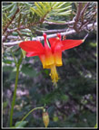
 First Indian Paintbrush |
 Sikta Valerian |
 Queens Cup |
 Penstemon |
 Western Anemone |
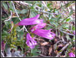
 First Shooting Stars |
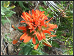 Bright Paintbrush |
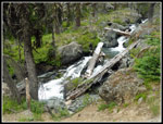
 Cascading Creek |
 Big Meadow |
 Shooting Stars & Creek |
 Perfect Shooting Star |
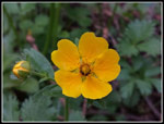 Cinquefoil |
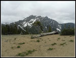
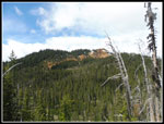 DeRoux Peak |
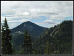 Koppen Mountain |
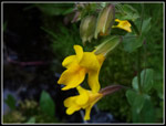
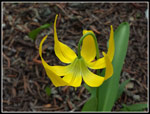 Glacier Lily |
 Gary & Hawkins |
 Another Glacier Lily |
 Gallagher Head Lake |
 Road & Lake |
 Big Puddle |
 Snow Patch |
 Creek & Meadow |
 Anemone Close Up |
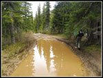 Bigger Puddle |
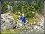 Gary Crossed Creek |
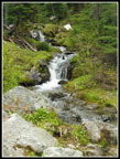 Small Falls |
 Hawkins Again |
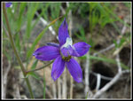 Larkspur |
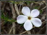 Phlox |
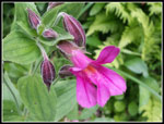
 Bouquet |
 Mt. Daniel |
 Hawkins From Pass |
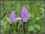
 Many Shooting Stars |
 Cascades |
 White Flowers |
 Aster |
 Dark Shooting Star |
 Very Cloudy Now |
 Scarlet Gilia |
 Columbia Lewisia |
 Bigger Columbia Lewisia |
 Red Columbine |
 Elephant Head |
 NF Teanaway River |
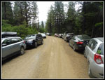 Lots Of Cars |
 Pink Monkeyflower |
 Yellow Monkeyflower |
 Big Pine Tree |
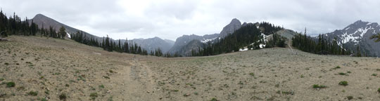 Panorama From Fortune Pass |
Trips - 2018
Home