3-25-18
Snow
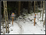
fell at low elevations on Saturday. I headed east for a close in trip
at a high starting elevation. Tiger Summit is at 1377'. The day before
the traffic camera showed snow covering the ground all along the road.
I was glad to find a snow plow in the lot and it was bare. The road
into the inner parking lot was plowed bare. No problem at all. There
was only one car in the lot by the highway and a few more in the inner
lot when I arrived at 8:22 am. No early morning crowds this day. By
8:25 am I was on my way. It was chilly at the start. Probably in the
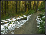
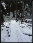
low to mid 30s. There were a few snow patches but the trail was mostly
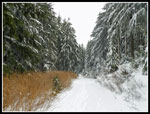
snow free on the Connector trail and the NW Timber Trail. Heading up
the Master Link it was still bare but snow patches started soon after.
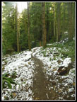
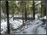
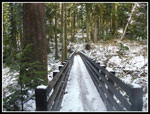
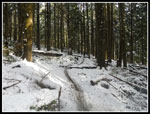
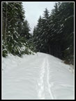
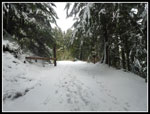
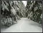
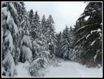
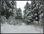
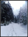
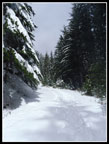
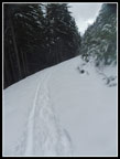
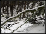
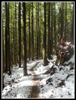
Heading uphill warmed me up. I was a little surprised that there was so little snow down low. The summit is at 3004' so I still expected a fair amount up high. Two bikers finally went past me. When I reached the junction with the Inside Passage Trail I caught up with them. A few minutes later I reached the big bridge. It is out in the open and snow on the bridge was deeper than in the forest. Snow was continuous above the bridge. Though a bit icy with a frozen track down the middle, footing was fine. I carried microspikes but never put them on. At the top of the Master Link the road was very snowy. No tracks going downhill and several sets of footprints heading uphill. I went back into forest on the Quick Link Trail. It was still snowy but much thinner than in the open on the road. The trail is longer than the road walk but the grade is very gentle.
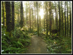
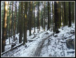
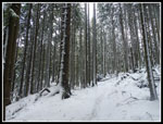
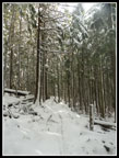
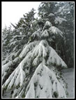
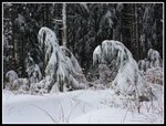
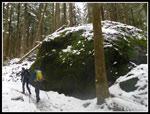
The forest was very photogenic. Tall trees had long white stripes. I stopped for more photos. The Quick Link brought me back to the road higher up. Now The snow was about six inches deep. Footprints packed down the snow though it was not flat like with snowshoes. Icy and not level steps made for slower going. There was also a single bike track in the snow. A few minutes on the road and I met two hikers coming down. Up to the high point then down to the junction with the summit spur road. Just .70 miles to go.
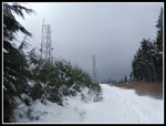
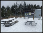
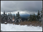
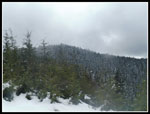
Some of the road walk to the top is forested enough to have a thinner snow cover. I was glad folks had put in compressed steps the day before. Much easier for me. The trees near the top were heavily flocked with recent snow. This trip gave me a really nice day in the snow without any avalanche danger. The snow covered everything but was nowhere close to requiring snowshoes. The best of all worlds. On the last climb I passed two more hikers coming down. That made for six people seen on the entire hike up. Passing the High Point trailhead on the north side of Tiger Mountain I saw dozens of cars at 8:10 am. On the east side I had a lot of solitude. I reached the summit at 10:20 am. The wind was almost non existent. Just what I had hoped for.
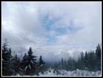
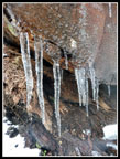
I spent 18 minutes on top alone. The cloud level was not far above me. I could see down but not out. I had hoped for some good views but it was not to be. Hiking down the road was much easier and faster. I stopped at the lower viewpoint and had some views out. Rather than doing a loop via the road I chose to retrace my steps on the way down. I hiked the road, the Quick Link, and part of the Master Link before I saw anyone else. About half way down I met two hikers. Soon I saw two more. Then the bikers started to show up. Still not crowded but more people than seen on the way up. Below the big bridge the snow seemed thinner. Farther down it had melted entirely since I hiked up. Not a lot less snow but noticeable. The last couple miles were crowded for this route but nowhere near most I-90 trails. I stopped for photos of icicles and fungus. I stopped for more snowy trees. Tiger always looks its best with a coating of fresh snow.
The gentle switchbacks lose elevation very slowly. The 2.5 miles of the Master Link Trail seem to go on and on. When the icy snow disappeared my speed picked up. I made it back to the parking lot at 12:30 pm. With lots of photo stops, break at the summit, a stop a the lower viewpoint, and icy snow I covered 4 miles down in 1:53. Not bad. For the day I hiked 8 miles with 1700' of elevation gain. Down low the forest is very green. Up high everything was white. Great contrast on one hike. I was home by 1:30 pm. Definitely a fun day on the trail.
Click on thumbnails to get
larger pictures.
Trips - 2018
Home
Heading uphill warmed me up. I was a little surprised that there was so little snow down low. The summit is at 3004' so I still expected a fair amount up high. Two bikers finally went past me. When I reached the junction with the Inside Passage Trail I caught up with them. A few minutes later I reached the big bridge. It is out in the open and snow on the bridge was deeper than in the forest. Snow was continuous above the bridge. Though a bit icy with a frozen track down the middle, footing was fine. I carried microspikes but never put them on. At the top of the Master Link the road was very snowy. No tracks going downhill and several sets of footprints heading uphill. I went back into forest on the Quick Link Trail. It was still snowy but much thinner than in the open on the road. The trail is longer than the road walk but the grade is very gentle.
The forest was very photogenic. Tall trees had long white stripes. I stopped for more photos. The Quick Link brought me back to the road higher up. Now The snow was about six inches deep. Footprints packed down the snow though it was not flat like with snowshoes. Icy and not level steps made for slower going. There was also a single bike track in the snow. A few minutes on the road and I met two hikers coming down. Up to the high point then down to the junction with the summit spur road. Just .70 miles to go.
Some of the road walk to the top is forested enough to have a thinner snow cover. I was glad folks had put in compressed steps the day before. Much easier for me. The trees near the top were heavily flocked with recent snow. This trip gave me a really nice day in the snow without any avalanche danger. The snow covered everything but was nowhere close to requiring snowshoes. The best of all worlds. On the last climb I passed two more hikers coming down. That made for six people seen on the entire hike up. Passing the High Point trailhead on the north side of Tiger Mountain I saw dozens of cars at 8:10 am. On the east side I had a lot of solitude. I reached the summit at 10:20 am. The wind was almost non existent. Just what I had hoped for.
I spent 18 minutes on top alone. The cloud level was not far above me. I could see down but not out. I had hoped for some good views but it was not to be. Hiking down the road was much easier and faster. I stopped at the lower viewpoint and had some views out. Rather than doing a loop via the road I chose to retrace my steps on the way down. I hiked the road, the Quick Link, and part of the Master Link before I saw anyone else. About half way down I met two hikers. Soon I saw two more. Then the bikers started to show up. Still not crowded but more people than seen on the way up. Below the big bridge the snow seemed thinner. Farther down it had melted entirely since I hiked up. Not a lot less snow but noticeable. The last couple miles were crowded for this route but nowhere near most I-90 trails. I stopped for photos of icicles and fungus. I stopped for more snowy trees. Tiger always looks its best with a coating of fresh snow.
The gentle switchbacks lose elevation very slowly. The 2.5 miles of the Master Link Trail seem to go on and on. When the icy snow disappeared my speed picked up. I made it back to the parking lot at 12:30 pm. With lots of photo stops, break at the summit, a stop a the lower viewpoint, and icy snow I covered 4 miles down in 1:53. Not bad. For the day I hiked 8 miles with 1700' of elevation gain. Down low the forest is very green. Up high everything was white. Great contrast on one hike. I was home by 1:30 pm. Definitely a fun day on the trail.
 A Little Snow At Start |
 Beautiful Forest |
 Snow Starts On Trail |
 Biker Ahead |
 Big Bridge In Sight |
 Snow On Bridge |
 Icy Snow |
 White Stripes |
 Snowier Bridge |
 More Striped Trees |
 Deeper Snow On Road |
 Gate Ahead |
 Snowy Trees |
 Snowy Branches |
 More Snowy Trees |
 Smaller Trees |
 Summit Towers |
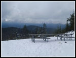
 Picnic Tables |
 Low Clouds |
 Sucker Hole |
 A Little Color |
 "T" Crossin |
 Bent Over |
 Sun On Road |
 Sunny Deeper Snow |
 Lower Viewpoint |
 Sally's Summit |
 Bike & Boot Tracks |
 No Bikes Allowed |
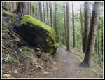
 Mossy Tree |
 Icicles |
 Two Hikers |
 Nice Color |
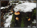 Fungus |
 No More Snow |
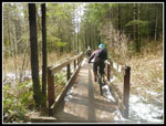 Bikes On The Bridge |
Trips - 2018
Home