12-01-18
It
rained all night and stopped in the morning. I headed out to Mt.
Washington to see a little snow but before it becomes deep. Not a drop
of rain as I drove east. Until I was one mile from the exit. Then it
started to rain. There were about 10 cars in the lot when I arrived at
8:30 am. By 8:40 I was on the trail. It was raining lightly. By the
time I reached the railroad grade it was raining enough to pull out my
umbrella. It was 34 degrees at the start. Nothing like very cold rain.
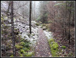
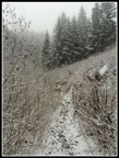
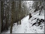
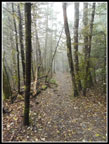
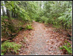
The trail is a rocky old road much of the way up. Add in wet leaves
down low and it's even more fun. I expected to see a number of folks on
the trail. Not on the way up. Hiking a rough trail with an umbrella
instead of poles was a bit of a pain. Not wearing a raincoat on a
steady climb was worth it. I stayed a lot drier.
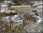
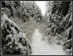
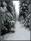
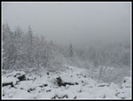
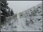
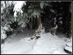
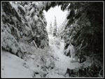
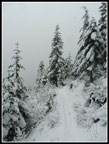
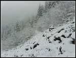
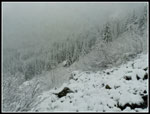
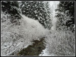
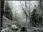
There are a couple trees down in the first section above the railroad grade. None were hard to get over. I expected the rain to end pretty quickly. It did not. After a few miles I did put the umbrella away though it remained misty. I took a short bread at the Owl Hike site. Views were zero. Visibility was in feet not miles. There were a few small fresh snow patches before the Owl spot but very little. After it the route is more open and there was off and on light snow covering. Washington Creek was running strong. I managed to rock hop with dry feet. The next section is one of my least favorite. The road heads straight uphill and it is very rocky. In forest it was mostly bare dirt. When the grade eased the trail came out of the forest into what I call "the meadow". Now the grass was completely snow covered though it was only an inch or so.
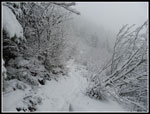
The brush along here was leaf free. Just wide enough to avoid and stay dry. After hopping across the creek the route heads uphill. The road is lower than the ground on both sides. The first part has a ditch on the uphill side at first. I dug three drains across the route and into the ditch. They dried the lower part. Above there there is no ditch and water runs right down the road/trail. Waterproof boots help a lot this time of year. Still some bare ground where under trees but mostly a thin fresh snow cover now. I reached the pond and the junction with the new mountain bike trail. There were a number of boot prints in the snow but no bike tracks.
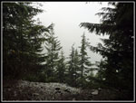
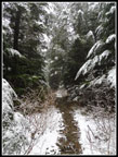
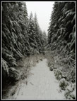
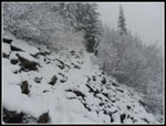
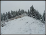
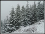
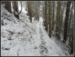
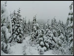
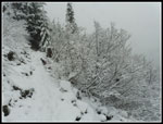
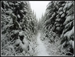
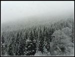
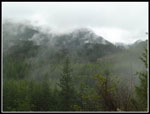
By now the trees were completely flocked. This was turning into the best of all worlds. Really beautiful snowy scenery but it was only a few inches deep. Hiking was still easy. Finally the old road gave way to the newer trail. Now the trail was much narrower. Crossing the talus field was pretty easy. Still rocks poking out of the snow. The scenery sure looked wintry now. The trees were more white than green. Just as I was reaching the north ridge I met the first hiker of the day. He was coming down. Zero views out and I could not see up to the summit. The clouds were thick. Although it was snowing lightly and below freezing I was comfortable in just two light layers.
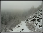
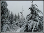
It was a little slick from here on up. Narrow trail and just enough packed snow to slide on. I did not bother putting on microspikes as it was not that bad. I crossed the road spur and then met a single person and a group of about six coming down. All though footprints I saw were people coming down just as I neared the top. I reached the summit ridge to find the expected zero views. Chester Morse Lake was somewhere right below me. Lost in the clouds.I headed up to the summit and passed on last guy heading down. Now I had the top to myself. A popular hike on I-90 near North Bend and I had almost total solitude on the way up and the summit to myself. What is this overcrowded trails I keep hearing about?
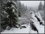
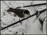
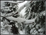
I spent almost 20 minutes on top. Enough tome to eat a sandwich while fending off aggressive camp robber jays. I arrived at the summit at 10:44 am and headed down at 11:01 am. It was cold with no views That was long enough. Heading down I started to see folks coming up. It was never crowded but I saw folks off and on much of the way down. I saw one big group of 17 boy scouts. They represented about half of the folks seen on the way down. The snow picked up on the descent. I stopped for quite a few photos as the now heavily flocked trees and bushes were especially scenic.
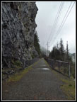
When I reached the Owl Hike spot the snow was about gone once again. Now I just had a wet crappy Mt. Washington trail to hike down. Lots of rocks and steps to negotiate. I like the route but I hate the knee busting last few miles down. That largely explains why I only do this close in hike about once per year. It was early when I reached the railroad grade so I kept heading east. It was just under one mile from the junction down to the parking lot and the bridge over Hall Creek. That brought the total mileage up to 10 miles. I saw only a few bikers on the grade. I reached the trailhead at 1:35 pm.
I started out in rain but this was a great trip. A whole lot more solitude than I expected. The snow was great. Really scenic but not deep enough to make the hike tougher. The views this day were close by not out to distant peaks and down to a big lake. Snowshoe season is coming but for now I had the great scenery without all the effort.
Click on thumbnails to get
larger pictures.
Trips - 2018
Home
There are a couple trees down in the first section above the railroad grade. None were hard to get over. I expected the rain to end pretty quickly. It did not. After a few miles I did put the umbrella away though it remained misty. I took a short bread at the Owl Hike site. Views were zero. Visibility was in feet not miles. There were a few small fresh snow patches before the Owl spot but very little. After it the route is more open and there was off and on light snow covering. Washington Creek was running strong. I managed to rock hop with dry feet. The next section is one of my least favorite. The road heads straight uphill and it is very rocky. In forest it was mostly bare dirt. When the grade eased the trail came out of the forest into what I call "the meadow". Now the grass was completely snow covered though it was only an inch or so.
The brush along here was leaf free. Just wide enough to avoid and stay dry. After hopping across the creek the route heads uphill. The road is lower than the ground on both sides. The first part has a ditch on the uphill side at first. I dug three drains across the route and into the ditch. They dried the lower part. Above there there is no ditch and water runs right down the road/trail. Waterproof boots help a lot this time of year. Still some bare ground where under trees but mostly a thin fresh snow cover now. I reached the pond and the junction with the new mountain bike trail. There were a number of boot prints in the snow but no bike tracks.
By now the trees were completely flocked. This was turning into the best of all worlds. Really beautiful snowy scenery but it was only a few inches deep. Hiking was still easy. Finally the old road gave way to the newer trail. Now the trail was much narrower. Crossing the talus field was pretty easy. Still rocks poking out of the snow. The scenery sure looked wintry now. The trees were more white than green. Just as I was reaching the north ridge I met the first hiker of the day. He was coming down. Zero views out and I could not see up to the summit. The clouds were thick. Although it was snowing lightly and below freezing I was comfortable in just two light layers.
It was a little slick from here on up. Narrow trail and just enough packed snow to slide on. I did not bother putting on microspikes as it was not that bad. I crossed the road spur and then met a single person and a group of about six coming down. All though footprints I saw were people coming down just as I neared the top. I reached the summit ridge to find the expected zero views. Chester Morse Lake was somewhere right below me. Lost in the clouds.I headed up to the summit and passed on last guy heading down. Now I had the top to myself. A popular hike on I-90 near North Bend and I had almost total solitude on the way up and the summit to myself. What is this overcrowded trails I keep hearing about?
I spent almost 20 minutes on top. Enough tome to eat a sandwich while fending off aggressive camp robber jays. I arrived at the summit at 10:44 am and headed down at 11:01 am. It was cold with no views That was long enough. Heading down I started to see folks coming up. It was never crowded but I saw folks off and on much of the way down. I saw one big group of 17 boy scouts. They represented about half of the folks seen on the way down. The snow picked up on the descent. I stopped for quite a few photos as the now heavily flocked trees and bushes were especially scenic.
When I reached the Owl Hike spot the snow was about gone once again. Now I just had a wet crappy Mt. Washington trail to hike down. Lots of rocks and steps to negotiate. I like the route but I hate the knee busting last few miles down. That largely explains why I only do this close in hike about once per year. It was early when I reached the railroad grade so I kept heading east. It was just under one mile from the junction down to the parking lot and the bridge over Hall Creek. That brought the total mileage up to 10 miles. I saw only a few bikers on the grade. I reached the trailhead at 1:35 pm.
I started out in rain but this was a great trip. A whole lot more solitude than I expected. The snow was great. Really scenic but not deep enough to make the hike tougher. The views this day were close by not out to distant peaks and down to a big lake. Snowshoe season is coming but for now I had the great scenery without all the effort.
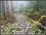 Starting Up The Trail |
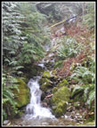 Waterfalls |
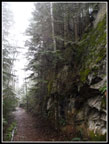 Steep Rock Wall |
 Owl Spot View |
 A Little Snow |
 Washington Creek |
 Snowy Trail Border |
 Cloudy Meadow |
 Leafless Brush |
 Snowy Old Road |
 Narrow Route |
 Pond |
 Deeper Snow |
 Talus Field |
 Looking Down |
 Forest Ahead |
 What Colors? |
 Up From North Ridge |
 Reaching Summit Ridge |
 Summit Just Above |
 Weather Station |
 Summit Refuge |
 Camp Robber Jay |
 Very Wintry |
 Heading Down |
 Framed |
 Heavily Flocked |
 Shades Of White |
 Talus Field Again |
 What Great Wall? |
 Snowy Brush |
 Snow Loaded |
 Trail Like Road |
 Great Contrast |
 Lost In The Clouds |
 Black And White Look |
 From Winter To Fall |
 Best Color |
 RR Grade View |
 Climbing Wall |
Trips - 2018
Home