12-27-18
The
year is rapidly coming to a close. A big November and December have
brought this year to among the most hiking miles and elevation gain
ever. After an extremely busy last few weeks at work I had time off for
a Thursday hike. Gary and John joined me for a one way hike over the
three summits of West Tiger Mountain. We met at the Sunset Way
trailhead at 10:00 am and drove to the Chirico Trailhead. That parking
lot was already 75% full. We started up the Chirico Trail to Poo Poo
Point at 10:12 am. The sky was overcast but there was a low chance of
rain. Pretty good conditions for late December.
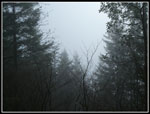
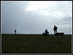
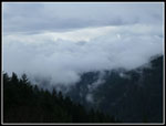
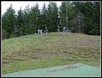
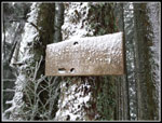
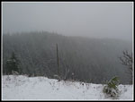
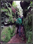
The Chirico Trail now has lots and lots of rocks steps. Not so bad to go up but a pain in the knees coming down. There was a reason we went up the trail but arranged a route where we would not be coming down it. The crowds also make it not a favorite trail. We saw quite a few folks going up and down this morning. The many steps decrease in frequency the farther up you go. We reached the lower take off zone for parasailors at 11:01 am to find no views out to Mt. Rainier. We quickly continued on to Upper Poo Poo Point. Five minutes later we reached the upper take off zone. Several group were already there. There were clouds above and below us. Issaquah was in and out of clouds. Those clouds were the most scenic thing to see.
After a short break we headed on. At the new bathrooms we stopped. I managed to drop my new camera into the mud. The lens was extended. Uh oh... The lens retracted fine but dirt blocked the small panels that cover the lens when it is powered off. Darn it... That was it for the day. All photos beyond this point were taken with my cell phone. The good news is that I was able to clean it at home. Camera works fine again. We followed the old road gently downhill then climbed up to the West Side Railroad Grade. That quickly brought us to a four way junction. I was just here a week earlier. Left is downhill on the Poo Poo Point Trail. right is uphill on the One View Trail. We headed right and uphill. I have no idea where the one view is. The entire .80 miles to the Tiger Mountain Trail (TMT) is in forest. It also has several hundred feet of downhill in addition to all the uphill. When we reached the TMT we turned right and soon reached the Hidden Forest Trail.
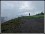
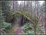
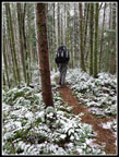
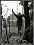
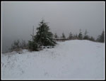
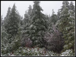
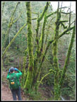
A let turn goes steeply uphill to the road heading to Tiger 2 and Tiger 1. Time for another short break. Across the road we picked up the Poo Top Trail. This one has some very steep sections. The Poo Top is on a high ridge and often has a steady breeze blowing through the trees. Not this day. We had almost zero wind all day. It was getting down to near freezing but with no wind it was not bad. As we ascended we saw a little snow on the ground. Higher up there was enough snow to cover the ground. We reached the top of Tiger 1 and headed down to the Bypass Trail. Tiger 1 at 2948' was the high point of our trip. As John pointed out in advance, the north side of the summit was much colder. The Bypass brought is to the Hiker's Hut.
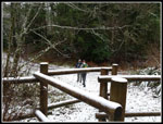
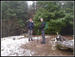
We dove into the Hut for our lunch break. It was about 12:50 when we reached the Hut. Insulated carpet and pads for the benches make the inside of the Hiker's Hut much more comfortable. He had a nice long lunch break. At 1:15 pm we headed out side again. It had begun to snow. There was only 2-4 inches of snow on the ground. Not even enough to cover all the grass. The white layer with the falling snow really did look wintry though. We rapidly dropped down the steep road to the saddle. Here we stopped again as small snow flakes became big ones. I took a short movie of the falling snow. Now we had the road climb up to the top of Tiger 2. Our summit stop was about five seconds. Down the Cable Line trail and we quickly dropped below snow level. A climb up to the top of Tiger 3 for another very short stop.
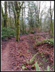
Now it was mostly downhill. The snow never did turn to rain. It stopped before that could happen. We saw a lot fewer folks on the trail down to Tradition Lake than I expected. This would be the least wet stormy day of the week and I expected a good crowd, at least up to Tiger 3. Not that we were complaining... At the junction with the Talus Rocks Trail we made the decision to take it even though that meant another uphill leg. Who wouldn't want a little more pain? The waterfall had a good flow. At the Nook Trail junction we went straight ahead on to the Section Line Trail. That took us down to the gas line. The Section Line has had a lot of work done recently. Every 10' to 20' there is a ditch dug to drain the trail. Unfortunately, there is no sign of any water damage. There was no mud or gravelly sections. There was no water damage at all. A lot of work that has no positive impact on the trail. Oh well...
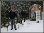
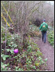
The easy thing to do form the gas line is to hike to Round Lake then on down to Sunset Way. Why do that? Instead we took the High School Trail to the Adventure Trail. That gave us another uphill section. And up we went. The Adventure Trail did take us to the Power Line Road/Trail. From there it was an easy hike to the view of Issaquah and then down the trail to the Sunset Way Trailhead. We arrived at 4:06 pm. Still 18 minutes before sunset. Traffic was no problem getting back to the Chirico Trailhead or driving home.
This was a fun trip. I always enjoy one way trips. This one took us from less than 200' at the trailheads to 2948' at Tiger 1. We reached Poo Poo Point and all three West Tiger Mountain summits. The first two miles were a little crowded but most of the rest of the way had a lot of solitude. Two days earlier my Mt. Si hike took me over 240,000' of elevation gain. That is only the fourth time I have done that. This trip brought me to the third highest elevation gain ever. This trip also brought me to 927 hiking miles for the year. That is the second highest amount I have reached in 36 years of keeping hiking statistics. Not too bad at my "more advanced" age. My highest mileage year was 26 years ago. I am quite pleased with how this year turned out. I still have time for a couple more hikes too.
Click on thumbnails to get
larger pictures.
Trips - 2018
Home
The Chirico Trail now has lots and lots of rocks steps. Not so bad to go up but a pain in the knees coming down. There was a reason we went up the trail but arranged a route where we would not be coming down it. The crowds also make it not a favorite trail. We saw quite a few folks going up and down this morning. The many steps decrease in frequency the farther up you go. We reached the lower take off zone for parasailors at 11:01 am to find no views out to Mt. Rainier. We quickly continued on to Upper Poo Poo Point. Five minutes later we reached the upper take off zone. Several group were already there. There were clouds above and below us. Issaquah was in and out of clouds. Those clouds were the most scenic thing to see.
After a short break we headed on. At the new bathrooms we stopped. I managed to drop my new camera into the mud. The lens was extended. Uh oh... The lens retracted fine but dirt blocked the small panels that cover the lens when it is powered off. Darn it... That was it for the day. All photos beyond this point were taken with my cell phone. The good news is that I was able to clean it at home. Camera works fine again. We followed the old road gently downhill then climbed up to the West Side Railroad Grade. That quickly brought us to a four way junction. I was just here a week earlier. Left is downhill on the Poo Poo Point Trail. right is uphill on the One View Trail. We headed right and uphill. I have no idea where the one view is. The entire .80 miles to the Tiger Mountain Trail (TMT) is in forest. It also has several hundred feet of downhill in addition to all the uphill. When we reached the TMT we turned right and soon reached the Hidden Forest Trail.
A let turn goes steeply uphill to the road heading to Tiger 2 and Tiger 1. Time for another short break. Across the road we picked up the Poo Top Trail. This one has some very steep sections. The Poo Top is on a high ridge and often has a steady breeze blowing through the trees. Not this day. We had almost zero wind all day. It was getting down to near freezing but with no wind it was not bad. As we ascended we saw a little snow on the ground. Higher up there was enough snow to cover the ground. We reached the top of Tiger 1 and headed down to the Bypass Trail. Tiger 1 at 2948' was the high point of our trip. As John pointed out in advance, the north side of the summit was much colder. The Bypass brought is to the Hiker's Hut.
We dove into the Hut for our lunch break. It was about 12:50 when we reached the Hut. Insulated carpet and pads for the benches make the inside of the Hiker's Hut much more comfortable. He had a nice long lunch break. At 1:15 pm we headed out side again. It had begun to snow. There was only 2-4 inches of snow on the ground. Not even enough to cover all the grass. The white layer with the falling snow really did look wintry though. We rapidly dropped down the steep road to the saddle. Here we stopped again as small snow flakes became big ones. I took a short movie of the falling snow. Now we had the road climb up to the top of Tiger 2. Our summit stop was about five seconds. Down the Cable Line trail and we quickly dropped below snow level. A climb up to the top of Tiger 3 for another very short stop.
Now it was mostly downhill. The snow never did turn to rain. It stopped before that could happen. We saw a lot fewer folks on the trail down to Tradition Lake than I expected. This would be the least wet stormy day of the week and I expected a good crowd, at least up to Tiger 3. Not that we were complaining... At the junction with the Talus Rocks Trail we made the decision to take it even though that meant another uphill leg. Who wouldn't want a little more pain? The waterfall had a good flow. At the Nook Trail junction we went straight ahead on to the Section Line Trail. That took us down to the gas line. The Section Line has had a lot of work done recently. Every 10' to 20' there is a ditch dug to drain the trail. Unfortunately, there is no sign of any water damage. There was no mud or gravelly sections. There was no water damage at all. A lot of work that has no positive impact on the trail. Oh well...
The easy thing to do form the gas line is to hike to Round Lake then on down to Sunset Way. Why do that? Instead we took the High School Trail to the Adventure Trail. That gave us another uphill section. And up we went. The Adventure Trail did take us to the Power Line Road/Trail. From there it was an easy hike to the view of Issaquah and then down the trail to the Sunset Way Trailhead. We arrived at 4:06 pm. Still 18 minutes before sunset. Traffic was no problem getting back to the Chirico Trailhead or driving home.
This was a fun trip. I always enjoy one way trips. This one took us from less than 200' at the trailheads to 2948' at Tiger 1. We reached Poo Poo Point and all three West Tiger Mountain summits. The first two miles were a little crowded but most of the rest of the way had a lot of solitude. Two days earlier my Mt. Si hike took me over 240,000' of elevation gain. That is only the fourth time I have done that. This trip brought me to the third highest elevation gain ever. This trip also brought me to 927 hiking miles for the year. That is the second highest amount I have reached in 36 years of keeping hiking statistics. Not too bad at my "more advanced" age. My highest mileage year was 26 years ago. I am quite pleased with how this year turned out. I still have time for a couple more hikes too.
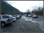 Chirico Parking Lot |
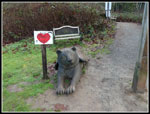 Trail Mascot |
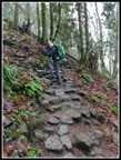 Rocky Trail |
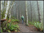 Getting Misty |
 Mt. Rainier View? |
 Hikers At Lower Point |
 Hikers At Upper Point |
 Clouds |
 Highest Point |
 Mossy Arch |
 Top Of One View |
 Snow Along Poo Top |
 2948' |
 Gary Atop Tiger 1 |
 At Hiker's Hut |
 Tiger 1 Snow Cover |
 Cloudy Poo Top Ridge |
 Snowy Trees |
 Guys On Tiger 3 |
 Witches Butter |
 Narrow Passage |
 Colorful Leaves |
 Colorful Trees |
 Ornaments On Trail |
Trips - 2018
Home