3-24-19
I
had only hiked the trails of Taylor Mountain three times. It had been
four years since my last visit. Time for a return trip. I had no exact
route in mind. Just looking for 8 to 9 miles. I arrived at the
trailhead just off Highway 18 at 8:48 am. There were half a dozen cars
in the lot and a horse party was just leaving. The outhouse was new
since my 2015 visit. It was overcast and remained that way all day. I
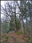
started up the Holder Ridge Trail. The A Road also heads out of the
parking lot. I looked closely for any early wildflowers No luck. I saw
a few yellow violets a few days earlier on Grand Ridge. I saw none this
day. The trail seemed wider and smoother than I remembered. It looked
like it had seen recent trail work. On my first two visits I saw
several towers of downtown Seattle. Try as I might, I could not see
them today. Trees have definitely grown up since 2010 by I'm not sure
if the view has been closed out of I just missed it.
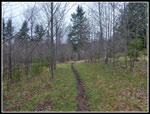
The trail climbs to the top of a bump, drops to cross a creek and then climbs up towards Holder Knob. At a junction, right drops quickly to Road A and left climbs up to the top of Holder Knob. A short cut boot path soon cuts to the top while the main trail goes around the Knob with a short side trail to the top. I took the longer route. My GPS showed it was 2.2 miles to the top. There is a narrow view out but I could not see much of anything. There is a picnic table on top with several horse tie ups. Back to the trail where is quickly begins to descend. The now road/trail drops to Road A. I planned to follow it down then take a different road/trail to the higher lands.
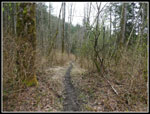
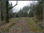
I noticed an obvious unsigned trail heading off to the left. Time for a little exploring. The trail dropped down and skirted a meadow then climbed an old road up another bump. near the top was another junction. Left quickly reached the top with another picnic table and horse tie ups. I dropped to the junction again and followed the road downhill. It came to another "T". Two horse riders caught up and passed me here. They went to the right and I went left on a narrower trail. Since I started on the trail near the top of Holder Knob none of the routes were on my GPS map or the official map I picked up at the trailhead.
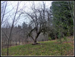
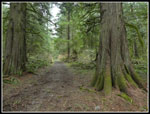
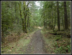
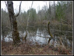
I did read that a private parcel in the area I was now in was purchased back in 2015 at the time of my last visit. There was talk of new trails. This might be part of that. A few trees had lots of bright white blossoms along here. It is also near a swamp as I heard the constant sound of frogs. My route brought me to Road K. This road I had walked back on 2010. At another junction I chose to go right on Road I. I had not down this one. It climbs steeply then flattens and enters older forest. There are some good sized trees here. The road crosses a creek that proved to be challenging. A log reached most of the way across but it was slick as can be. I managed to rock hop across. The route now reaches another road called Beaver Pond on the map. Farther down it is called Road A. That is the same road that goes back to the parking lot.
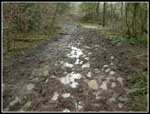
My NWTopos map on my GPS called the junction a shingle mill. If so, there are no traces left. Just a wider spot in the road. I continued higher on the now very narrow and muddy road/trail. My official King County Parks trail map showed that to the east is the City of Seattle Watershed. I was leaving the park land to the north but there were no signs about the watershed. There were no signs at all. It may be fine to continue or it may not. It was way too muddy to keep slogging uphill. I turned around and headed back to wide dry road at the junction where I first reached this road. I chose to head down the road rather than retrace my route. The map showed several good sized creeks crossing the road. I did not know if there were by bridges or culverts. It might be interesting. If fact it was.
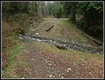
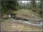
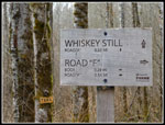
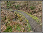
The road has been decommissioned. There are half a dozen places where culverts have been removed. Most are easy crossings. Two were a bit challenging with higher spring water flow. I managed to cross all with dry feet. After only seeing the two horse riders so far the crowds began to appear. Well, not really crowds. Just some people. A group of hikers were first. Next came half a dozen folks on horseback. The rest of the way I saw quite a few horse riders. This has become a popular place to ride. I took Road A down to where it turns right and heads back to the trailhead. I chose to drop left on Road F to the Whiskey Still Trail. This climbs back up to Road A. Right across the road is a signed trail that climbs up to the junction I reached earlier below Holder Knob. To the right is an unsigned road heading uphill. I took it. It climbs to where I first left the road on the unmarked trail. This closed my loop. I stopped again atop Holder Knob.
Now I retraced my steps back down the trail to the trailhead. Just before the trailhead is another junction with the Holder Creek Trail. On my first three visits this trail was washed out and closed near the bridge crossing the creek. This time it was open. I followed the trail for .4 miles and then turned around. At home later I saw recent trip reports that the trail is now open. There is a wide creek crossing higher up that would be challenging this time of year. The trail does allow for some other loop options. I arrived back at my car at 12:45 pm.
Over just about four hours I hiked 10 miles with 1600' of elevation gain. Other than the short detour on Road F and the Whiskey Still Trail I did nothing south of Road A. I could have brought my trip up to about 14 miles. For such a relatively small area there are quite a few trails to hike. I was able to get in a good leg stretching hike and still get home by early afternoon. It was fun to explore some new trails too. This is not a place where I will spend a sunny summer day but it makes for a fun fall or winter hike. There were a lot more horses than I expected but it was a fun day out on the trail.
Click on thumbnails to get
larger pictures.
Trips - 2019
Home
The trail climbs to the top of a bump, drops to cross a creek and then climbs up towards Holder Knob. At a junction, right drops quickly to Road A and left climbs up to the top of Holder Knob. A short cut boot path soon cuts to the top while the main trail goes around the Knob with a short side trail to the top. I took the longer route. My GPS showed it was 2.2 miles to the top. There is a narrow view out but I could not see much of anything. There is a picnic table on top with several horse tie ups. Back to the trail where is quickly begins to descend. The now road/trail drops to Road A. I planned to follow it down then take a different road/trail to the higher lands.
I noticed an obvious unsigned trail heading off to the left. Time for a little exploring. The trail dropped down and skirted a meadow then climbed an old road up another bump. near the top was another junction. Left quickly reached the top with another picnic table and horse tie ups. I dropped to the junction again and followed the road downhill. It came to another "T". Two horse riders caught up and passed me here. They went to the right and I went left on a narrower trail. Since I started on the trail near the top of Holder Knob none of the routes were on my GPS map or the official map I picked up at the trailhead.
I did read that a private parcel in the area I was now in was purchased back in 2015 at the time of my last visit. There was talk of new trails. This might be part of that. A few trees had lots of bright white blossoms along here. It is also near a swamp as I heard the constant sound of frogs. My route brought me to Road K. This road I had walked back on 2010. At another junction I chose to go right on Road I. I had not down this one. It climbs steeply then flattens and enters older forest. There are some good sized trees here. The road crosses a creek that proved to be challenging. A log reached most of the way across but it was slick as can be. I managed to rock hop across. The route now reaches another road called Beaver Pond on the map. Farther down it is called Road A. That is the same road that goes back to the parking lot.
My NWTopos map on my GPS called the junction a shingle mill. If so, there are no traces left. Just a wider spot in the road. I continued higher on the now very narrow and muddy road/trail. My official King County Parks trail map showed that to the east is the City of Seattle Watershed. I was leaving the park land to the north but there were no signs about the watershed. There were no signs at all. It may be fine to continue or it may not. It was way too muddy to keep slogging uphill. I turned around and headed back to wide dry road at the junction where I first reached this road. I chose to head down the road rather than retrace my route. The map showed several good sized creeks crossing the road. I did not know if there were by bridges or culverts. It might be interesting. If fact it was.
The road has been decommissioned. There are half a dozen places where culverts have been removed. Most are easy crossings. Two were a bit challenging with higher spring water flow. I managed to cross all with dry feet. After only seeing the two horse riders so far the crowds began to appear. Well, not really crowds. Just some people. A group of hikers were first. Next came half a dozen folks on horseback. The rest of the way I saw quite a few horse riders. This has become a popular place to ride. I took Road A down to where it turns right and heads back to the trailhead. I chose to drop left on Road F to the Whiskey Still Trail. This climbs back up to Road A. Right across the road is a signed trail that climbs up to the junction I reached earlier below Holder Knob. To the right is an unsigned road heading uphill. I took it. It climbs to where I first left the road on the unmarked trail. This closed my loop. I stopped again atop Holder Knob.
Now I retraced my steps back down the trail to the trailhead. Just before the trailhead is another junction with the Holder Creek Trail. On my first three visits this trail was washed out and closed near the bridge crossing the creek. This time it was open. I followed the trail for .4 miles and then turned around. At home later I saw recent trip reports that the trail is now open. There is a wide creek crossing higher up that would be challenging this time of year. The trail does allow for some other loop options. I arrived back at my car at 12:45 pm.
Over just about four hours I hiked 10 miles with 1600' of elevation gain. Other than the short detour on Road F and the Whiskey Still Trail I did nothing south of Road A. I could have brought my trip up to about 14 miles. For such a relatively small area there are quite a few trails to hike. I was able to get in a good leg stretching hike and still get home by early afternoon. It was fun to explore some new trails too. This is not a place where I will spend a sunny summer day but it makes for a fun fall or winter hike. There were a lot more horses than I expected but it was a fun day out on the trail.
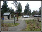 Trailhead Parking Lot |
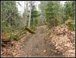 Holder Ridge Trail |
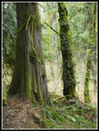 Cedar Tree |
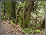 Nurse Stump |
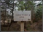 Horse Picnic? |
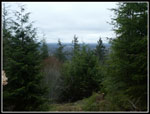 View From Knob |
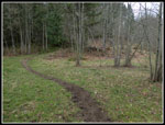 Skirting Meadow |
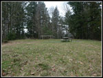 Another Picnic Spot |
 Narrow Trail |
 Fruit Tree? |
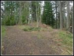
 Big Meadow |
 Blooming Tree |
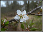 Close Up Blossom |
 Big Cedars |
 Forested Road |
 Narrow Trail/Road |
 A Little Muddy |
 Road Junction |
 Creek Crossing |
 Bigger Crossing |
 More Tree Blossoms |
 Pond |
 Good Signage |
 Culvert Architecture |
 Bare Trees |
 Unsigned Trail |
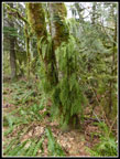
 Mossy Tree |
 Fern Tree |
Trips - 2019
Home