4-19-20
Sunday
would be mostly sunny and
warm. I wanted a trip other than Phinney Ridge or Queen Anne Hill. This
one required almost a four mile drive. I headed north to small
Llandover Woods Park. I was the first car in the lot at 7:20 am. This
was my first visit. I planned on two five mile loops with about 700' of
elevation gain for each one. That included a side trip down towards
Puget Sound on each loop. The park is small but a nice forest in the
city. I saw a woodpecker right near the start. I kept left at the
junction taking the lightly longer route. The two trails came back
together farther along. The trail dropped to the bottom of the gully
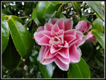
and popped out at the end of a long dead end street Some nice flowering
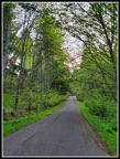
cherry trees here. The road is narrow but with homes well spread out
there is little traffic. At the first junction I went right on a dead
end street.
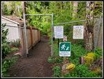
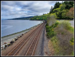
I dropped a little and reached a private property sign. Right before the sign I had a view down to the water and the railroad tracks. I could see a little of Puget Sound. Some views but not great. I back went up to the junction and took the main road. I saw a couple walkers and runners on this section. I passed a turn off to Hill Top and continued on. The road turned south and widened. Soon I was in the regular housing grid. I crossed a bridge and continued on. At 132nd I turned right and descended to 12th Ave NW. By now I realized I had missed the road down to near the water. I had planned to go down to 127th then turn around and head uphill crossing 3rd Ave NW, the main drag. 1st NW would take me back to my car at Llandover Woods Park. Instead I thought about continuing south to Carkeek Park.
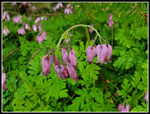
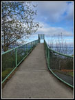
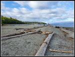
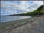
Having missed some elevation loss and gain by missing that part of my planned route I decided to get back the elevation and a bit more mileage by going to Carkeek. I knew the parking lot was cosed but locals would be going to the park. I continued down 12th Ave NW to 117th and found the trail into the park located right between two houses. The trail took me to a road which I followed down to the main park. The lots were empty and I saw only a couple people in the park. The road now ran parallel to Piper's Creek heading for Puget Sound. Alongside the road was a big patch of blooming bleeding hearts. A spring wildflower I did not expect to see this year. I took the bridge over the railroad tracks and down to the beach. The tide was mostly in but there was plenty of room for me and one other group well away from me. After being couped up in my house with a few walks around North Seattle it was very nice to be an the sandy beach by salt water.
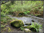
I stayed for about 15 minutes. It was still only 8:52 am when I started back. Three spaced out groups were heading over the tracks. When one came down the steps the next one would appear above. The steps are very narrow and I preferred to not pass anyone too closely during the pandemic. I waited and waited until I could get up the steps and away from the beach. The big meadow was still empty with just a couple of photographers with tripods looking out on Puget Sound. On the way back I took the path right along Piper's Creek. The water level was pretty low. We have had very little rain this April. I took a different path back up to 12th Ave NW. It is shorter but narrow. As luck would have it two groups came down as I neared the top. Getting off the trail on a steep hillside was not easy.
Once back on the road I had no trouble avoiding folks the rest of my trip. It was now warm enough that I put on a short sleeve shirt and zipped off my pats legs. Probably in the high 50s or around d60 but the sunshine felt pretty warm. I headed back to 132nd, then west across 3rd NW to 1st NW. From there it was easy walking north back to the trailhead. I turned a planned 5 mile loop into a 7 mile loop. I left off a mile on the road I missed and added about 3 miles down to the beach and back. Time to start lap two.
I followed my route from lap one until I reached the side road up to Hill Top. It is a short steep road up to a cul de sac. I hoped to find a bit of a view of the water but it was almost non existent. Down I came and I continued on to the bridge. I had consulted my gps map and realized on the first lap I should have turned downhill right before the bridge. This time I did so. The road down has a couple switchbacks as it loses elevation. Nice walking with plenty of blooming flowers in the yards. The road seemed to be going on longer than I expected when I reached the bottom. There are several tall cedar trees forming a wall blocking views of Puget Sound. I went around them and saw the water was less than 100' below me. All the driveways are private property so this is the literal end of the road. I noticed some forget-me-nots blooming right alongside the road. Another mountain wildflower I did not think I would see this year. I headed back up the road gaining 225' in .63 miles. Up and down added 1 1/4 miles.
I was a bit tired at the top but decided since I had missed the route on lap one I would do it twice on lap two. Down I went. After going down and up again I was getting a bit tired. This lap I did go down to 127th and then work my way back up the hill and over to 1st NW. Climbing up the hill I had a good look backwards to Puget Sound. By the time I reached my car I had hiked about 13 miles with 1800' of elevation gain. Not bad for a trip that started four miles from my house. With my early start it was still just before 12:00 pm when I finished my trip. Not a bad way to spend a morning during a pandemic.
Click on thumbnails to get
larger pictures.
Trips - 2020
Home
I dropped a little and reached a private property sign. Right before the sign I had a view down to the water and the railroad tracks. I could see a little of Puget Sound. Some views but not great. I back went up to the junction and took the main road. I saw a couple walkers and runners on this section. I passed a turn off to Hill Top and continued on. The road turned south and widened. Soon I was in the regular housing grid. I crossed a bridge and continued on. At 132nd I turned right and descended to 12th Ave NW. By now I realized I had missed the road down to near the water. I had planned to go down to 127th then turn around and head uphill crossing 3rd Ave NW, the main drag. 1st NW would take me back to my car at Llandover Woods Park. Instead I thought about continuing south to Carkeek Park.
Having missed some elevation loss and gain by missing that part of my planned route I decided to get back the elevation and a bit more mileage by going to Carkeek. I knew the parking lot was cosed but locals would be going to the park. I continued down 12th Ave NW to 117th and found the trail into the park located right between two houses. The trail took me to a road which I followed down to the main park. The lots were empty and I saw only a couple people in the park. The road now ran parallel to Piper's Creek heading for Puget Sound. Alongside the road was a big patch of blooming bleeding hearts. A spring wildflower I did not expect to see this year. I took the bridge over the railroad tracks and down to the beach. The tide was mostly in but there was plenty of room for me and one other group well away from me. After being couped up in my house with a few walks around North Seattle it was very nice to be an the sandy beach by salt water.
I stayed for about 15 minutes. It was still only 8:52 am when I started back. Three spaced out groups were heading over the tracks. When one came down the steps the next one would appear above. The steps are very narrow and I preferred to not pass anyone too closely during the pandemic. I waited and waited until I could get up the steps and away from the beach. The big meadow was still empty with just a couple of photographers with tripods looking out on Puget Sound. On the way back I took the path right along Piper's Creek. The water level was pretty low. We have had very little rain this April. I took a different path back up to 12th Ave NW. It is shorter but narrow. As luck would have it two groups came down as I neared the top. Getting off the trail on a steep hillside was not easy.
Once back on the road I had no trouble avoiding folks the rest of my trip. It was now warm enough that I put on a short sleeve shirt and zipped off my pats legs. Probably in the high 50s or around d60 but the sunshine felt pretty warm. I headed back to 132nd, then west across 3rd NW to 1st NW. From there it was easy walking north back to the trailhead. I turned a planned 5 mile loop into a 7 mile loop. I left off a mile on the road I missed and added about 3 miles down to the beach and back. Time to start lap two.
I followed my route from lap one until I reached the side road up to Hill Top. It is a short steep road up to a cul de sac. I hoped to find a bit of a view of the water but it was almost non existent. Down I came and I continued on to the bridge. I had consulted my gps map and realized on the first lap I should have turned downhill right before the bridge. This time I did so. The road down has a couple switchbacks as it loses elevation. Nice walking with plenty of blooming flowers in the yards. The road seemed to be going on longer than I expected when I reached the bottom. There are several tall cedar trees forming a wall blocking views of Puget Sound. I went around them and saw the water was less than 100' below me. All the driveways are private property so this is the literal end of the road. I noticed some forget-me-nots blooming right alongside the road. Another mountain wildflower I did not think I would see this year. I headed back up the road gaining 225' in .63 miles. Up and down added 1 1/4 miles.
I was a bit tired at the top but decided since I had missed the route on lap one I would do it twice on lap two. Down I went. After going down and up again I was getting a bit tired. This lap I did go down to 127th and then work my way back up the hill and over to 1st NW. Climbing up the hill I had a good look backwards to Puget Sound. By the time I reached my car I had hiked about 13 miles with 1800' of elevation gain. Not bad for a trip that started four miles from my house. With my early start it was still just before 12:00 pm when I finished my trip. Not a bad way to spend a morning during a pandemic.
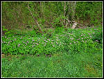
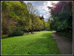 Empty Park |
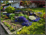 Bright Flowerbed |
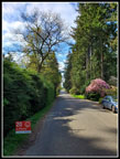 Quiet Road |
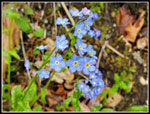 Forget-Me-Nots |
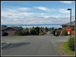 View Of The Sound |
Trips - 2020
Home


