9-20-20
I
needed 11 miles to reach 24000. I
needed elevation gain sine I did not have much this month. I needed to
get out and hike after two weeks of forest fire smoke over the entire
state. I did 7 miles with 2400' on Tiger Mountain on Saturday. I had
just the hike to meed my goals. I seldom hike up the new Mt. Si Trail
as it is too crowded year round. The route via the Mt. Teneriffe
Road/Trail is longer and less crowded. That fit the bill. I reached the
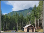
new Mt. Teneriffe Trailhead at 7:45 am. I was the tenth car in the lot.
Though the Doppler radar showed no rain in the state I had my wipers on
for much of the drive. It was dry and 56 degrees as I headed out. Not a
trace of smoke in the air. On Friday the Air Quality Index was 200.
This morning in North Bend it was 5. A little rain goes a
long
way. I made good time on the new trail then on the old road/trail. I
passed one guy before the Teneriffe Falls turnoff. My took that trail
leaving me alone on the old Teneriffe Road/Trail. I reached the bridge
with the waterfall where the flat road begins the long climb up the
slope. I stopped to zip off pant legs and switch into a short sleeve
shirt.
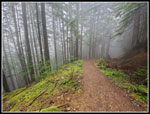
After an easy 1 1/2 miles the grade increased for the rest of the ascent. This was a road not long ago. It has been changed into a trail. In a few places it is pretty narrow. Most of the way it is a wide trail not a road any longer. The smooth grade makes for a pretty good pace. I passed several groups coming down already. That was it. A very quiet and uncrowded hike. Just what I was looking for. I reached the viewpoint right after a switchback in 1:30. No view of Mt. Rainier or Rattlesnake Mountain. I could see layers of clouds. The clouds were so much better than the smoke of the past two weeks. I reached the junction with the trail over to Mt. Si in 1:50. 4.2 miles down and .80 to go. There was one hiker going up towards Mt. Teneriffe when I arrived. I have hiked this last leg more often on snow than dirt. It used to be a path with occasional trees down. Now it is an official trail and in fine shape.
I passed on last hiker coming down. I noticed where the old road to Blowdown Mountain cuts off. I had considered checking it out over the years. Since I needed 11 miles on a 10 mile trail I thought about tasking it on my way down. Nearing the high point I saw a number of big mushrooms that had recently popped out of the ground. I stopped for photos. From just over 4000' I dropped down to the end of the main Mt. Si Trail where it goes around to the scramble route up the Haystack. Recent rain had the brush wet as I dropped into Haystack Basin. There were still a few wildflowers in bloom including some Indian paintbrush.
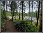
I cut across to the viewpoint above North Bend. I expected to find folks at the benches. Not a one. Not anybody. It was 10:04 am and nobody else was there. Quite a surprise. A few minutes later I could see a few folks arrive at the rocky point just south of me. In sight but not very close. I put on a windshirt for warmth but there was no wind at all. I spent 15 minutes there. Layers of clouds all around but no views down to North Bend. Just a few short opening that quickly closed up again. I made a slow return through the basin. Raindrops hanging from flowers and trees were photogenic. One moment there was blue sky over the Haystack. A minute later it was all clouds again. I climbed back to the high point passing two hikers just arriving from the Mt. Teneriffe side. They were the last folks I saw until I was half way back to the trailhead.
When I reached the path heading for Blowdown Mountain I took it. It follows an old decommissioned road. That means some tank traps where trenches were put in when the road was taken out. Mostly they have flattened somewhat. The route is not all that brushy but it had begun to rain lightly and I was soon getting soaked. After gaining 150' I turned around. I will finish this route at a later date. It was easy walking back to the Mt. Teneriffe Road and down from there. I hiked in and out of thick mist though the light rain soon stopped. As mentioned, half way down I passed a hiker coming up then another and another. Then I was alone once again.
On an earlier trip of Mt. Teneriffe I saw few folks going up and then many more on my way down. This day I saw very few folks in either direction. When I reached the flats with 1 1/2 miles to go I started to meet folks hiking up. I hiked .40 miles along the flat section then turned around and hiked back to the bridge by the waterfall. That added the .80 miles I needed to round out my 11 mile day and bring me up to 24,000' total miles. In the last half mile I met a number of parties and for the first time all day most did not wear masks. Everyone I saw earlier had one. I reached the parking lot at 12:56 pm to find it about half full. As is usual most folks were heading to Kamikaze Falls and or the short route up Mt. Teneriffe.
The hike turned out great. My early start meant I saw few folks on my way up. I was very surprised to find almost nobody on Mt. Si. I checked out a little of a new to me route to Blowdown Mountain. I had a lot of solitude on the way down. The mushroom show was very nice. I stopped for more photos coming down. After all the smoke even the light rain was refreshing. 11 miles with 3600' of elevation gain and I was down before 1:00 pm. With the coronavirus I have been choosing hikes where I will not see a lot of people. That is hard to do near Seattle. This proved to be one more in a long list of trips that have fit the bill. After getting in 100' of elevation gain the last weekend, I managed 6000' this weekend. A much better result.
Trips - 2020
Home


