8-13-20
Time
for my first after work mid week hike in several weeks. John was
available but Gary was down with an injury. This day would be in the
low to mid 70s. Sunday would be about 90 degrees. All the more reason
to hike now. We met at the Mt. Washington trailhead at 3:20 pm. We took
a while to get going as Johns gps map was very dark and the trails were
missing. He decided to record a track anyway. When he was at home later
is was working just fine again. We had debated scrambling up the ridge
above Change Creek but decided a late start on a scramble route we had
not done was not such a good idea. Instead we planned a loop trip over
Mt. Washington via the Change Creek Trail. John had done this route
about 10 years earlier and I did it in August of 2014. At nearly 11
miles the loop is longer than the usual trail up Washington but much
less crowded.
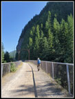
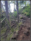
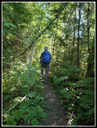
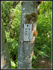
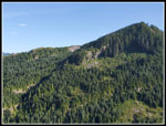
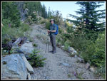
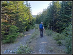
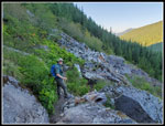
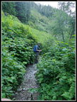
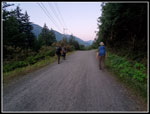
The parking lot was much less full than I expected. That was a good sign. We hiked up to the railroad grade and passed a family coming down on the first narrow trail section. Masks on. We saw quite a few bikers and some hikers on the grade. Most hikers were wearing masks even on the 20' wide grade. Before reaching the Hall Creek trestle we took the not entirely obvious Change Creek Trail. It climbs an extremely steep slope at a reasonable grade with many switchbacks. We hoped to not have to pass anyone along here. We did not. Though it was only about 70 degrees and largely in forest I was not feeling very speedy. John had no problem and easily stayed ahead of me. Fortunately, I felt much better after the first steep climb. Near the ridge top an obvious trail headed north along the narrow ridge. It was not signed but we figured it was the route to Olallie Point. It is. There was a sign in 2014. I remembered the first knife edge spot. I forgot about the other couple. Falling is not an option but the scramble proved okay.
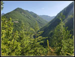
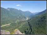
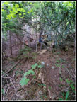
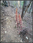
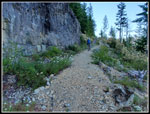
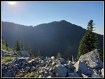
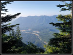
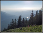
From the point there is a good view north and east up the valley of the NF Snoqualmie River. Right below is the railroad grade/trail and the Hall Creek trestle. Up the valley of Change Creek we could see the steep ridge we chose not to scramble. After a few photos we were on our way. With darkness now at about 9:00 pm we wanted to keep moving and finish before dark if possible. We scrambled back to the trail and continued on. More climbing but not as constant as the first part. The trail becomes and old road. It has almost turned into a trail at this point. The trail continues higher to a short cut. Last time I took the longer road and the brush was terrible. This time we took the shortcut and it was fine. I did see pinedrop here. The only saprophyte we saw this day. Last time I took the trail around the pond missing the short cut sign there. This time we took the shortcut but did not go over to the pond shore. That brought us to an old road. Some work has been done here as it is smoother with some big rocks providing an edge.
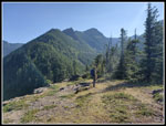
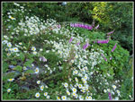
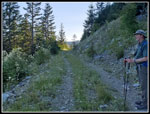
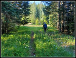
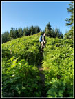
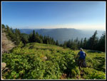
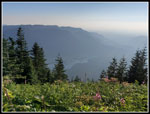
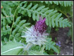
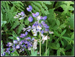
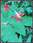
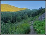
Lots of wildflowers along this section. It was now out of the forest with plenty of sunshine. Daisies, Indian paintbrush, foxglove, and fireweed were most seen. The next junction was the trail to the Great Wall and the new bile path from down on the railroad grade. We turned left on the route to the Great Wall. This section gains elevation and seems to go on way to long. We passed by the summit of Change Peak and then dropped to the Great Wall. For the first 25 years I hiked across this road on a flattened ridge top it was bare. Great views out and big drops on both sides. It was really changed. Now trees have grown up on both sides. Other than the very start there are no views now. We crossed and took a right turn on the ridge top leading to Mt. Washington. This ridge is the border of the Seattle Watershed. No Trespassing signs lined the left side. This old gravel road is turning into a grassy road. It is pleasant walking now. Until the new trail went in the Great Wall route was the trail used by the few folks who hiked up Mt. Washington. With the new trail and publicity the summit is often crowded now.
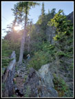
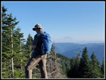
The old trail went right up the ridge to the summit. The new trail comes in from the side most of the way up. The old route is steep and it is still there as it cuts through brush. We went right to the top to find... nobody at all. We arrived at 6:30 pm. Three hours to hike up about 6 1/2 miles. Not bad after my slow start. After a few photos we dropped down to the spot with views down to Chester Morse Lake and out to the east. Mt. rainier was there but a bit haze, The lake was even more hazy. We sat in the sunshine for dinner. Well, if granola bars count for my dinner. We spent 25 minutes on top. At 6:55 pm we headed down.
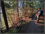
This trail is rocky and not one I look forward to descending. It helped not having any other folks to pass. We saw nobody on above the railroad grade. Nearly the whole hike and no pulling out the face mask every time another hiker comes into sight. We made good time slip sliding down the trail. Not many things to photograph. Just keep hiking. As we reached the last half mile of trail it became clear that we would reach the grade before dark. With the trail on the north side of the ridge is gets dark sooner than to the south. Nearing the grade we heard voices. Just after reaching the grade two climbers caught up and passed us. We saw folks on the grade coming and going but nobody above it.
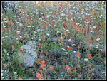
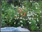
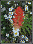
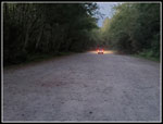
Back at the parking lot there were still half a dozen cars. One was leaving and another was close. It was 8:39 pm. Sunset was at 8:23 pm. We just avoided another headlamp hike. This turned out to be a great hike. We were able to do a big loop hike and come down late enough to miss the usual crowd on Mt. Washington. The temperature was just about perfect. The wildflowers were not prolific but were much better than I expected. The Indian paintbrush were huge. I may stay off the trail this weekend as 90+ degrees does not sound like fun. We did get in a hike a few days early and 70 sure beats 90 degrees. This is not a trip that I would usually do in summer when the high country beckons but in a pandemic year and for an after work hike it was terrific.
Click on thumbnails to get
larger pictures.
Trips - 2020
Home
The parking lot was much less full than I expected. That was a good sign. We hiked up to the railroad grade and passed a family coming down on the first narrow trail section. Masks on. We saw quite a few bikers and some hikers on the grade. Most hikers were wearing masks even on the 20' wide grade. Before reaching the Hall Creek trestle we took the not entirely obvious Change Creek Trail. It climbs an extremely steep slope at a reasonable grade with many switchbacks. We hoped to not have to pass anyone along here. We did not. Though it was only about 70 degrees and largely in forest I was not feeling very speedy. John had no problem and easily stayed ahead of me. Fortunately, I felt much better after the first steep climb. Near the ridge top an obvious trail headed north along the narrow ridge. It was not signed but we figured it was the route to Olallie Point. It is. There was a sign in 2014. I remembered the first knife edge spot. I forgot about the other couple. Falling is not an option but the scramble proved okay.
From the point there is a good view north and east up the valley of the NF Snoqualmie River. Right below is the railroad grade/trail and the Hall Creek trestle. Up the valley of Change Creek we could see the steep ridge we chose not to scramble. After a few photos we were on our way. With darkness now at about 9:00 pm we wanted to keep moving and finish before dark if possible. We scrambled back to the trail and continued on. More climbing but not as constant as the first part. The trail becomes and old road. It has almost turned into a trail at this point. The trail continues higher to a short cut. Last time I took the longer road and the brush was terrible. This time we took the shortcut and it was fine. I did see pinedrop here. The only saprophyte we saw this day. Last time I took the trail around the pond missing the short cut sign there. This time we took the shortcut but did not go over to the pond shore. That brought us to an old road. Some work has been done here as it is smoother with some big rocks providing an edge.
Lots of wildflowers along this section. It was now out of the forest with plenty of sunshine. Daisies, Indian paintbrush, foxglove, and fireweed were most seen. The next junction was the trail to the Great Wall and the new bile path from down on the railroad grade. We turned left on the route to the Great Wall. This section gains elevation and seems to go on way to long. We passed by the summit of Change Peak and then dropped to the Great Wall. For the first 25 years I hiked across this road on a flattened ridge top it was bare. Great views out and big drops on both sides. It was really changed. Now trees have grown up on both sides. Other than the very start there are no views now. We crossed and took a right turn on the ridge top leading to Mt. Washington. This ridge is the border of the Seattle Watershed. No Trespassing signs lined the left side. This old gravel road is turning into a grassy road. It is pleasant walking now. Until the new trail went in the Great Wall route was the trail used by the few folks who hiked up Mt. Washington. With the new trail and publicity the summit is often crowded now.
The old trail went right up the ridge to the summit. The new trail comes in from the side most of the way up. The old route is steep and it is still there as it cuts through brush. We went right to the top to find... nobody at all. We arrived at 6:30 pm. Three hours to hike up about 6 1/2 miles. Not bad after my slow start. After a few photos we dropped down to the spot with views down to Chester Morse Lake and out to the east. Mt. rainier was there but a bit haze, The lake was even more hazy. We sat in the sunshine for dinner. Well, if granola bars count for my dinner. We spent 25 minutes on top. At 6:55 pm we headed down.
This trail is rocky and not one I look forward to descending. It helped not having any other folks to pass. We saw nobody on above the railroad grade. Nearly the whole hike and no pulling out the face mask every time another hiker comes into sight. We made good time slip sliding down the trail. Not many things to photograph. Just keep hiking. As we reached the last half mile of trail it became clear that we would reach the grade before dark. With the trail on the north side of the ridge is gets dark sooner than to the south. Nearing the grade we heard voices. Just after reaching the grade two climbers caught up and passed us. We saw folks on the grade coming and going but nobody above it.
Back at the parking lot there were still half a dozen cars. One was leaving and another was close. It was 8:39 pm. Sunset was at 8:23 pm. We just avoided another headlamp hike. This turned out to be a great hike. We were able to do a big loop hike and come down late enough to miss the usual crowd on Mt. Washington. The temperature was just about perfect. The wildflowers were not prolific but were much better than I expected. The Indian paintbrush were huge. I may stay off the trail this weekend as 90+ degrees does not sound like fun. We did get in a hike a few days early and 70 sure beats 90 degrees. This is not a trip that I would usually do in summer when the high country beckons but in a pandemic year and for an after work hike it was terrific.
 Change Creek Bridge |
 Starting Up Trail |
 View Up Valley |
 Heading For Ridge |
 Overhanging Rock |
 Narrow Trail |
 SF Snoqualmie Valley |
 Olallie Point View |
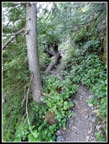
 Forested Trail |
 MMM Ridge Trail |
 Short Cut |
 Pinedrops |
 Great Wildflowers |
 Daisies & Paintbrush |
 Bouquet |
 Big Colorful Paintbrush |
 MMM Ridge |
 John On Shady Trail |
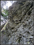
 Vertical Rock Wall |
 Shady Road/Trail |
 On Great Wall |
 Mr.Washington |
 Road Is A Meadow |
 Brushy Summit Ridge |
 View North From Top |
 John On Mt. Washington |
 Heading Down |
 Hazy Lake |
 Glowing Rattlesnake Lake |
 Thistle |
 Lupine |
 Columbine |
 Open Terrain |
 Tall Brush |
 Sun On Change Peak |
 Late Sun Shines Through |
 Climbers On Grade |
 Lot Empties |
Trips - 2020
Home