4-04-20
Weekend
#2 of the Stay At Home
Order for the coronavirus pandemic. I needed to find some elevation
gain in North Seattle. The previous weekend I did 8.5 miles but only
700' of gain. Time to go to Queen Anne Hill. I was out the door at 7:30
am. Ten minutes later I was parked just off Nickerson St. and on my
way. My goal was to get in more than 1000' of gain. If my feet held up
I hoped to get more. I was just getting over a case of plantar
fasciitis when the trails were all shut down. Pavement hurts a lot more
than dirt trail with plantar.
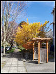
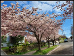
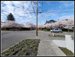
The route is pretty steep on both the north and south side. After my trip I found that there are three sections of my route that are 18 or 19 percent grades. That is very steep. Steep climbs at the ends and the top of the hill is pretty flat. I went from about 35' above sea level to about 450' at the high point. While I am missing out on spring wildflowers in the mountains it is time for city flower gardens to be in bloom. I saw a lot of flowers on this trip and also a lot of flowering cherry trees. The early morning start meant there were not a lot of folks out yet. All the better to stay away from other folks during a pandemic.
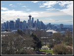
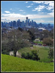
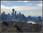
It actually felt good to hike up a steep road. That is what most hikes are like. Keeping up hiking shape without mountains is a challenge. From the top of the climb it was a very gentle uphill to the south end of Queen Anne Hill. I passed by Suzanne's old home. I drove there so many times when we were hiking together most weekends for years. From the high point it was even steeper roads down with a few stairways as well. I dropped to a block from the Seattle Center. Now I was seeing a few folks. Rather than retrace my steps I headed west a few blocks and headed up Queen Anne Avenue. This is the steep main auto route up the hill. It was also less steep than the route I had come down. On my descent I had some good views out to downtown Seattle. It was mostly cloudy but there were a few bits of sunshine too.
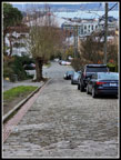
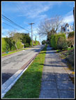
I headed back to my route up across the top of Queen Anne Hill. I went down one block farther east. I went lower than where I had parked continuing all the way to Nickerson Street. There was still very little traffic. My first venture across and back totaled 3.4 mile with 700' of elevation gain. Time for another. I headed right back up and across the top and back down the south side. This time I retraced my route. When I passed Suzanne's old place I gave her a call east of the Cascades. I dropped back down to Nickerson and turned around again. I climbed up the slope for the third time. This time I had a different plan.
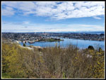
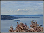
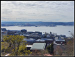
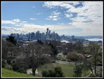
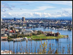
I decided to head west on Lynn Street to the viewpoint looking northeast. I missed the turn and went a few blocks to far before I realized my mistake. I headed back to Lynn and then west. The street came to an end. Two folks ahead of me went straight ahead. There is a trail that connects back up to Lynn Street. On the way I passed a p-patch. I passed another one on my city hike the previous weekend. Where I reached Lynn the road was lined with flowering cherry trees. Lots of big ones. The next block was a highlight of the trip. I reached the viewpoint and enjoyed the scenery. Lake Union and Gasworks Park were below. The University District was right there. Really nice views. I first came here during my years at the University of Washington. I often walked around Lake Union and went over Queen Anne Hill. I have only been back a few times in the last 40 or so years.
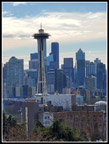
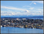
Next I headed for Kerry Park. It is to the west of Queen Anne Avenue. I expected to see folks there. By now the sun was really coming out. Still some clouds but lots of blue sky. From Kerry Park I could see Mt. Rainier. With the morning clouds I did not expect that. not full blue sky that would be ideal but not too bad either. On the way back I headed higher up on East QA then headed west to my earlier route. across the top. I went south to the high point near the water tower and headed back. Trying to round up my mileage to an even number I went back to the Lynn Street viewpoint. By now it was 11:30 am. Quite a few more folks were out. It was still easy enough to avoid them. My feet were getting a bit sore on the last descent to Nickerson. From there I went up the steepest block of the day back to my car. 19 percent is steep. I was glad to get to the end. I was very happy I kept going until I had 11 miles hiked with 2000' of elevation gain. Not bad since the top of the hill is only 456' above see level.
This was a fun day. I really am looking forward to getting back on dirt trails in the mountains but for now this will have to do. The next day I hiked 8 miles from home with 800'of gain. Not a bad weekend for in city hiking.
Click on thumbnails to get
larger pictures.
Trips - 2020
Home
The route is pretty steep on both the north and south side. After my trip I found that there are three sections of my route that are 18 or 19 percent grades. That is very steep. Steep climbs at the ends and the top of the hill is pretty flat. I went from about 35' above sea level to about 450' at the high point. While I am missing out on spring wildflowers in the mountains it is time for city flower gardens to be in bloom. I saw a lot of flowers on this trip and also a lot of flowering cherry trees. The early morning start meant there were not a lot of folks out yet. All the better to stay away from other folks during a pandemic.
It actually felt good to hike up a steep road. That is what most hikes are like. Keeping up hiking shape without mountains is a challenge. From the top of the climb it was a very gentle uphill to the south end of Queen Anne Hill. I passed by Suzanne's old home. I drove there so many times when we were hiking together most weekends for years. From the high point it was even steeper roads down with a few stairways as well. I dropped to a block from the Seattle Center. Now I was seeing a few folks. Rather than retrace my steps I headed west a few blocks and headed up Queen Anne Avenue. This is the steep main auto route up the hill. It was also less steep than the route I had come down. On my descent I had some good views out to downtown Seattle. It was mostly cloudy but there were a few bits of sunshine too.
I headed back to my route up across the top of Queen Anne Hill. I went down one block farther east. I went lower than where I had parked continuing all the way to Nickerson Street. There was still very little traffic. My first venture across and back totaled 3.4 mile with 700' of elevation gain. Time for another. I headed right back up and across the top and back down the south side. This time I retraced my route. When I passed Suzanne's old place I gave her a call east of the Cascades. I dropped back down to Nickerson and turned around again. I climbed up the slope for the third time. This time I had a different plan.
I decided to head west on Lynn Street to the viewpoint looking northeast. I missed the turn and went a few blocks to far before I realized my mistake. I headed back to Lynn and then west. The street came to an end. Two folks ahead of me went straight ahead. There is a trail that connects back up to Lynn Street. On the way I passed a p-patch. I passed another one on my city hike the previous weekend. Where I reached Lynn the road was lined with flowering cherry trees. Lots of big ones. The next block was a highlight of the trip. I reached the viewpoint and enjoyed the scenery. Lake Union and Gasworks Park were below. The University District was right there. Really nice views. I first came here during my years at the University of Washington. I often walked around Lake Union and went over Queen Anne Hill. I have only been back a few times in the last 40 or so years.
Next I headed for Kerry Park. It is to the west of Queen Anne Avenue. I expected to see folks there. By now the sun was really coming out. Still some clouds but lots of blue sky. From Kerry Park I could see Mt. Rainier. With the morning clouds I did not expect that. not full blue sky that would be ideal but not too bad either. On the way back I headed higher up on East QA then headed west to my earlier route. across the top. I went south to the high point near the water tower and headed back. Trying to round up my mileage to an even number I went back to the Lynn Street viewpoint. By now it was 11:30 am. Quite a few more folks were out. It was still easy enough to avoid them. My feet were getting a bit sore on the last descent to Nickerson. From there I went up the steepest block of the day back to my car. 19 percent is steep. I was glad to get to the end. I was very happy I kept going until I had 11 miles hiked with 2000' of elevation gain. Not bad since the top of the hill is only 456' above see level.
This was a fun day. I really am looking forward to getting back on dirt trails in the mountains but for now this will have to do. The next day I hiked 8 miles from home with 800'of gain. Not a bad weekend for in city hiking.
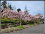 Cherry Trees At Start |
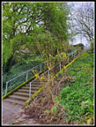 Stairway |
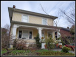 Suzanne's Old House |
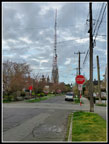 TV Antenna |
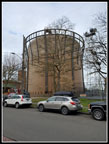 Water Tower |
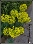 Flowers |
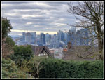 Downtown In Sight |
 Steep Descent |
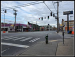 Empty Mercer Street |
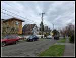 Old & New Houses |
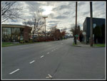 Empty Nickerson Street |
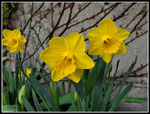 Daffodils |
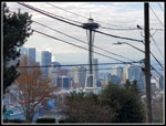 Space Needle In Sight |
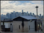 Most Of Downtown |
 Steep Climb |
 Shadows |
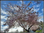 More Cherry Blossoms |
 Lynn St. Viewpoint |
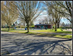
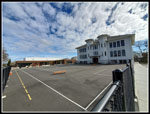 Queen Anne Elementary |
 Kerry Park View |
 Green View |
 Classic View Of Seattle |
 Washington State Ferry |
 Harbor Island |
 Seattle & Mt. Rainier |
 Wide Angle View |
 Container Ship Arriving |
 Fall Colors? |
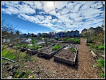 P-Patch |
 Best Cherry Trees |
 Lynn St. Again |
 View Northeast |
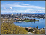 Gasworks Park |
 Lynn St. Cherry Trees |
Trips - 2020
Home