3-06-21
With
crappy rainy weather on tap I looked for the least bad place to go
hiking. My first plan was for a trip to Wallace Lake. The likelihood of
steady rain changed my mind. Closer to Puget Sound looked to be driest.
I changed the destination to Cougar Mountain. The only problem was that
the Highway 520 bridge would be closed all weekend. Getting home might
be a challenge. The Cougar Mountain Regional Wildland Park opens at
8:00 am. I pulled into the lot at 8:03 am. There were nearly a dozen
cars in the lot. It pays to be early. My plan was to get an early start
and hike a big loop on lesser traveled trails the first half way. I
hoped to avoid much of the crowds that would show up later. I headed
south taking the Wildside Trail to the Indian Trail.I saw a few runners
at this early hour but no hikers for quite a while.
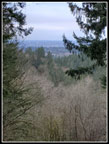
I turned left onto the trail to Far Country Lookout and the climbing began. The route up was once an old logging road straight up the fall line. Now it is a gentler switchbacking trail. The lookout used to be near the high point. Now it is on a trail just below. Trees long ago grew up to block the upper viewpoint. I seldom run a gps track on these close in trails I hike often. For fun I did so this day. From FCL the trail drops then begins a steady climb. At the next junction I turned right on the Deceiver Trail. Now I began to see more runners. From here to Long View Peak I saw nearly a dozen groups. That is about ten more than I am used to seeing. The pandemic has really brought out the crowds. Still far from overwhelming like many trails it is still far more people than I'm used to seeing here.
I took a short detour to see Doughty Falls. Some water but not a lot. At the bridge crossing I looked for any skunk cabbage leaves coming up through the mud. I saw none. Still too early in the year. From the creek to the ridge top is where I saw most of the people I even saw a couple groups of hikers. I took the short trail to the top of Long View Peak. The old view below the summit is now almost entirely gone. I could see thick low clouds through the trees. There were a few raindrops too. As I hiked on towards Shy Bear Pass the drops stopped. That was about it for rain all day. I did check the weather radar and there was rain father east as expected. The steadiest rain was up near Wallace Lake. At Shy Bear Pass I headed up to Wilderness Peak. Several groups passed me going up and down. I had the summit to myself for a few minutes before heading down.
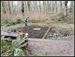
I felt like I must be half way through my 11 mile planned trip and the gps showed I had only covered 4.7 miles. Maybe I would not get in 11 miles.I headed over to Fred's Railroad and turned right on the East Fork Trail heading to the Clay Pit. This trail used to be called the Backdoor Trail long ago. A trail was once constructed from this trail to Wilderness Peak. After only 2 or 3 years it was closed down. I often look for the start. It's hit or miss that I can recognize it. This day I did find it. It has a narrow trail visible now. Seems some folks are keeping it open. I'll have to explore it again soon. I passed Jerry's duck pond, went passed the screened over mine entrance and dropped to the Clay Pit Road.
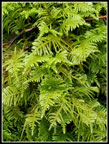
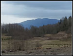
I took the usual walk over to the viewpoint east and down into the Clay Pit. I could see Tiger Mountain clearly. Time for some food and then back on the trail. The Trail to Anti Aircraft Peak drops to Tibbetts Creek then climbs up to AA Peak. Along the way I took a short detour to check a good spring skunk cabbage spot. As expected no skunk cabbage at the creek. I looked downstream and saw a yellow patch. Could it be? Only one way to find out. I pushed through some devils club, through some muddy spots and found one single skunk cabbage right it the peak. Not a single other leaf pushing up anywhere. Quite a lucky find. On the way back tot he trail I found a perfect bunch of turkey tail fungus too. A double find. That made the trip worthwhile all on its own.
Tibbetts Creek is dry much of the year under the bridge but it has a good flow now. Higher up is a big puddle that covers the entire trail in winter and spring. It was mostly dry. Approaching AA Peak I detoured over to the Million Dollar View and pergola. The short trail was really muddy. That's okay I would come back on the dry trail to the parking lot. Except there was a wedding going on as I approached. I was almost to the dry trail abut not close enough. I went back through the mud. The lot was nearly full. Lots of folks out now. I walked across the meadow to the covered picnic building at the far end. I was now at 8.1 miles. Now it looked like I would get in 11 miles.
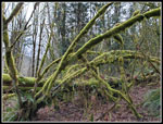
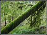
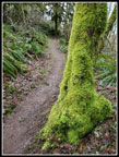
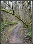
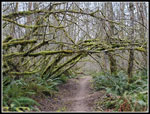
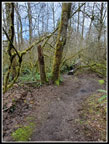
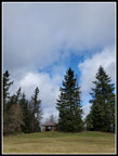
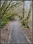
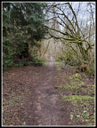
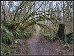
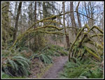
Instead of my usual trip to Cougar Pass and then down the Cave Hole Road back to Red Town I took a route I first hiked on my last trip here. Up tot he high point of AA Peak then down the Lost Beagle Trail to the Klondike Swamp Trail. I passed more folks along this trail. After reaching Far Country Lookout I saw folks off and on the rest of the day. Most had on masks. Three or four groups did not. The trails were wide enough to pass most everywhere. The major theme of the day was Green Arches. My route had many mossy trees arched over the trail. I stopped to photograph most of them. When I reconnected with the trail down from Cougar Pass I stayed on route heading down the Cave Hole Road. At the junction with the Sky Country Trailhead Trail I turned right on that trail. It goes right alongside the old Nike Missile site. I remember when the empty silos were still there. Now it is just a big grassy meadow.
I passed the Sky Country Trailhead and began the descent back to Red Town. This route is mostly soft trail vs the hard Cave Hole Road route. It is longer and can be muddier. It was muddy. I reached the my car at 12:47 pm. The lot was full. Over 4:39 I hiked 11.34 miles with about 1700' of elevation gain. I missed all the rain showers that fell this day. There were a lot of folks out but my route avoided most of them. Even so, it was more crowded than I have seen on most of my trips during the pandemic. The green arches just kept coming. The single bright yellow skunk cabbage was a most unexpected delight. The only negative was the drive home. Getting across the floating bridge was problem at all. The traffic in Seattle and the unexpected construction on 50th Street turned a half hour drive into an hour long one. A small price to pay for a fun hike close to the city.
Click on thumbnails to get
larger pictures.
Trips - 2021
Home
I turned left onto the trail to Far Country Lookout and the climbing began. The route up was once an old logging road straight up the fall line. Now it is a gentler switchbacking trail. The lookout used to be near the high point. Now it is on a trail just below. Trees long ago grew up to block the upper viewpoint. I seldom run a gps track on these close in trails I hike often. For fun I did so this day. From FCL the trail drops then begins a steady climb. At the next junction I turned right on the Deceiver Trail. Now I began to see more runners. From here to Long View Peak I saw nearly a dozen groups. That is about ten more than I am used to seeing. The pandemic has really brought out the crowds. Still far from overwhelming like many trails it is still far more people than I'm used to seeing here.
I took a short detour to see Doughty Falls. Some water but not a lot. At the bridge crossing I looked for any skunk cabbage leaves coming up through the mud. I saw none. Still too early in the year. From the creek to the ridge top is where I saw most of the people I even saw a couple groups of hikers. I took the short trail to the top of Long View Peak. The old view below the summit is now almost entirely gone. I could see thick low clouds through the trees. There were a few raindrops too. As I hiked on towards Shy Bear Pass the drops stopped. That was about it for rain all day. I did check the weather radar and there was rain father east as expected. The steadiest rain was up near Wallace Lake. At Shy Bear Pass I headed up to Wilderness Peak. Several groups passed me going up and down. I had the summit to myself for a few minutes before heading down.
I felt like I must be half way through my 11 mile planned trip and the gps showed I had only covered 4.7 miles. Maybe I would not get in 11 miles.I headed over to Fred's Railroad and turned right on the East Fork Trail heading to the Clay Pit. This trail used to be called the Backdoor Trail long ago. A trail was once constructed from this trail to Wilderness Peak. After only 2 or 3 years it was closed down. I often look for the start. It's hit or miss that I can recognize it. This day I did find it. It has a narrow trail visible now. Seems some folks are keeping it open. I'll have to explore it again soon. I passed Jerry's duck pond, went passed the screened over mine entrance and dropped to the Clay Pit Road.
I took the usual walk over to the viewpoint east and down into the Clay Pit. I could see Tiger Mountain clearly. Time for some food and then back on the trail. The Trail to Anti Aircraft Peak drops to Tibbetts Creek then climbs up to AA Peak. Along the way I took a short detour to check a good spring skunk cabbage spot. As expected no skunk cabbage at the creek. I looked downstream and saw a yellow patch. Could it be? Only one way to find out. I pushed through some devils club, through some muddy spots and found one single skunk cabbage right it the peak. Not a single other leaf pushing up anywhere. Quite a lucky find. On the way back tot he trail I found a perfect bunch of turkey tail fungus too. A double find. That made the trip worthwhile all on its own.
Tibbetts Creek is dry much of the year under the bridge but it has a good flow now. Higher up is a big puddle that covers the entire trail in winter and spring. It was mostly dry. Approaching AA Peak I detoured over to the Million Dollar View and pergola. The short trail was really muddy. That's okay I would come back on the dry trail to the parking lot. Except there was a wedding going on as I approached. I was almost to the dry trail abut not close enough. I went back through the mud. The lot was nearly full. Lots of folks out now. I walked across the meadow to the covered picnic building at the far end. I was now at 8.1 miles. Now it looked like I would get in 11 miles.
Instead of my usual trip to Cougar Pass and then down the Cave Hole Road back to Red Town I took a route I first hiked on my last trip here. Up tot he high point of AA Peak then down the Lost Beagle Trail to the Klondike Swamp Trail. I passed more folks along this trail. After reaching Far Country Lookout I saw folks off and on the rest of the day. Most had on masks. Three or four groups did not. The trails were wide enough to pass most everywhere. The major theme of the day was Green Arches. My route had many mossy trees arched over the trail. I stopped to photograph most of them. When I reconnected with the trail down from Cougar Pass I stayed on route heading down the Cave Hole Road. At the junction with the Sky Country Trailhead Trail I turned right on that trail. It goes right alongside the old Nike Missile site. I remember when the empty silos were still there. Now it is just a big grassy meadow.
I passed the Sky Country Trailhead and began the descent back to Red Town. This route is mostly soft trail vs the hard Cave Hole Road route. It is longer and can be muddier. It was muddy. I reached the my car at 12:47 pm. The lot was full. Over 4:39 I hiked 11.34 miles with about 1700' of elevation gain. I missed all the rain showers that fell this day. There were a lot of folks out but my route avoided most of them. Even so, it was more crowded than I have seen on most of my trips during the pandemic. The green arches just kept coming. The single bright yellow skunk cabbage was a most unexpected delight. The only negative was the drive home. Getting across the floating bridge was problem at all. The traffic in Seattle and the unexpected construction on 50th Street turned a half hour drive into an hour long one. A small price to pay for a fun hike close to the city.
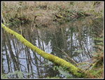
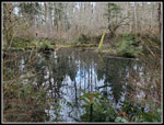
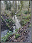 Coal Creek |
 First Mossy Arch |
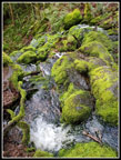
 Lots Of Moss |
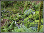
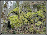 Mossy Rocks |
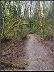
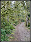 Mossy Indian Trail |
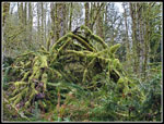 Pile Of Mossy Logs |
 Far Country Falls |
 Top Of FCF |
 Far Country Lookout |
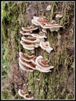 Turkey Tail Fungus |
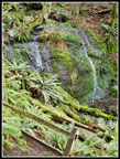 Doughty Falls |
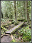 Bridge |
 Big Mossy Log |
 More Moss |
 Very Green |
 Look, A Mossy Arch! |
 Jerry's Duck Pond |
 Archy Green |
 Grate Over Mine |
 Clay Pit & Tiger Mt. |
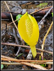 Skunk Cabbage! |
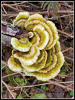 Perfect Turkey Tail |
 Tibbetts Creek Bridge |
 Anti Aircraft Peak |
 Klondike Swamp Trail |
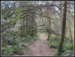
 More Arches |
 Big Arch |
 Yet Another |
 Cave Hole Pond |
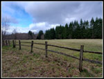 Nike Missiles Meadow |
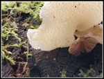 Mushrooms |
 The Final Mossy Arch |
Trips - 2021
Home