02-13-22
I
did an 11 mile hike on Saturday with a long drive. I wanted a shorter
drive and hike for Sunday. It looked to be another sunny winter day
before rain returned on Monday. Saturday night I settled on a trip up
and around South Tiger Mountain. The north peak was logged about 10
years ago. The south summit was logged just a couple years ago. I did
one trip up the south summit in February 2020, just before the pandemic
hit. There were a lot of down trees near the top. I expected high 30s
to start. It was much colder. In North Seattle there was fog and 32
degrees. Around Tiger weather stations showed high 20s all around. The
station at Poo Poo Point showed near 50 degrees. Another at 1600' on
the south side of Tiger showed 44 degrees. I was prepared for cold to
start. I held off leaving hoping for some warming. When that did not
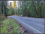
happen I headed out. I arrived at the trailhead at 8:20 am. There was
one car there. On the drive in the Chirico Trail was full with cars
parked along the road. I like less crowded. One more car pulled in as I
was starting out at 8:25 am.
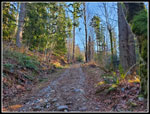
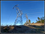
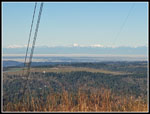
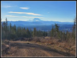
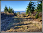
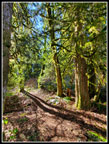
I made good time trying to warm up. It was 27 degrees. I reached Holder Gap at 1.4 miles in 30 minutes. I heard voices catching up with me as I arrived. I went left then steeply uphill on the South Tiger Traverse Trail. They must have taken the TMT as I did not see them. The steep road climb brought me to the power line corridor. It was now noticeably warmer. Add in some sunshine and it felt much warmer. I had views west to the Olympic Mountains. The fog was just in the Seattle area. I had blue sky from Eastgate on. With no low cloud cover where did the significant temperature inversion come from? I still have no idea. The road used to revert to trail beyond the power lines. Now it is a new logging road with trees cut down on both sides. I continued up the road. The point where the South Tiger Traverse Trail turns off the road is well signed. I continued up the road gaining more elevation. The trip would not have a lot and I wanted to add a little more. When the road flattened I turned around. I now had a great view of Mt. Rainier. The low morning light lit up the mountain.
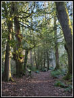
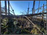
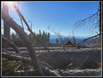
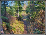
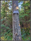
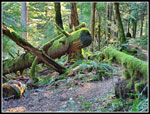
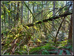
Dropping back down to where the trail leaves the road, Rainier is still in sight though not by much. It was nice to be back on soft trail. The route enters forest and stays there for a while. It reaches the clear cut of the top of the south summit of South Tiger Mountain. The trail turns north just into the clearcut. I could have gone for the summit from here. I chose to go on to the start of the old way trail to the top. In 2020 I took that trail a short way and lost it n down trees and slash. I thought I would see if anyone had tried to repair the old route. The big old stump with a face cut into it is still at the start of the route. I was only 200' below the summit. The trail starts out okay. Soon enough I lost it at several big down trees. I never found any part of it again. Now it was just slog up the slope trying to avoid all the big down trees, piles of branches, and sticker bushes. It is not difficult but is a real pain.
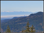
Part way up I hit the new logging road that comes up from near the saddle between the two South Tiger summits. It does not go any higher. I was back to cross country travel. The top is a mess of down trees, small branches, and holes to avoid. The very top requires climbing over trees in about all directions. It is not worth the effort unless one just wants to reach the top. I did find that there is now a view of part of the buildings in downtown Seattle. I was surprised I could see it over taller Squak Mountain from only 2020'. I could also see that the towers rose above a sea of fog in Seattle. I arrived on top at 9:56 am. Photo opportunities and navigating the clearcut slowed me way down. From here it was much easier to drop to the saddle between the two summits. There I picked up the road and then boot path up to the north summit. In 2012 the views were great after it was clearcut. Now the new trees are 20'+ tall and there are no views at all. I had my lunch break here.
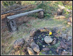
Next, I dropped back to the logging road and followed it down to the north. Part way down I took another road heading left. It quickly reached the South Tiger Traverse Trail. Even for a short distance I prefer the trail to the road. This brought me to another logging road. Across the road is the old horse trail up to the Carole Hapke picnic spot. Three is a cut on a tree but no trail sign. It is getting very narrow at the bottom as trees grow and nobody cuts them. The going is better higher up. This once lead to a viewpoint but the trees have grown a lot since I first visited it several decades ago. It was one more spot to add a little more elevation gain. I dropped back to the road. I had now traveled 4 miles. Half way done and I had not seen a single person. Heard but not seen. In 2020 I spotted a woodpecker here. This day I heard a woodpecker. Same guy?
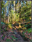
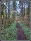
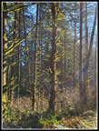
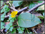
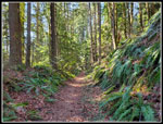
The road starts dropping. I quickly picked up the road I took from north South Tiger. Two runners passed me by. The road drops to meet the Tiger Mountain Trail. (TMT). In 2020 I turned left and followed the TMT to the old railroad wreckage site. That added 1.2 miles round trip. I debated doing it again bu my feet were getting sore from the two days of hiking. I went to the Main Tiger Mountain Road and decided to just head back. The TMT is a fun hike along the backside of South Tiger Mountain. There was no sunshine at all in the forest and a little chilly again. There was some sun shining through the trees. Since most trees were draped with moss the sun really lit them up. I also saw one tiny lone yellow wildflower. It was not a yellow violet or a buttercup. I'm not sure what it was. It was the first wildflower I have seen this year. The grade is very gentle and I set a good pace but stopped many times for photos. I finally ran into some hikers heading out as well.
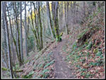
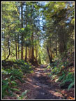
The TMT hits a logging spur and then the main power line corridor. I was back in the sunshine. It soon leaves the road for forested trail. That was about it for sunshine this hike. The trail brought me back to Holder Gap. Just 1.4 miles to go. The fist .40 miles is two different trails. I came up on the hiker trail and went down on the horse trail. The hiker trail crosses a steep slope on a narrow trail near the Gap. The horse trail is wider all the way. I usually go up one way and down the other. The last mile went by pretty quickly. I did have a lot more sunlit mossy trees that slowed me down. That ended being the photo theme for this trip. I arrived back at the trailhead along Tiger Mountain Road at 12:20 pm. I hiked 8 miles with 1700' of gain in 3:55. Considering the lunch break and 140 photos that was not a terrible time.
This hike accomplished all my goals. I had a short drive and an easy hike by the numbers. The clearcut slog was a bit more work and much slower. I did see a number of folks the last 2 miles but the first 6 miles I had a lot of solitude. It was much colder than expected at the start but as I climbed it became much warmer. This might be the first time I can recall the temperature doubling during a 4 hour hike. It was 27 at the start and 54 at the end. That is pretty warm for mid February. I was even home hours before the Super Bowl started. A fun day on a close to home trail.
Click on thumbnails to get
larger pictures.
Trips - 2022
Home
I made good time trying to warm up. It was 27 degrees. I reached Holder Gap at 1.4 miles in 30 minutes. I heard voices catching up with me as I arrived. I went left then steeply uphill on the South Tiger Traverse Trail. They must have taken the TMT as I did not see them. The steep road climb brought me to the power line corridor. It was now noticeably warmer. Add in some sunshine and it felt much warmer. I had views west to the Olympic Mountains. The fog was just in the Seattle area. I had blue sky from Eastgate on. With no low cloud cover where did the significant temperature inversion come from? I still have no idea. The road used to revert to trail beyond the power lines. Now it is a new logging road with trees cut down on both sides. I continued up the road. The point where the South Tiger Traverse Trail turns off the road is well signed. I continued up the road gaining more elevation. The trip would not have a lot and I wanted to add a little more. When the road flattened I turned around. I now had a great view of Mt. Rainier. The low morning light lit up the mountain.
Dropping back down to where the trail leaves the road, Rainier is still in sight though not by much. It was nice to be back on soft trail. The route enters forest and stays there for a while. It reaches the clear cut of the top of the south summit of South Tiger Mountain. The trail turns north just into the clearcut. I could have gone for the summit from here. I chose to go on to the start of the old way trail to the top. In 2020 I took that trail a short way and lost it n down trees and slash. I thought I would see if anyone had tried to repair the old route. The big old stump with a face cut into it is still at the start of the route. I was only 200' below the summit. The trail starts out okay. Soon enough I lost it at several big down trees. I never found any part of it again. Now it was just slog up the slope trying to avoid all the big down trees, piles of branches, and sticker bushes. It is not difficult but is a real pain.
Part way up I hit the new logging road that comes up from near the saddle between the two South Tiger summits. It does not go any higher. I was back to cross country travel. The top is a mess of down trees, small branches, and holes to avoid. The very top requires climbing over trees in about all directions. It is not worth the effort unless one just wants to reach the top. I did find that there is now a view of part of the buildings in downtown Seattle. I was surprised I could see it over taller Squak Mountain from only 2020'. I could also see that the towers rose above a sea of fog in Seattle. I arrived on top at 9:56 am. Photo opportunities and navigating the clearcut slowed me way down. From here it was much easier to drop to the saddle between the two summits. There I picked up the road and then boot path up to the north summit. In 2012 the views were great after it was clearcut. Now the new trees are 20'+ tall and there are no views at all. I had my lunch break here.
Next, I dropped back to the logging road and followed it down to the north. Part way down I took another road heading left. It quickly reached the South Tiger Traverse Trail. Even for a short distance I prefer the trail to the road. This brought me to another logging road. Across the road is the old horse trail up to the Carole Hapke picnic spot. Three is a cut on a tree but no trail sign. It is getting very narrow at the bottom as trees grow and nobody cuts them. The going is better higher up. This once lead to a viewpoint but the trees have grown a lot since I first visited it several decades ago. It was one more spot to add a little more elevation gain. I dropped back to the road. I had now traveled 4 miles. Half way done and I had not seen a single person. Heard but not seen. In 2020 I spotted a woodpecker here. This day I heard a woodpecker. Same guy?
The road starts dropping. I quickly picked up the road I took from north South Tiger. Two runners passed me by. The road drops to meet the Tiger Mountain Trail. (TMT). In 2020 I turned left and followed the TMT to the old railroad wreckage site. That added 1.2 miles round trip. I debated doing it again bu my feet were getting sore from the two days of hiking. I went to the Main Tiger Mountain Road and decided to just head back. The TMT is a fun hike along the backside of South Tiger Mountain. There was no sunshine at all in the forest and a little chilly again. There was some sun shining through the trees. Since most trees were draped with moss the sun really lit them up. I also saw one tiny lone yellow wildflower. It was not a yellow violet or a buttercup. I'm not sure what it was. It was the first wildflower I have seen this year. The grade is very gentle and I set a good pace but stopped many times for photos. I finally ran into some hikers heading out as well.
The TMT hits a logging spur and then the main power line corridor. I was back in the sunshine. It soon leaves the road for forested trail. That was about it for sunshine this hike. The trail brought me back to Holder Gap. Just 1.4 miles to go. The fist .40 miles is two different trails. I came up on the hiker trail and went down on the horse trail. The hiker trail crosses a steep slope on a narrow trail near the Gap. The horse trail is wider all the way. I usually go up one way and down the other. The last mile went by pretty quickly. I did have a lot more sunlit mossy trees that slowed me down. That ended being the photo theme for this trip. I arrived back at the trailhead along Tiger Mountain Road at 12:20 pm. I hiked 8 miles with 1700' of gain in 3:55. Considering the lunch break and 140 photos that was not a terrible time.
This hike accomplished all my goals. I had a short drive and an easy hike by the numbers. The clearcut slog was a bit more work and much slower. I did see a number of folks the last 2 miles but the first 6 miles I had a lot of solitude. It was much colder than expected at the start but as I climbed it became much warmer. This might be the first time I can recall the temperature doubling during a 4 hour hike. It was 27 at the start and 54 at the end. That is pretty warm for mid February. I was even home hours before the Super Bowl started. A fun day on a close to home trail.
 Lots Of Open Parking |
 Cold Start |
 Sunshine! |
 Steep Slope |
 South Tiger Traverse |
 Power Line Corridor |
 Olympic Mountains |
 Mt. Rainier |
 Leaving Road |
 Traversing Clearcut |
 South Tiger Is Above |
 On Boot Path |
 On South Tiger Summit |
 Sort Of View |
 Downtown Seattle |
 Yellow Rose Of Tiger |
 Heading Down |
 Back On ST Traverse |
 Carole Hapke Spot |
 On The TMT |
 More Sunshine |
 First Wildflower 2022 |
 3 Mile Marker |
 More Good Colors |
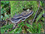 Fungus & Moss |
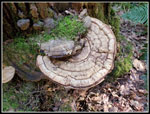 More Fungus |
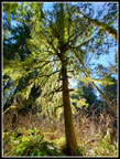 Backlighting |
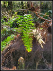 Bright Fern |
 Long Shadow |
 Trail In Trench |
 More Mossy Logs |
 Nearing The Car |
Trips - 2022
Home