Day 4
We
awoke for the final day of our trip
to find more clear skies. We were up at 6:30 am but it was 8:02 before
we were on our way. On my two previous loop trips we climbed White
Mountain on the morning of the last day. This time we were not as
motivated. The first time we were 20 years younger. The last
time
we were 11 years younger. We had great views the day before and we
still had over nine miles of downhill with a lot of elevation to go. On
the other hand, we were open to doing something a different. The day
before we sat at White Pass before heading back to camp. There was a
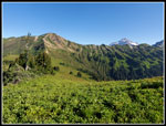
point above the PCT to the south. That looked interesting. I was not
feeling that good at the start but opted to join in. We followed the
PCT a short way and turned off on another unsigned trail. Here we
dropped our backs and continued on. The route followed the crest. We
saw another possible campsite below. It still had some snow left but
will be a dry camp in a few weeks. The path ended and we continued to
follow the crest as it turned left. We dropped won almost to the PCT
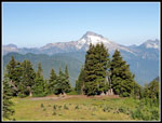
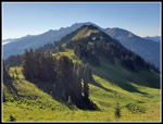
before starting the final climb to the summit. There was an animal path
we followed. It weaved around trees rising on a grassy slope. We topped
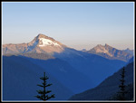
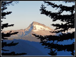
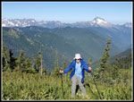
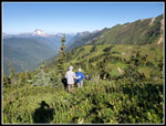
out on the summit with pretty good views. We could see Sloan Peak and
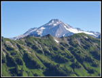
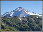
the Monte Cristo Peaks to the west. Glacier Peak was clearly visible to
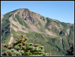
the north. Three Fingers stood out in the distance. Indian Head Peak
was close by. To the south were Mt. Stuart, The Cradle, Mt. Dainiel,
Mt. Hinman, Overcoat and the crest peaks north of Snoqualmie Pass, and
Mt. Rainier. Only Gary had a real optical zoom camera but
John
and I did the best we could with our phone cameras.
Our stay on top was short but enjoyable. On the way down we took the PCT when we neared it. We were back to our packs and started down at 9:17 am. First we had to ascend to the high point below White Mountain and then it was nearly all downhill. A lot of downhill. We could see a big group ahead of us. We hoped they would continue on the PCT. Nope, they headed down the NF Sauk Trail. In earlier years we likely would have caught up and passed them. Not this time. Once they were out of sight we never saw them again. That was fine with us. We had all day to do another nine or so miles. The trail makes a long traverse downstream. We periodically saw a few hikers coming up. I did not expect to see many people early on a Tuesday morning. In forest the trail was good. In the open it was a bit dusty. We finally left big enough gaps between us to let the dust settle before the next person reached it. That worked pretty well. The views began to disappear as we dropped below the ridges. There were still some wildflowers in the open areas but not many.
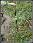
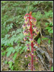
The descending finally moderated as we reached river level at the spot of the old Mackinaw Shelter. Now the trail just goes up and then down again and again. The way is mostly in forest though there are some open brushy sections. Normally they are brushy. Those spots have been recently brushed out. It was much brushier on my two previous visits. The forest is impressive. There are lots of big trees and and some very big trees. It was getting a lot hotter but the forest kept it much cooler. The forest is the star of this part of the loop trip. Soon we began to see saprophytes. Pinedrop was predominant. We only saw a few coralroot and they were nearly finished. One pinedrop was huge. It was nearly as tall as our hiking poles or in my case hiking pole.
We took one last long break at Red Creek. We had lunch at just after noon. It was a good spot to pump water too. The last four miles started off at a slow pace. We took one last short break at the junction with the Pilot Ridge Trail. We had completed the loop. On the last just short of two mile section Gary took off. I had to speed up as much as possible to keep up. I only took a couple photos as I just wanted to keep up. Other than a few rocky spots and one uphill, the pace continued. Twenty minute miles with full backpacks at the end of a four day trip is not what I was expecting. I was glad to see the parking lot. We arrived at the lot at 2:20 pm. My car was actually in the shade which was unexpected. The lot was perhaps two thirds full. Much better than Saturday morning. The drive down the NF Sauk Road was worse then coming in. Sun and shadows made it hard to see all the pot holes. It is 6.8 miles to the Mountain Loop Highway and I averaged 9 mph. I even caught and passed a Subaru. The MLH was bad but much better than the NF Sauk Road. We made it back to North Seattle at rush hour without any major slowdowns.
After no backpacking trips last year and only two overnighters the year before, I was really ready for a longer trip. I had two backpacking trips in July. That represents twice as many nights out as the past two years combined. This was one of those great trips. A lot of work to get up to the high country then days at near or above 6000'. The PCT from Dishpan Gap to Red Pass is real high country roaming in the Washington Cascades. The Foam Basin-Red Pass Loop proved great scenery, rocks and ice, marmots, and a cross country section. This is why I love to go backpacking. It is only the start of August. I hope to add more backpacking trips this year.
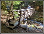 Red Creek Bridge |
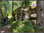 Big Rock |
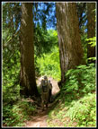 Tall Twins |
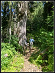
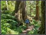 Gary & Big Tree |
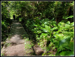 Skunk Cabbage Leaves |
<< Day 3
Pilot Ridge - NF Sauk Loop Report
Trips - 2023
Home
