06-17-23
John
was free for a hike on
Saturday. The weather west of the crest looked to be mostly rain and
cool.
East of the crest in the Teanaway area it looked to be cool and dry
with high afternoon winds. What to do? We decided to try to get in one
of my favorite scrambles. I have done Three Brothers many times but not
since 2012. There area several ways to do it. I have approached via
four routes. All of them started at the Stafford Creek Trailhead. My
original route was up to Navaho Pass then follow the County Line Trail
to the saddle below Three Brothers. It was a trailless scramble up from
there. That route is 17 miles round trip. On the 2012 trip Gary
Westerlund and I took the Stafford Trail to the creek crossing to the
left of Little Navaho Peak then scrambled up to the saddle. We went up
the ridge towards Navaho to the County Line Trail. We dropped down to
the pass and climbed Three Brothers. Our route back sent us up Navaho
Peak and a descent to Navaho Pass and out. That was 15 miles with 6000'
of gain.
For this trip we hoped to take the route Gary and I took up Three Brothers and return the same way. If the 22 mph wind gusts came in early we would change to Navaho Peak. Either way, we needed an early start. We met at Eastgate at 6:30 am and headed east. The Teanaway Road was in good condition and the Stafford Road was in very good condition. We did 30 mph vs 10 mph when the potholes are deep and numerous. The embedded rocks on the Stafford Road are gone. It is now a smooth drive. We arrived at the Stafford Trailhead at 8:03 am. The parking lot was full. We were the second vehicle to park before the bridge. We were packed and on our way at 8:07. With the temperature in the upper 40s we hiked with long sleeves and long pants all day. The expected 40% overcast was zero percent. We had clouds and some rain for much of the drive. The blue sky was appreciated.
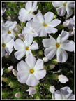
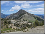
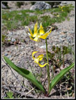
The Stafford Creek Trail is moderately graded. The creek is sometimes in sight and often heard. We set a good pace but the better than expected wildflower display kept giving us reasons to stop to take photos. A short way up the trail two backpackers passed us on their way back. More backpackers passed us coming down. It seemed pretty early to be well down the trail. After a couple miles Little Navaho Peak came into view. Climbers now call it Freedom Peak. Our route would take us up the left side of the peak to a high saddle between Little Navaho and Navaho Peak. We saw blooming tiger lilies, roses, yarrow, yellow Indian paintbrush, red paintbrush, and orange paintbrush. Additionally, we saw larkspur, thimbleberry, columbine, starflower, lupine, arnica, phlox, shooting stars and scarlet gilia. The gilia is one of my favorites and I had not seen it yet this year.
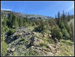
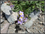
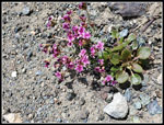
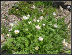
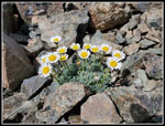
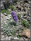
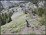
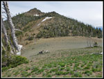
We reached the creek at about 3.45 miles. We stopped for a food and water break. The route was about to get a lot steeper. We left the trail and headed uphill. Now we saw more wildflowers. Columbia Lewisia was the first. There was a lot of it in full bloom. The wind was picking up a bit and the long thin stems made it hard to get a photo that was not blurry. We also saw buckwheat and many very small flowers. Higher up blooming Douglasia was seen. Nearing the saddle I took photos of what I thought was more Douglasia. Checking at home, I found that it was Wenatchee spring beauty. We were both a little beat when we reached the saddle. We climbed 1230' in .67 miles. We had gained 1716' in the first 3.45 miles. There was still a little snow on the east edge of the saddle. We had a great view across to the west peak of Three Brothers Mountain.
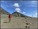
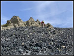
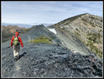
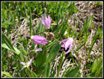
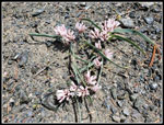
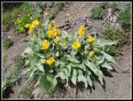
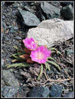
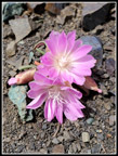
All to soon, we headed up the very steep ridge that leads north to Navaho Peak. We saw a little arrowleaf balsamroot that was still blooming and some red Indian paintbrush. I had some hope that the dark black rock slope above would have bitterroot in bloom. We reached the bottom of the black scree like rock and suddenly we could see many small bright pink bitterroot in bloom. The wind had picked up to the point that I put on a windshirt before the saddle so the hood would keep my ball cap from blowing away. The bitterroot are so small and low to the ground that the wind did not blow them around. We took many photos. This was a really good display. On my 2016 trip here, I saw pink and white bitterroot. I have not seen the white variety since. The pink ones were spectacular, however.
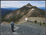
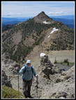
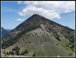
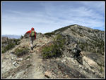
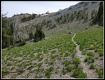
After many photos, we continued up the slope. Below we could see three hikers reaching the saddle. At the top are a few steep loose spots where care is needed. Going down is more of a problem. Once atop the ridge we had a mostly level hike with the ridge dropping off fast on both sides. Navaho Peak was in front of us. Earl Peak was to our left. Three Brothers and part of the Stuart Range was to our right. There was some snow on the east side near the top but not on our route. We reached the junction with the County Line Trail and headed right and down the trail. The trail went by snow but there was none left on the trail. We quickly dropped down into the basin. I was looking for a wet meadow with lots of shooting stars. We found it and the blooming shooting stars. The three hikers seen earlier passed us along here. We next dropped to the pass where the Etienne and Falls Creek trails meet. Two more hikers were returning after climbing up Three Brothers. It was 12:08 when we reached the pass.
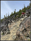
Now we just had .80 miles with 1225' of gain to the summit. Some clouds were now coming in and a bit of shade was appreciated. The route starts up an open slope covered with blooming balsamroot, buckwheat, penstemon, lupine, onions, and more. In past years I have seen scarlet gilia and Indian paintbrush but not this time. We may have been a little early for those flowers. The fun of this scramble is that lots of ways work. Too far right or left and there are some cliffs and some steep open rocky slopes. Stay near the ridge and you get loose rock, good rock, and small trees to get around. In past years I seldom came down exactly where I went up. Many Teanaway summits did not have trails 30 years ago. Now many have very obvious boot paths to the top. Three Brothers does have tracks but there is not a completely obvious route all the way up.
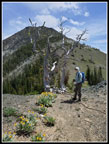
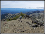
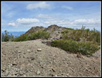
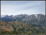
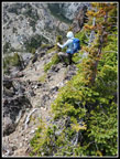
We did stay on some tracks most of the way up. I do multiple 4000' gain trips each year but it had been almost four years since my last 5000' gain day trip. Add in the multiple very steep sections and this was a tough trip. Both John and I had to slow down on the last climb to the summit. We kept going but it was challenging. As we ascended, views improved. We could see the whole ridge across from us, from Miller Peak to Little Navaho to Navaho Peak. Earl Peak rose over that ridge. Little Annapurna came into view in the Stuart Range. Higher up even Three Queens near Snoqualmie Pass came into view. A group of runners went by lower on the ridge. They passed as again near the top. After they went by, the three hikers who passed us earlier passed again on their way down. Now there was nobody ahead of us. I recalled a false summit but not four of them. At last we reached the top at 1:26 pm. We went back to the previous high point and decided it was a few feet higher. It was 1:28 when we sat down for a summit stay.
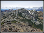
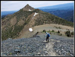
High clouds continued coming in but it was still partly sunny. We had great views of Teanaway peaks along with Fortune, the Ingalls Peaks, and Stuart and the Stuart Range. I was in no hurry to start down but we had a long way to go back. At 1:52 pm we headed down. The loose sand and rock slopes were more of a pain to descend. The effort was much less. We made better time going down. We managed to follow our up track much of the way. The lighting was much different in the lower wildflower fields and we did stop for more photos. We reached the saddle at 2:49 pm. We now had a 540' climb to get back up on the ridge of Navaho Peak.We went back through the shooting star meadow and saw many western anemone in bloom. The last climb up to the ridge top gets steeper as you rise. We were pleased to reach the top. Almost all the elevation gain was finished. We passed one last hiker going up Three Brothers on our way down. That was it until we reached the Stafford Creek Trail. We headed along the ridge then scrambled down to the top of the black scree slope. There were still bitterroot in bloom but some had already closed up for the day. The flowers open and close each day. One more break at the pass and down we went. Tired legs were not thrilled with losing 1230' in .67 miles.
We pumped water at the creek on the Stafford Trail. It was much sunnier and warmer than forecast. The last 3.5 miles seemed to drag on though our pace picked up. We passed several groups heading down on our descent. We reached the car at 6:13 pm. The sky was now mostly white. For the day we hiked about 12.5 miles with 5300' of elevation gain. It was quite a workout. The drive home was full speed. No slowdowns. That is the advantage of a Saturday trip across the mountains vs. a Sunday trip.
This was the eighth time I tried to hike up Three Brothers and the seventh time I succeeded. On one trip I cramped up part way up the final slope of Three Brothers. It is a long day and a lot of very steep slopes. There is very little exposure on this route and even less if you take the longer route on the County Line Trail from Navaho Pass. The wildflower show was much better than I was expecting. We saw dozens of different wildflowers in bloom. Some of them I do not see all that often. It did get windy but we never had the 20 mph+ gusts forecast. We had a lot more sunshine than expected. The days of doing this trip and not seeing anyone off the Stafford Creek Trail are over. We did see see ten hikers and runners on that section. That is still far from crowded. I was a lot slower than my trips up in my 20s and 30s but I still made it up and back with time to drive home before dark.
Click on thumbnails to get
larger pictures.
Trips - 2023
Home
For this trip we hoped to take the route Gary and I took up Three Brothers and return the same way. If the 22 mph wind gusts came in early we would change to Navaho Peak. Either way, we needed an early start. We met at Eastgate at 6:30 am and headed east. The Teanaway Road was in good condition and the Stafford Road was in very good condition. We did 30 mph vs 10 mph when the potholes are deep and numerous. The embedded rocks on the Stafford Road are gone. It is now a smooth drive. We arrived at the Stafford Trailhead at 8:03 am. The parking lot was full. We were the second vehicle to park before the bridge. We were packed and on our way at 8:07. With the temperature in the upper 40s we hiked with long sleeves and long pants all day. The expected 40% overcast was zero percent. We had clouds and some rain for much of the drive. The blue sky was appreciated.
The Stafford Creek Trail is moderately graded. The creek is sometimes in sight and often heard. We set a good pace but the better than expected wildflower display kept giving us reasons to stop to take photos. A short way up the trail two backpackers passed us on their way back. More backpackers passed us coming down. It seemed pretty early to be well down the trail. After a couple miles Little Navaho Peak came into view. Climbers now call it Freedom Peak. Our route would take us up the left side of the peak to a high saddle between Little Navaho and Navaho Peak. We saw blooming tiger lilies, roses, yarrow, yellow Indian paintbrush, red paintbrush, and orange paintbrush. Additionally, we saw larkspur, thimbleberry, columbine, starflower, lupine, arnica, phlox, shooting stars and scarlet gilia. The gilia is one of my favorites and I had not seen it yet this year.
We reached the creek at about 3.45 miles. We stopped for a food and water break. The route was about to get a lot steeper. We left the trail and headed uphill. Now we saw more wildflowers. Columbia Lewisia was the first. There was a lot of it in full bloom. The wind was picking up a bit and the long thin stems made it hard to get a photo that was not blurry. We also saw buckwheat and many very small flowers. Higher up blooming Douglasia was seen. Nearing the saddle I took photos of what I thought was more Douglasia. Checking at home, I found that it was Wenatchee spring beauty. We were both a little beat when we reached the saddle. We climbed 1230' in .67 miles. We had gained 1716' in the first 3.45 miles. There was still a little snow on the east edge of the saddle. We had a great view across to the west peak of Three Brothers Mountain.
All to soon, we headed up the very steep ridge that leads north to Navaho Peak. We saw a little arrowleaf balsamroot that was still blooming and some red Indian paintbrush. I had some hope that the dark black rock slope above would have bitterroot in bloom. We reached the bottom of the black scree like rock and suddenly we could see many small bright pink bitterroot in bloom. The wind had picked up to the point that I put on a windshirt before the saddle so the hood would keep my ball cap from blowing away. The bitterroot are so small and low to the ground that the wind did not blow them around. We took many photos. This was a really good display. On my 2016 trip here, I saw pink and white bitterroot. I have not seen the white variety since. The pink ones were spectacular, however.
After many photos, we continued up the slope. Below we could see three hikers reaching the saddle. At the top are a few steep loose spots where care is needed. Going down is more of a problem. Once atop the ridge we had a mostly level hike with the ridge dropping off fast on both sides. Navaho Peak was in front of us. Earl Peak was to our left. Three Brothers and part of the Stuart Range was to our right. There was some snow on the east side near the top but not on our route. We reached the junction with the County Line Trail and headed right and down the trail. The trail went by snow but there was none left on the trail. We quickly dropped down into the basin. I was looking for a wet meadow with lots of shooting stars. We found it and the blooming shooting stars. The three hikers seen earlier passed us along here. We next dropped to the pass where the Etienne and Falls Creek trails meet. Two more hikers were returning after climbing up Three Brothers. It was 12:08 when we reached the pass.
Now we just had .80 miles with 1225' of gain to the summit. Some clouds were now coming in and a bit of shade was appreciated. The route starts up an open slope covered with blooming balsamroot, buckwheat, penstemon, lupine, onions, and more. In past years I have seen scarlet gilia and Indian paintbrush but not this time. We may have been a little early for those flowers. The fun of this scramble is that lots of ways work. Too far right or left and there are some cliffs and some steep open rocky slopes. Stay near the ridge and you get loose rock, good rock, and small trees to get around. In past years I seldom came down exactly where I went up. Many Teanaway summits did not have trails 30 years ago. Now many have very obvious boot paths to the top. Three Brothers does have tracks but there is not a completely obvious route all the way up.
We did stay on some tracks most of the way up. I do multiple 4000' gain trips each year but it had been almost four years since my last 5000' gain day trip. Add in the multiple very steep sections and this was a tough trip. Both John and I had to slow down on the last climb to the summit. We kept going but it was challenging. As we ascended, views improved. We could see the whole ridge across from us, from Miller Peak to Little Navaho to Navaho Peak. Earl Peak rose over that ridge. Little Annapurna came into view in the Stuart Range. Higher up even Three Queens near Snoqualmie Pass came into view. A group of runners went by lower on the ridge. They passed as again near the top. After they went by, the three hikers who passed us earlier passed again on their way down. Now there was nobody ahead of us. I recalled a false summit but not four of them. At last we reached the top at 1:26 pm. We went back to the previous high point and decided it was a few feet higher. It was 1:28 when we sat down for a summit stay.
High clouds continued coming in but it was still partly sunny. We had great views of Teanaway peaks along with Fortune, the Ingalls Peaks, and Stuart and the Stuart Range. I was in no hurry to start down but we had a long way to go back. At 1:52 pm we headed down. The loose sand and rock slopes were more of a pain to descend. The effort was much less. We made better time going down. We managed to follow our up track much of the way. The lighting was much different in the lower wildflower fields and we did stop for more photos. We reached the saddle at 2:49 pm. We now had a 540' climb to get back up on the ridge of Navaho Peak.We went back through the shooting star meadow and saw many western anemone in bloom. The last climb up to the ridge top gets steeper as you rise. We were pleased to reach the top. Almost all the elevation gain was finished. We passed one last hiker going up Three Brothers on our way down. That was it until we reached the Stafford Creek Trail. We headed along the ridge then scrambled down to the top of the black scree slope. There were still bitterroot in bloom but some had already closed up for the day. The flowers open and close each day. One more break at the pass and down we went. Tired legs were not thrilled with losing 1230' in .67 miles.
We pumped water at the creek on the Stafford Trail. It was much sunnier and warmer than forecast. The last 3.5 miles seemed to drag on though our pace picked up. We passed several groups heading down on our descent. We reached the car at 6:13 pm. The sky was now mostly white. For the day we hiked about 12.5 miles with 5300' of elevation gain. It was quite a workout. The drive home was full speed. No slowdowns. That is the advantage of a Saturday trip across the mountains vs. a Sunday trip.
This was the eighth time I tried to hike up Three Brothers and the seventh time I succeeded. On one trip I cramped up part way up the final slope of Three Brothers. It is a long day and a lot of very steep slopes. There is very little exposure on this route and even less if you take the longer route on the County Line Trail from Navaho Pass. The wildflower show was much better than I was expecting. We saw dozens of different wildflowers in bloom. Some of them I do not see all that often. It did get windy but we never had the 20 mph+ gusts forecast. We had a lot more sunshine than expected. The days of doing this trip and not seeing anyone off the Stafford Creek Trail are over. We did see see ten hikers and runners on that section. That is still far from crowded. I was a lot slower than my trips up in my 20s and 30s but I still made it up and back with time to drive home before dark.
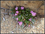 Wenatchee Sp[ring Beauty |
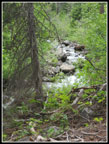 Stafford Creek |
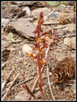 Coralroot |
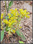 Stonecrop |
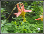 Another Columbine |
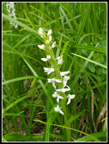 Bog Orchid |
Trips - 2023
Home


