09-15-24
Gary
and John were free for a hike. It looked to be mostly dry and cool in
the Teanaway Valley so we decided on the long drive east. It was the
first day of the High Hunt for deer in the Alpine Lakes Wilderness.
Just a small part of our route might be in the wilderness. I saw might
because we did not settle on a destination before the trip.
We were leaning towards a long 12 mile 4200' gain loop over
Navaho Peak. We settled on one of my other favorites, a loop over Bean
Peak. We met in Issaquah at 6:30 am and headed east. Though there was
no rain forecast for the Seattle area I had my wipers on for much of
the drive. That was not a good omen. Gary was driving this day. It was
mostly dry as we headed over Snoqualmie Pass and on to Cle Elum. It was
clearing to the north over the Teanaway area. At the end of pavement on
the NF Teanaway Road we were pleasantly surprised to find it recently
graded. There were no pot holes and almost no washboarding. It was full
speed ahead. Now we just had the really bad Beverly Creek Road to drive
up. More than a decade ago, the mostly good road had drain ditches cut
across it in several places. These were not places where there had been
water damage. I have been bitching about it ever since. In recent years
I have had to come to a complete stop to wade through the deep ditches
with my four wheel drive SUV. They are all gone. The road was graded
and all the ditches were filled in. A Corvette could drive the road
now. I am very pleased by this unexpected event. We easily drove the
road at three times the previous speed. We arrived at the trailhead at
about 8:06 am. The lot was nearly full. That was a surprise.
We packed up and were on our way at 8:13 am. I did not know the route ahead of time and it did rain over hear the past few days. I brought a larger pack with more clothes than usual for a summer day hike. It was a cool 41F when we started. That is the coldest hike I we had been on in many months. I usually do the trip clockwise, reaching the top of Bean Peak at about the 5 mile mark. Since the weather was supposed to deteriorate in the early afternoon, we decided to do it counterclockwise and reach the summit earlier. Hopefully, we would still have some good views before the clouds arrived in force. This did mean gaining the elevation in a much shorter distance. That would be easier on our knees coming down.
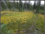
We quickly reached Bean Creek to find the expected late summer moderate flow. This is the start and finish or our loop. We headed right alongside the creek. This section can be very overgrown by late summer. This year it is not. It had been brushed out and even if the brush was wet it would not have been a problem. We reached the next crossing to find it an easy rock hop. Now it as time to ascend into lower Bean Creek Basin. In spring this is a wildflower extravaganza. In fall there is some leaf color. In late summer there is neither. We hiked into the upper basin. Bean Peak was now is sight at the end of the basin. To our right was Earl Peak. Gary and I hiked up Earl earlier in the year. That was my only trip up the NF Teanaway all year. The sky was mostly white over Bean Peak but there was still some blue in other directions.
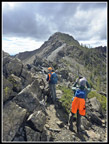
There were tents in the campsites though I did not see them. The others did. We headed up the basin. The trail moves over to the side of the big meadow and then begins to climb steeply. Years ago, the boot path went up a short way then petered out. I would go left and come up from below the summit. Now the path is more of a trail all the way up to the ridge top right of Bean Peak. On my last trip up the peak from the basin side Gary and I took it. I still much prefer my cross country route. We headed left and uphill at a much gentler grade. No two routes are ever the same. This time I avoided all the loose rocks. We cam up right under the summit and scrambled up the last part. We arrived on the 6743' summit at 10:41 am.
Mt. Rainier was largely in clouds. The summit was just above the white. The tops of the Stuart Range were mostly in the clouds too. All the Teanaway Peaks were in the clear. Some Cascade Crest peaks were clear and some in the clouds. Overall, the views were really pretty good. Some sun shone through the clouds above and it was much warmer. The weather was slowly deteriorating but it was still good enough that we did not want to leave too soon. Two scramblers reached the summit. They stayed a short time and then headed down the ridge to Mary Peak. They made great time as we watched. Another group arrived just as we were planning to leave. It was 11:42 am when we started down the north side. We spent one hour on top. That was time well spent. The north side is much easier than the south side. We were able to stay on the ridge top much of the way. I needed to put on a windshirt as it was a cold wind. We reached the saddle between Bean and Volcanic Neck at 12:12 pm. On the summit we saw some hikers go over the saddle and down into Hardscrabble Basin. That trail has been abandoned for many years. I still have not been down there.
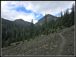
We did not stay long at the saddle. Switchbacks took us down to the flat area below. Gary and John had camped there a few years back. Last year Gary and I camped there too. I went out to Devil's Head Peak for the first time on that trip. We saw a few gentians near the campsite. We were to seem more on the trip down but none were in full bloom yet. We saw a backpacking family who headed down ahead of us. The trail down starts out very rocky. We had several rocky sections on the way back. The trail over to Fourth Creek Pass is a favorite of mine. Great wildflowers in early summer. High on the ridge above from Bean to Mary Peaks there are larch trees. I checked and none are yet beginning to turn golden. As we descended the Stuart Range dropped out of sight. This part was in the wilderness and we had on orange hats just in case any hunters were there. We saw none and heard no shots all day long. Be the time we reached Fourth Creek Pass the sky was getting darker. We passed one group doing our loop in the opposite direction. They were unlikely to have the views we did from the top of Bean Peak.
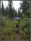
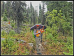
Part way down the Beverly Creek Trail we felt the first raindrops. There were just a few at first then they picked up. We were still in the open valley when we stopped to take out our umbrellas. At first it was mostly hail with a little rain. Hale in September? Yes indeed. We stopped under a tree when the rain became very hard. The 20% chance of rain was all over our heads. I hoped getting into the forest would block most of the rain. After some food and water we headed down. Nearing the forest the trail had big puddles in it. Big puddles after less than half an hour of rain? We were less than two miles from the car and the rain really did not matter. In the forest it was still raining hard. Maybe it was a little drier.
We crossed Bean Creek and had just under a mile to go. The rain began to let up. We reached the car at 3:01 pm. The rain had almost stopped. The lot was still mostly full. That was a real surprise.
This turned out to be a great hike. We had good weather most of the day. The rain was not so bad under umbrellas. There was very little wind except on the summit and north ridge. Views were not cloud free but the clouds added a moody feeling on the near and distant mountains. We saw seven or eight groups over the course of our 6:48 hike. We had a lot of solitude. It was John's first time up Bean Peak from the Bean Creek side. It is a trip I do at least every other year and it is a real favorite. I'm sure I will be back soon. Summer is very warm in the Teanaway but September and October can be great before the snow falls.
Trips - 2024
Home


