07-27-25
Gary
and John were both free for a Sunday hike. I did 7 miles with 2400' of
gain on Tiger on Saturday. Gary had more than 3000' of gain planned for
Tuesday. We wanted a fun trip to views without being too long or hard.
Time for my old favorite trip to Iron Peak. This would be my 50th time
on top since my first visit in 1988. Gary and I met John at Sunset Way
at 6:55 am and John drove us east. We sailed up the NF Teanaway Road to
Beverly Creek and then up to the trailhead. More than a dozen years ago
the forest service decided to cut deep drain channels across the road
in two places. There was no water damage in either place in previous
years. The result was deeper and deeper depressions. It became
difficult to get a small car up the road. On this trip I immediately
noticed that they had been filled in and graded. They are almost
unnoticeable now. That is a very nice change. We arrived to find the
small lot about two-thirds full. When we turned onto the Teanaway Road
it was 63 degrees. It was not 46F. It was cool but not to cold. Much
better than usual July heat in the Teanaway. We packed up and were on
our way at 8:29 am.
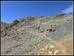
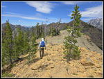
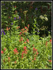
There were a few ripe thimbleberries in the lot and a few flowers on the first old road section. The flowers were past prime. Bean Creek is usually pretty easy to rock hop by late July and that proved to be the case. The trail is steep climbing away from Bean Creek. We reached the boulder field and Gary noticed ripe huckleberries. This trail has always had huckleberry bushes. It has never had ripe huckleberries. At least not more than a few. To my shock they continued. Lots and lots of ripe huckleberries. We ate those right alongside the trail. But left a whole lot more just beyond the trail. Our pace did slow down a little. The forest section up into Beverly Basin is a real plus when coming down on a hot summer day. The trail leaves the forest and heads over to Beverly Creek. This is the start of a really nice section of wildflowers. We were late and most were finished but some scarlet gilia and others were still hanging on. The trail switchbacks above the creek and heads up the valley.
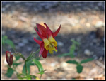
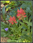
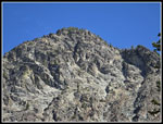
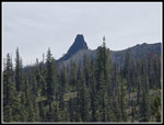
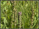
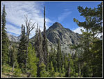
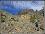
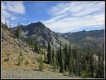
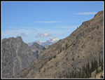
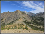
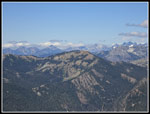
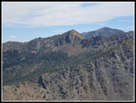
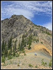
Bill Peak is the first to come into view. Teanaway Peak is next with a view up to the summit ridge of Iron Peak. The sky was mostly blue with a few wispy clouds blowing by. After a section out in the open we went back into thinner forest. We took a short break at the Fourth Creek Trail junction. It was 9:55 am and we had covered 2.66 miles. With all the cars in the lot we expected to find at least one group camping in Beverly Basin. There were none. The short distance over to the crossing of Beverly Creek can be filled with wildflowers in season. Though there were few lower down there were a lot at this spot. The big meadow had a lot of blooming monkshood as well as Indian paintbrush, harebells, columbine, thistles, bistort, and more. The creek is usually nearly dry by mid summer but it was still running well. Now it was time to climb out of the valley and up to the saddle between Iron and Teanaway Peaks. Along the way we passed more wildflowers. One wet meadow had the last few flowering elephant head lousewort and a big patch of bright red Indian paintbrush. This spot was wetter than normal for this time of year.
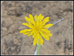
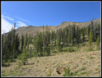
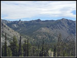
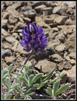
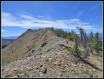
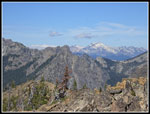
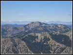
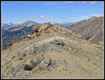
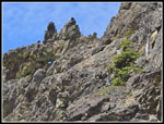
Our route brought us out in the open. We had trees to our left and nothing grows to the right. We could see a group on the ridge top. They were the first people we had seen all morning. Final switchbacks took us up to the saddle. The bright orange rock at the saddle is unique. We headed a short way up the ridge and met the group of three we had seen from below. They came up the Eldorado Creek trail and were heading back down. We had a short conversation. After they left I needed some food. Breakfast at 5:30 am was a long time before. The last half mile or so the the summit is fine ridge walking. There is one longer steep section and some easier walking. There are unique plants that grow in the serpentine soil atop the Iron Peak Ridge. We saw the lupine that is only a few inches high. Other flowers I cannot identify. Gary headed for the summit as John and I were getting down and up taking photos. We had views to Devil's Head, Volcanic Neck, Bean, and Mary Peaks on the way up. Once on the ridge we had the views to the west including Cascade Crest peaks and more from the Teanaway. As we climbed the ridge Mt. Daniel and Hinman came into view. We reached the summit at 11:28 am. We had hiked just over 4.5 miles with about 2900' of elevation gain.
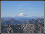
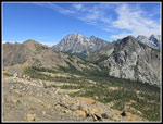
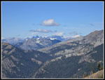
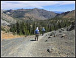
There were no other people on Iron Peak. It remained that way. They views are really outstanding from the volcanoes Mt. Adams and Mt. Rainier to a view of a lot of Cascade Crest peaks. Navaho and Earl plus Fortune, South Ingalls, and Ingalls are Teanaway Peaks over 7000'. At 6510' the view from Iron is only blocked to the north by Mt. Stuart. We were in no hurry so we enjoyed the sunshine and cool breeze as we relaxed on the summit. We finally packed up and headed down at 12:47 pm. We had 1:19 on the summit. Gary took off first with John and I close behind. More photos slowed us down a little. We reached the saddle and 1:18 pm. The trip down was much easier as the trail is moderately graded. We took one break at the Fourth Creek junction and were soon on our way. So far we had just seen three other people. It was getting toasty in the open and I was glad to go back into forest. That also brought us back to huckleberry bushes. Our pace was slow and the berries were ripe. We did meet one guy and then a couple of hikers in the last mile+. We reached the trailhead at 3:40 pm.
This turned out to be a great hike. Though we covered just over 9 miles with almost 3000' of gain the cool forest and mostly moderate grade made for easy hiking. Even in the sunshine we had some breeze much of the time. The berries were extremely unexpected. Beverly Creek has never had a great huckleberry crop on any trip I have taken there. The wildflower show was better than expected higher up. The near total solitude was really unexpected. Coming up the Eldorado Creek Trail is much shorter and easier than our route. I normally see multiple groups on or near the summit in the summer. Not this time. We stopped in Cle Elum for milkshakes and then had an easy drive home. All lanes were slow before Highway 18. The divergent diamond interchange just opened but it is still just one lane down to Deep Creek and traffic backup onto and well down the highway. That was a minor hiccup on an unusually cool July day in the NF Teanaway Valley.
Click on thumbnails to get
larger pictures.
Trips - 2025
Home
There were a few ripe thimbleberries in the lot and a few flowers on the first old road section. The flowers were past prime. Bean Creek is usually pretty easy to rock hop by late July and that proved to be the case. The trail is steep climbing away from Bean Creek. We reached the boulder field and Gary noticed ripe huckleberries. This trail has always had huckleberry bushes. It has never had ripe huckleberries. At least not more than a few. To my shock they continued. Lots and lots of ripe huckleberries. We ate those right alongside the trail. But left a whole lot more just beyond the trail. Our pace did slow down a little. The forest section up into Beverly Basin is a real plus when coming down on a hot summer day. The trail leaves the forest and heads over to Beverly Creek. This is the start of a really nice section of wildflowers. We were late and most were finished but some scarlet gilia and others were still hanging on. The trail switchbacks above the creek and heads up the valley.
Bill Peak is the first to come into view. Teanaway Peak is next with a view up to the summit ridge of Iron Peak. The sky was mostly blue with a few wispy clouds blowing by. After a section out in the open we went back into thinner forest. We took a short break at the Fourth Creek Trail junction. It was 9:55 am and we had covered 2.66 miles. With all the cars in the lot we expected to find at least one group camping in Beverly Basin. There were none. The short distance over to the crossing of Beverly Creek can be filled with wildflowers in season. Though there were few lower down there were a lot at this spot. The big meadow had a lot of blooming monkshood as well as Indian paintbrush, harebells, columbine, thistles, bistort, and more. The creek is usually nearly dry by mid summer but it was still running well. Now it was time to climb out of the valley and up to the saddle between Iron and Teanaway Peaks. Along the way we passed more wildflowers. One wet meadow had the last few flowering elephant head lousewort and a big patch of bright red Indian paintbrush. This spot was wetter than normal for this time of year.
Our route brought us out in the open. We had trees to our left and nothing grows to the right. We could see a group on the ridge top. They were the first people we had seen all morning. Final switchbacks took us up to the saddle. The bright orange rock at the saddle is unique. We headed a short way up the ridge and met the group of three we had seen from below. They came up the Eldorado Creek trail and were heading back down. We had a short conversation. After they left I needed some food. Breakfast at 5:30 am was a long time before. The last half mile or so the the summit is fine ridge walking. There is one longer steep section and some easier walking. There are unique plants that grow in the serpentine soil atop the Iron Peak Ridge. We saw the lupine that is only a few inches high. Other flowers I cannot identify. Gary headed for the summit as John and I were getting down and up taking photos. We had views to Devil's Head, Volcanic Neck, Bean, and Mary Peaks on the way up. Once on the ridge we had the views to the west including Cascade Crest peaks and more from the Teanaway. As we climbed the ridge Mt. Daniel and Hinman came into view. We reached the summit at 11:28 am. We had hiked just over 4.5 miles with about 2900' of elevation gain.
There were no other people on Iron Peak. It remained that way. They views are really outstanding from the volcanoes Mt. Adams and Mt. Rainier to a view of a lot of Cascade Crest peaks. Navaho and Earl plus Fortune, South Ingalls, and Ingalls are Teanaway Peaks over 7000'. At 6510' the view from Iron is only blocked to the north by Mt. Stuart. We were in no hurry so we enjoyed the sunshine and cool breeze as we relaxed on the summit. We finally packed up and headed down at 12:47 pm. We had 1:19 on the summit. Gary took off first with John and I close behind. More photos slowed us down a little. We reached the saddle and 1:18 pm. The trip down was much easier as the trail is moderately graded. We took one break at the Fourth Creek junction and were soon on our way. So far we had just seen three other people. It was getting toasty in the open and I was glad to go back into forest. That also brought us back to huckleberry bushes. Our pace was slow and the berries were ripe. We did meet one guy and then a couple of hikers in the last mile+. We reached the trailhead at 3:40 pm.
This turned out to be a great hike. Though we covered just over 9 miles with almost 3000' of gain the cool forest and mostly moderate grade made for easy hiking. Even in the sunshine we had some breeze much of the time. The berries were extremely unexpected. Beverly Creek has never had a great huckleberry crop on any trip I have taken there. The wildflower show was better than expected higher up. The near total solitude was really unexpected. Coming up the Eldorado Creek Trail is much shorter and easier than our route. I normally see multiple groups on or near the summit in the summer. Not this time. We stopped in Cle Elum for milkshakes and then had an easy drive home. All lanes were slow before Highway 18. The divergent diamond interchange just opened but it is still just one lane down to Deep Creek and traffic backup onto and well down the highway. That was a minor hiccup on an unusually cool July day in the NF Teanaway Valley.
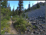 Berries & Boulders |
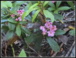 Pipsissewa |
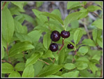 Ripe Berries! |
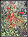 Scarlet Gilia |
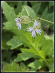
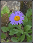
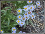 Asters |
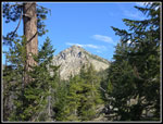 Bill Peak First View |
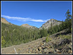 Beverly Basin Peaks |
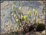
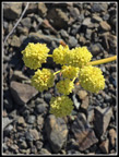 Yellow Flower |
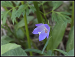 Harebell |
 Columbine |
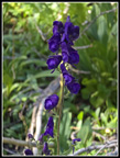 Monkshood |
 Paintbrush & Harebell |
 Steep Bill Peak |
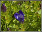 Gentians |
 Volcanic Neck |
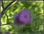 Thistle |
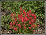 Dense Paintbrush Patch |
 Salsify? |
 Elephant Head |
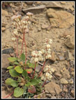
 White Flower |
 Lone Aster |
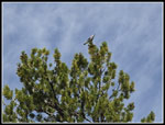 Clark's Nutcracker |
 Bill Peak Again |
 Iron Peak Ridge |
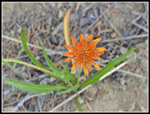 Agoseris |
 Yellow/Creme Paintbrush |
 Saddle Is In Sight |
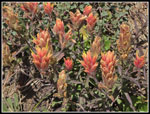 Orange/Creme Paintbrush |
 Last Switchbacks |
 View East |
 V Neck, Bean, & Mary |
 Mt. Rainier |
 Mt. Daniel |
 Tiny Lupine |
 White Flower |
 Mt. Stuart |
 On Iron Ridge |
 Mt. Stuart Framed |
 View West |
 Mts. Hinman & Daniel |
 DeRoux Peak |
 Jolly Mountain |
 Bean & Navaho Peaks |
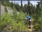
 Heading Down |
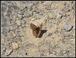 Butterfly |
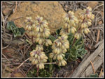 Unusual Flower |
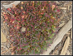 Red & Green Leaves |
 Smooth Leaves |
 John On Iron Ridge |
 Gary At Saddle |
 Window In Rock |
 Descending From Saddle |
 Meadow Flowers |
 Berries & Boulders II |
Trips - 2025
Home