07/11-13/25
Gary
was interested in a three day
backpacking trip and I had free time. I took Friday off work. We had
three clear warm days forecast. Neither of us managed to get in a
backpacking trip last year and we were glad to get out overnight
again. It was my turn to drive as we headed out early to beat Seattle
morning traffic. We sailed over Snoqualmie Pass and then through Roslyn
and up past Lake Cle Elum. The long dirt road was graded with almost no
pot holes left. Unfortunately, the washboard sections were pretty bad.
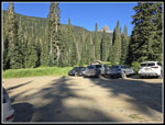
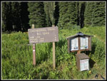
We reached the Cathedral Pass Trailhead at about 8:46 am and were
packed up and on our way at 8:54 am. The lot by the start was almost
full. It is popular, even on a weekday. The walk down to the bridge
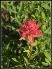
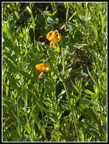
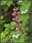
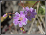
over the Cle Elum River was lined with wildflowers. I saw the only
tiger lily of the day here. Add in some red Indian paintbrush and
columbine and more. We crossed the river and the climbing began. The
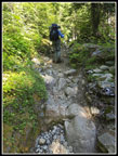
trail is a bit rockier than I recalled on my only other time up it
which was in 2002 on an attempted climb of Mt.
Daniel.
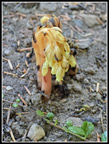
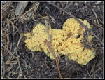
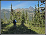
Early on we saw some pinesap and lots of wintergreen. The forest was mostly dark and cool. Our ascent on the Cathedral Pass Trail lasted for a bout 2 miles. Along the way we saw two people coming down. It would be more than 24 hours until we saw anyone else. We were heading up a very popular trail to some much less popular lakes. At the 2 mile junction we turned off left on the Trail Creek Trail. The Trail Creek Trail does not actually follow alongside Trail Creek. It does cross the creek than climbs well above it. Climbs above is not exactly true as the trail descends but the creek falls faster. The other end of the trail ends at the Waptus River. Fording can be challenging. I doubt many people do cross it. We found the trail to be mostly smooth easy walking. That was not true of most of the trails we hiked on this trip. After almost two years since our last backpacking trip, it took a while to get used to the weight again. The morning was also warming up fast. We reached the Michael Lake junction at 11:37 am. We had hiked about 4.8 miles so far. Now it would be almost entirely uphill to Moonshine Lake. That would be our base camp for two nights.
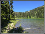
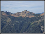
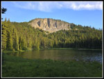
The Michael Lake Trail is steeper and rockier than the Trail Creek Trail. There were logs down across it. None were a real problem to get over or around. Part way up we stopped for a break. I really needed food and water. We had enough water left to reach Moonshine Lake. It turned out to be about a 24 minute break. After that, we continued uphill. The turnoff to Moonshine Lake is not marked. It is fairly obvious if you are looking for it. We used the GPS to let us know when we were close. The trail to the lake is short at about one third of a mile but a bit rocky. We finally reached the lake at 1:18 pm. We dropped our packs and explored around the lake. There is a big campsite across the outlet creek to the right. There was even a big patch of snow left. We saw very little snow on this trip. We headed back to the main trail and found another site to the left of it. We chose this one for our campsite. On a 2000 trip to Polallie Lookout site Gary noticed the green meadows on a ridge to the northeast. On our return trip a week earlier Gary again pointed out the ridge. That was the reason for this trip. A week earlier, neither of us had heard of Moonshine Lake. The ridge runs behind the lake and turns 90 degrees with two bumps near the end. One is Peak 6158 and the other is Peak 6102. We planned to summit them on the trip.
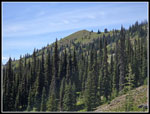
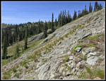
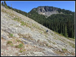
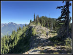
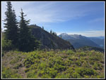
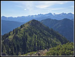
We set up camp and jumped in our tents. The mosquitoes were annoying but not too bad while hiking. They were really awful if you sat still. We wore head nets most of the time in camp along with windshirts. The tent gave us a safe spot and we were tired after the early start and hike. After a break we talked abut what to do next. Gary was up for hiking up at least Peak 6158 before dinner. It was the hottest time of day but I agreed. We set out at 4:08 pm. A group camped at Moonshine Lake a week earlier and climbed North Goat Mountain as well as Peaks 6158 and 6102. They posted a report with some photos but no details of the 6158 route. We decided to either go right to the ridge at a saddle or just go straight up the slope to the top. The latter would be shorter but steeper. We hiked through forest until coming to a big rock face. Going up before it was very steep. The rock itself was less steep. Beyond the rock Goat Creek is found and it runs up to the saddle. The base of the rock was a pain to get around. We chose to ascend the rock. Near the top we veered left and rose towards the saddle. We reached the ridge top when at the saddle. From the top it was a cliff to the east which provided great views out. There were also many blooming flowers on the ridge from there to the summit of Peak 6158.
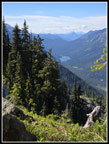
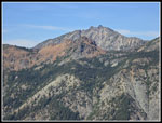
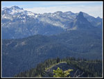
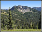
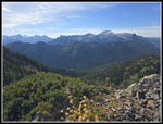
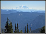
We stopped for photos and continued up the mostly forested ridge. The going was easy as we climb up the ridge. The ridge made the 90 degree turn left and brought us to the top. From there we were high enough to see most of Moonshine Lake. The Cascade Crest was in sight from Mt. Rainier to the far southwest to most every peak from Three Queens to Mt. Daniel and Cathedral Rock. Daniel looked pretty good but farther south the peaks were hazy. To the east we could see the Cradle and Mt. Stuart among many peaks in sight. It is a great viewpoint. I was a little surprised that we could see back to Moonshine Lake set in forest. It would have been nice to be on top early in the morning with little haze but it was still very good this day. It was hot enough and we had already done 3300' of gain so the idea of the walk over to Peak 6102 for lower but similar views did not motivate us enough. We headed back at 5:49 pm after 39 minutes on top.
Our route down was following the ridge back to the saddle and then dropping straight down. This worked very well as it was less steep with better footing than our ascent. Lower down we turned to our left and ended up coming out right near our campsite. It was a slightly longer route down but much easier. We arrived at camp at 6:28 and were more than ready for dinner. We headed into our tents after 9:00 pm. Day one provided some nice wildflowers, tremendous solitude, a neat lake, and great views from Peak 6158. For the day we hiked about 9 miles with 3300' of gain.
Click on thumbnails to get
larger pictures.
Day 2
Trips - 2025
Home
Early on we saw some pinesap and lots of wintergreen. The forest was mostly dark and cool. Our ascent on the Cathedral Pass Trail lasted for a bout 2 miles. Along the way we saw two people coming down. It would be more than 24 hours until we saw anyone else. We were heading up a very popular trail to some much less popular lakes. At the 2 mile junction we turned off left on the Trail Creek Trail. The Trail Creek Trail does not actually follow alongside Trail Creek. It does cross the creek than climbs well above it. Climbs above is not exactly true as the trail descends but the creek falls faster. The other end of the trail ends at the Waptus River. Fording can be challenging. I doubt many people do cross it. We found the trail to be mostly smooth easy walking. That was not true of most of the trails we hiked on this trip. After almost two years since our last backpacking trip, it took a while to get used to the weight again. The morning was also warming up fast. We reached the Michael Lake junction at 11:37 am. We had hiked about 4.8 miles so far. Now it would be almost entirely uphill to Moonshine Lake. That would be our base camp for two nights.
The Michael Lake Trail is steeper and rockier than the Trail Creek Trail. There were logs down across it. None were a real problem to get over or around. Part way up we stopped for a break. I really needed food and water. We had enough water left to reach Moonshine Lake. It turned out to be about a 24 minute break. After that, we continued uphill. The turnoff to Moonshine Lake is not marked. It is fairly obvious if you are looking for it. We used the GPS to let us know when we were close. The trail to the lake is short at about one third of a mile but a bit rocky. We finally reached the lake at 1:18 pm. We dropped our packs and explored around the lake. There is a big campsite across the outlet creek to the right. There was even a big patch of snow left. We saw very little snow on this trip. We headed back to the main trail and found another site to the left of it. We chose this one for our campsite. On a 2000 trip to Polallie Lookout site Gary noticed the green meadows on a ridge to the northeast. On our return trip a week earlier Gary again pointed out the ridge. That was the reason for this trip. A week earlier, neither of us had heard of Moonshine Lake. The ridge runs behind the lake and turns 90 degrees with two bumps near the end. One is Peak 6158 and the other is Peak 6102. We planned to summit them on the trip.
We set up camp and jumped in our tents. The mosquitoes were annoying but not too bad while hiking. They were really awful if you sat still. We wore head nets most of the time in camp along with windshirts. The tent gave us a safe spot and we were tired after the early start and hike. After a break we talked abut what to do next. Gary was up for hiking up at least Peak 6158 before dinner. It was the hottest time of day but I agreed. We set out at 4:08 pm. A group camped at Moonshine Lake a week earlier and climbed North Goat Mountain as well as Peaks 6158 and 6102. They posted a report with some photos but no details of the 6158 route. We decided to either go right to the ridge at a saddle or just go straight up the slope to the top. The latter would be shorter but steeper. We hiked through forest until coming to a big rock face. Going up before it was very steep. The rock itself was less steep. Beyond the rock Goat Creek is found and it runs up to the saddle. The base of the rock was a pain to get around. We chose to ascend the rock. Near the top we veered left and rose towards the saddle. We reached the ridge top when at the saddle. From the top it was a cliff to the east which provided great views out. There were also many blooming flowers on the ridge from there to the summit of Peak 6158.
We stopped for photos and continued up the mostly forested ridge. The going was easy as we climb up the ridge. The ridge made the 90 degree turn left and brought us to the top. From there we were high enough to see most of Moonshine Lake. The Cascade Crest was in sight from Mt. Rainier to the far southwest to most every peak from Three Queens to Mt. Daniel and Cathedral Rock. Daniel looked pretty good but farther south the peaks were hazy. To the east we could see the Cradle and Mt. Stuart among many peaks in sight. It is a great viewpoint. I was a little surprised that we could see back to Moonshine Lake set in forest. It would have been nice to be on top early in the morning with little haze but it was still very good this day. It was hot enough and we had already done 3300' of gain so the idea of the walk over to Peak 6102 for lower but similar views did not motivate us enough. We headed back at 5:49 pm after 39 minutes on top.
Our route down was following the ridge back to the saddle and then dropping straight down. This worked very well as it was less steep with better footing than our ascent. Lower down we turned to our left and ended up coming out right near our campsite. It was a slightly longer route down but much easier. We arrived at camp at 6:28 and were more than ready for dinner. We headed into our tents after 9:00 pm. Day one provided some nice wildflowers, tremendous solitude, a neat lake, and great views from Peak 6158. For the day we hiked about 9 miles with 3300' of gain.
 Trailhead |
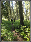
 Cathedral Pass Trail |
 Red Indian Paintbrush |
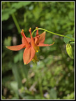
 Tiger Lilies |
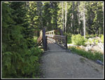 Bridge |
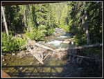 Cle Elum River |
 Bunch Of Bunchberries |
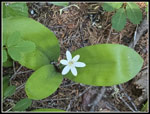 Queen's Cup |
 Wintergreen |
 Pinesaps |
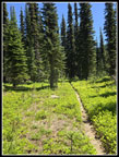
 Rocky Trail |
 Yellow Fungus |
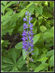 Lupine |
 A Little Brushy |
 Columbine |
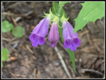
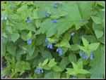 Bluebells |
 Purple Penstemon |
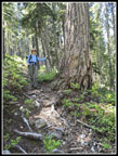 Gary & Big Tree |
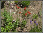 Paintbrush & Penstemon |
 Sunny Meadow |
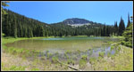 Moonshine Lake |
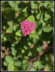 Spirea |
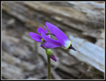 Lone Shooting Star |
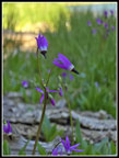 More Shooting Stars |
 Lake & Peak 6158 |
 Peak 6102 |
 Rocky Slope |
 Gary Ascending 6158 |
 Columbia Lewisia |
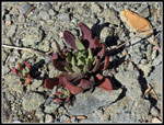 Unknown Plant |
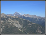 Mt Stuart & Ingalls Peaks |
 Hyas Lake |
 Jim On Ridge |
 The Cradle |
 Daniel & Cathedral Rock |
 Summit Ahead |
 Moonshine Lake In Sight |
 View West |
 Mt. Rainier |
 Peak 6102 & Crest Peaks |
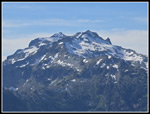 Mt. Daniel Close Up |
 Paddy-Go-North Peak |
 Buckwheat |
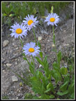 Asters |
 Heading Down |
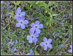 Phlox |
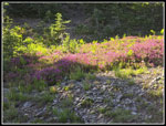 Lit Up Heather |
 Moonshine Near Dusk |
Day 2
Trips - 2025
Home