04-05-25
It
was time for a long hike. I have
done this one the past two years. It makes for a good long workout
without seeing many other folks. I hiked up Mt. Si via the old trail on
Thursday and hoped I would be feeling well enough to make it all the
way up. I was out of the house at 6:40 am heading east. The day was
supposed to be partly to mostly cloudy but warming into the mid 60s at
the bottom. I arrived at the start just southeast of the Hwy 18 - I-90
junction at 7:16 am. It was 42F and a bit chilly. I was the only car
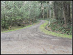
there. By 7:19 am I was on my way. The gate at the start is usually
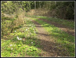
closed but it was open this day. I headed down the paved road across
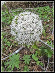
the swamp. Part way across I started seeing blooming skunk cabbage.
There was a lot of skunk cabbage. The sun was low in the sky but it lit
up the skunk cabbage. I saw more in a few places along my route but
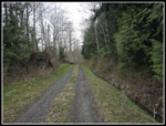
most were right near the start. The road tuns and heads uphill. After
the short climb it is very flat until past the 2 mile mark. At half a
mile the paving ends. I reached the big power sub-station and had views
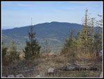
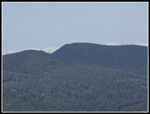
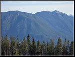
west to East Tiger Mountain. I was at about 1000' and would later be
above 3007' East Tiger.
My GPS added half my driving distance to my new track at the start even though the app was not open on the drive. I canceled the track and started a new one. Mission accomplished, I thought. At the 1 mile mark I checked to see my speed. It said 45 mph and 18.3 miles finished. It had again added half my driving miles at some point after I started the new track. I just love technology at times. I did know when I started and was able to mentally calculate miles per hour as the route has mile and half mile markers. I made very good time on the flats with the cool temperature helping. At about 2.1 miles the route began to climb. It was still not very steep. I crossed Canyon Creek on the nice big bridge and in a few minutes I was climbing higher. This section is straight up the fall line. I felt good and kept pushing. At about 3 miles the route turns right and the grade lessens significantly. I passed the spur road I often use to push the distance up to 17 miles. That is taken on the descent.
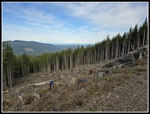
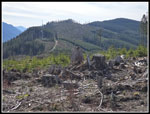
I passed the 3.5 mile sign and kept up a fast pace. I was very pleased as less than two full days earlier we hiked 8 miles up Mt. Si gaining 3500'. We had slushy snow near the top which was harder to walk in. I feared I would be sore and slow this day. That was not the case. At 4.5 miles there is a gated road turning left and heading uphill. That was my route. I checked the time and it was 8:34 am. I had taken 1:15 to hike 4.5 miles. That is 3.6 mph. That is fast for me. On my 2024, 2023, and 2020 trips, I took exactly 1:19 each time. That is crazy consistency over 4.5 miles. This trip was 4 minutes faster. I had a fast food and water break and started uphill. Most of the elevation gain is in the last 3.5 miles. About fifteen years ago this was a forest walk to the summit. Now large parts of the route have been clearcut. That is unfortunate for the forest but it does mean there are some great views. The summit was just clearcut five or six years ago and it has even better views.
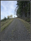
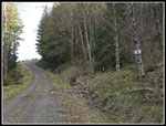
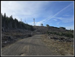
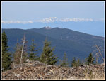
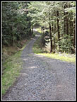
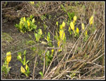
The 5 mile marker is at a right switchback. The next switchback left is right at the 6 mile marker. The views really began to open up now. So far I had seen almost nobody, just as I expected. I did see two runners coming towards me as I left the 4.5 mark but they did not follow me. They were only seen at a distance. I still felt great as the elevation gain continued. I saw blooming coltsfoot down low and most of the way up. I looked for at least one blooming trillium but saw nothing going up. I often do see them this time of year. The 6 mile marker is at the bottom of a dip. Climbing out of it is about the biggest uphill on the way back. At about 6.5 miles the road meets a road that comes up from the Snoqualmie Point Road just off I-90. That seems to be the new main road to the summit for service vehicles. The rest of the mileage markers are for that route. I turned right and continued to ascend. Before and after the junction I was in forest. Higher up it would be mostly in clearcuts.
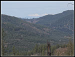
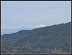
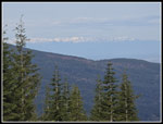
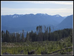
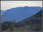
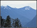
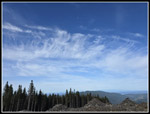
The overcast was supposed to come in by late morning but so far I still had mostly blue sky. To the south it was all blue and to the northeast it was turning white. As I rose, the tops of the Olympic Mountains began to come into view to the right and left of East Tiger. Soon Tiger 1 was in view. Higher still, they Olympic peaks were coming into view over Tiger peaks. I passed the bicycle trail that comes up from Snoqualmie Point. I saw a biker zoom down and across the road as I came nearer. I would see lots of bikers until I reached this spot coming down. I was after miles so I stayed on the road. The summit towers of West Rattlesnake Mountain were now is sight above the big clearcut. The road entered forest and reached the last switchback right. The Rattlesnake Mountain hiking trail is only about 50' away and I often cut across on trips up the RMT that loop over West Rattlesnake. This day I stayed on the road. It came back out of the forest with some very nice views. I took more photos but kept up my pace.
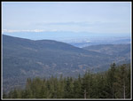
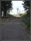
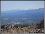
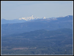
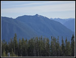
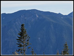
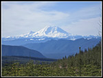
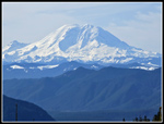
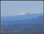
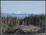
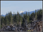
I noticed a little snow in the ditch along the road. There was more snow here in the past couple weeks. I crossed two bike trails and had one ore switchback left before the towers were right in front of me. It just took a few more minutes to reach the summit. I arrived at 9:54 am. I had hiked 8 miles with about 2350 of gain in 2:35. That is 3.1 mph. That is a great time for me. Last year I took 2:50. The road is very smooth and never overly steep. Perfect for a fast hike. Now I had views in all directions. I looked north and Mt. Baker and Three Fingers Mountain were very clear. Blue sky would have been better but I was still pleased with the views. To the south I could see part of Mt. Rainier and it really stood out. I had to walk a short way off the road into a clearcut to find a stump that put above the small new trees for a clear shot of Mt. Rainier. I took a food and water break and then walked to the east side of the summit for views of Mt. Si, Mt. Teneriffe, and peaks along I-90. Granite Mountain was all snow on top and Mailbox Peak across the valley had snow near the top. The views were very good. I dropped to the lower towers and returned. Several groups of mountain bikers passed by during my summit stay.
There was a light cold breeze but a wind shirt fixed that. I would liked to have spent a few hours on top but I had a long trip back and the college basketball final four was on in late afternoon. After 50 minutes I packed up and headed down. I left at 10:44 am. It was still pretty early in the day. I was not in a hurry hiking down. I still made good time but did not push it at all. 17 miles nearly double my average hike and I did not want to end up too sore. Coming down I had a view to the northeast that was blocked on the summit. I saw a snowy Mt. Index and Glacier Peak. I enjoyed the views as the Olympic Mountains began to slide behind Tiger Mountain. At about the 5 mile mark I started looking very closely for at least one trillium. I saw no leaves at all until a look through the trees along the road showed a blob of white. I crossed the ditch and poked by way though a little brush into the forest. And there was a perfect trillium. Then I saw another and another and another. That supplied my trillium fix for the weekend.
Back at the 4.5 mile marker I took another short break. It was now noticeably warmer. The wind shirt came off. Other than the one steep down the fall line section it was a very gentle grade going back from here. I did take the short route to another bridge over Canyon Creek that rounded my trip up to 17 miles. I retraced my steps to the main route and dropped the steeper section. As I approached the main bridge over Canyon Creek I met a big group of a dozen or so mountain bikers. They never did pass me going out. My legs were getting a bit sore after 15 miles but I kept up a reasonably fast pace the last two miles. I reached my car at 1:57 pm. There were now six other cars next to mine.
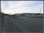
This proved to be a very nice hike. I had my fastest time up just two days after a strenuous hike up Mt. Si. I felt pretty good on the entire trip. The cool start and great views really made this a good hike. At the conclusion my car registered 67F. It was plenty warm coming down. I expected to see bikers near the top and I did. I did not expect the big group near the end but I only saw them once. Otherwise, it was a lonesome hike pretty close to home. I ended up with several hundred photos as there was a whole lot to see and enjoy. My drive home was more interesting. Highway 18 has been under construction adding two new lanes for a couple years. Now the interchange with I-90 is a work in progress. My return required me to take I-90 east then head back went. West bound I-90 had the Hwy 18 exit closed sending those drivers west to Preston to turn around and detour back. That led to a backup west bound from 18 to Preston. The bumper to bumper traffic was a small price to pay for a great day doing a long hike to great views.
Click on thumbnails to get
larger pictures.
Trips - 2025
Home
My GPS added half my driving distance to my new track at the start even though the app was not open on the drive. I canceled the track and started a new one. Mission accomplished, I thought. At the 1 mile mark I checked to see my speed. It said 45 mph and 18.3 miles finished. It had again added half my driving miles at some point after I started the new track. I just love technology at times. I did know when I started and was able to mentally calculate miles per hour as the route has mile and half mile markers. I made very good time on the flats with the cool temperature helping. At about 2.1 miles the route began to climb. It was still not very steep. I crossed Canyon Creek on the nice big bridge and in a few minutes I was climbing higher. This section is straight up the fall line. I felt good and kept pushing. At about 3 miles the route turns right and the grade lessens significantly. I passed the spur road I often use to push the distance up to 17 miles. That is taken on the descent.
I passed the 3.5 mile sign and kept up a fast pace. I was very pleased as less than two full days earlier we hiked 8 miles up Mt. Si gaining 3500'. We had slushy snow near the top which was harder to walk in. I feared I would be sore and slow this day. That was not the case. At 4.5 miles there is a gated road turning left and heading uphill. That was my route. I checked the time and it was 8:34 am. I had taken 1:15 to hike 4.5 miles. That is 3.6 mph. That is fast for me. On my 2024, 2023, and 2020 trips, I took exactly 1:19 each time. That is crazy consistency over 4.5 miles. This trip was 4 minutes faster. I had a fast food and water break and started uphill. Most of the elevation gain is in the last 3.5 miles. About fifteen years ago this was a forest walk to the summit. Now large parts of the route have been clearcut. That is unfortunate for the forest but it does mean there are some great views. The summit was just clearcut five or six years ago and it has even better views.
The 5 mile marker is at a right switchback. The next switchback left is right at the 6 mile marker. The views really began to open up now. So far I had seen almost nobody, just as I expected. I did see two runners coming towards me as I left the 4.5 mark but they did not follow me. They were only seen at a distance. I still felt great as the elevation gain continued. I saw blooming coltsfoot down low and most of the way up. I looked for at least one blooming trillium but saw nothing going up. I often do see them this time of year. The 6 mile marker is at the bottom of a dip. Climbing out of it is about the biggest uphill on the way back. At about 6.5 miles the road meets a road that comes up from the Snoqualmie Point Road just off I-90. That seems to be the new main road to the summit for service vehicles. The rest of the mileage markers are for that route. I turned right and continued to ascend. Before and after the junction I was in forest. Higher up it would be mostly in clearcuts.
The overcast was supposed to come in by late morning but so far I still had mostly blue sky. To the south it was all blue and to the northeast it was turning white. As I rose, the tops of the Olympic Mountains began to come into view to the right and left of East Tiger. Soon Tiger 1 was in view. Higher still, they Olympic peaks were coming into view over Tiger peaks. I passed the bicycle trail that comes up from Snoqualmie Point. I saw a biker zoom down and across the road as I came nearer. I would see lots of bikers until I reached this spot coming down. I was after miles so I stayed on the road. The summit towers of West Rattlesnake Mountain were now is sight above the big clearcut. The road entered forest and reached the last switchback right. The Rattlesnake Mountain hiking trail is only about 50' away and I often cut across on trips up the RMT that loop over West Rattlesnake. This day I stayed on the road. It came back out of the forest with some very nice views. I took more photos but kept up my pace.
I noticed a little snow in the ditch along the road. There was more snow here in the past couple weeks. I crossed two bike trails and had one ore switchback left before the towers were right in front of me. It just took a few more minutes to reach the summit. I arrived at 9:54 am. I had hiked 8 miles with about 2350 of gain in 2:35. That is 3.1 mph. That is a great time for me. Last year I took 2:50. The road is very smooth and never overly steep. Perfect for a fast hike. Now I had views in all directions. I looked north and Mt. Baker and Three Fingers Mountain were very clear. Blue sky would have been better but I was still pleased with the views. To the south I could see part of Mt. Rainier and it really stood out. I had to walk a short way off the road into a clearcut to find a stump that put above the small new trees for a clear shot of Mt. Rainier. I took a food and water break and then walked to the east side of the summit for views of Mt. Si, Mt. Teneriffe, and peaks along I-90. Granite Mountain was all snow on top and Mailbox Peak across the valley had snow near the top. The views were very good. I dropped to the lower towers and returned. Several groups of mountain bikers passed by during my summit stay.
There was a light cold breeze but a wind shirt fixed that. I would liked to have spent a few hours on top but I had a long trip back and the college basketball final four was on in late afternoon. After 50 minutes I packed up and headed down. I left at 10:44 am. It was still pretty early in the day. I was not in a hurry hiking down. I still made good time but did not push it at all. 17 miles nearly double my average hike and I did not want to end up too sore. Coming down I had a view to the northeast that was blocked on the summit. I saw a snowy Mt. Index and Glacier Peak. I enjoyed the views as the Olympic Mountains began to slide behind Tiger Mountain. At about the 5 mile mark I started looking very closely for at least one trillium. I saw no leaves at all until a look through the trees along the road showed a blob of white. I crossed the ditch and poked by way though a little brush into the forest. And there was a perfect trillium. Then I saw another and another and another. That supplied my trillium fix for the weekend.
Back at the 4.5 mile marker I took another short break. It was now noticeably warmer. The wind shirt came off. Other than the one steep down the fall line section it was a very gentle grade going back from here. I did take the short route to another bridge over Canyon Creek that rounded my trip up to 17 miles. I retraced my steps to the main route and dropped the steeper section. As I approached the main bridge over Canyon Creek I met a big group of a dozen or so mountain bikers. They never did pass me going out. My legs were getting a bit sore after 15 miles but I kept up a reasonably fast pace the last two miles. I reached my car at 1:57 pm. There were now six other cars next to mine.
This proved to be a very nice hike. I had my fastest time up just two days after a strenuous hike up Mt. Si. I felt pretty good on the entire trip. The cool start and great views really made this a good hike. At the conclusion my car registered 67F. It was plenty warm coming down. I expected to see bikers near the top and I did. I did not expect the big group near the end but I only saw them once. Otherwise, it was a lonesome hike pretty close to home. I ended up with several hundred photos as there was a whole lot to see and enjoy. My drive home was more interesting. Highway 18 has been under construction adding two new lanes for a couple years. Now the interchange with I-90 is a work in progress. My return required me to take I-90 east then head back went. West bound I-90 had the Hwy 18 exit closed sending those drivers west to Preston to turn around and detour back. That led to a backup west bound from 18 to Preston. The bumper to bumper traffic was a small price to pay for a great day doing a long hike to great views.
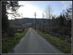 Crossing The Swamp |
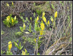 Lots Of Skunk Cabbage |
 Power Sub-Station |
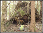
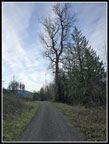 The Big Tree |
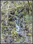 Cascading Creek |
 Blooming Coltsfoot |
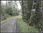 2 1/2 Miles In |
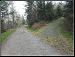 Detour On Return |
 4 1/2 Mile Junction |
 Grassy Road |
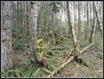 Mossy Forest |
 Peaks In Sight |
 Olympic Mountains |
 Getting Steeper |
 East Tiger Mountain |
 6 Mile Marker |
 North Olympics |
 Two Bikers |
 Downtown Bellevue |
 Peak In The Saddle |
 Summit Towers |
 Almost On Top |
 Baker & Three Fingers |
 Three Fingers |
 View West |
 McClellan Butte |
 Mt. Teneriffe |
 Mt. Si |
 Beautiful Mt. Rainier |
 Bandera Mountain |
 Mt. Rainier Close Up |
 Olympics Over Tiger 1 |
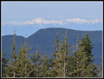 Olympics Over E. Tiger |
 Mts. Si & Teneriffe |
 Ridge To East Peak |
 Mt. Baker Close Up |
 Neat Clouds |
 Mt. Index |
 Glacier Peak |
 Steep Downhill |
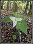 Trillium |
 Big Stump |
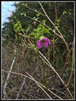 Blooming Salmonberry |
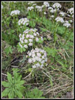
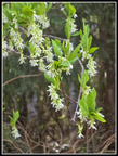 White Flowers |
 On Detour Route |
 Coltsfoot Close Up |
 Hiker Bridges |
 Skunk Cabbage By End |
Trips - 2025
Home