1-09-10
I have been
hiking close in peaks of Cougar, Squak, Tiger, and Rattlesnake
Mountains since 1983. I also had looked through Footsore 1 and seen
logging road routes on Taylor Mountain. Taylor sits south of West
Rattlesnake Mountain and east across Highway 18 from the Tiger Peaks.
In recent years some new trails have been built and a new trailhead
parking area is in place. I made my first visit just a month ago with
Kim. We did a short hike on the Holder Ridge Trail. I decided to return
and see a bit more of the area.
The awful forecast was way off and the day turned out to be dry and warm. I had a late start and it was nearly 11:00 am when I got started. I came via Highway 18 from I-90 taking the Hobart Road exit, the first one after Tiger Summit. The trailhead is left under the highway and another few hundred feet. There was only one other car when I arrived. I had a map printed off the Internet and another better one was found at the trailhead.
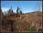
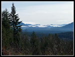
I chose to take the Holder Ridge trail again. It did not take long to reach the intersection with the Holder Knob Trail where we turned around on the first visit. This time I took the unsigned left turn on the Knob trail. It climbed up to near the top and then turned to the other side. At the top a very short spur led to a picnic spot with horse tie ups. Not a bad view from under 1500'. Although the mountain is well east of Seattle the Columbia Tower is visible from several spots. Mt. Rainier was completely under one big cloud though above and around it were in the clear. Mostly blue sky and unseasonable warmth had me in short sleeves much of the day.
My map showed a big block of private land with a "proposed trail" going along the edge of it. It left the Knob trail just beyond the summit. I found the spot at a curve and found at least an animal trail heading off the trail. I followed it a short way and saw a building. Not wanting to intrude I turned around and headed back. I guess that proposed trail is still on the drawing board. The Knob trail descended to meet the main road. That road begins from the same lot where I was parked. I planned on returning via that route.
I took a left on the road and headed on. This road is wide enough for two big trucks to pass each other. Not wilderness by any means but it does get you across the area to a number of other trails. I passed a road left that led into the private property. It is unsigned and ungated but I had no interest in going there. A little farther along I came to a creek and a big pond. Here I turned left on the Sherwood Trail. This one is signed as "Sherwood Trail" the first one I saw with a trail sign. It crossed behind the pond, crossed the creek and soon met another road. This road is much smaller than the main road.
The Sherwood Trail goes across but I chose to turn left on the road. I hoped to get up higher on the mountain as easily as possible. The trail was a bit muddy. The road was not. The road climbs at a gentle grade. In about a mile I came to a turn around and a hairpin curve. The road heading down goes into the private property and also splits with one road heading over to the Holder Creek Trail. The Holder Creek Trail has a big washout and has a "closed" sign at the bridge near the trailhead. At least it did in December.
At the turn around I crossed a berm and found the road heading on. It was very muddy at first and is like a creek in a number of places. Probably best to hike this when it has dried out later in the year. This road soon neared a creek (Holder?). When it came to crossing the creek the water was too high to get across with dry feet. I did find a spot just downstream where I could jump across. The map shows a loop road and more options and two other roads heading off the map. There is also another big pond here were the creek is dammed. I was getting towards my turn around time but chose to head left on the loop road.
A short distance brought me to a gated road. This drops down to the Holder Creek Trail making it a way to loop back to the trailhead when that trail is open again. The road soon began to look more like a trail as it has not been used in some time. I was now above Highway 18 again but trees have grown back and I had no views. It was now time to head back. I hiked back to the pond and crossed the creek. As I hiked down the muddy creek road/trail I head a noise and a minute later a motorcycle passed me. That was only the second person I had seen all day.
I passed the Sherwood Trail and stayed on the road all the way back to the main road. Now it was just straight shot back to the trailhead. I passed a few roads and trails on the way back. I have some more exploring to do. In the last mile I passed several groups heading out. Back at the trailhead the lot was 2/3 full. Five horse trailers and nine cars. For the day I traveled 9 miles with 1400' of elevation gain. The area is a bit limited with homes on one side, a highway on another, and the Seattle Watershed on another. Still it is a good low elevation area of trails that will add some variety to my snow free winter hiking. A fun day of exploring a close in area I have neglected for the past 27 years.
Click on thumbnails to get larger pictures.
Trips - 2010
Home
The awful forecast was way off and the day turned out to be dry and warm. I had a late start and it was nearly 11:00 am when I got started. I came via Highway 18 from I-90 taking the Hobart Road exit, the first one after Tiger Summit. The trailhead is left under the highway and another few hundred feet. There was only one other car when I arrived. I had a map printed off the Internet and another better one was found at the trailhead.
I chose to take the Holder Ridge trail again. It did not take long to reach the intersection with the Holder Knob Trail where we turned around on the first visit. This time I took the unsigned left turn on the Knob trail. It climbed up to near the top and then turned to the other side. At the top a very short spur led to a picnic spot with horse tie ups. Not a bad view from under 1500'. Although the mountain is well east of Seattle the Columbia Tower is visible from several spots. Mt. Rainier was completely under one big cloud though above and around it were in the clear. Mostly blue sky and unseasonable warmth had me in short sleeves much of the day.
My map showed a big block of private land with a "proposed trail" going along the edge of it. It left the Knob trail just beyond the summit. I found the spot at a curve and found at least an animal trail heading off the trail. I followed it a short way and saw a building. Not wanting to intrude I turned around and headed back. I guess that proposed trail is still on the drawing board. The Knob trail descended to meet the main road. That road begins from the same lot where I was parked. I planned on returning via that route.
I took a left on the road and headed on. This road is wide enough for two big trucks to pass each other. Not wilderness by any means but it does get you across the area to a number of other trails. I passed a road left that led into the private property. It is unsigned and ungated but I had no interest in going there. A little farther along I came to a creek and a big pond. Here I turned left on the Sherwood Trail. This one is signed as "Sherwood Trail" the first one I saw with a trail sign. It crossed behind the pond, crossed the creek and soon met another road. This road is much smaller than the main road.
The Sherwood Trail goes across but I chose to turn left on the road. I hoped to get up higher on the mountain as easily as possible. The trail was a bit muddy. The road was not. The road climbs at a gentle grade. In about a mile I came to a turn around and a hairpin curve. The road heading down goes into the private property and also splits with one road heading over to the Holder Creek Trail. The Holder Creek Trail has a big washout and has a "closed" sign at the bridge near the trailhead. At least it did in December.
At the turn around I crossed a berm and found the road heading on. It was very muddy at first and is like a creek in a number of places. Probably best to hike this when it has dried out later in the year. This road soon neared a creek (Holder?). When it came to crossing the creek the water was too high to get across with dry feet. I did find a spot just downstream where I could jump across. The map shows a loop road and more options and two other roads heading off the map. There is also another big pond here were the creek is dammed. I was getting towards my turn around time but chose to head left on the loop road.
A short distance brought me to a gated road. This drops down to the Holder Creek Trail making it a way to loop back to the trailhead when that trail is open again. The road soon began to look more like a trail as it has not been used in some time. I was now above Highway 18 again but trees have grown back and I had no views. It was now time to head back. I hiked back to the pond and crossed the creek. As I hiked down the muddy creek road/trail I head a noise and a minute later a motorcycle passed me. That was only the second person I had seen all day.
I passed the Sherwood Trail and stayed on the road all the way back to the main road. Now it was just straight shot back to the trailhead. I passed a few roads and trails on the way back. I have some more exploring to do. In the last mile I passed several groups heading out. Back at the trailhead the lot was 2/3 full. Five horse trailers and nine cars. For the day I traveled 9 miles with 1400' of elevation gain. The area is a bit limited with homes on one side, a highway on another, and the Seattle Watershed on another. Still it is a good low elevation area of trails that will add some variety to my snow free winter hiking. A fun day of exploring a close in area I have neglected for the past 27 years.
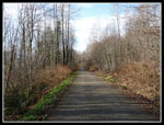
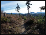 Holder Ridge View |
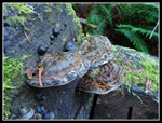 Fungus |
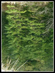
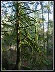 Mossy Tree |
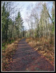
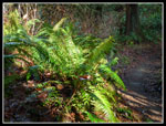 Sun On Ferns |
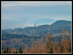 Downtown Seattle |
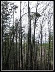
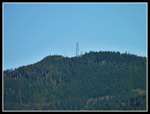 East Tiger Towers |
 Holder Knob |
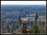 Farms & Homes |
 Low Clouds |
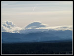 Mt. Rainier In Clouds |
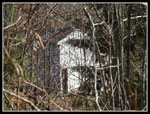 A House? Out Here? |
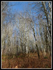 Leafless Trees |
 Main Road |
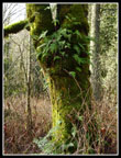 Ferns & Moss On Tree |
 Narrower Road |
 Skinny Tree |
 Pond Reflection |
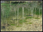 Another Reflection |
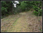 Road Becoming A Trail |
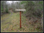 Taylor Mt. Trail Sign |
Trips - 2010
Home