6-19-10
I joined Kim and
Janet for a trip on the eastern edge of the Teanaway area. The forecast
was dismal so we headed east. It rained all the way over the mountains
to near Cle Elum. We headed north on Highway 970 then 97 to Mineral
Springs Resort and a few hundred feet beyond. The Blue Creek Road is
nicely graded and no problem to drive. The road is signed at the
junction. Left to Red Top Lookout and right to the ridge top and down
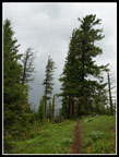
to the NF Teanaway Road near 29 Pines campground. We stopped at the
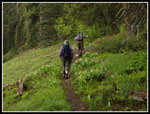
ridge top to begin our hike. Not surprisingly, there were no other cars
there.
I have hiked the Teanaway Ridge trail north from Red Top Lookout and south from Iron Bear Pass. This is one section I had not been on. A gated road heading north was our route. A steep ungated road south is the continuation of the trail heading south. We lucked out as the dark overcast was not spitting any rain. The actual old trail shows on the map above the road in this section. The road is much easier to walk. Janet is recovering from double knee replacement and this would be her most challenging trip since surgery. No point following an abandoned trail to make it more difficult.
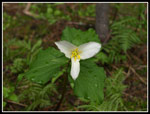
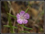
I had a much more difficult trip set for the next day and an easy walk appealed to me. The first thing we noticed is that at about 4400' on the ridge we went back to early spring. Glacier lilies, spring beauty, trillium, and yellow violets were all in bloom. In a normal year they would be finished by the start of summer. This cool wet spring has not been normal. There was no snow on the route making for easy walking.
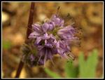
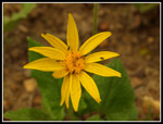
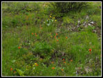
Although this is a popular motorcycle trail we did not see a single one all day. We did see a mushroom or two as the cool spring seems to have helped them. The route begins with a gentle descent. A trail angles off to the right side. The road turns to trail not too much farther. Kim took the trail on her previous visit. It is the original Teanaway Ridge tread. It merges back to the road turned trail a little way ahead. At that junction a right turn and a very short scramble leads to an open viewpoint. Probably nice views to the south and east on a clear day. We did find blooming balsamroot and daisies up there.
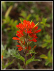
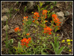
The trail begins to drop and climb as it hugs the ridge crest in forest. One spot is steep and loose as the cycles have turned the straight up tread loose rock and dirt. Not all that bad unless you are recovering from knee replacements. Janet made it up and down just fine. At one saddle I went ahead and Janet turned back. Kim was behind taking more photos. I continued to a rocky viewpoint with more flowers including blazing red Indian Paintbrush. I wanted to get beyond the 2 1/2 mile point. The five miles on the day gave me a cumulative 15,000 miles on the trail since I started logging my trips in June 1982. That's a little over 10 miles per week for 28 years.
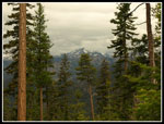
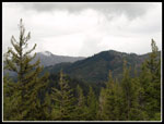
At my turn around point I had a nice view north to Three Brothers, my destination for the next day. It was in the clear though Mt. Stuart was buried in white clouds. I sped back to catch up with the others. They left a pack on the trail and climbed out to a viewpoint for lunch. I followed and found another clump of paintbrush. We could see a rain squall to the southeast. It was heading our way. It just brushed us but was enough to put on a raincoat for a short while.
After lunch we had a leisurely hike back to the car. We did run into our friend Kirsten and Steve. The only folks seen all day were and we knew them. It was an easy walk with a lot of flowers and few people. The most mileage and elevation for Janet post surgery and more than a few photo opportunities. For the most part we avoided the rain.
On our way back we decided to check out the old Blue Creek Trail. At one time it went from Mineral Springs to Red Top Lookout. It is now chopped up by roads and for the most part abandoned. The upper part from the road to the Teanaway Ridge trail near the lookout is still there. On my one drive up to the very short trail to Red Top I remembered passing a small sign for the trail. We drove down to the junction and took a right on the road to the lookout.
I had my GPS with a map that included much of the old trail. Just past the crossing of Blue Creek we found the trailhead and a nice big newer sign. My map showed the trail crossing the road before the creek. We went up the trail a short way and found many flowers in bloom. My GPS track of the new trail shows it to cross but not be on the old trail. More exploration is in store at a later date. We tried to find the trail on the downhill side of the road. One possible track is on the opposite side of the creek from what is on the map. I followed the route on the old map and found some openings in the trees but not any cut bank. It seems the downhill side trail is completely gone.
The rain began as we finished our exploring. While it was dry in Cle Elum it rained hard most of the way from Easton to North Bend. I was pleased to have avoided the deluge. All in all it turned out to be an easy hike but a very enjoyable one.
Click on thumbnails to get larger pictures.
Trips - 2010
Home
I have hiked the Teanaway Ridge trail north from Red Top Lookout and south from Iron Bear Pass. This is one section I had not been on. A gated road heading north was our route. A steep ungated road south is the continuation of the trail heading south. We lucked out as the dark overcast was not spitting any rain. The actual old trail shows on the map above the road in this section. The road is much easier to walk. Janet is recovering from double knee replacement and this would be her most challenging trip since surgery. No point following an abandoned trail to make it more difficult.
I had a much more difficult trip set for the next day and an easy walk appealed to me. The first thing we noticed is that at about 4400' on the ridge we went back to early spring. Glacier lilies, spring beauty, trillium, and yellow violets were all in bloom. In a normal year they would be finished by the start of summer. This cool wet spring has not been normal. There was no snow on the route making for easy walking.
Although this is a popular motorcycle trail we did not see a single one all day. We did see a mushroom or two as the cool spring seems to have helped them. The route begins with a gentle descent. A trail angles off to the right side. The road turns to trail not too much farther. Kim took the trail on her previous visit. It is the original Teanaway Ridge tread. It merges back to the road turned trail a little way ahead. At that junction a right turn and a very short scramble leads to an open viewpoint. Probably nice views to the south and east on a clear day. We did find blooming balsamroot and daisies up there.
The trail begins to drop and climb as it hugs the ridge crest in forest. One spot is steep and loose as the cycles have turned the straight up tread loose rock and dirt. Not all that bad unless you are recovering from knee replacements. Janet made it up and down just fine. At one saddle I went ahead and Janet turned back. Kim was behind taking more photos. I continued to a rocky viewpoint with more flowers including blazing red Indian Paintbrush. I wanted to get beyond the 2 1/2 mile point. The five miles on the day gave me a cumulative 15,000 miles on the trail since I started logging my trips in June 1982. That's a little over 10 miles per week for 28 years.
At my turn around point I had a nice view north to Three Brothers, my destination for the next day. It was in the clear though Mt. Stuart was buried in white clouds. I sped back to catch up with the others. They left a pack on the trail and climbed out to a viewpoint for lunch. I followed and found another clump of paintbrush. We could see a rain squall to the southeast. It was heading our way. It just brushed us but was enough to put on a raincoat for a short while.
After lunch we had a leisurely hike back to the car. We did run into our friend Kirsten and Steve. The only folks seen all day were and we knew them. It was an easy walk with a lot of flowers and few people. The most mileage and elevation for Janet post surgery and more than a few photo opportunities. For the most part we avoided the rain.
On our way back we decided to check out the old Blue Creek Trail. At one time it went from Mineral Springs to Red Top Lookout. It is now chopped up by roads and for the most part abandoned. The upper part from the road to the Teanaway Ridge trail near the lookout is still there. On my one drive up to the very short trail to Red Top I remembered passing a small sign for the trail. We drove down to the junction and took a right on the road to the lookout.
I had my GPS with a map that included much of the old trail. Just past the crossing of Blue Creek we found the trailhead and a nice big newer sign. My map showed the trail crossing the road before the creek. We went up the trail a short way and found many flowers in bloom. My GPS track of the new trail shows it to cross but not be on the old trail. More exploration is in store at a later date. We tried to find the trail on the downhill side of the road. One possible track is on the opposite side of the creek from what is on the map. I followed the route on the old map and found some openings in the trees but not any cut bank. It seems the downhill side trail is completely gone.
The rain began as we finished our exploring. While it was dry in Cle Elum it rained hard most of the way from Easton to North Bend. I was pleased to have avoided the deluge. All in all it turned out to be an easy hike but a very enjoyable one.
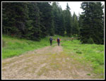 Start Of The Route |
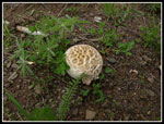 Mushroom |
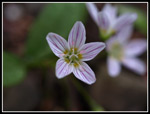 Spring Beauty |
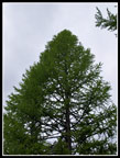 Green Larch Tree |
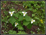 Four Trillium |
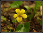 Yellow Violet |
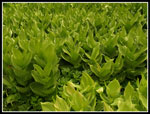
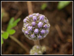
 Ballhead Waterleaf |
 Bugs On Arnica |
 False Hellebore |
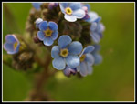 Forget-Me_Nots |
 Three Brothers |
 Lone Trillium |
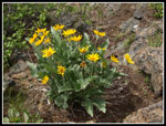 Balsamroot |
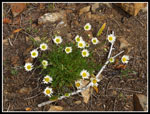 Daisies |
 Red Top Lookout |
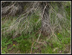 Spider Web Branches |
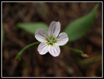 Another Spring Beauty |
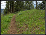 Ridge Top Trail |
 Broomrape |
 Lunch Spot View |
 Fiery Indian Paintbrush |
 Paintbrush Patch |
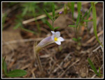
 Small Pink Flower |
 Wet Hikers |
 Green & White |
 Pre Blooming Waterleaf |
 Sun On Balsamroot |
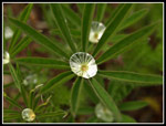 Lupine Water Drop |
 Flower Field |
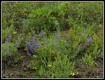 Lupine |
Trips - 2010
Home