4-28-12
I
seldom write up trip reports for
Tiger Mountain. I was curious about the current status of logging along
the Tiger Mountain Trail (TMT) on the Highway 18 side. After a week of
warm spring weather it was back to cold and wet for the weekend. I
chose a close in loop trip on a less visited side of Tiger. Nice dry
drive until I reached Issaquah. That's when the rain began. By the time
I turned onto Highway 18 it was coming down hard. At the parking lot it
was still raining though lighter. The gate is now open to the summer
parking lot. The seasonally closed trails opened on April 15. There
were a number of cars in the lot by the highway. I was the first in the
inner lot. I did notice that the outer lot has been graded and
graveled. It was filled with lake sized puddles on my last visit. It
was 9:30 am when I put on my rain jacket, pulled out my umbrella, put
on my backpack and started up the trail.
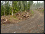
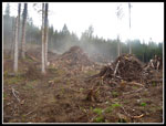
I headed out on the Iverson Railroad trail. I would be doing a big clockwise loop. The forest was dripping rain and the colors were really vivid. I saw many trillium and violets along the trail. A short way in I met several bikers coming back. A single runner passed by. That was it for the next few hours. Not many folks hike most of my route. Half an hour into the hike the rain turned to a very light mist. By the time I reached the main road it had stopped. Except for a few short spits it was dry for the rest of the hike. At the road things were much different. The road used to cross a creek over a culvert. that was removed and a big concrete bridge has taken its place. The road was slightly realigned. A small clear cut here a year ago is now a much larger one. It was just a few minutes on the road before I reached the TMT.
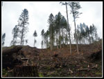
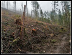
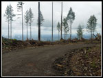
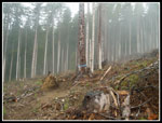
On my last visit the TMT was still in forest though there were clear cuts on both sides. The one on the left has grown. Now it comes right up to the trail. The tread is still fine though there are no trees on one side for a considerable distance. Dark forest has become very light and open. I considered trying to see if the Artifacts Trail was still intact. Instead, I stayed on the TMT. The trail continues on the edge of clear cut for some distance. It crosses a new logging road and soon after returns to forest. While it is disappointing to see the clear cut along the trail, the trail itself is still easily hiked. I don't think I crossed a single downed log the whole day. While I prefer the dark forest there are now views out to the lowlands below.
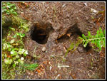
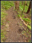
Once back in forest the TMT was back to normal. The TMT has signs stating that it is hiker only. I found lots of bike tracks and horse hoof holes along the way. The horses managed to break through consistently. Dozens if not hundreds of 4 - 12" deep round holes in the trail. The soft wet tread was no match for a heavy horse. I doubt the horse enjoyed all the stumbling either. At the junction with the Middle Tiger Trail I took a right turn and headed up to the summit. It was 11:10 am when I reached the top of Middle Tiger. My GPS recorded 4.2 miles so far. There was no wind an it was a balmy 42 degrees. Time for a food and water break and nine minutes later I was back on the move. The summit was in the clouds but after descending only about 80' it was clear once again. I thought there might be some snow above 2500' but saw none.
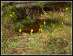
The old road/trail back to the main road was lined with blooming coltsfoot. I heard voices but did not see anyone (Yes, real voices. I met those folks on East Tiger). At the main road I took another right turn and headed steeply uphill. Some views out here but still very cloudy. Just before reaching the Preston RR Trail there was a nice big bog of blooming skunk cabbage. At the junction I met a group of bikers. The first people I had seen since the runner early in the day. After only a few yards on the Preston RR I turned off onto the new East Tiger Trail. This is primarily a mountain bike trail though hikers can use it. It is much shorter than the all road walk around and up East Tiger. John and I were surprised to run into the "in progress" trail on a December 31, 2011 hike cross country up East Tiger. It was finished last year. It had a think slick sayer of red mud that made traction difficult.
I followed the new trail up to the East Tiger spur road. I crossed the road and continued on trail to the top. This is another of the seasonal closure trails that just opened up a few weeks ago. The first steady wind of the day was on top of East Tiger. No snow but 41 degrees and a cold wind. I met several groups of bikers while I finished my lunch. I also met the "voices" I had heard below Middle Tiger. Those folks had a much longer day planned than me. The rest of the day was mostly downhill. I still had one final high point to reach.
At the bottom of the East Tiger spur I followed the road a short way and picked up the unmarked trail to Sally's Summit. I followed the ridge down to the main road just a mile and a half from the bottom. The last road walk went fast. As usual, I met a diverse assortment of folks hiking up the road in the early afternoon. Just before the bottom I took the short trail back to the parking lot. Lots more trillium and violets in this lower elevation forest. It was only 2:00 pm when I reached my car.
It's always fun to do a true loop with no trail repeated. I took an extra lap around the parking lot to finish with an even 11.0 miles hikes. Add in about 2600' of gain and it was a good though not overly strenuous day. What started out as a rainy day ended up being mostly dry with little wind but cold temperatures. As expected I saw few other people. I walked about 3 miles of road and 8 miles of trail. I was able to confirm that logging has changed the character of a small part of the TMT but the trail itself is in fine hiking condition, so long as you don't fall into any horse made holes. All in all, a fine half day hike close to the city.
Click on thumbnails to get
larger pictures.
Trips - 2013
Home
I headed out on the Iverson Railroad trail. I would be doing a big clockwise loop. The forest was dripping rain and the colors were really vivid. I saw many trillium and violets along the trail. A short way in I met several bikers coming back. A single runner passed by. That was it for the next few hours. Not many folks hike most of my route. Half an hour into the hike the rain turned to a very light mist. By the time I reached the main road it had stopped. Except for a few short spits it was dry for the rest of the hike. At the road things were much different. The road used to cross a creek over a culvert. that was removed and a big concrete bridge has taken its place. The road was slightly realigned. A small clear cut here a year ago is now a much larger one. It was just a few minutes on the road before I reached the TMT.
On my last visit the TMT was still in forest though there were clear cuts on both sides. The one on the left has grown. Now it comes right up to the trail. The tread is still fine though there are no trees on one side for a considerable distance. Dark forest has become very light and open. I considered trying to see if the Artifacts Trail was still intact. Instead, I stayed on the TMT. The trail continues on the edge of clear cut for some distance. It crosses a new logging road and soon after returns to forest. While it is disappointing to see the clear cut along the trail, the trail itself is still easily hiked. I don't think I crossed a single downed log the whole day. While I prefer the dark forest there are now views out to the lowlands below.
Once back in forest the TMT was back to normal. The TMT has signs stating that it is hiker only. I found lots of bike tracks and horse hoof holes along the way. The horses managed to break through consistently. Dozens if not hundreds of 4 - 12" deep round holes in the trail. The soft wet tread was no match for a heavy horse. I doubt the horse enjoyed all the stumbling either. At the junction with the Middle Tiger Trail I took a right turn and headed up to the summit. It was 11:10 am when I reached the top of Middle Tiger. My GPS recorded 4.2 miles so far. There was no wind an it was a balmy 42 degrees. Time for a food and water break and nine minutes later I was back on the move. The summit was in the clouds but after descending only about 80' it was clear once again. I thought there might be some snow above 2500' but saw none.
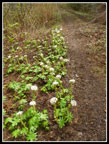
The old road/trail back to the main road was lined with blooming coltsfoot. I heard voices but did not see anyone (Yes, real voices. I met those folks on East Tiger). At the main road I took another right turn and headed steeply uphill. Some views out here but still very cloudy. Just before reaching the Preston RR Trail there was a nice big bog of blooming skunk cabbage. At the junction I met a group of bikers. The first people I had seen since the runner early in the day. After only a few yards on the Preston RR I turned off onto the new East Tiger Trail. This is primarily a mountain bike trail though hikers can use it. It is much shorter than the all road walk around and up East Tiger. John and I were surprised to run into the "in progress" trail on a December 31, 2011 hike cross country up East Tiger. It was finished last year. It had a think slick sayer of red mud that made traction difficult.
I followed the new trail up to the East Tiger spur road. I crossed the road and continued on trail to the top. This is another of the seasonal closure trails that just opened up a few weeks ago. The first steady wind of the day was on top of East Tiger. No snow but 41 degrees and a cold wind. I met several groups of bikers while I finished my lunch. I also met the "voices" I had heard below Middle Tiger. Those folks had a much longer day planned than me. The rest of the day was mostly downhill. I still had one final high point to reach.
At the bottom of the East Tiger spur I followed the road a short way and picked up the unmarked trail to Sally's Summit. I followed the ridge down to the main road just a mile and a half from the bottom. The last road walk went fast. As usual, I met a diverse assortment of folks hiking up the road in the early afternoon. Just before the bottom I took the short trail back to the parking lot. Lots more trillium and violets in this lower elevation forest. It was only 2:00 pm when I reached my car.
It's always fun to do a true loop with no trail repeated. I took an extra lap around the parking lot to finish with an even 11.0 miles hikes. Add in about 2600' of gain and it was a good though not overly strenuous day. What started out as a rainy day ended up being mostly dry with little wind but cold temperatures. As expected I saw few other people. I walked about 3 miles of road and 8 miles of trail. I was able to confirm that logging has changed the character of a small part of the TMT but the trail itself is in fine hiking condition, so long as you don't fall into any horse made holes. All in all, a fine half day hike close to the city.
 Sally's Summit |
 Big Stump |
 Bright Green |
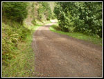 On The Road Again |
Trips - 2013
Home


