10-26-13
Over
30 years of hiking I have hiked the Defiance trail as far as Mt.
Defiance many times. I've hiked to Granite Lakes many times too. Once I
snowshoed past the Thompson Lake trailhead. The section from that
trailhead to Thompson Lake and on to Mt. Defiance I had never hiked.
This day I visited a part of that gap on a hike to Thompson Lake. I
hiked the Granite Creek Road to
trail conversion in early February this year. The snow became very deep
and I was not able to reach Granite Lakes. Where culverts were pulled
there was running water. The snow was eight feet deep on either side.
There was no way to get across. I saw the lower conversion to trail but
the upper trail was under too much snow to see anything. For this trip
I had a different plan in mind.
I cruised by the Granite Creek trailhead and continued to near the vehicle bridge over the Middle Fork Snoqualmie River. I have known about the short cut trail for some time. I even found the upper end at the Granite Creek Road/trail. This day I hiked it for the first time. I left the 8:40' starting place at 8:17 am. the trail is very steep in places and buried under leaves in others. I climbed up to the road and took a left turn. Quickly the road looked more abandoned than converted to trail. There is a good reason for that. It was an abandoned road. Heading back to where I reached the road I spied steps heading up the steep cut bank on the uphill side. Lesson #1 on the short cut trail. When you reach a road continue up the hillside. A few minutes later I reached the real Granite Creek route. Just about exactly one mile to this point.
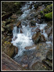
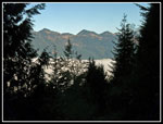
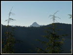
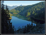
Now I took that left turn and headed up the trail. In just a few minutes Granite Creek was right below me. In short order I reached the log bridge over Granite Creek. Back in February it was a little icy and had no hand rail. Now it was dry and has a secure rail. Much easier and safer to cross. For more than 10 days the Puget Sound Basin has been under an inversion. Dark fog/clouds near the surface. Above about 1200' is blue sky and much warmer temperatures. This would be the last day of the inversion. I left the car in a dark mist and it continued beyond the creek crossing. Soon the sky became lighter and before I reached the turn off to Granite Lakes I was under bright blue sky. I could look down the road/trail and see peaks to the north and a sea of white clouds below me. So much better than the dark dank in town.
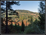
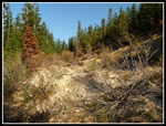
The road conversion is much better higher up in my opinion. The trail is still constantly turning from one side of the old road to the other. It does so much more gradually. Fewer sharp turns straight across the old road rather than heading up it. The only time I went beyond the Granite Lakes junction was on snow. It was interesting to see hike it on dirt. The road switches back a few times as it gains elevation at a steady clip. It was feeling warmer as thinning forest provided some more sunshine. One final switchback to the right and I reached the old Thompson Lake trailhead. On my earlier winter trip we snowshoed by this point. Above here the road has been obliterated. It looks to be very hard to hike. Might be okay with six feet of snow on it..
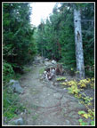
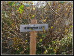
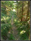
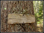
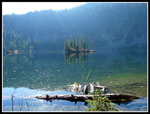
The trail is in pretty good shape. It is narrow but easy to hike. A steep descent crosses a creek then climbs back up. After that the grade steepens. It climbs up to the top of the ridge. From there it is a steep descent to Thompson Lake. The trail reaches a big boulder field at the end of the lake. I started across when I realized that the trail switches back into forest. The route down is a little muddy near the bottom. I found a sign showing GRANITE CR. RD. one way and the Mt. Defiance TR. the other. So this is where the Mt. Defiance Trail begins. The trail drops to near lake level and crosses the bottom of the boulder field. It then climbs the next ridge and continues on to Mt. Defiance then Rainbow and near Island Lakes. I found a campsite near the lake and went to the shore. It was sunny here and I ended up spending over an hour.
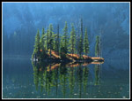
It was warm and sunny, two things that were not going to happen back in Seattle. I reached the lake shore at 11:23 am. It took my 3:06 to hike 5 1/2 miles with 3550' of gain. At 12:30 pm the sun was behind the ridge and I headed back. I climbed up to the trail sign and found the trail heading around the left side of the lake. It was still sunny over there. The trail has ups and downs. There are a couple big trees down. It did not take long to hike to the lake outlet. At the outlet I had a clear view down the lake. There are several islands at the end of the lake. Very warm back in the sunshine. I crossed the outlet and went a little farther. The GPS map shows it drops a short way to a much smaller lake/pond. I choses not to go there. Back at the outlet I could hear voices. Several folks were at the far end of the lake where I had spent an hour. I was looking into the sun and could not see them. It 1:00 pm I started back.
In short order I reached the trail sign and started the steep climb back to the ridge top. Near the top I caught up with a hiker. At the ridge top I met his friend. These guys started at the Ira Spring trailhead, hiked up Mt. Defiance, and were on their way down the Granite Creek trail. That is a one way trip I would like to do. I left first and sped down the trail. Soon I was on the road. Just before I reached the Granite Lakes junction I caught up with another hiker. She too had been to Thompson Lake. Those three were the only people I saw all day. As I hiked down the trail I could now see the top of the cloud layer below me. I had no desire to drop back into the cold dark gloom. When I did the temperature dropped at least 10 degrees instantly. I had to put on a long sleeve shirt and gloves.
I found the top of the short cut trail and the last mile went quickly. I reached my car at 3:47 pm. It took 2:47 to come down from the far end of the lake. This was a great hike. Two new sections of trail and a lake I had looked down on but never visited. Near total solitude right next to Mailbox Peak, one of the busiest hikes in the area. Best of all, I spent much of the day above the gloom with bright sunshine. Now I just need to do the one way hike and see the last few miles of the Mt. Defiance trail I have not hiked.
Click on thumbnails to get
larger pictures.
Trips - 2013
Home
I cruised by the Granite Creek trailhead and continued to near the vehicle bridge over the Middle Fork Snoqualmie River. I have known about the short cut trail for some time. I even found the upper end at the Granite Creek Road/trail. This day I hiked it for the first time. I left the 8:40' starting place at 8:17 am. the trail is very steep in places and buried under leaves in others. I climbed up to the road and took a left turn. Quickly the road looked more abandoned than converted to trail. There is a good reason for that. It was an abandoned road. Heading back to where I reached the road I spied steps heading up the steep cut bank on the uphill side. Lesson #1 on the short cut trail. When you reach a road continue up the hillside. A few minutes later I reached the real Granite Creek route. Just about exactly one mile to this point.
Now I took that left turn and headed up the trail. In just a few minutes Granite Creek was right below me. In short order I reached the log bridge over Granite Creek. Back in February it was a little icy and had no hand rail. Now it was dry and has a secure rail. Much easier and safer to cross. For more than 10 days the Puget Sound Basin has been under an inversion. Dark fog/clouds near the surface. Above about 1200' is blue sky and much warmer temperatures. This would be the last day of the inversion. I left the car in a dark mist and it continued beyond the creek crossing. Soon the sky became lighter and before I reached the turn off to Granite Lakes I was under bright blue sky. I could look down the road/trail and see peaks to the north and a sea of white clouds below me. So much better than the dark dank in town.
The road conversion is much better higher up in my opinion. The trail is still constantly turning from one side of the old road to the other. It does so much more gradually. Fewer sharp turns straight across the old road rather than heading up it. The only time I went beyond the Granite Lakes junction was on snow. It was interesting to see hike it on dirt. The road switches back a few times as it gains elevation at a steady clip. It was feeling warmer as thinning forest provided some more sunshine. One final switchback to the right and I reached the old Thompson Lake trailhead. On my earlier winter trip we snowshoed by this point. Above here the road has been obliterated. It looks to be very hard to hike. Might be okay with six feet of snow on it..
The trail is in pretty good shape. It is narrow but easy to hike. A steep descent crosses a creek then climbs back up. After that the grade steepens. It climbs up to the top of the ridge. From there it is a steep descent to Thompson Lake. The trail reaches a big boulder field at the end of the lake. I started across when I realized that the trail switches back into forest. The route down is a little muddy near the bottom. I found a sign showing GRANITE CR. RD. one way and the Mt. Defiance TR. the other. So this is where the Mt. Defiance Trail begins. The trail drops to near lake level and crosses the bottom of the boulder field. It then climbs the next ridge and continues on to Mt. Defiance then Rainbow and near Island Lakes. I found a campsite near the lake and went to the shore. It was sunny here and I ended up spending over an hour.
It was warm and sunny, two things that were not going to happen back in Seattle. I reached the lake shore at 11:23 am. It took my 3:06 to hike 5 1/2 miles with 3550' of gain. At 12:30 pm the sun was behind the ridge and I headed back. I climbed up to the trail sign and found the trail heading around the left side of the lake. It was still sunny over there. The trail has ups and downs. There are a couple big trees down. It did not take long to hike to the lake outlet. At the outlet I had a clear view down the lake. There are several islands at the end of the lake. Very warm back in the sunshine. I crossed the outlet and went a little farther. The GPS map shows it drops a short way to a much smaller lake/pond. I choses not to go there. Back at the outlet I could hear voices. Several folks were at the far end of the lake where I had spent an hour. I was looking into the sun and could not see them. It 1:00 pm I started back.
In short order I reached the trail sign and started the steep climb back to the ridge top. Near the top I caught up with a hiker. At the ridge top I met his friend. These guys started at the Ira Spring trailhead, hiked up Mt. Defiance, and were on their way down the Granite Creek trail. That is a one way trip I would like to do. I left first and sped down the trail. Soon I was on the road. Just before I reached the Granite Lakes junction I caught up with another hiker. She too had been to Thompson Lake. Those three were the only people I saw all day. As I hiked down the trail I could now see the top of the cloud layer below me. I had no desire to drop back into the cold dark gloom. When I did the temperature dropped at least 10 degrees instantly. I had to put on a long sleeve shirt and gloves.
I found the top of the short cut trail and the last mile went quickly. I reached my car at 3:47 pm. It took 2:47 to come down from the far end of the lake. This was a great hike. Two new sections of trail and a lake I had looked down on but never visited. Near total solitude right next to Mailbox Peak, one of the busiest hikes in the area. Best of all, I spent much of the day above the gloom with bright sunshine. Now I just need to do the one way hike and see the last few miles of the Mt. Defiance trail I have not hiked.
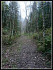 Starting Out |
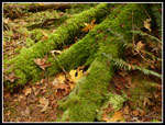
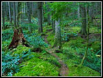 Great Mossy Color |
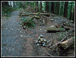 Trail Junction |
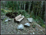 Trailside Bench |
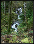 Granite Creek Cascades |
 Crossing Granite Creek |
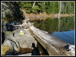
 Bridge |
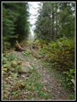 Looking Like Trail |
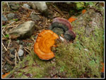 Bright Fungi |
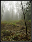 Very Foggy |
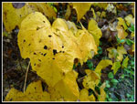 Bright Yellow Leaves |
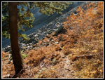
 Muted Colors |
 Near Lower Granite Lake |
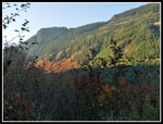
 Above The Clouds |
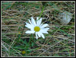 October Flowers? |
 Lakes Junction |
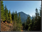
 Mailbox High Above |
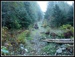
 Thompson Road/Trail |
 Obliterated Road |
 Thompson Trail |
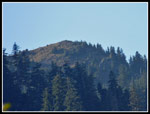
 McClellan? |
 Beargrass |
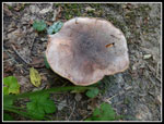 Mushroom |
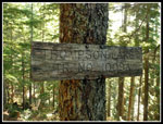 Old Trail Sign |
 Nearing Lake |
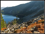 Thompson Lake Below |
 Mt. Defiance Trail |
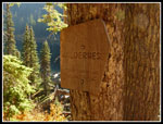 Wilderness Sign |
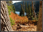 Fall Color & Lake |
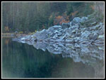
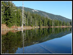 Lake Reflection |
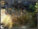 Grass |
 My Lake Spot |
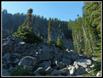 Rock Field |
 Boulders Reflection |
 Island |
 Colorful Island |
 Leaving Lake |
 Steep Climb |
 Web Mountain |
 Zoomed Mailbox Peak |
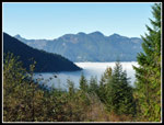 Cloud Layer Nears |
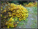 More Yellow Leaves |
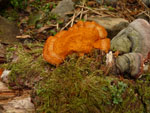 Reddish Fungus |
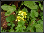 More Wildflowers? |
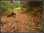 Leaves Cover Trail |
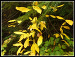 Even More Yellow |
 Moss & Leaves |
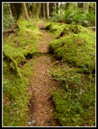 Mossy Trail |
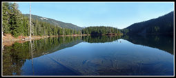 Thompson Lake Panorama |
Trips - 2013
Home