7/04-06/14
The
Suiattle River Road washed out at Downey Creek in 2003. It washed out
another 8.5 miles before Downey in 2006. Since then the only way to get
back there is to walk or bike the road. In 2009
Kim, Randy, and I explored the old lower part of the Green Mountain
Road. It gains 2000' in 2.4 miles to reach the logging road near the
normal trailhead. It beats biking with an overnight backpack up the 6+
steep miles of the Green Mountain Road. On our 2009 trip we managed to
follow the old trail, abandoned some 55 years, to the current
trailhead. We continued to the upper basin and camped. In the evening
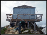
we climbed snow to the lookout sight. The building was then down in
Darrington being repaired.
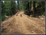
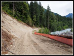
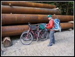
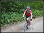
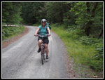
In 2012 I repeated the trip with Gary. His route finding skills avoided the several times we lost the trail on the first trip. This trip was in the fall and the lookout was back in place. The Suiattle River Road is scheduled to be fully repaired by late October this year. Kim and I hatched a plan for a final visit before the crowds "rediscover" the trail after eight years. Gwen was nutty enough to sign on too. We headed east to Darrington on Friday July 4th. We arrived at the current end of the road, some nine miles from Downey Creek. The road is a steady though not steep climb. The new construction is apparent in several places. We were able to ride the low road where a new bypass will take the road higher and away from the river and its destructive capability.
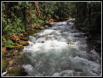
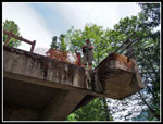
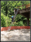
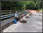
We stopped several times and arrived at Downey Creek at about 2:30 pm. In the past there was a wooden ramp up to the concrete bridge. Construction will remove much dirt and build a long bridge to connect to the existing one. The mouth of Downey Creek will be much wider. Enough dirt has been remove to leave a long drop from the bridge to the ground. At least for now, a temporary metal ladder is in place. I'm not sure anyone should count on it remaining while construction continues. We chose to climb the ladder with our backpacks and camp in the Downy Creek Campgrounds. On our way in we met one group of Ptarmigan Traversers walking out and on the way out we met some Dome Peak climbers heading out. Fortunately the ladder was in place. Fording Downey Creek right now would be very dangerous.
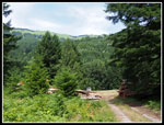
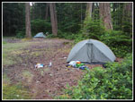
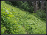
We set up camp and had dinner on the bridge. It had enough breeze to minimize the skeeters. later we walked the road several miles to the Sulphur Creek Trail, Campgrounds, and Bridge. The road beyond Downey Creek was been closed for almost eleven years now. There are a lot of trees and brush growing in it. That will all change soon. The campgrounds is choked with brush and trees. The road loop and the sites as well. We took a short tour. We returned to camp to find some light drizzle starting and soon went to bed.
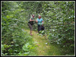
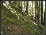
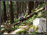
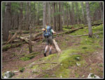
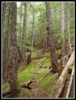
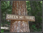
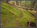
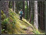
At 6:30 am I marshaled the troops and we started getting ready for the day. We were back at the bikes and ready to get started at 8:30 am. The old abandoned trail is hard to describe. Plain in spots and just a small depression in the moss in others. Lots of trees down though less than I would expect after six decades without maintenance. There is lots of salal and low brush at first. That goes away as the trail climbs. On the first trip we completely lost the trail about 500' up. it took awhile to find it again. We had trouble there on the way down too. On trip two we sailed right through the jumble of downed trees at the trouble spot in both directions. This time it was just like trip one. It took us some time in both directions to get back on track again. Other than that one spot we kept right on track.
There are some big trees back there. They are worth the effort alone. It was humid in spots which was not appreciated. We did avoid any rain. I recalled a few trouble spots and we finally plunged out onto the road just down from the normal trailhead. As I climbed up to the road I looked around and saw... two bikers and a dog. All that effort and there were two folks right there. What are the odds? They were the only people we saw off the Suiattle Road all weekend. They went up as far the the snow and turned around. We took a break at the parking lot and compared cuts and bruises. You can't climb over all those trees without getting quite a few.
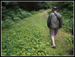
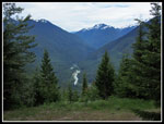
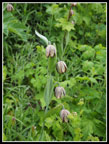
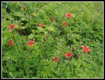
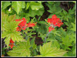
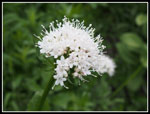
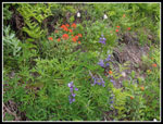
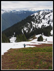
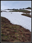
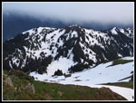
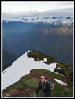
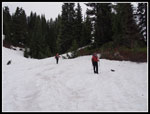
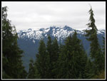
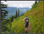
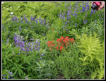
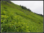
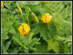
Now came the easy part. There were logs down on the 2009 trip and none on the 2012 trip. There are none more than an easy step over now. The morning ordeal took a bit out of us and we were not all that fast heading up the now nice trail. The creek just up from the trailhead was the first water we found since Downey Creek. We filled up. The upper trail comes out of the forest into the huge green meadows the hike is known for. We saw chocolate lilies, valerian, Indian paintbrush, lupine, tiger lilies, columbine, yellow violets, Jacobs ladder, and more. It is still well short of the peak of the wildflower show but it is nice already. Lots of small berries for the bears later. We had clear views to Whitechuck Mountain and Pugh and Sloan and many more but Glacier Peak was in the clouds.
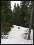
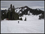
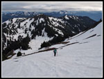
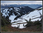
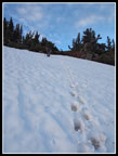
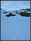
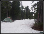
I learned on the late June 2009 trip that when the trail traversed from the south side to the east then north the snow starts immediately. We were prepared. Bare ground turned to three feet of snow in two minutes. We pulled out gaiters and continued. The GPS was very helpful in keeping us on route. At the high point before dropping to the tarn and meadow below we stopped. The consensus was to camp here instead of dropping as on the prior trips. We had Flat snow and a view of the summit of Green Mountain. The clouds had come in and the weather was threatening. This would be an easy place to break camp and head out in a hurry if necessary.
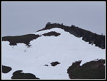
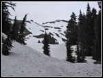
It was 4:30 pm when we set up camp. After dinner we discussed trying for the summit. Gwen decided 4000' of gain, half of it on an abandoned trail log crossing scramble, was enough for the day. Kim and I decided to give it a try. I did not want to come down the steep snow in the dark so we planned on an 8:: pm turn around time. At 6:15 pm we headed out. A quick drop brought us to the tarn, still mostly snow covered. From there it was straight uphill. We debated trying to follow the summer trail. It looked like it would require some steep side hilling in places. Instead we went straight up. The snow was in pretty good shape. Well consolidated but with the top soft enough to kick steps. Higher up we switched a pole for ice axes. The route brought us to a spot where the cliffy ridge is bare dirt and allowed access to the ridge top trail. From there it was an easy walk to the top. We arrive on top at 8:01 pm.
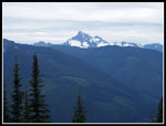
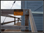
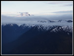
All the peaks to the north were in the clouds. Those to the south were mostly in the clear. Glacier Peak was the exception. We brought along a sign to affix to the railing courtesy of the USFS. Screwing it into the wood with no pilot hole took awhile. We were finished and started down at 8:17pm. Easily my shortest stay on top. Just as we left the top of Glacier Peak came out of the clouds. That made it all worthwhile. We climbed gingerly down the steepest snow and as the grade moderated just a little it was time for some glissading. The snow was hard enough to provide some good speed. It was 1300' up from the tarn. We lost half that in minutes. Then began the long trudge back to camp. We arrived just before dark at 9:35 pm.
During the night we had a little rain but it had stopped by morning. Since it was all down hill on day three we slept in until 7"30 am. We finally started down at 9:30 am. In no time we were off the snow and gaiters, long pants and jackets gave way to shorts and short sleeves. The fear of all the brush in the upper meadows being soaking wet was misplaced. It was completely dry. Still no views of Glacier Peak that morning. We were back at the upper trailhead by noon. The short road walk and then back on the abandoned trail. All the log crossing quickly became tiresome but we made much better time. In the lower sections it was extremely muggy. We lost the trail at the bad spot and went cross country before picking it up once again. By 3:15 we were back at Downey Creek.
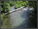
Soon the five Dome Peak climbers arrived and talked about their successful climb. We headed over to the creek to clean up and enjoy the cold water and breeze. The creek really moves fast under the bridge. We did not wade out. It was 4:30 pm when we mounted our bikes for the ride out. After 16 miles of hiking and 5500' of gain plus the abandoned trail up and down we were not looking forward to nine more miles. The biking proved to be fun. It took only 1:15 to reach the truck. Another successful trip up the old trail to Green Mountain.
This will likely be the last time I hike the lower trail. Next year the road should be open to 3500' instead of the 1450' where the Downey Creek start is located. There will be reason to hike a piece of pacific northwest history. I am glad that I did it all three times. It was a fun if strenuous three day weekend. Thanks to Kim and Gwen for keeping it lighthearted when the bug bites and cuts began to mount.
Click on thumbnails to get
larger pictures.
Trips - 2014
Home
In 2012 I repeated the trip with Gary. His route finding skills avoided the several times we lost the trail on the first trip. This trip was in the fall and the lookout was back in place. The Suiattle River Road is scheduled to be fully repaired by late October this year. Kim and I hatched a plan for a final visit before the crowds "rediscover" the trail after eight years. Gwen was nutty enough to sign on too. We headed east to Darrington on Friday July 4th. We arrived at the current end of the road, some nine miles from Downey Creek. The road is a steady though not steep climb. The new construction is apparent in several places. We were able to ride the low road where a new bypass will take the road higher and away from the river and its destructive capability.
We stopped several times and arrived at Downey Creek at about 2:30 pm. In the past there was a wooden ramp up to the concrete bridge. Construction will remove much dirt and build a long bridge to connect to the existing one. The mouth of Downey Creek will be much wider. Enough dirt has been remove to leave a long drop from the bridge to the ground. At least for now, a temporary metal ladder is in place. I'm not sure anyone should count on it remaining while construction continues. We chose to climb the ladder with our backpacks and camp in the Downy Creek Campgrounds. On our way in we met one group of Ptarmigan Traversers walking out and on the way out we met some Dome Peak climbers heading out. Fortunately the ladder was in place. Fording Downey Creek right now would be very dangerous.
We set up camp and had dinner on the bridge. It had enough breeze to minimize the skeeters. later we walked the road several miles to the Sulphur Creek Trail, Campgrounds, and Bridge. The road beyond Downey Creek was been closed for almost eleven years now. There are a lot of trees and brush growing in it. That will all change soon. The campgrounds is choked with brush and trees. The road loop and the sites as well. We took a short tour. We returned to camp to find some light drizzle starting and soon went to bed.
At 6:30 am I marshaled the troops and we started getting ready for the day. We were back at the bikes and ready to get started at 8:30 am. The old abandoned trail is hard to describe. Plain in spots and just a small depression in the moss in others. Lots of trees down though less than I would expect after six decades without maintenance. There is lots of salal and low brush at first. That goes away as the trail climbs. On the first trip we completely lost the trail about 500' up. it took awhile to find it again. We had trouble there on the way down too. On trip two we sailed right through the jumble of downed trees at the trouble spot in both directions. This time it was just like trip one. It took us some time in both directions to get back on track again. Other than that one spot we kept right on track.
There are some big trees back there. They are worth the effort alone. It was humid in spots which was not appreciated. We did avoid any rain. I recalled a few trouble spots and we finally plunged out onto the road just down from the normal trailhead. As I climbed up to the road I looked around and saw... two bikers and a dog. All that effort and there were two folks right there. What are the odds? They were the only people we saw off the Suiattle Road all weekend. They went up as far the the snow and turned around. We took a break at the parking lot and compared cuts and bruises. You can't climb over all those trees without getting quite a few.
Now came the easy part. There were logs down on the 2009 trip and none on the 2012 trip. There are none more than an easy step over now. The morning ordeal took a bit out of us and we were not all that fast heading up the now nice trail. The creek just up from the trailhead was the first water we found since Downey Creek. We filled up. The upper trail comes out of the forest into the huge green meadows the hike is known for. We saw chocolate lilies, valerian, Indian paintbrush, lupine, tiger lilies, columbine, yellow violets, Jacobs ladder, and more. It is still well short of the peak of the wildflower show but it is nice already. Lots of small berries for the bears later. We had clear views to Whitechuck Mountain and Pugh and Sloan and many more but Glacier Peak was in the clouds.
I learned on the late June 2009 trip that when the trail traversed from the south side to the east then north the snow starts immediately. We were prepared. Bare ground turned to three feet of snow in two minutes. We pulled out gaiters and continued. The GPS was very helpful in keeping us on route. At the high point before dropping to the tarn and meadow below we stopped. The consensus was to camp here instead of dropping as on the prior trips. We had Flat snow and a view of the summit of Green Mountain. The clouds had come in and the weather was threatening. This would be an easy place to break camp and head out in a hurry if necessary.
It was 4:30 pm when we set up camp. After dinner we discussed trying for the summit. Gwen decided 4000' of gain, half of it on an abandoned trail log crossing scramble, was enough for the day. Kim and I decided to give it a try. I did not want to come down the steep snow in the dark so we planned on an 8:: pm turn around time. At 6:15 pm we headed out. A quick drop brought us to the tarn, still mostly snow covered. From there it was straight uphill. We debated trying to follow the summer trail. It looked like it would require some steep side hilling in places. Instead we went straight up. The snow was in pretty good shape. Well consolidated but with the top soft enough to kick steps. Higher up we switched a pole for ice axes. The route brought us to a spot where the cliffy ridge is bare dirt and allowed access to the ridge top trail. From there it was an easy walk to the top. We arrive on top at 8:01 pm.
All the peaks to the north were in the clouds. Those to the south were mostly in the clear. Glacier Peak was the exception. We brought along a sign to affix to the railing courtesy of the USFS. Screwing it into the wood with no pilot hole took awhile. We were finished and started down at 8:17pm. Easily my shortest stay on top. Just as we left the top of Glacier Peak came out of the clouds. That made it all worthwhile. We climbed gingerly down the steepest snow and as the grade moderated just a little it was time for some glissading. The snow was hard enough to provide some good speed. It was 1300' up from the tarn. We lost half that in minutes. Then began the long trudge back to camp. We arrived just before dark at 9:35 pm.
During the night we had a little rain but it had stopped by morning. Since it was all down hill on day three we slept in until 7"30 am. We finally started down at 9:30 am. In no time we were off the snow and gaiters, long pants and jackets gave way to shorts and short sleeves. The fear of all the brush in the upper meadows being soaking wet was misplaced. It was completely dry. Still no views of Glacier Peak that morning. We were back at the upper trailhead by noon. The short road walk and then back on the abandoned trail. All the log crossing quickly became tiresome but we made much better time. In the lower sections it was extremely muggy. We lost the trail at the bad spot and went cross country before picking it up once again. By 3:15 we were back at Downey Creek.
Soon the five Dome Peak climbers arrived and talked about their successful climb. We headed over to the creek to clean up and enjoy the cold water and breeze. The creek really moves fast under the bridge. We did not wade out. It was 4:30 pm when we mounted our bikes for the ride out. After 16 miles of hiking and 5500' of gain plus the abandoned trail up and down we were not looking forward to nine more miles. The biking proved to be fun. It took only 1:15 to reach the truck. Another successful trip up the old trail to Green Mountain.
This will likely be the last time I hike the lower trail. Next year the road should be open to 3500' instead of the 1450' where the Downey Creek start is located. There will be reason to hike a piece of pacific northwest history. I am glad that I did it all three times. It was a fun if strenuous three day weekend. Thanks to Kim and Gwen for keeping it lighthearted when the bug bites and cuts began to mount.
 New Road Section |
 Buck Creek |
 Green Mt. Pasture |
 Widened Road |
 Gwen On Downey Bridge |
 Kim Climbs Ladder |
 Downey Creek |
 Road Closed |
 Dinner On The Bridge |
 Gwen On Suiattle Road |
 Overgrown Discussion |
 Sulphur Creek |
 Thumbs Up! |
 Downey Campsite |
 Ready To Hike |
 On Old Trail |
 Over The Log |
 Gwen On Trail |
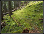 Thick Mossy Trail |
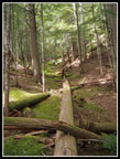 Up The Swale |
 Nearing Road |
 View From Trailhead |
 Whitechuck Mountain |
 Chocolate Lilies |
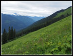 Big Meadow |
 Columbine |
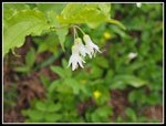 Hooker's Fariybells |
 Indian Paintbrush |
 Valerian |
 Lupine & Paintbrush |
 Onto Snow |
 Green Mt. Summit |
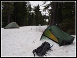 Campsite |
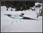 Frozen Tarn |
 Summit In Sight |
 Kim On Flats |
 Onto Bare Ground |
 Ridge Above |
 Climbing Snow |
 Onto The Ridge |
 Sign In Place |
 Kim At Lookout |
 Our Route Up |
 Glacier Peak |
 Kim On Ridge |
 Steep Near Ridge |
 Glissading! |
 Near The Bottom |
 Sunday Morning |
 Glissade Tracks |
 Heading Down |
 Snowy Peaks |
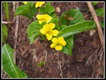 Yellow Violets |
 Gwen & Camera |
 Bouquet |
 Vast Meadow |
 Tiger Lilies |
 Brushy |
 Trailhead Sign |
 Back On Old Trail |
 Kim On Old Trail |
 Gwen & Hedgy |
 Kim Finishes Biking |
Trips - 2014
Home