11-02-14
In
2012 I was invited to join Steve Payne for his annual group hike of the
Iron
Goat Trail near Stevens Pass. It
was the first time that I hiked the trail. Two years later I joined
Steve's group once more. The hike is along the old railroad grade that
tunneled under Stevens Pass. When the new tunnel was opened
in 1929 the old grade was abandoned. One problem with the old
grade is that avalanches often came down Windy Mountain and across the
tracks. Over six miles of snowsheds were built to try to protect the
trains. The Wellington avalanche in 1910 knocked a train off the tracks
and killed 96 people. The longer lower tunnel still being used today
was the solution. For most of the next 85 years the route became
overgrown and unused. In recent years it was rebuilt as a hiking trail.
Lots of history to be seen on this hike.
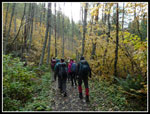
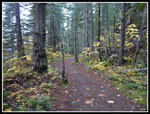
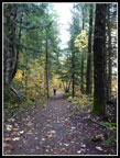
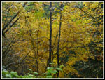
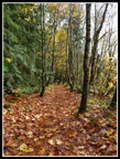
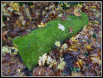
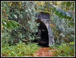
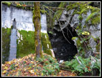
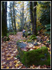
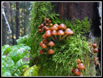
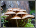
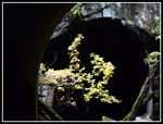
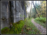
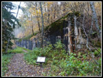
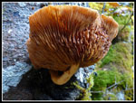
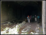
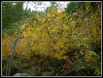
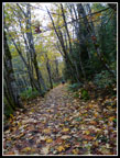
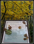
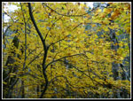
Gwen and I arrived at 9:07 am, just a few minutes late. twenty five minutes later everyone else arrived. It was a gray cloudy day but it never did rain. The Martin Creek trailhead is 3.7 miles off of Highway 2. It is at a switchback in the old railroad grade. You can hike downhill to the trailhead right along Highway 2 or up towards the old tunnel. We chose to head downhill to start. There are a number of old tunnels along the grade. Most have collapsed at one end. There are also many walls from old snowsheds. Quite a few interpretive signs explain the historical features. This is a good time of year to hike the trail. There are many deciduous trees along the grade. Lots of colorful leaves on trees and on the ground. There were a lot of mushrooms too.
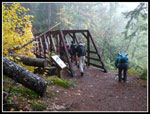
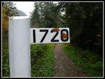
The grade is very gently graded. Very gently. We slowly lost elevation on our way to Highway 2. With all the leaves, tunnels, and viewpoints the group made many stops. At 2.8 miles we reached the lower trailhead. More interpretive signs, railroad cars, and restrooms were found. After a break we headed on. A short backtrack to the junction then uphill. The next mile gains about 700' to reach the upper grade. that's just about all the elevation gain for the day. The trail up has many short switchbacks. The grade starts easy but gets steep near the top. The sign at the top shows it is 3 miles back to the Martin Creek trailhead. It is only a quarter mile up the grade to Windy Point. That would be our lunch spot.
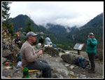
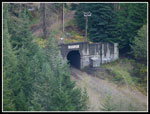
We arrived to find the group enjoying lunch. Since it was just a few days after Halloween there were a lot of treats being shared. Although it was cloudy we had better views than in 2012. Below us was the entrance to the current railroad tunnel. Highway 2 climbed the walls of the valley across from us. With almost no wind it was not uncomfortably cool. I put on a jacket but no insulating layer. We spent nearly 45 minutes at Windy Point. The way down the upper grade was easy walking. Lots more tunnels, snowshed walls, leaves, and mushrooms. There were plenty of photo opportunities. We met several groups coming up the grade. That was it for the day. A whole lot of solitude on an easy trail near the highway.
Steve's Halloween hikes are a lot of fun. It did not rain, there was a lot to see and photograph. Folks all had a good time. At some point I want to continue on the trail to the site of the Wellington avalanche. Maybe it will be next year.
Click on thumbnails to get
larger pictures.
Trips - 2014
Home
Gwen and I arrived at 9:07 am, just a few minutes late. twenty five minutes later everyone else arrived. It was a gray cloudy day but it never did rain. The Martin Creek trailhead is 3.7 miles off of Highway 2. It is at a switchback in the old railroad grade. You can hike downhill to the trailhead right along Highway 2 or up towards the old tunnel. We chose to head downhill to start. There are a number of old tunnels along the grade. Most have collapsed at one end. There are also many walls from old snowsheds. Quite a few interpretive signs explain the historical features. This is a good time of year to hike the trail. There are many deciduous trees along the grade. Lots of colorful leaves on trees and on the ground. There were a lot of mushrooms too.
The grade is very gently graded. Very gently. We slowly lost elevation on our way to Highway 2. With all the leaves, tunnels, and viewpoints the group made many stops. At 2.8 miles we reached the lower trailhead. More interpretive signs, railroad cars, and restrooms were found. After a break we headed on. A short backtrack to the junction then uphill. The next mile gains about 700' to reach the upper grade. that's just about all the elevation gain for the day. The trail up has many short switchbacks. The grade starts easy but gets steep near the top. The sign at the top shows it is 3 miles back to the Martin Creek trailhead. It is only a quarter mile up the grade to Windy Point. That would be our lunch spot.
We arrived to find the group enjoying lunch. Since it was just a few days after Halloween there were a lot of treats being shared. Although it was cloudy we had better views than in 2012. Below us was the entrance to the current railroad tunnel. Highway 2 climbed the walls of the valley across from us. With almost no wind it was not uncomfortably cool. I put on a jacket but no insulating layer. We spent nearly 45 minutes at Windy Point. The way down the upper grade was easy walking. Lots more tunnels, snowshed walls, leaves, and mushrooms. There were plenty of photo opportunities. We met several groups coming up the grade. That was it for the day. A whole lot of solitude on an easy trail near the highway.
Steve's Halloween hikes are a lot of fun. It did not rain, there was a lot to see and photograph. Folks all had a good time. At some point I want to continue on the trail to the site of the Wellington avalanche. Maybe it will be next year.
 Starting Out |
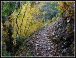
 Winding Trail |
 Evergreens & Leaves |
 Nice Leaf Color |
 Many Fallen Leaves |
 Bright Mossy Log |
 Old Tunnel |
 Wall & Tunnel |
 Gwen & Leaves |
 Interesting Bridge |
 Many Shrooms |
 More Shrooms |
 Bright & Dark |
 Snowshed Wall |
 Trail Along Wall |
 1720 Miles |
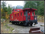 Red Caboose |
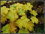 Bright Leaves |
 Connector Trail |
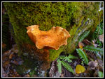 Orange Fungus |
 Big Mushroom |
 Lunch At Windy Point |
 Current Cascade Tunnel |
 Checking Out Tunnel |
 More Color |
 Tilted Forest |
 Trailside Narrative |
 Last Leaf Color |
Trips - 2014
Home