4-18-14
Good
Friday is a holiday in my business. Since so few folks are off work
that day I usually take a hike with near total solitude. Gwen was free
this day and we debated where to go. East of the crest would be sunny
but with very strong winds. We chose instead to head west. I don't do
many day hikes to the Olympics as ferry rides take longer and are more
expensive than drives to the Cascades. I had done Mt. Townsend twice
before. Both trips were in June. A little snow on top and zero
visibility on the first trip. No snow and very hot on the second. This
trip would be much earlier in the year. We met in Edmonds at 7:30 am
and took the ferry to Kingston. From there we drove across the Hood
Canal Floating Bridge and headed south to Quilcene. Just 1.5
miles south of town we took the Penny Creek road. Much of the road to
the trailhead is paved. A report a week earlier mentioned that they
were able to drive to within a quarter mile of the upper trailhead It
is at 3250' and is often snowbound in April.
We encountered some snow on the spur road to the trailhead. Tracks went through it and the Subaru did not touch the snow between the tracks. After several patches the road was clear to the parking lot. It should be all melted out within a week. There was one truck in the lot. The sunshine we had in Edmonds and Kingston gave way to clouds as we neared the mountains. As we packed up it was completely overcast and about 35 degrees. There was some snow in the lot but none on the trail at first. It was just after 10:00 am when we started hiking. The lower part of the trail is lined by rhododendrons. There is plenty of bright green moss too. This is the dry side of the Olympics but it is very green.
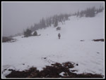
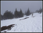
The trail gains 2950' from the upper trailhead to the summit in 4.1 miles. Although that works out to over 700' gained per mile the well graded trail does not seen that steep. At about the one mile mark we entered the Buckhorn Wilderness. Still no snow on the trail. At about 1.5 miles we had some snow. After crossing the second creek the snow began in a hurry. It was hard and icy. After a few bare patches it became more continuous and we stopped to put on microspikes. Traction was great from there on. I had hoped that the clouds would lift or that we might get above them. No such luck. On the positive side, the wind was almost nonexistent. By the time we were hiking on snow it began to snow. Light flakes at first then harder. It would be a 60 degree sunny day in Seattle and we had winter on Mt. Townsend. Since it was snow and not rain I chose not to put on a rain jacket. I was warm enough on the ascent.
It had snowed overnight and with more coming down we had a thin new layer over the icy snow. As we climbed higher the snow was not so icy. We kept the spikes on but traction would not have been too bad with just boots. When there was enough snow to clearly show our tracks I was surprised to not see tracks from the folks in the truck at the trailhead. Where they ahead of us? Near Camp Windy tracks seemed to go off in several directions. We took the most obvious ones and soon reached the trail junction. Tracks went both ways. We took the right turn. After being out in the open we were now back in forest. The snow was again icy. Tracks were melted and snowed on. We still followed them though they were not as distinct.
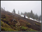
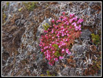
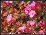
The tracks went straight up in some places then made gentle traverses in others. At times we were on the summer trail. Traversing below a bare rocky slope Gwen noticed bright pink flowers. We stopped there on the way back for photos. The slope was never steep enough or the snow hard enough that we needed to use our ice axes. Nor was there ever more than a couple feet of snow. We did very little post holing on the way up. The snow softened and we did sink in in places on the upper descent. The snow was never more than knee deep before hitting dirt. In another 3 or 4 weeks the trail should be nearly snow free.
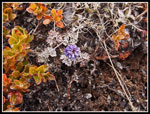
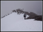
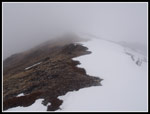
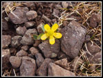
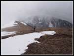
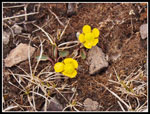
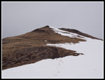
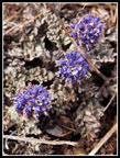
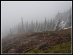
The pattern continued on the upper mountain Tracks leading straight up, reaching a little dirt trail, following the trail until under snow and then heading straight up again. I'm sure there were a lot of snow covered peaks around us but our visibility was minimal. The only tricky spots were where we climbed sections of bare ground. Easy to go up. I just feared finding our prints again on the way down. That did not prove to be a problem for us. While the climb is not technically difficult right now there is some route finding to do. Steeper slops gave way to more gentle and we were funneled to the bare saddle on the ridge top. From there we had non views in another direction. The rest of the way to the summit was partly on snow and partly on dirt. The ridge crest is bare from saddle to summit. Where the trail is on the right side it is on snow. When it moves left it is bare. We saw some yellow and purplish flowers blooming along the ridge.
When we reached the summit there were no other people and almost no wind. We went all day without seeing any other people. Total solitude on a very popular trail in the summer. The lack of wind allowed us to have a long lunch break without freezing. As the day warmed we kept ascending and my thermometer was between 34 and 38 degrees all day long. 35 on the summit did not seem all that cold with no wind. I made sure to take a 360 degree panorama video and I will include it below with the photos. Not quite the same as my last visit on a very hot and clear June day.
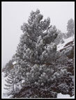
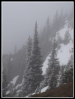
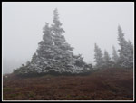
After about half and hour we packed up and headed down. The recent snow left trees half rime ice white and half green. The mist clouds also added to the mood. We took quite a few photos of the upper mountain on the way down. We had removed the microspikes when the upper ridge was largely bare ground. When we entered the forest above Camp Windy it was prudent to put them back on. It was still quite icy in the trees. We had noticed tracks heading straight up in the morning which connected some switchbacks on snow. Heading down we chose to take one to save some time. Bad choice. We chose the only one that did not connect switchbacks. We dropped several hundred feet and below us were cliffs and a big meadow. We did not see any meadow on the way up. Hmmm... A quick look at the GPS showed we were too far right of the switchbacking trail. Go back up or traverse across to the trail? The flat option of course. The map did not show the deep gully in between. We fought through very tightly spaced trees to find the gully. Down below was no trace of our uphill tracks. Where was the trail? I crossed the gully and climbed to find the trail. Gwen had more sense and just went up. It was not the first time that an "obvious" short cut took much longer than staying on trail. I still wonder why so many tracks went down to a dead end.
Our last mistake was taking off the spikes too early. There was not much snow left but what there was was very icy. We each took a few ungraceful falls. Once off snow the descent went fast. Back at the trailhead we were the only vehicle. The snow had turned to rain the last few miles and we quickly packed up and headed down the road. The missed the ferry by a few minutes and stopped for dinner as we had a 40 minute wait. That is part of the fun of taking a ferry to hike.
This turned out to be a great hike. A last blast of winter as we near May. I was surprised that we could drive to the upper trailhead and hike the whole route without snowshoes this early in the year. We did not get the fantastic views of volcanoes, islands, and big cities below but we had total solitude on a very popular trail. The misty clouds and rime ice on the trees plus a few blooming wildflowers were a real treat. The lack of wind was very much appreciated. Add in the great company and it was a terrific day to be out hiking.
Click on thumbnails to get
larger pictures.
Trips - 2014
Home
We encountered some snow on the spur road to the trailhead. Tracks went through it and the Subaru did not touch the snow between the tracks. After several patches the road was clear to the parking lot. It should be all melted out within a week. There was one truck in the lot. The sunshine we had in Edmonds and Kingston gave way to clouds as we neared the mountains. As we packed up it was completely overcast and about 35 degrees. There was some snow in the lot but none on the trail at first. It was just after 10:00 am when we started hiking. The lower part of the trail is lined by rhododendrons. There is plenty of bright green moss too. This is the dry side of the Olympics but it is very green.
The trail gains 2950' from the upper trailhead to the summit in 4.1 miles. Although that works out to over 700' gained per mile the well graded trail does not seen that steep. At about the one mile mark we entered the Buckhorn Wilderness. Still no snow on the trail. At about 1.5 miles we had some snow. After crossing the second creek the snow began in a hurry. It was hard and icy. After a few bare patches it became more continuous and we stopped to put on microspikes. Traction was great from there on. I had hoped that the clouds would lift or that we might get above them. No such luck. On the positive side, the wind was almost nonexistent. By the time we were hiking on snow it began to snow. Light flakes at first then harder. It would be a 60 degree sunny day in Seattle and we had winter on Mt. Townsend. Since it was snow and not rain I chose not to put on a rain jacket. I was warm enough on the ascent.
It had snowed overnight and with more coming down we had a thin new layer over the icy snow. As we climbed higher the snow was not so icy. We kept the spikes on but traction would not have been too bad with just boots. When there was enough snow to clearly show our tracks I was surprised to not see tracks from the folks in the truck at the trailhead. Where they ahead of us? Near Camp Windy tracks seemed to go off in several directions. We took the most obvious ones and soon reached the trail junction. Tracks went both ways. We took the right turn. After being out in the open we were now back in forest. The snow was again icy. Tracks were melted and snowed on. We still followed them though they were not as distinct.
The tracks went straight up in some places then made gentle traverses in others. At times we were on the summer trail. Traversing below a bare rocky slope Gwen noticed bright pink flowers. We stopped there on the way back for photos. The slope was never steep enough or the snow hard enough that we needed to use our ice axes. Nor was there ever more than a couple feet of snow. We did very little post holing on the way up. The snow softened and we did sink in in places on the upper descent. The snow was never more than knee deep before hitting dirt. In another 3 or 4 weeks the trail should be nearly snow free.
The pattern continued on the upper mountain Tracks leading straight up, reaching a little dirt trail, following the trail until under snow and then heading straight up again. I'm sure there were a lot of snow covered peaks around us but our visibility was minimal. The only tricky spots were where we climbed sections of bare ground. Easy to go up. I just feared finding our prints again on the way down. That did not prove to be a problem for us. While the climb is not technically difficult right now there is some route finding to do. Steeper slops gave way to more gentle and we were funneled to the bare saddle on the ridge top. From there we had non views in another direction. The rest of the way to the summit was partly on snow and partly on dirt. The ridge crest is bare from saddle to summit. Where the trail is on the right side it is on snow. When it moves left it is bare. We saw some yellow and purplish flowers blooming along the ridge.
When we reached the summit there were no other people and almost no wind. We went all day without seeing any other people. Total solitude on a very popular trail in the summer. The lack of wind allowed us to have a long lunch break without freezing. As the day warmed we kept ascending and my thermometer was between 34 and 38 degrees all day long. 35 on the summit did not seem all that cold with no wind. I made sure to take a 360 degree panorama video and I will include it below with the photos. Not quite the same as my last visit on a very hot and clear June day.
After about half and hour we packed up and headed down. The recent snow left trees half rime ice white and half green. The mist clouds also added to the mood. We took quite a few photos of the upper mountain on the way down. We had removed the microspikes when the upper ridge was largely bare ground. When we entered the forest above Camp Windy it was prudent to put them back on. It was still quite icy in the trees. We had noticed tracks heading straight up in the morning which connected some switchbacks on snow. Heading down we chose to take one to save some time. Bad choice. We chose the only one that did not connect switchbacks. We dropped several hundred feet and below us were cliffs and a big meadow. We did not see any meadow on the way up. Hmmm... A quick look at the GPS showed we were too far right of the switchbacking trail. Go back up or traverse across to the trail? The flat option of course. The map did not show the deep gully in between. We fought through very tightly spaced trees to find the gully. Down below was no trace of our uphill tracks. Where was the trail? I crossed the gully and climbed to find the trail. Gwen had more sense and just went up. It was not the first time that an "obvious" short cut took much longer than staying on trail. I still wonder why so many tracks went down to a dead end.
Our last mistake was taking off the spikes too early. There was not much snow left but what there was was very icy. We each took a few ungraceful falls. Once off snow the descent went fast. Back at the trailhead we were the only vehicle. The snow had turned to rain the last few miles and we quickly packed up and headed down the road. The missed the ferry by a few minutes and stopped for dinner as we had a 40 minute wait. That is part of the fun of taking a ferry to hike.
This turned out to be a great hike. A last blast of winter as we near May. I was surprised that we could drive to the upper trailhead and hike the whole route without snowshoes this early in the year. We did not get the fantastic views of volcanoes, islands, and big cities below but we had total solitude on a very popular trail. The misty clouds and rime ice on the trees plus a few blooming wildflowers were a real treat. The lack of wind was very much appreciated. Add in the great company and it was a terrific day to be out hiking.
|
Panorama From Mt. Townsend Summit |
Trips - 2014
Home


