6-20-15
Time
for a trip to the Teanaway
Valley before the heat of summer picks up. Everyone else had plans so
this was a solo trip. I was out the door by 6:30 am and heading east.
The NF Teanaway Road was partly paved on my last visit. Now
it is
all new pavement from Highway 970 all the way to the end of pavement at
29 Pines campground. The dirt part has also been recently graded. It is
in fine shape. I turned off at Beverly Creek and the road is still not
great. It used to be fine but many drainage ditches cut across the road
in recent years have left deep trenches to cross. That might be a fair
trade off except that only one of them is in a spot that has ever had
drainage problems. Nothing like fixing problems that never existed. I
drove very slowly looking for them and almost made it out unscathed. I
managed to bottom out once on the way out.
I arrived at the Beverly Creek Trailhead at 8:20 am. By 8:26 I was on my way. There were three other cars in the lot. It was a little chilly at the start. It would get up into the mid 70s and the cool morning was fine. Bean Creek still has a reasonable flow but it was easy to rock hop across. There were some wildflowers right from the start. In fact, much of the trip had at least some flowers in bloom. Lots of roses right before Bean Creek. Gwen and I tried to hike up Iron Peak on March 22nd of this year. We drove to the trailhead and hiked up into Beverly Basin before hitting snow. It was quickly too deep and the crossing of Beverly Creek to difficult. We opted for Mary Peak instead. Snow was certainly not a problem this day.
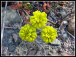
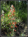
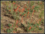
I popped out of the forest near the creek and reached the beginning of the wildflower fields. Not a huge variety but lots of wildflowers in bloom. The scarlet gilia was the most prolific. Lots of it and right near prime. I also saw Sitka valerian, harebells, buckwheat, Columbia lewisia, spring beauty, stonecrop, and more. I made a lot of photo stops. There was just enough wind to make it difficult to get a non blurry shot. I hiked at a good pace but the stops slowed me way down. The south sides of Teanaway and Bill Peak were snow free. It was 10:00 am by the time I reached the Fourth Creek junction. More than 1.5 hours to hike just under three miles. Not a great time but I had all day. It was already warming up.
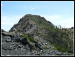
The meadow before crossing Beverly Creek was full of shooting stars. I have seen lots of Indian paintbrush here but only a few at this time. There were more flowers along the switchbacking trail. many columbine though nearly all past prime. Also more shooting stars. In the early spring I climb directly to the summit ridge of Iron on snow. The trail takes a much less direct and longer route. The slope is rapidly drying as some small creeks are already dry. I finally topped out at the saddle below Teanaway Peak and now could see all the peaks to the west. It was a sunny day and the views were great. The ridge hike to the 6510' summit climbs a barren slope that has an amazing array or wildflowers that are unique to this spot. I noticed a lupine like flower that was not like the lupine I usually see. Another looked similar to douglasia but different. Quite a variety of colors along the way. I reached the summit at 11:15 am. I took 2:45 to hike 4 1/2 miles with 2900' of elevation gain.
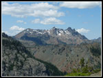
The views from the summit are outstanding. Rainier is to the southwest The Cascade Crest peaks are to the west. Hawkins and Esmerelda are close by. Mt. Stuart and the Stuart Range dominate to the north. Teanaway, Bill, Mary, Judi, and Earl are nearby Teanaway Peaks. I could see that there was a little snow left on Fortune Peak but not much. I sat down for the first part of my lunch and just admired the views. The relative ease of snow ascents of Iron make it an excellent winter/early spring backpacking trip. I have now camped on the summit on snow five times and loved each trip. So different when all the peaks are white. Here is a link to my 2011 summit camp trip report.
I spent 35 minutes on top and headed down at 11:50 am. Almost 3.5 hours and I had not yet seen a single person. I hiked down the ridge, then back down into Beverly Basin. At the junction with the Fourth Creek Trail I turned left and headed uphill. Two hikers coming up the valley beat me to the junction by one minute. I quickly passed them. Heading up I ran into a hiker I have met on the trail two times previously. He recognized me from my site on the trail to Buck Creek Pass and again last November on the Green Mountain Trail. We seem to frequent the same trails on the same days. He was doing the loop over Bean Peak in the opposite direction. We stopped to talk once again. I'm awful at recognizing a face I have only seen a time or two over several years. Fortunately he is not. Nice to run into folks on the trail.
I really enjoy the trail over to the ridge of Bean Peak above Hardscrabble Basin. It was a bit muddy in spots but very green still. The two largest creeks were still running. Farther along there are good views to the Stuart Range. It was getting toasty as I reached the rocky section that goes straight uphill. The little bits of shade were the last ones I would have until down into Bean Creek Basin. Up on the ridge next to Volcanic Neck there was a cool breeze that was much appreciated. The scramble up to the summit of Bean Peak is very straight forward. Just since my last visit a few years ago a boot path has emerged. I guess the route is getting more popular.
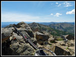
I reached the summit at 2:45 pm. The leg from Iron Peak took me 2:55. More than I expected. Still, I had plenty of daylight left on this day before the longest day of the year. Great views from the summit. There is was still some snow beneath the summits of Stuart, Colchuck, and Dragontail Peaks. A small patch on the ridge from Bean to Mary on the north side. Not much else. Soon after I arrived a lone scrambler came up from the Bean Creek side. He was the fourth and last person I saw all day. He was heading over to Volcanic Neck. We had a nice conversation before he continued on. I stayed on top until 3:35 pm. The fifty minutes went by very fast.
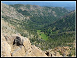
I headed straight down the face. Quite steep but very good hand and footholds. Instead of heading left into the basin I headed right. A little longer but less steep route. At the head of the basin the wildflower show began. It is very wet there. Lots of thistles, Indian paintbrush, bog orchids, and elephant's head. The last is very small. You need to get up real close to see the big ears and trunks of the "elephants". Heading over to the new trail I came upon two coyotes in the meadow. They never saw me. That is an unusual sighting for me. I was surprised to see no trace of anyone else in the basin on a Saturday afternoon in wildflower season. I had it all to myself. Heading down to the lower basin the flower show turned back to buckwheat, pearly everlasting, and a lot more scarlet gilia. Not a huge flower display but still very good.
I picked up the pace once back in forest and headed non stop back to the trailhead, arriving at 5:40 pm. This is a favorite hike and I had great conditions this day. Great views, a good wildflower display, and a strange lack of other human beings. Any time I can hike a dozen miles on moderately popular trails in June and I see half as many coyotes as people I've had more than my share of solitude. For the day I hiked 12 miles with 4400' of elevation gain.
Click on thumbnails to get
larger pictures.
Trips - 2015
Home
I arrived at the Beverly Creek Trailhead at 8:20 am. By 8:26 I was on my way. There were three other cars in the lot. It was a little chilly at the start. It would get up into the mid 70s and the cool morning was fine. Bean Creek still has a reasonable flow but it was easy to rock hop across. There were some wildflowers right from the start. In fact, much of the trip had at least some flowers in bloom. Lots of roses right before Bean Creek. Gwen and I tried to hike up Iron Peak on March 22nd of this year. We drove to the trailhead and hiked up into Beverly Basin before hitting snow. It was quickly too deep and the crossing of Beverly Creek to difficult. We opted for Mary Peak instead. Snow was certainly not a problem this day.
I popped out of the forest near the creek and reached the beginning of the wildflower fields. Not a huge variety but lots of wildflowers in bloom. The scarlet gilia was the most prolific. Lots of it and right near prime. I also saw Sitka valerian, harebells, buckwheat, Columbia lewisia, spring beauty, stonecrop, and more. I made a lot of photo stops. There was just enough wind to make it difficult to get a non blurry shot. I hiked at a good pace but the stops slowed me way down. The south sides of Teanaway and Bill Peak were snow free. It was 10:00 am by the time I reached the Fourth Creek junction. More than 1.5 hours to hike just under three miles. Not a great time but I had all day. It was already warming up.
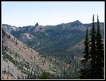
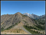
The meadow before crossing Beverly Creek was full of shooting stars. I have seen lots of Indian paintbrush here but only a few at this time. There were more flowers along the switchbacking trail. many columbine though nearly all past prime. Also more shooting stars. In the early spring I climb directly to the summit ridge of Iron on snow. The trail takes a much less direct and longer route. The slope is rapidly drying as some small creeks are already dry. I finally topped out at the saddle below Teanaway Peak and now could see all the peaks to the west. It was a sunny day and the views were great. The ridge hike to the 6510' summit climbs a barren slope that has an amazing array or wildflowers that are unique to this spot. I noticed a lupine like flower that was not like the lupine I usually see. Another looked similar to douglasia but different. Quite a variety of colors along the way. I reached the summit at 11:15 am. I took 2:45 to hike 4 1/2 miles with 2900' of elevation gain.
The views from the summit are outstanding. Rainier is to the southwest The Cascade Crest peaks are to the west. Hawkins and Esmerelda are close by. Mt. Stuart and the Stuart Range dominate to the north. Teanaway, Bill, Mary, Judi, and Earl are nearby Teanaway Peaks. I could see that there was a little snow left on Fortune Peak but not much. I sat down for the first part of my lunch and just admired the views. The relative ease of snow ascents of Iron make it an excellent winter/early spring backpacking trip. I have now camped on the summit on snow five times and loved each trip. So different when all the peaks are white. Here is a link to my 2011 summit camp trip report.
I spent 35 minutes on top and headed down at 11:50 am. Almost 3.5 hours and I had not yet seen a single person. I hiked down the ridge, then back down into Beverly Basin. At the junction with the Fourth Creek Trail I turned left and headed uphill. Two hikers coming up the valley beat me to the junction by one minute. I quickly passed them. Heading up I ran into a hiker I have met on the trail two times previously. He recognized me from my site on the trail to Buck Creek Pass and again last November on the Green Mountain Trail. We seem to frequent the same trails on the same days. He was doing the loop over Bean Peak in the opposite direction. We stopped to talk once again. I'm awful at recognizing a face I have only seen a time or two over several years. Fortunately he is not. Nice to run into folks on the trail.
I really enjoy the trail over to the ridge of Bean Peak above Hardscrabble Basin. It was a bit muddy in spots but very green still. The two largest creeks were still running. Farther along there are good views to the Stuart Range. It was getting toasty as I reached the rocky section that goes straight uphill. The little bits of shade were the last ones I would have until down into Bean Creek Basin. Up on the ridge next to Volcanic Neck there was a cool breeze that was much appreciated. The scramble up to the summit of Bean Peak is very straight forward. Just since my last visit a few years ago a boot path has emerged. I guess the route is getting more popular.
I reached the summit at 2:45 pm. The leg from Iron Peak took me 2:55. More than I expected. Still, I had plenty of daylight left on this day before the longest day of the year. Great views from the summit. There is was still some snow beneath the summits of Stuart, Colchuck, and Dragontail Peaks. A small patch on the ridge from Bean to Mary on the north side. Not much else. Soon after I arrived a lone scrambler came up from the Bean Creek side. He was the fourth and last person I saw all day. He was heading over to Volcanic Neck. We had a nice conversation before he continued on. I stayed on top until 3:35 pm. The fifty minutes went by very fast.
I headed straight down the face. Quite steep but very good hand and footholds. Instead of heading left into the basin I headed right. A little longer but less steep route. At the head of the basin the wildflower show began. It is very wet there. Lots of thistles, Indian paintbrush, bog orchids, and elephant's head. The last is very small. You need to get up real close to see the big ears and trunks of the "elephants". Heading over to the new trail I came upon two coyotes in the meadow. They never saw me. That is an unusual sighting for me. I was surprised to see no trace of anyone else in the basin on a Saturday afternoon in wildflower season. I had it all to myself. Heading down to the lower basin the flower show turned back to buckwheat, pearly everlasting, and a lot more scarlet gilia. Not a huge flower display but still very good.
I picked up the pace once back in forest and headed non stop back to the trailhead, arriving at 5:40 pm. This is a favorite hike and I had great conditions this day. Great views, a good wildflower display, and a strange lack of other human beings. Any time I can hike a dozen miles on moderately popular trails in June and I see half as many coyotes as people I've had more than my share of solitude. For the day I hiked 12 miles with 4400' of elevation gain.
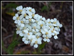 Sitka Valerian |
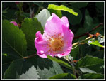 Rose |
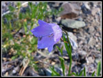 Harebell |
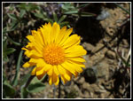
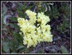 Bright Yellow Flower |
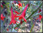 Blooming Scarlet Gilia |
 Vibrant Color |
 Another Gilia |
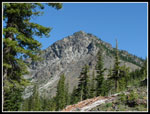
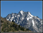
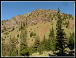 Mary Peak |
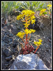 Stonecrop |
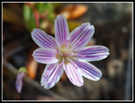 Columbia Lewisia |
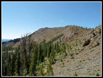
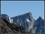
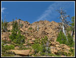
 Bill Peak |
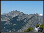
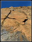
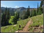
 Iron Peak Ridge |
 Fourth Creek Area |
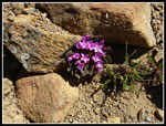
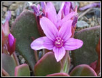 Bright Pink Flower |
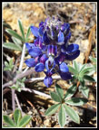 Lupine Like |
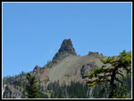
 Teanaway Peak |
 Mt. Stuart |
 Little Annapurna |
 More Pink Flower |
 Hawkins & Esmerelda |
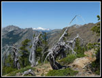 Ridge Top Snags |
 Very Yellow |
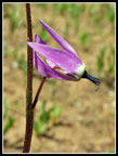 Shooting Star |
 Volcanic Neck |
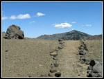 Lined Trail On Ridge Top |
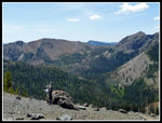 Looking Back To Iron |
 Fortune & Ingalls |
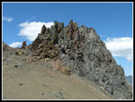 Wide Volcanic Neck |
 Bean Northeast Ridge |
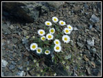 Daisies |
 Bean Peak Summit |
 Basin Is Below |
 Steep Descent |
 Bean Beak Above |
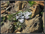 Phlox |
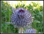 Thistle |
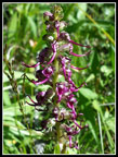 Elephant's Head |
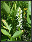 Bog Orchid |
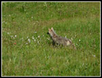 Coyote |
 Upper Basin |
 Last Scarlet Gilia |
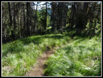 Long Grass |
Trips - 2015
Home