9-10-16
Back
in April I set out to hike to Exclamation Point Rock. My GPS did not
have the map and I had to poke around to find it but I did. Gary
suggested a return visit so he could do the trip too. Off we went to
the WF Teanaway Valley. Instead of parking at the end of pavement like
I did the first time, we drove to the gate. I was not the least
surprised to find nobody else parked there at 8:50 am. We were packed
up and on our bikes by 9:00 am. Between the road and the WF Teanaway
River is a very big meadow. In the spring it was all green. Now it is
all brown. Deciduous trees line the river and one is just turning
yellow. In a few weeks there should be a lot of fall color. Very
quickly the road reaches the switchback. The old road was washed out
ahead and now you must climb several hundred feet up to a road parallel
to the river. Climbing up on the rocky road quickly made me recall how
aerobic it is to ride a mountain bike uphill. Much harder than on
pavement.
At the top we turned left and continued. The route gains just a little elevation. next is a drop to where the road crosses a creek. Another short uphill followed soon by the final descent. At the bottom we passed the other end of the old washed out road. A short flat ride leads to the junction. We headed left and immediately crossed the river on a nice wide bridge. There is not even a fraction of the water I saw in April. It was about three miles to the bridge. The route continues flat until the climbing begins. Not too steep for us to climb but loose sandy dirt brought me to a stop and I had to walk a bit near the top. At the spot our final loop would end we stashed the bikes. We started in long steeves and long pants as it was only 47 degrees. By now it was getting quite warm. Down to short sleeves and shorts.
We continued a short way on the road and then followed a bike route up on some dirt and a lot of exposed slabs of rock. This is something I just don't find on hikes in Washington state. As we crested the ridge I suggested Gary take a look to our right. Through the trees was Exclamation Point Rock. I minute later we were at the base. On my first visit I was alone. I did not have any photos with a person for scale. Having Gary along solved this problem. The rock is one of a kind for this area. At least I've never seen anything like it here. The blue sky was nice in the photos. All the trees around it do provide more or less permanent shadows. We next followed the narrow trail along the backside of Mammoth Rock, heading to the far end. From there we were able to climb up onto the rock. This is really one mammoth rock. We hiked all the way back to the other end near Exclamation Point. The wind was supposed to pick up in the afternoon and it was blowing on the rock. The same as on my first visit.
We planned to continue west on the bike trail but did not have a specific plan. The idea of the trip only came up two days before and we did not have time for much planning. We spent about 40 minutes on Mammoth Rock and headed out at 11:30 am. The high temperature for the day was forecast at about 70 degrees and it was already warmer than that. A few minutes along the trail and I was glad we stashed the bikes below. The ridge walk climbed in elevation with a number of big ups followed by smaller downs. the route was very sandy and steep. Not anything that I would have been able to bike. As Gary said on the ride in, "we have logging road bikes not mountain bikes". They have proved to be very useful over the years but not for steep narrow trail riding.
The route met a road and then we took a trail that ran parallel to it. From Mammoth Rock we saw two ridges running perpendicular to our ridge. One had a very big steep rock wall. One had a smaller rock wall. We were not quite sure how to get to either one. When it became clear we had gone beyond a rocky wall, we headed back. When we were above the rocky ridge on the map we looked all over for a trail. None was seen. We decided to go cross country and hope to run into one. In fact, in a very short distance we picked one up. It wasted no time in descending. It ran straight down the fall line. It was surprising that we did not fall going down it. As the grade moderated we met the first big rock. Looking to our left, we saw the big rock wall in the distance. We were almost atop a much smaller rock wall. This trail crosses the valley on a ridge then meets a road that crosses Sandstone Creek. We went down to where the big rocky slabs are. Another really unusual spot. We finished our lunch here.
At about 1:15 pm we headed back. The steep climb back to the ridge was not as bad as we expected. As we headed back down the ridge to Mammoth Rock we saw a jeep with two passengers. They went by and a few minutes later came back. They were the only folks we saw all day. On the way up the ridge we saw what looked like huge bird prints. In places they were several inches deep suggesting heavy birds. On the way back we took some more photos of them. They were about 4 inches long. We had lots of speculation but had no real idea what created them. At home, the closest examples we found online were from an emu or a wild turkey. There are emu ranches and breeders in the area so it is not all that far fetched. Since I saw wild turkeys on my previous visit to Mammoth Rock, that is what is most likely. Still, I will be on the lookout for a six foot tall emu when I come back.
When we returned to Mammoth Rock we took another long break. It was plenty warm but the strong breeze cooled us down. From the rock we could see Yellow Hill across the valley of Sandstone Creek. Farther away was Navaho, Little Navaho, Three Brothers and Miller Peak. More peaks than I would have expected. It was almost 3:00 pm when we finally headed out. Back down to the trail along the back of Mammoth Rock then over to Exclamation Point Rock. Rather than retrace our route up from the road we chose to follow the ridge down. There is a an old motorcycle now bike trail along the ridge top. We encountered several more mini Mammoth Rocks. We went farther than our exit route then came back. A little cross country brought us to the old road that went back to where our bikes were stashed. That section has the best leaf color of the day.
Now it was all wheels for 4.1 miles back to the car. We quickly descended to near the WF Teanaway bridge. We took one last break to check out an old bus. Then it was across the bridge and up the first hill. Down to the creek crossing then up another hill. Now it was all downhill the last mile plus. Even with our stop at the bus we came down those 4.1 miles in about 45 minutes. It was 4:42 pm when we rode around the gate to the finish. Except we were not quite finished. We drove back to the end of pavement and parked. Both the places we parked this day require a Discover Pass. The gated old WF Teanaway Road section (it too was washed out) goes along the river. We went about half a mile to where the banks and the bottom of the river are all sandstone. Unlike anything I have seen around here. I've said that a few times now.
The day was a rousing success. we had virtually total solitude. Exclamation and Mammoth Rocks are both worthy destinations on their own. This time the bikes allowed us to go farther than on my first visit. All that and the weather was perfect. Warm but not too hot and with a cool breeze blowing much of the day. Gary edited his GPS track and came up with about 8.3 miles biked and 6.6 miles hiked plus about a mile at the end of the day along the river. Added up that's about 16 miles covered on the day. With all the ups and downs we had about 2700' of elevation gain. It was a most interesting day in the Teanaway River Valley.
Click on thumbnails to get
larger pictures.
Trips - 2016
Home
At the top we turned left and continued. The route gains just a little elevation. next is a drop to where the road crosses a creek. Another short uphill followed soon by the final descent. At the bottom we passed the other end of the old washed out road. A short flat ride leads to the junction. We headed left and immediately crossed the river on a nice wide bridge. There is not even a fraction of the water I saw in April. It was about three miles to the bridge. The route continues flat until the climbing begins. Not too steep for us to climb but loose sandy dirt brought me to a stop and I had to walk a bit near the top. At the spot our final loop would end we stashed the bikes. We started in long steeves and long pants as it was only 47 degrees. By now it was getting quite warm. Down to short sleeves and shorts.
We continued a short way on the road and then followed a bike route up on some dirt and a lot of exposed slabs of rock. This is something I just don't find on hikes in Washington state. As we crested the ridge I suggested Gary take a look to our right. Through the trees was Exclamation Point Rock. I minute later we were at the base. On my first visit I was alone. I did not have any photos with a person for scale. Having Gary along solved this problem. The rock is one of a kind for this area. At least I've never seen anything like it here. The blue sky was nice in the photos. All the trees around it do provide more or less permanent shadows. We next followed the narrow trail along the backside of Mammoth Rock, heading to the far end. From there we were able to climb up onto the rock. This is really one mammoth rock. We hiked all the way back to the other end near Exclamation Point. The wind was supposed to pick up in the afternoon and it was blowing on the rock. The same as on my first visit.
We planned to continue west on the bike trail but did not have a specific plan. The idea of the trip only came up two days before and we did not have time for much planning. We spent about 40 minutes on Mammoth Rock and headed out at 11:30 am. The high temperature for the day was forecast at about 70 degrees and it was already warmer than that. A few minutes along the trail and I was glad we stashed the bikes below. The ridge walk climbed in elevation with a number of big ups followed by smaller downs. the route was very sandy and steep. Not anything that I would have been able to bike. As Gary said on the ride in, "we have logging road bikes not mountain bikes". They have proved to be very useful over the years but not for steep narrow trail riding.
The route met a road and then we took a trail that ran parallel to it. From Mammoth Rock we saw two ridges running perpendicular to our ridge. One had a very big steep rock wall. One had a smaller rock wall. We were not quite sure how to get to either one. When it became clear we had gone beyond a rocky wall, we headed back. When we were above the rocky ridge on the map we looked all over for a trail. None was seen. We decided to go cross country and hope to run into one. In fact, in a very short distance we picked one up. It wasted no time in descending. It ran straight down the fall line. It was surprising that we did not fall going down it. As the grade moderated we met the first big rock. Looking to our left, we saw the big rock wall in the distance. We were almost atop a much smaller rock wall. This trail crosses the valley on a ridge then meets a road that crosses Sandstone Creek. We went down to where the big rocky slabs are. Another really unusual spot. We finished our lunch here.
At about 1:15 pm we headed back. The steep climb back to the ridge was not as bad as we expected. As we headed back down the ridge to Mammoth Rock we saw a jeep with two passengers. They went by and a few minutes later came back. They were the only folks we saw all day. On the way up the ridge we saw what looked like huge bird prints. In places they were several inches deep suggesting heavy birds. On the way back we took some more photos of them. They were about 4 inches long. We had lots of speculation but had no real idea what created them. At home, the closest examples we found online were from an emu or a wild turkey. There are emu ranches and breeders in the area so it is not all that far fetched. Since I saw wild turkeys on my previous visit to Mammoth Rock, that is what is most likely. Still, I will be on the lookout for a six foot tall emu when I come back.
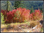
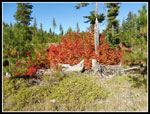
When we returned to Mammoth Rock we took another long break. It was plenty warm but the strong breeze cooled us down. From the rock we could see Yellow Hill across the valley of Sandstone Creek. Farther away was Navaho, Little Navaho, Three Brothers and Miller Peak. More peaks than I would have expected. It was almost 3:00 pm when we finally headed out. Back down to the trail along the back of Mammoth Rock then over to Exclamation Point Rock. Rather than retrace our route up from the road we chose to follow the ridge down. There is a an old motorcycle now bike trail along the ridge top. We encountered several more mini Mammoth Rocks. We went farther than our exit route then came back. A little cross country brought us to the old road that went back to where our bikes were stashed. That section has the best leaf color of the day.
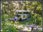
Now it was all wheels for 4.1 miles back to the car. We quickly descended to near the WF Teanaway bridge. We took one last break to check out an old bus. Then it was across the bridge and up the first hill. Down to the creek crossing then up another hill. Now it was all downhill the last mile plus. Even with our stop at the bus we came down those 4.1 miles in about 45 minutes. It was 4:42 pm when we rode around the gate to the finish. Except we were not quite finished. We drove back to the end of pavement and parked. Both the places we parked this day require a Discover Pass. The gated old WF Teanaway Road section (it too was washed out) goes along the river. We went about half a mile to where the banks and the bottom of the river are all sandstone. Unlike anything I have seen around here. I've said that a few times now.
The day was a rousing success. we had virtually total solitude. Exclamation and Mammoth Rocks are both worthy destinations on their own. This time the bikes allowed us to go farther than on my first visit. All that and the weather was perfect. Warm but not too hot and with a cool breeze blowing much of the day. Gary edited his GPS track and came up with about 8.3 miles biked and 6.6 miles hiked plus about a mile at the end of the day along the river. Added up that's about 16 miles covered on the day. With all the ups and downs we had about 2700' of elevation gain. It was a most interesting day in the Teanaway River Valley.
 Great Fall Color |
 More Color |
 Here Is A Panorama Shot From Atop Mammoth Rock |
 Old Bus |
 Sandstone River Bottom |
Trips - 2016
Home


