6-05-16
After
an 11 mile hike with 3800' of gain on a very hot day the day before, I
signed on for a much easier one on Sunday. I met Kim in Bothell at 7:00
am. The I-90 bridge was down to one lane westbound and I did not want
to mess with in on the way home. We drove just beyond North Bend and
headed up the Middle Fork Snoqualmie River Road. Neither of us had been
far up it since the paving project began two years ago. I was
interested in seeing what shape it was in. There is one big puddle
where they are working before the big bridge. Otherwise it is just some
minor potholes. The best shape I have seen it in a long time. The last
few miles were on the new pavement. That went very fast. We arrived at
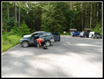
the MF trailhead to find less than ten cars. We packed up and
were on the trail by 8:45 am.
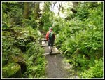
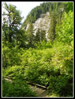
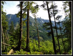
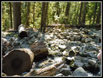
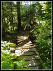
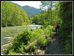
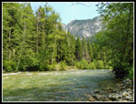
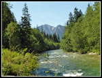
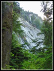
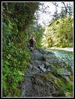
I hiked the new Pratt River Connector trail several years ago. In fact I did it several times. In all my years of hiking I had never hiked upstream on the MF trail. Ironically I did visit after another hike back in the 1990 when the new bridge at the trailhead was under construction. Unfortunately, I did not have a camera that day. No photo of the superstructure with no walkway in place yet. North Bend was forecast to reach 93 degrees and I was hoping for some shade and breeze this day. It was comfortably cool in the early morning. Bugs were bothersome in the parking lot but not so much on the trail. The trail starts right along the river. Very quickly the Taylor River joins it. There is one huge near vertical wall just inland. It's very impressive. The trail soon leaves the river for quite awhile. The route more or less follows a very old logging railroad grade.
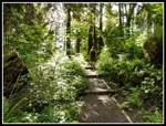
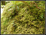
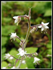
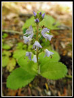
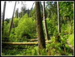
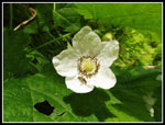
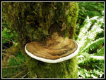
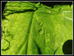
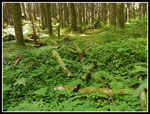
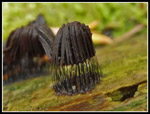
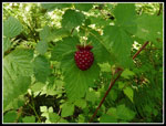
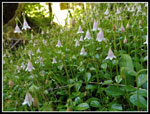
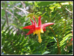
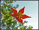
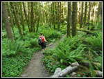
The green is overwhelming. Trees, underbrush, and moss cover everything. I thought the trail was in and out of forest. It is more like short segments in the open and mostly in forest. All the better when you want shade. The MF Trail is open to mountain bikes on odd numbered days between June 1 and October 31. This day was odd and we did see some bikes. Not so many to be bothersome. Hikers, bikers, and runners were all on the trail this day. The wildflower show was in progress though not near its peak. We saw bleeding hearts, salmonberries and a few salmonberry flowers, thimbleberry flowers, spring beauty, columbine, twin flowers, and slime mold. Most folks walked past the slime mold but Kim always finds it. We took a number of photos of the tiny molds.
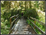
I don't think we had to climb over any logs in the first two miles. There were a number in the last mile. One smashed a bridge though it is still intact other than the hand rails. Limbs had been cut off on most all of them. Kim had been up the trail a few times though not recently. She thought there was a spot on the riverbank at about the three mile mark. She was right. There was one old washout where we easily rock hopped the creek. It was cool with a breeze. We considered staying there but wanted to see about the spot on the river.
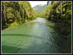
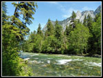
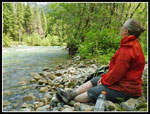
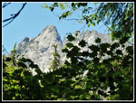
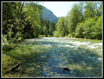
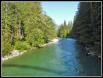
The trail reaches the river at a spot with another down tree. We climbed over it and the trail went a little inland. In a few minutes was saw a boot path heading towards the river. Indeed, we were at the rocky beach Kim recalled. We rock hopped across a small channel to a thin slice of trees that abutted the river. A perfect spot in the shade with a cool breeze blowing by. We sat down at 11:30 am. It was getting warm but we were in the coolest spot around. The river was moving fast in this spot. We could see up towards Mt. Garfield high above on the other side. One group came and played in the water. They left and another group arrived. They were all across the shallow channel. We had a bit of solitude.
In all, four groups came and went. We stayed put. It was almost 3:00 pm when we headed back. About 3.5 hours on the riverbank. No complaints from me. We took our time on the way back. No hurry to get back to a home with no air conditioning. At the washout creek we liked it so much we spent another 45 minutes there. I did not notice much downhill on the way in but there are a number of short uphill segments going out. It was 5:25 pm when we crossed the bridge over the Middle Fork. The lot was about as full as when we arrived. One person there said that it was nearly full when they arrived. We seem to have missed most of the crowd.
This trail goes a long way up the river. All the way to Goldmyer Hot Springs and on to the trail up to Dutch Miller Gap. We did just a short three miles each way. There is much more for me to explore on another visit. If bikes bother you there is one day each weekend when they are not allowed on the trail. I did not find them to be a problem. There is no great viewpoint or lake on this trail. The forest is the reason to hike it. That and the sections along the river. It is amazingly green in the forest. I hiked a new trail near Seattle, avoided the worst of the heat, and had a very good time. A fall return may be in order.
Click on thumbnails to get
larger pictures.
Trips - 2016
Home
I hiked the new Pratt River Connector trail several years ago. In fact I did it several times. In all my years of hiking I had never hiked upstream on the MF trail. Ironically I did visit after another hike back in the 1990 when the new bridge at the trailhead was under construction. Unfortunately, I did not have a camera that day. No photo of the superstructure with no walkway in place yet. North Bend was forecast to reach 93 degrees and I was hoping for some shade and breeze this day. It was comfortably cool in the early morning. Bugs were bothersome in the parking lot but not so much on the trail. The trail starts right along the river. Very quickly the Taylor River joins it. There is one huge near vertical wall just inland. It's very impressive. The trail soon leaves the river for quite awhile. The route more or less follows a very old logging railroad grade.
The green is overwhelming. Trees, underbrush, and moss cover everything. I thought the trail was in and out of forest. It is more like short segments in the open and mostly in forest. All the better when you want shade. The MF Trail is open to mountain bikes on odd numbered days between June 1 and October 31. This day was odd and we did see some bikes. Not so many to be bothersome. Hikers, bikers, and runners were all on the trail this day. The wildflower show was in progress though not near its peak. We saw bleeding hearts, salmonberries and a few salmonberry flowers, thimbleberry flowers, spring beauty, columbine, twin flowers, and slime mold. Most folks walked past the slime mold but Kim always finds it. We took a number of photos of the tiny molds.
I don't think we had to climb over any logs in the first two miles. There were a number in the last mile. One smashed a bridge though it is still intact other than the hand rails. Limbs had been cut off on most all of them. Kim had been up the trail a few times though not recently. She thought there was a spot on the riverbank at about the three mile mark. She was right. There was one old washout where we easily rock hopped the creek. It was cool with a breeze. We considered staying there but wanted to see about the spot on the river.
The trail reaches the river at a spot with another down tree. We climbed over it and the trail went a little inland. In a few minutes was saw a boot path heading towards the river. Indeed, we were at the rocky beach Kim recalled. We rock hopped across a small channel to a thin slice of trees that abutted the river. A perfect spot in the shade with a cool breeze blowing by. We sat down at 11:30 am. It was getting warm but we were in the coolest spot around. The river was moving fast in this spot. We could see up towards Mt. Garfield high above on the other side. One group came and played in the water. They left and another group arrived. They were all across the shallow channel. We had a bit of solitude.
In all, four groups came and went. We stayed put. It was almost 3:00 pm when we headed back. About 3.5 hours on the riverbank. No complaints from me. We took our time on the way back. No hurry to get back to a home with no air conditioning. At the washout creek we liked it so much we spent another 45 minutes there. I did not notice much downhill on the way in but there are a number of short uphill segments going out. It was 5:25 pm when we crossed the bridge over the Middle Fork. The lot was about as full as when we arrived. One person there said that it was nearly full when they arrived. We seem to have missed most of the crowd.
This trail goes a long way up the river. All the way to Goldmyer Hot Springs and on to the trail up to Dutch Miller Gap. We did just a short three miles each way. There is much more for me to explore on another visit. If bikes bother you there is one day each weekend when they are not allowed on the trail. I did not find them to be a problem. There is no great viewpoint or lake on this trail. The forest is the reason to hike it. That and the sections along the river. It is amazingly green in the forest. I hiked a new trail near Seattle, avoided the worst of the heat, and had a very good time. A fall return may be in order.
 Trailhead |
 Looking Up The River |
 Steps On Trail |
 Steep Rock Wall |
 Sun & Shade |
 Mossy Rock |
 Tiny Flower |
 Small Flower |
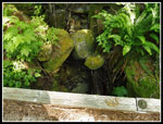
 Very Lush Forest |
 View Out |
 Thimbleberry Flower |
 Shelf Fungus |
 Drops And Shadows |
 Green Ground |
 Brown Slime Mold |
 Close Up |
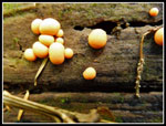 Orange Slime Mold |
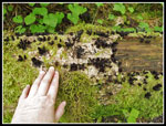 Scale |
 Natural Bridge |
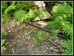 Old Rail |
 Washout |
 Salmonberry |
 Twin Flowers |
 Broken Bridge |
 At The River |
 Downstream |
 Columbine |
 Kim On The Shore |
 River From Break Spot |
 Peaks & Leaves |
 The Mighty MF |
 Under A Columbine |
 Heading Back |
 Busted Up Bridge |
 Very Green Valley |
 Back At Wall |
 Narrow Trail |
 MF From Bridge |
Trips - 2016
Home