8-06-16
I
needed to be home by late afternoon and I wanted to get in a good
amount of elevation gain. Time for another visit to Mt. Dickerman.
Yesterday the forecast was for increasing clouds. This morning it was
changed to sunny. I had another fairly early start as I left North
Seattle at 6:10 am. North to Granite Falls then onto the Mountain Loop
Highway (MLH). I was not the only one heading out early. Three cars
were ahead of me all the way up the MLH. I reached the parking lot at
about 7:35 am. Their were about a dozen cars in the lot already. I was
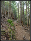
on the trail at 7:42 am. It was cool but the trail has a lot of
elevation gain and I was warm fast. The trailhead is at 1900'. The top
is at 5723. Throw in a minimal amount of ups and downs and there is
3900' of gain in 4.3 miles. In a short distance the route meets the old
trail and the switchbacks begin.
Though this trail gains 500' more than Mt. Si it does not seem overly steep. It just keeps climbing all the way. Lots and lots of switchbacks. The drive up was mostly in low clouds though I saw a few blue spots while nearing the trailhead. Big Four was completely in the clouds as I drove by. I made steady progress. Not a lot of photos down low as there were few flowers and no views out. At the partial viewpoint below the trail of Big Four Mountain I saw just more clouds. At that point a woman zipped on by me. She did not seem to be working hard at all. Well, she did look to be about three decades younger than me. At the one hour mark I had gained 1600'. Not even close to half the elevation. I met a group coming down. They camped on the summit. I asked and they said it was clear up top when they started down. So there was hope!
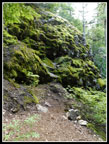
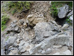
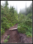
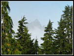
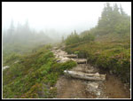
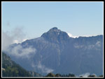
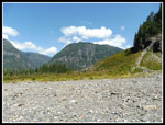
The switchbacks came to an end as the trail traverses to the left. I passed by the huge rock and then popped out of the forest for a short bit. Here I had a view of the top of Big Four Mountain. The bottom was in clouds but the top was out in the sunshine. Things were looking up. Speaking of up, I looked up Dickerman and just saw more clouds up above. At the creek crossing there are now several big rocks in the creek that were not there on my last visit. Instead of a drop into the creek bed it is more just scrambling across and around the boulders. Soon I was into the meadows. Lots of rock laid down now. Less mud in the early summer but it is hard on the feet.
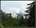
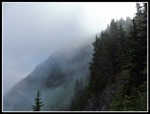
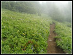
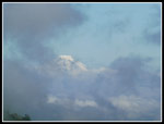
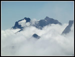
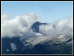
When I reached the ridge where there is a view over to Stillaguamish Peak all I saw was clouds. Looking up towards the top of Dickerman I saw... more clouds. The berries in the meadow were barely formed. It will be some time before they are ripe. I continued up and traversed over to below the summit. Berries here were fully formed and still green. It will be awhile. Now came the switchbacks up the slope to the top. The clouds were getting thinner as I climbed. Lots of bistort and other white flowers on the slopes. There was a little lupine too. Nearer the top I passed four hikers. That was the total for the ascent. I passed four and was passed by one. Pretty good solitude on a busy trail. I reached the top to find pretty much all peaks hidden by clouds. I had lots of time to wait. It was only 10:02 am.
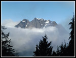
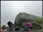
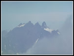
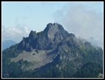
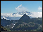
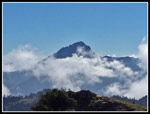
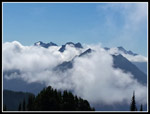
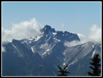
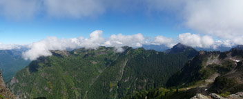
In fact, the clouds did move. An opening showed Three Fingers Mountain. A few minutes later it was gone. Mt. Baker popped into sight for a minute. Soon Mt. Forgotten came out. After awhile I saw Whitechuck, Pugh, half of Glacier Peak. Then I saw the top of Sloan Peak. Big Four came in and out of clouds. I have been atop Dickerman many times on sunny clear days. In some ways the peaks surrounded by clouds were even more photogenic. People came and went while I sat on the summit. I finally packed up and headed down at 11:18 am. Still early in the day.
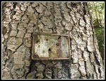
The trip down was a little faster. With all the big wooden steps it was slow at first. When I dropped below the middle meadows the steps and laid down rock ended. Back on smoother dirt I picked up the pace. I looked for the old 2 mile marker on the way up and did not find it. I thought it was just below the huge rock and I looked carefully for it. Bingo! It is rusted and hard to see on the tree but it is still there. The steady stream of hikers heading up thinned out on the lower half of the trail. I made it back to the trailhead at about 1:19 pm. It was early enough that I had time for one more stop.
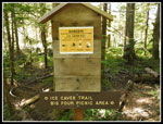
I drove down the road a mile or so to the Ice Caves parking lot. It is just one mile and 200' of gain to the caves. I was back on the trail. First I took the old railroad grade over to the site of the Big Four Inn. Then I headed down to the river. This was the first time I saw the new bridge. It is huge. In short order I was up at the site of the ice caves. After they melted out entirely last year, it's back. The sky was now blue and it was toasty. The breeze blowing out of the caves is instant air conditioning. Very nice. After a short visit I headed back.
For the day I hiked 11 miles with 4100' of elevation gain. Mt. Dickerman is a serious workout. The Big Four Ice Caves are an easy walk. Added together they are a fun pair of hikes for one day. With my early start I was back home in Seattle by 4:15 pm. Mission accomplished. The two trips made for a great day.
Click on thumbnails to get
larger pictures.
Trips - 2016
Home
Though this trail gains 500' more than Mt. Si it does not seem overly steep. It just keeps climbing all the way. Lots and lots of switchbacks. The drive up was mostly in low clouds though I saw a few blue spots while nearing the trailhead. Big Four was completely in the clouds as I drove by. I made steady progress. Not a lot of photos down low as there were few flowers and no views out. At the partial viewpoint below the trail of Big Four Mountain I saw just more clouds. At that point a woman zipped on by me. She did not seem to be working hard at all. Well, she did look to be about three decades younger than me. At the one hour mark I had gained 1600'. Not even close to half the elevation. I met a group coming down. They camped on the summit. I asked and they said it was clear up top when they started down. So there was hope!
The switchbacks came to an end as the trail traverses to the left. I passed by the huge rock and then popped out of the forest for a short bit. Here I had a view of the top of Big Four Mountain. The bottom was in clouds but the top was out in the sunshine. Things were looking up. Speaking of up, I looked up Dickerman and just saw more clouds up above. At the creek crossing there are now several big rocks in the creek that were not there on my last visit. Instead of a drop into the creek bed it is more just scrambling across and around the boulders. Soon I was into the meadows. Lots of rock laid down now. Less mud in the early summer but it is hard on the feet.
When I reached the ridge where there is a view over to Stillaguamish Peak all I saw was clouds. Looking up towards the top of Dickerman I saw... more clouds. The berries in the meadow were barely formed. It will be some time before they are ripe. I continued up and traversed over to below the summit. Berries here were fully formed and still green. It will be awhile. Now came the switchbacks up the slope to the top. The clouds were getting thinner as I climbed. Lots of bistort and other white flowers on the slopes. There was a little lupine too. Nearer the top I passed four hikers. That was the total for the ascent. I passed four and was passed by one. Pretty good solitude on a busy trail. I reached the top to find pretty much all peaks hidden by clouds. I had lots of time to wait. It was only 10:02 am.
In fact, the clouds did move. An opening showed Three Fingers Mountain. A few minutes later it was gone. Mt. Baker popped into sight for a minute. Soon Mt. Forgotten came out. After awhile I saw Whitechuck, Pugh, half of Glacier Peak. Then I saw the top of Sloan Peak. Big Four came in and out of clouds. I have been atop Dickerman many times on sunny clear days. In some ways the peaks surrounded by clouds were even more photogenic. People came and went while I sat on the summit. I finally packed up and headed down at 11:18 am. Still early in the day.
The trip down was a little faster. With all the big wooden steps it was slow at first. When I dropped below the middle meadows the steps and laid down rock ended. Back on smoother dirt I picked up the pace. I looked for the old 2 mile marker on the way up and did not find it. I thought it was just below the huge rock and I looked carefully for it. Bingo! It is rusted and hard to see on the tree but it is still there. The steady stream of hikers heading up thinned out on the lower half of the trail. I made it back to the trailhead at about 1:19 pm. It was early enough that I had time for one more stop.
I drove down the road a mile or so to the Ice Caves parking lot. It is just one mile and 200' of gain to the caves. I was back on the trail. First I took the old railroad grade over to the site of the Big Four Inn. Then I headed down to the river. This was the first time I saw the new bridge. It is huge. In short order I was up at the site of the ice caves. After they melted out entirely last year, it's back. The sky was now blue and it was toasty. The breeze blowing out of the caves is instant air conditioning. Very nice. After a short visit I headed back.
For the day I hiked 11 miles with 4100' of elevation gain. Mt. Dickerman is a serious workout. The Big Four Ice Caves are an easy walk. Added together they are a fun pair of hikes for one day. With my early start I was back home in Seattle by 4:15 pm. Mission accomplished. The two trips made for a great day.
 Heading Up Trail |
 Mossy Rock |
 Big Four Mountain |
 Rocks In Creek Crossing |
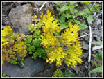 Stonecrop |
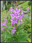 Fireweed |
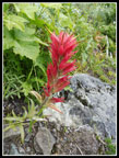 Indian Paintbrush |
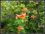 Columbine |
 Into The Clouds |
 Cloudy Peak |
 Aster |
 All Cloudy |
 Summit In Clouds |
 Into Upper Meadows |
 Some Wildflowers |
 Folks On The Summit |
 Three Fingers |
 Mt. Pugh |
 Mt. Forgotten |
 Mt. Baker |
 Glacier Peak |
 Sloan Peak |
 Monte Cristo Peaks |
 Close Up |
 Del Campo Peak |
 Vesper Peak |
 Huge Rock |
 2 Mile Marker |
 Lit Up Saprophyte |
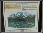 Big Four Trails Map |
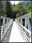 Long New Bridge |
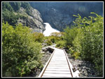 Almost To Caves |
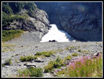 Big Four Ice Cave |
 Mt. Dickerman |
 Only Warning Sign |
 Panorama Of Stillaguamish - Forgotten Ridge. |
Trips - 2016
Home